
2025 Walker’s Haute Route Trail Updates
Every year hikers from all over the world flock to the Alps to complete one of the most famous multi-day trails, Walker’s Haute Route. It is a challenging journey of physical, mental and spiritual triumph. Our mission is to help these adventurers confidently plan and safely navigate their journey from Chamonix to Zermatt.
Having access to the latest Walker’s Haute Route trail updates, such as early season snow conditions and route/transport changes, is necessary to be well prepared for the adventure. It helps hikers confirm their gear choice, make any relevant adjustments to their itinerary, and prevent unexpected interruptions to their journey. For over 5 years, The Hiking Club has been bringing this information together and providing expert commentary for the Walker’s Haute Route.
Our trail updates program includes the following information. Scroll down to view the details or click on the link of one to zoom straight there;

NOtice board
Trail, transport and accommodation updates that may impact the plans of hikers completing the Walker’s Haute Route.
Have an update to share? Email us at info@thehiking.club
At the end of June 2024, severe storms hit the Mattertal Valley which resulted in the closure of a section of the Europaweg trail for the 2024 hiking season. According to the Swiss Hiking Federation (via Swisstopo), the trail will be closed for until October 2025.
Read this detailed blog on how this closure impacts Walker’s Haute Route hikers, and how to adjust your itinerary.
According to the owners, they are not accepting bookings for the 2025 summer season.
Ultra-Trail du Mont Blanc (aka UTMB) is a trail running event with 8 races that will be held between 28 August and 2 September, 2025. If you are hiking during this time, make sure to factor in extra time for cheering and letting runners past. It's a pretty inspiring thing to share the trail with athletes that can circumnavigate Mont Blanc in less than 20 hours 🤯
Ultra Tour Monte Rosa (UTMR) is a trail running event with 4 races that will be held between 3-6 September, 2025. If you are hiking during this time, make sure to factor in extra time for cheering and letting runners past. Details of race route and schedule can be found here.
Sierra Zinal is one of the most famous mountain races in the Alps that will be held on 9 August, 2025. For those hiking between Zinal and Gruben on this day, make sure to factor in extra time for cheering and letting runners past. Details of race route and schedule can be found here.

2025 snow SUMMARY
As the 2025 hiking season approaches, it’s important to keep a close eye on latest snow updates!
less-snow-than-average

As of 12th May, 2025, there is less-snow-than-average at Arolla snow station (2,847m), despite the big snow dump on April 18th and new snow in the past week.
Unlike 2024, which saw higher-than-average snow accumulation and a cold May that prolonged the snow-melt, the 2025 winter has brought a below-average snowfall across the Mont Blanc and Valais region, and there has already been bouts of warm weather.
Despite a huge dump of snow in mid April this still remains the view when looking at the long term averages in the Valais region (Switzerland). There is always some new snowfall in May/June which can significantly change the early season hiking conditions so whilst its looking favourable for July hikers, we’ll have to wait and see.
Comparisons to previous years
2024: Cold and wet spring kept high and deep snow-pack well into June. Dry trail by 2nd week July.
2023: Moderate snow year, typical melt pattern, some lingering snow into late June.
2022: Low snowpack, early melt, dry trails by mid-June.
2021: Similar to 2024 — heavy late snow and cold spring delayed melt until early July.
2020: COVID-restricted season, but snow conditions were average.

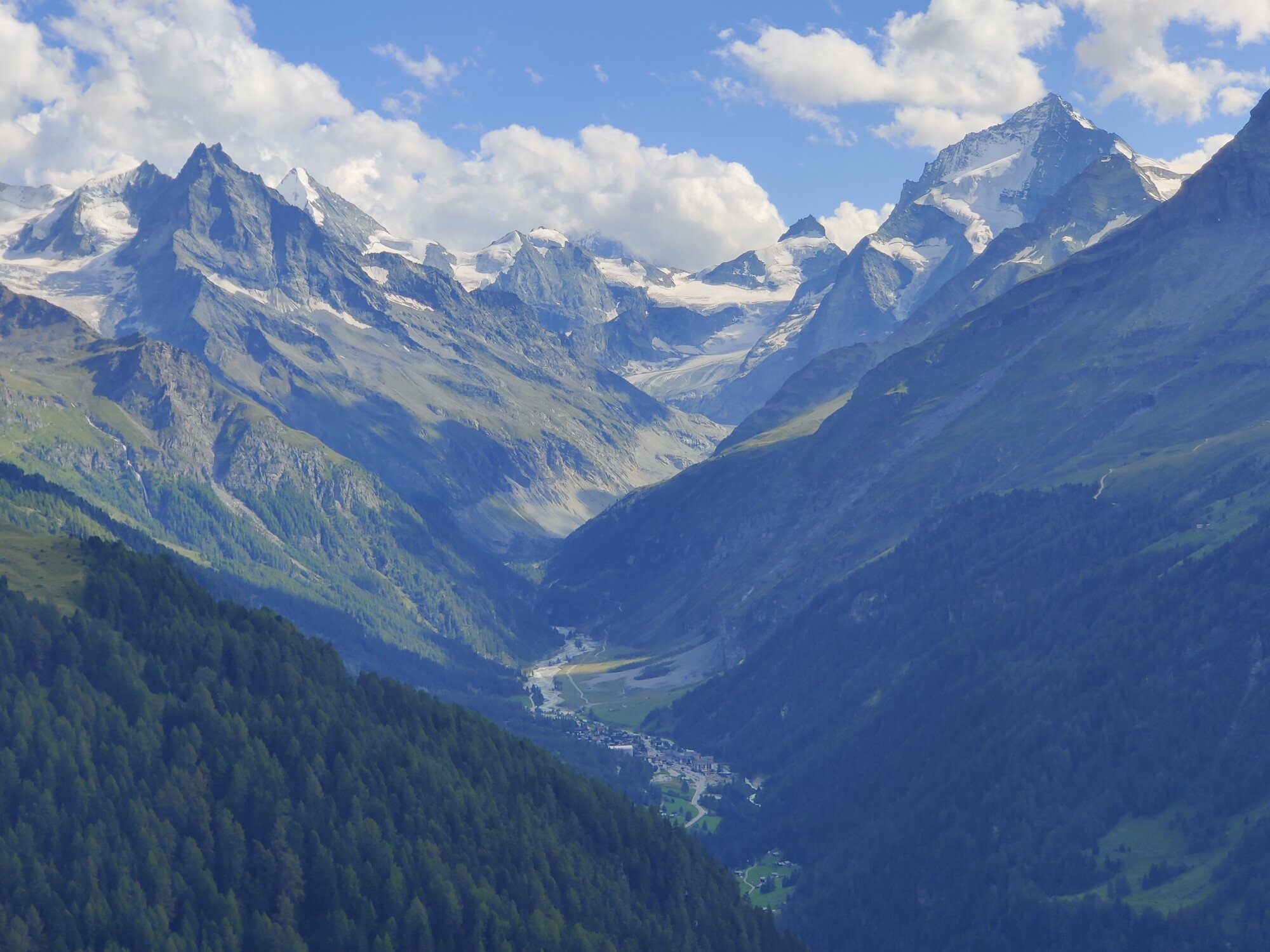
📸 Refuge Col de la Balme. May 27th, 2022
factors for favourable JULY Hiking Conditions
We’ve been monitoring conditions closely since 2017 and every year it’s a roller coaster. Some look incredibly promising until huge snow dumps at the end of May dramatically changes the picture. Others have resulted in above average snow fall disappearing by early June due to prolonged warm spells in May. While every year is different, these are some of the factors that can lead to favourable July hiking condition;
A smaller snow pack from the winter months that needs to melt away
Freezing level spending an increasing amount of time above the highest elevation points on the trail (~2,500m) during Spring
Limited new snow accumulation during Spring
Plenty of solar radiation hitting the snow from clear sunny days

snow on the WHR
See the estimated snow depth along the Walker’s Haute Route in our planning app
The estimated current snow depth and 48 hour snow forecast layers in our planning app are updated daily and inform hikers where snow is expected to be located along their route. This information is provided through our partnership with ExoLab.
CURRENT SNOW DEPTH
Check the snow conditions prior to your hike to understand if there is snow and its expected depth along your route. You can decide to alter your route to an alternative route with no/less snow or skip ahead with transport.
48 HOUR SNOW FORECAST
Understand where and how much snow is expected to fall along the trail for informed hiking decisions.
Not a customer? Get access via our Complete and Expert Access packages.
webcams along WHR
See real-time video footage along the Walker’s Haute Route.
The Walker’s Haute Route passes through various ski resorts, which have live webcams showing current conditions, including: Le Tour, Verbier, Grande Dixence, Arolla, Barrage Moiry, Grimentz/Zinal, Turtmann, St Luc, Grächen and Zermatt. Because this is live footage, the video will be black at night time and the current weather may impact the footage too. Most of the webams have a feature that allow you to choose a different time to see footage.

📷 LE TOUR (2,180M / 7,152ft)
At time of writing, this camera was not available and stuck on a past date - so please check the date before relying upon its footage. We’ve included it incase it comes back to life. The camera is in a privileged position at the top of the Tete de Balme chairlift in the Le Tour ski area. When it is looking south east, you can squint to see Refuge du Col de Balme in the saddle of its namesake mountain pass. As the camera pans around clockwise, you can see the Le Tour ski area where the main trail passes through, and Aiguillette des Posettes in the foreground (alternative route). In the background, you can see the entire Chamonix valley, including Mont Blanc (in the far distance) and the Aiguilles Rouges, where the WHR trail traverses to eventually reach Chamonix.
📷 VERBIER - FANTANET (2,479M / 8,133FT)
This camera provides views from within the Verbier ski area across to Cabane du Mont Fort, the main trail via Sentier des Chamois and the alternative trail to Col de la Chaux (2,940m / 9,645ft).
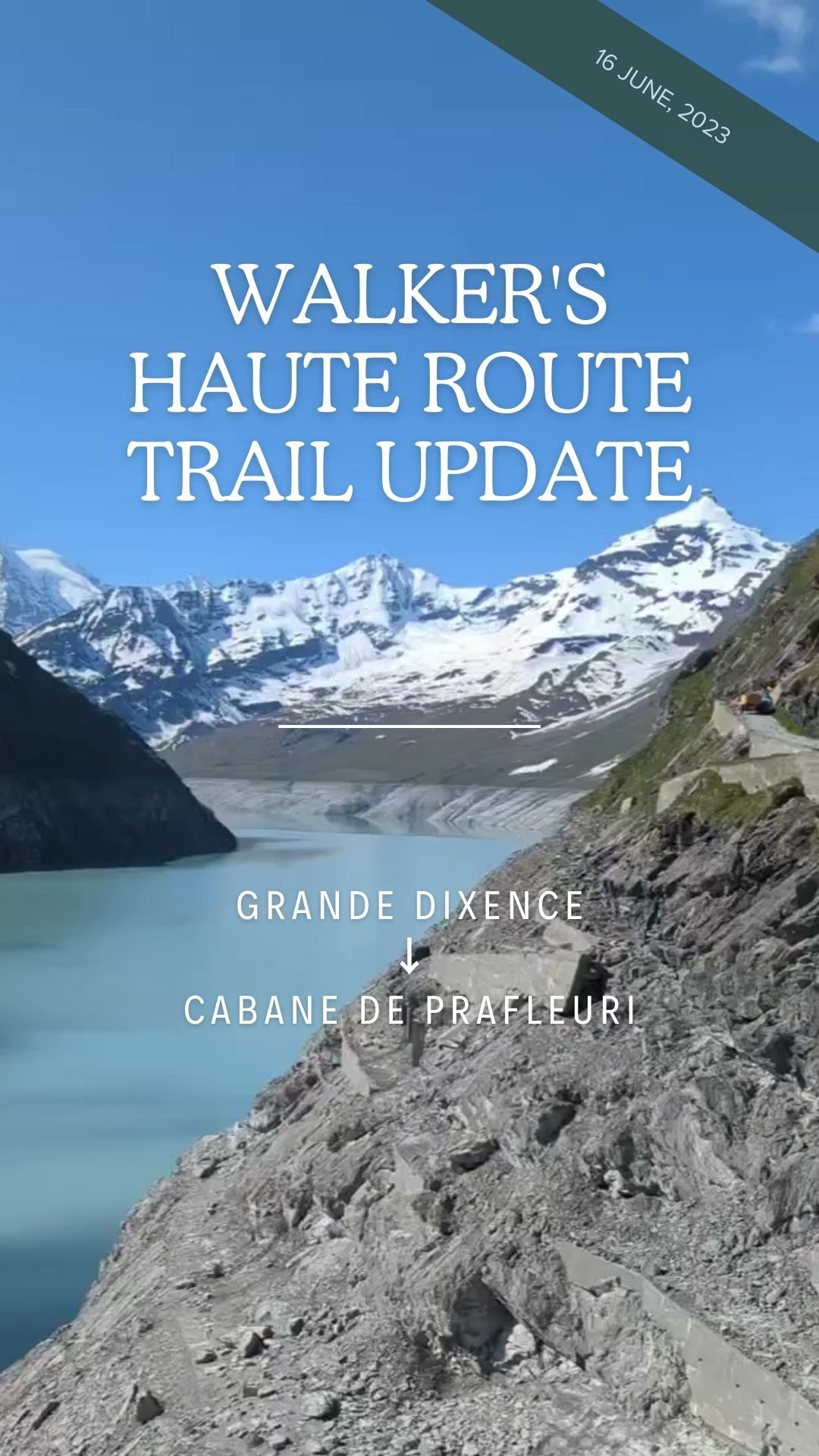
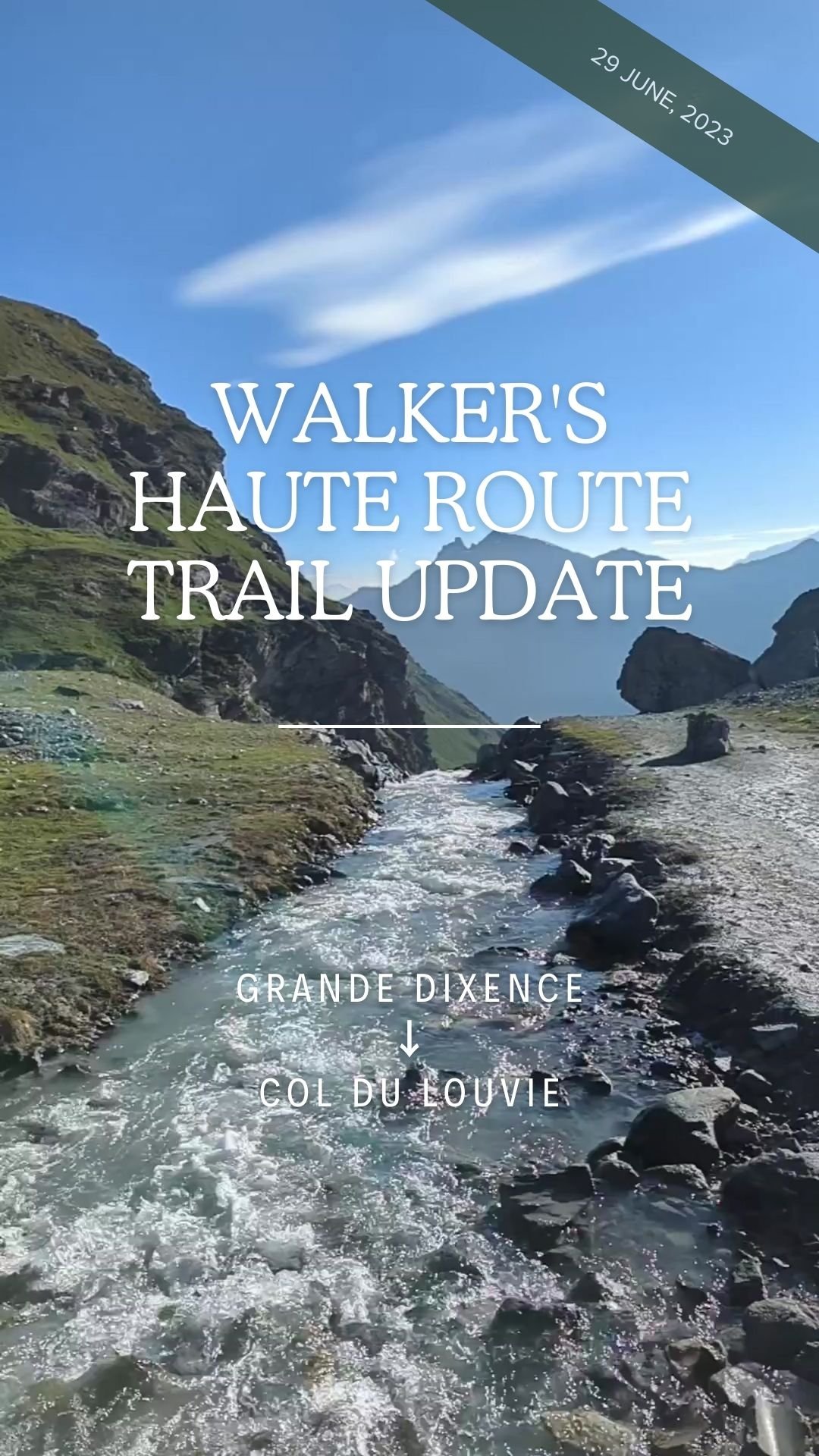
📷 GRANDE DIXENCE (2,364m / 7,756FT)
This camera is positioned at the Grande Dixence barrage, located on a popular alternative route that connects the valley of Prafleuri with the valley of Hermence. at Grande Dixence. The dam wall of Lac des Dix towers over the hotel originally constructed to provide accommodation to the dam builders, now for hikers and adventurers.
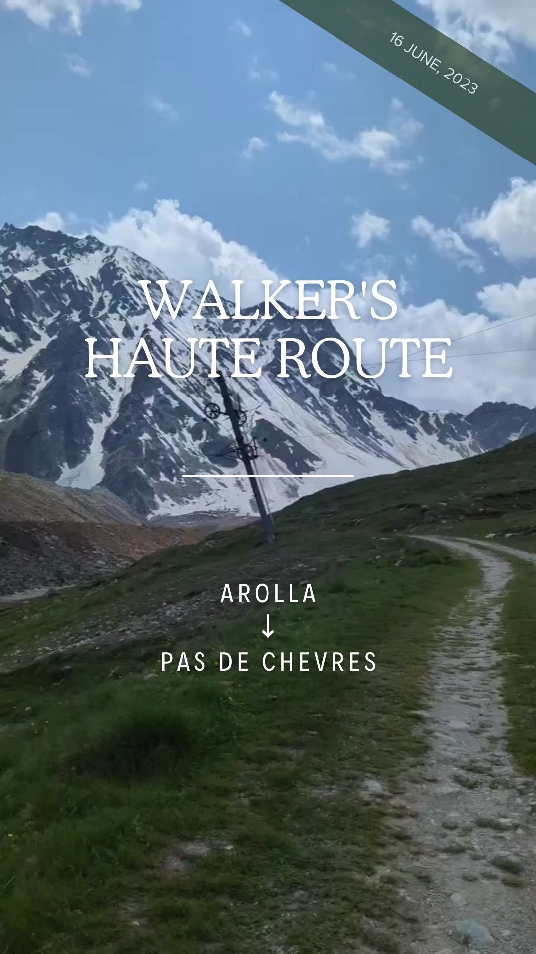
📷 AROLLA (2,290M / 7,513FT)
This camera is positioned within the Arolla ski area and provides views up to Col de Riedmatten (the recommended pass from Val des Dix, not Pas de Chevres which has been closed since the 2023 hiking season) and all the way through the ski area down to Arolla.
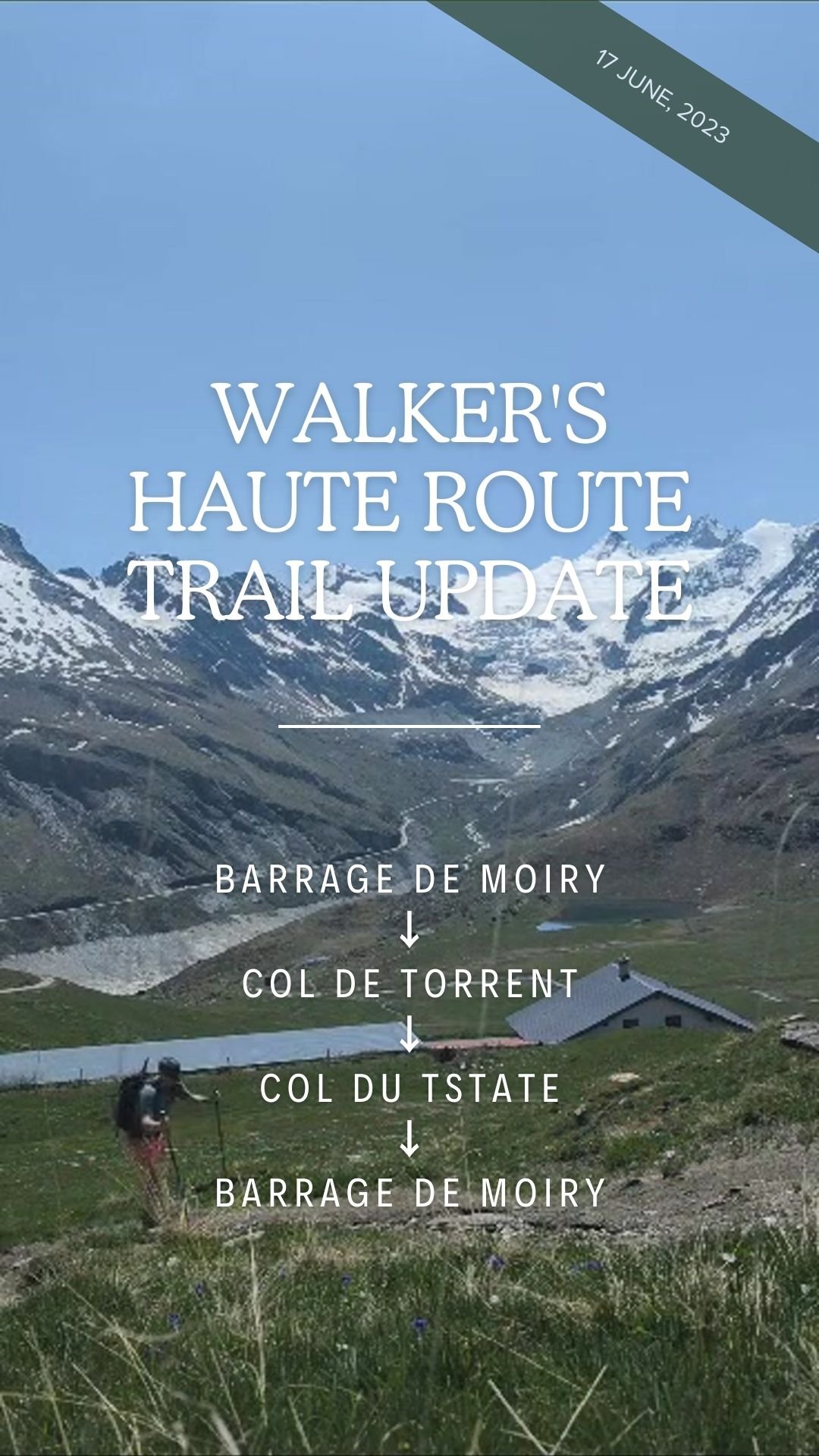
📷 Barrage de Moiry (2,250M / 7,380FT)
This camera is positioned at Barrage di Moiry and provides a good perspective of the snow conditions on the alternative route via Col de Torrent (2,916m), the main balcony trail along the east side of Lac de Moiry and views of the switchbacks up to Sorebois (2,895m).
📷 ZINAL - SOREBOIS (2,440M / 8,005FT)
This camera is positioned in the Zinal ski area and provides great views up to Sorebois (highest point on the main trail), down through the ski area, all the way to Zinal. For those who wish to skip this section, the gondola between Sorebois and Zinal village operates during peak season. (You can find 2025 timetable within our planning app).
📷 ST LUC - TIGNOUSA (2,180M / 7,152FT)
This camera is positioned at the top of the St Luc <> Tignousa funicular and is pointed towards Hotel Weisshorn, located on the mountain in the background. This camera is important for hikers taking the alternative route to Cabane Bella Tola. Unfortunately, this is a static camera and therefore doesn’t show the conditions for the trail up to Cabane de Bella Tola, only enroute.
📷 TURTMANNTAL (2,180m / 7,152FT)
This camera is positioned at the head of one of the most remote Swiss valleys - Turtmann, along the alternative trail to Turtmannhütte. The hut can be seen across from the lake, in front of the Turtmann glacier. This little dam is filled with the runoff from the Brunegg and Turtmann glaciers that lies at the end of the valley.
📷 GRächen (1,710M / 5,610FT)
This camera is not positioned on the Walker’s Haute Route, but gives views across to Augstbordpass and the trail via Jüngen to St Niklaus. For those staying in Grächen, the village can be seen clearly from this camera.
📷 ZERMATT - SUNNEGGA (2,290M / 7,513FT)
This camera is positioned at the top of the Sunnegga funicular and provides spectacular views of the Matterhorn (when weather permits!). For those choosing to hike the alternative route into Zermatt via Sunnegga, this is a sample of the views you will experience for your final descent of your Chamonix > Zermatt adventure.

Break the trail
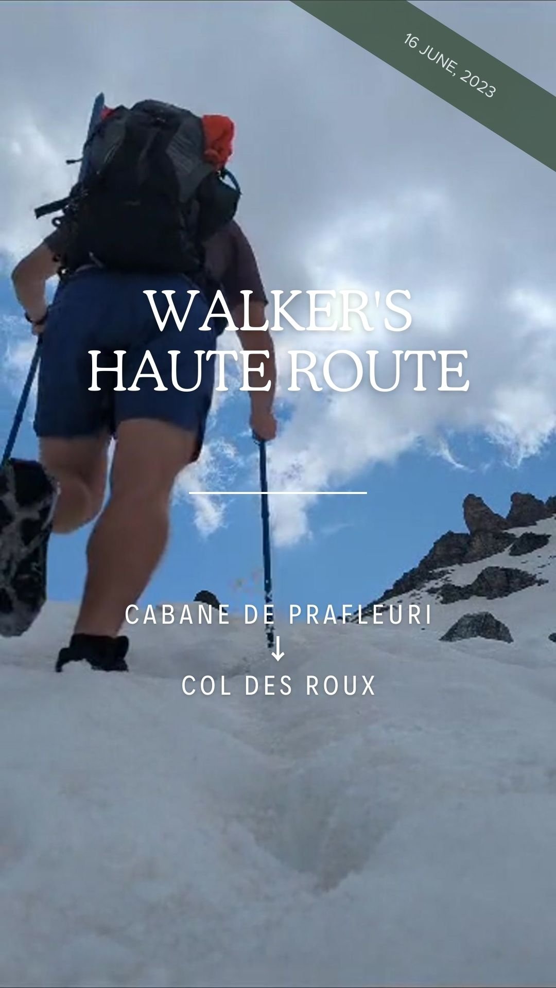
The Hiking Club team hits the trails to capture and share a snapshot of early season conditions with the self-guided hiking community.
For over 5 years, The Hiking Club team has completed a “Break The Trail” journey to provide the first trail report for the legendary trails in the Alps that we support. We share these early-season trail updates for hikers to understand the latest snow conditions, adjust their routes (when necessary), and confirm gear choices.
Our Trail Expert who leads our Walker’s Haute Route hike is, Brendan Jones, Co-founder of The Hiking Club
When will we share updateS?
During June and early July, we will share trip reports via our social channels. Our focus is on the conditions on the mountain passes, peaks and difficult trail sections, as this is where the most uncertainty exists.
HOW WILL WE COVER ALL THE TRAILS?
Over the course of 6 weeks, our team will cover +1,000km / +600mi. We usually cover between 30-45km / 20-30mi per day and then jump online to post our trail report and deliver customer support! It’s a busy period for us!
FOLLOW US ON SOCIAL TO GET REAL-TIME TRAIL UPDATES
WATCH THE 2024 WALKER’S HAUTE ROUTE “BREAK THE TRAIL” VIDEOS:
Disclaimer: Brendan is an experienced early season hiker with extensive knowledge of the Walker’s Haute Route. We do not encourage anyone to hike the Walker’s Haute Route at this time of year. The season officially commences July and goes until late September.

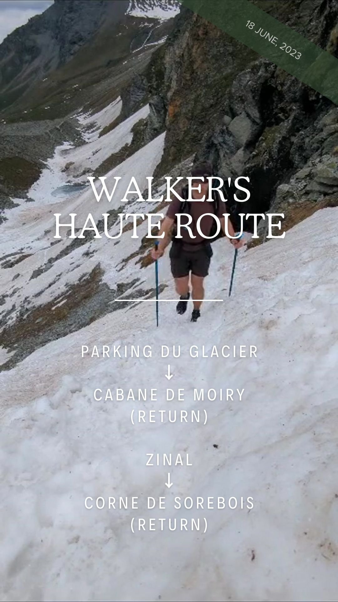
📹 June 25, 2024 - Walker’s Haute Route update (Watch)

📹 June 26, 2024 - Walker’s Haute Route update (Watch)
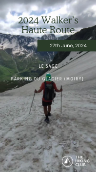
📹 June 27, 2024 - Walker’s Haute Route update (Watch)

📹 June 27, 2024 - Walker’s Haute Route update (Watch)

📹 June 27, 2024 - Walker’s Haute Route (Watch)

📹 June 28, 2024 - Walker’s Haute Route update (Watch)

📹 June 28, 2024 - Walker’s Haute Route update (Watch)
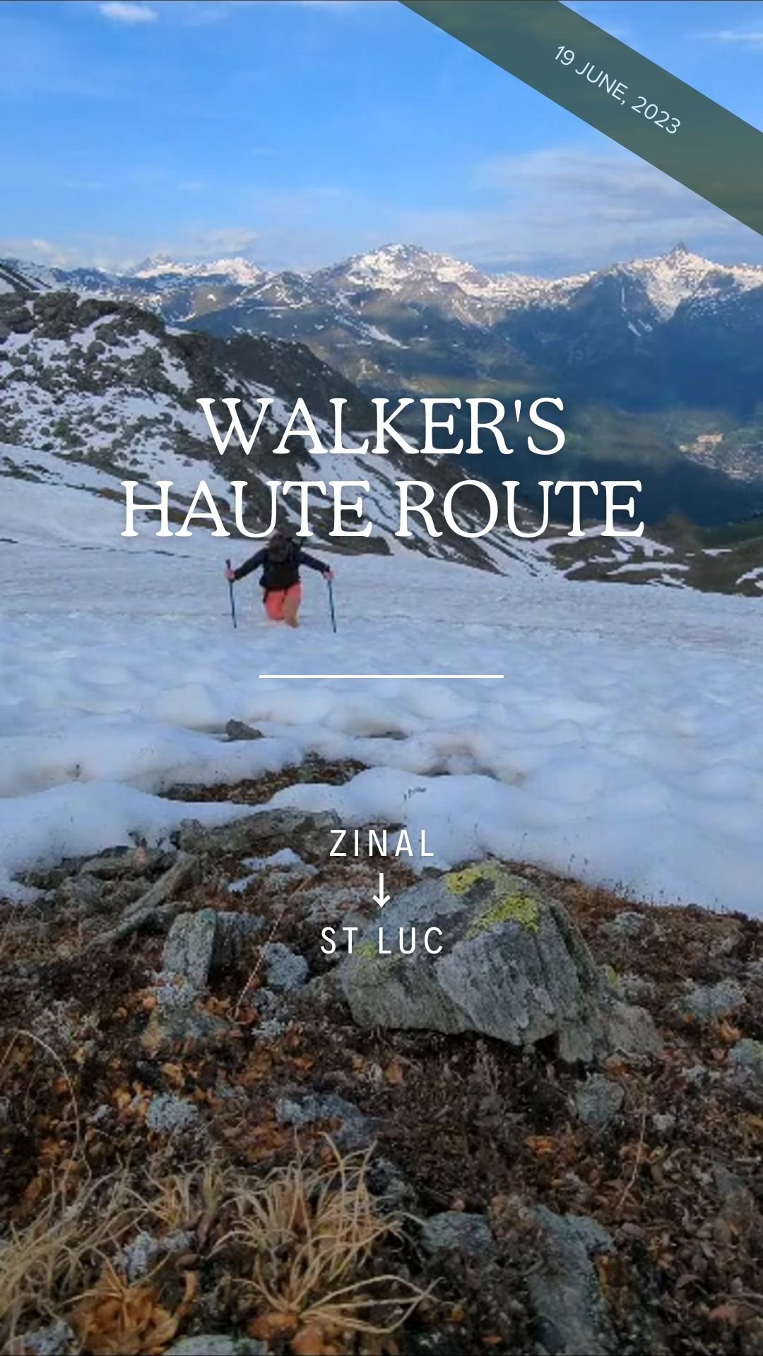
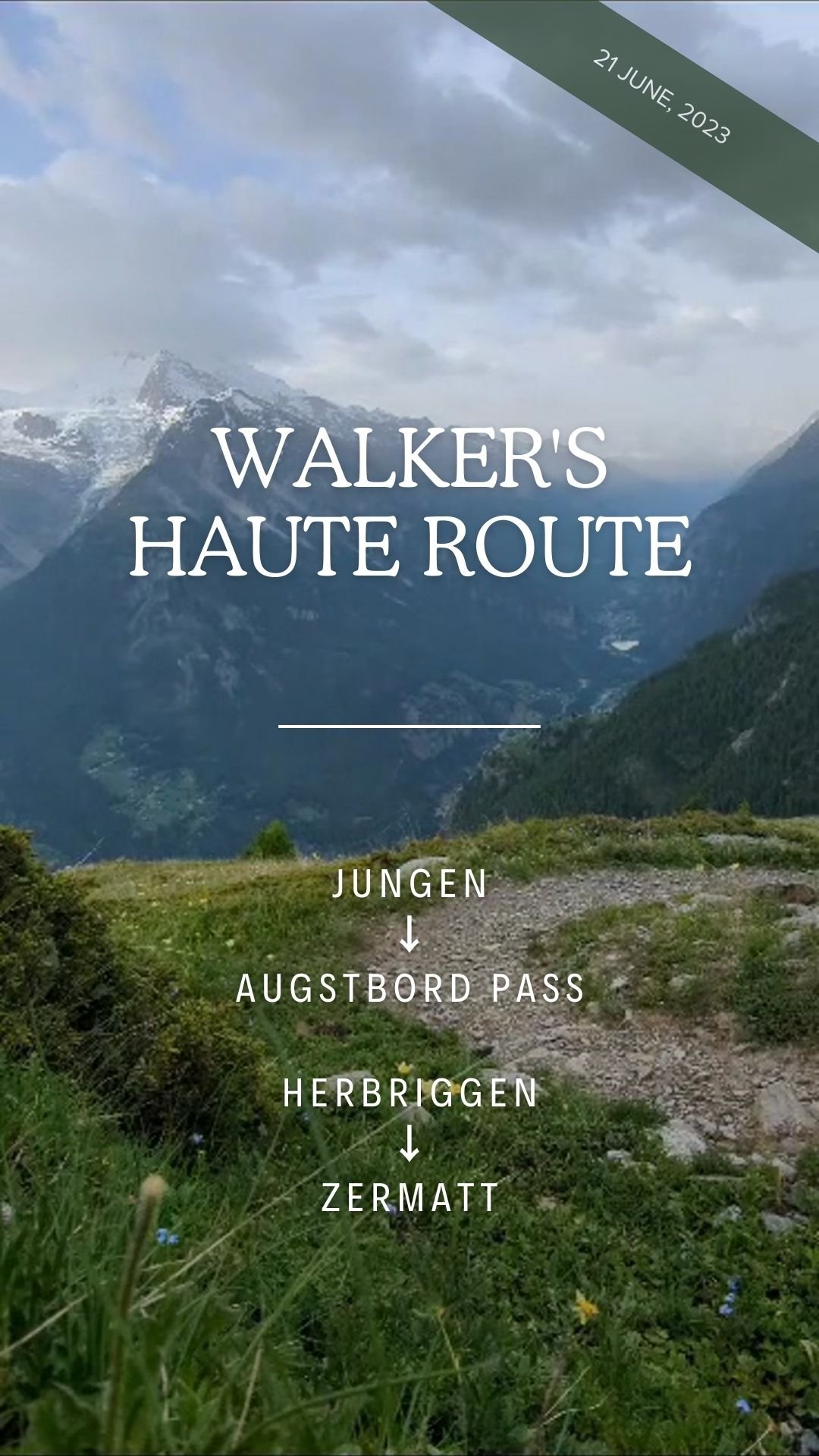
WATCH THE 2023 WALKER’S HAUTE ROUTE “BREAK THE TRAIL” VIDEOS:

trail ambassadors
In 2024, over 60 trail ambassadors shared over 500 trip reports via our social channels that reached 200k hikers ❤️
Everything we do at The Hiking Club is to make the end-to-end experience of planning and navigating a multi-day hike easy, achievable, and inspiring. Our trail ambassador program has become a key part of providing confidence to others by showcasing all the different ways hikers experience legendary trails. Whether you hike fast or slow, sleep in a tent or lux, go with a crew or solo, picnic or dine in for long lunches - the community wants to hear how you do it! Every experience on the trail is different and the more versions of a journey we share, the better future hikers understand how to create themselves the best plan and what to expect along the way.
2025 trail ambassador program
What will you do?
As a trail ambassador, you will provide “live from the trail” content about trail conditions, route updates, and memorable experiences. This content will be shared with The Hiking Club Walker’s Haute Route community to keep fellow hikers up-to-date, via Instagram and Facebook
What will you get in return?
In addition to helping out your fellow hikers with information that will help prepare them for their hiking adventure, you’ll also receive an exclusive swag box from our brand sponsors to kit you out for success on your hike!
Who are we looking for?
Solo hikers. Groups of friends tackling an adventure together. Adventurous families with kids of all ages. Fastpackers. Wanderers with their dogs. You name it! We want a diverse group of hikers who represent all the different types of people completing the Walker’s Haute Route between June and September 2025.
What is the time commitment?
Kick off session: To ensure we set you up for success, there will be a 30 min briefing session in May.
During your hike: Share your trail updates and photos via Instagram or Whatsapp (max 15 mins per day)

preparation resources
Some help from The Hiking Club to prepare for your legendary trail with confidence!
1) prepare for the alps webinar series
Watch our webinars to get your body and gear list ready to tackle your multi-day hike this summer.

PREPARE YOUR BODY FOR THE ALPS WEBINAR
Join Stacey Hardin, Doctor of Physical Therapy, for a 90-minute webinar on how to train for your multi-day Alps hike: big elevation, mountain conditions, back-to-back days. Learn more.
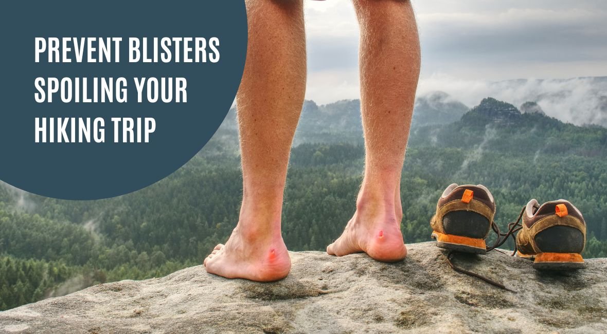
PREVENT BLISTERS SPOILING YOUR NEXT HIKE
Join Rebecca Rushton, podiatrist and owner of Blister Prevention, for a free 45-minute webinar on how to prevent and treat foot blisters during your upcoming multi-day hike.

HOW TO SUSTAIN ENERGY ON A MULTI_DAY HIKE
Join Dr Andrius Ramonas, PhD in Exercise Physiology and Sports Nutrition, Co-Founder of Roam, for a free 45-minute webinar on how to sustain energy on a multi-day hike. Learn more.
2) BE PREPARED WITH THE CORRECT GEAR
It’s best to assume that early season hikers will require micro spikes and poles to reduce the risk of incidents on difficult snow covered sections, including sloped terrain and steam crossings. Download our recommended gear list here
A special note on ice-axes: We are sometimes asked whether early season hikers should take an ice-axe. Unless you have training and experience with them, our position is no. Completing a section that requires an ice-axe changes the experience from hiking to mountaineering. If you are not an experienced mountaineer, organise a training with a qualified mountain guide and/or practice your skills on mountains/terrain you are familiar with. Bringing an ice-axe without this experience may give you false confidence to attempt challenging sections that significantly increases the risk of incident. Our advice is to identify the high risk sections and then turn around to avoid them. If you watch our break the trail videos from previous years, we practice what we preach by avoiding high risk snow sections every year. Needless to say, coming home safe is much more important than walking every step on the trail.
3) PRIOR TO DEPARTURE, CHECK SNOW CONDITIONS ON YOUR ROUTE
General snow updates are good, but identifying snow conditions on your planned route is even better. Use current snow depth data in our planning app to check your planned route and determine whether to change your route to a lower/alternative route or to bring gear to match the expected conditions.
CONFIDENTLY PLAN AND NAVIGATE THE WALKER’s HAUTE ROUTE
Check out our self-guided packages that include everything you need to plan, book, prepare, and navigate your adventure between Chamonix and Zermatt.

