
Tour of Monte Rosa | Complete Guide
Everything you need to plan, book and self-guide this epic multi-day hike through the Alps
Updated for the 2026 hiking season, based on hut bookings, latest routes and transport options
What is the Tour of MOnte Rosa?
The Tour of Monte Rosa (TMR) is a 162 km / 100 mi legendary hike through the Italian and Swiss Alps, touring around a collection of some of the most iconic 4,000m+ / 13,000ft+ peaks in Western Europe.
Monte Rosa is the second highest mountain massif in Western Europe and is home to the Dufourspitze (4,634m / 15,203ft), highest mountain peak wholly in Switzerland and second highest in Western Alps (after Mont Blanc), and the Breithorn, a popular 4000m+ summit for those looking to try mountaineering. But that’s not all the Tour of Monte Rosa has to offer hikers, as the route also guides its way past the Matterhorn (4,478m / 14,691ft), with its truly unique pyramidal peak and around the Mischabel range, the highest massif wholly in Switzerland.
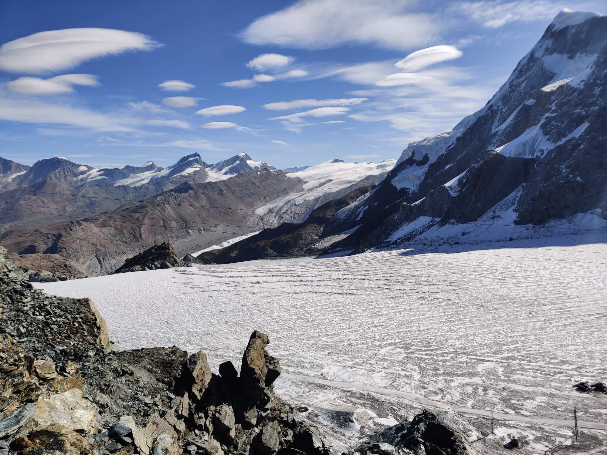
While the tour still leads hikers through fertile valleys and alpine hamlets, it is the combination of rock and ice from giant peaks and glaciers dominating your landscape views that make it stand apart from other legendary trails in the area.
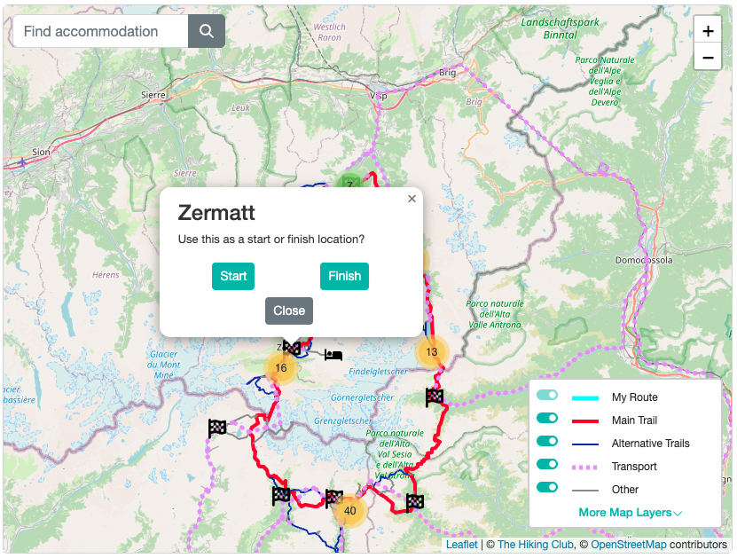
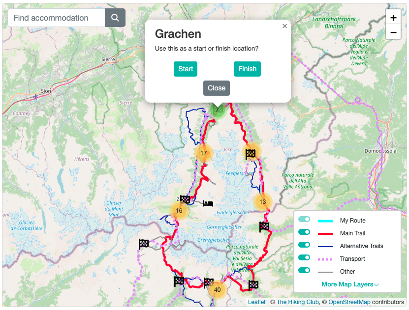
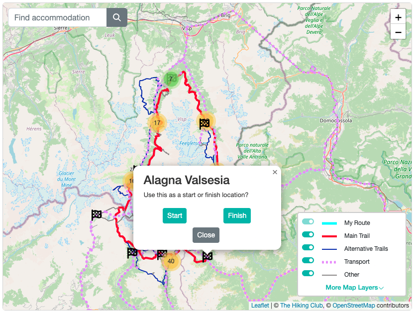
Tour of Monte Rosa: High level map from our planning app showing the trail around the massif which is located at the intersection between the Italian and Swiss borders. Zermatt lies on the West side of the trail, Saas Fee on the East, Grächen on the North, and Alagna Valsesia on the South.
OUR SELF-GUIDED HIKING PACKAGES
Everything you need to plan, book, prepare and navigate your Tour of Monte Rosa adventure.

Everything you need to plan, book, prepare and navigate your adventure. This package includes;

Access a trail expert to prepare an itinerary that meets your needs.
This package includes;
60 min consultation
Personalised itinerary designed by our trail expert
Is there only one Tour of MOnte Rosa?
Yes! Unlike the Walker’s Haute Route that shares its name with events and adventures in other locations, there is only one Tour of Monte Rosa. There are a few points to mention which may help avoid confusion when looking at different sources to do with the TMR.
The most popular method for completing the Tour of Monte Rosa is by hiking.
Hiking: The name may suggest that you’ll just be completing a circuit of the Monte Rosa massif (like the Tour du Mont Blanc going around the Mont Blanc massif), however, the route also leads you around a second connected massif called the Mischabel group. This is due to the high alpine terrain preventing a hiking trail from being established between the Monte Rosa and Mischabel massifs. However, the inclusion of the Mischabel group offers hikers more iconic peaks (such as the Dom (4,545m / 14,911ft) - the third highest peak in the Western Alps and second highest in Switzerland), charming Swiss alpine villages, an optional unguided glacier crossing and thrilling balcony trails that fit perfectly with the Tour of Monte Rosa.
Trail Running: Since 2015, there is a popular trail running series called “Ultra Tour Monte Rosa” (UTMR) held at the start of September. There are several races of different lengths, but the premier 170km race shares much of the same trail as the hiking route. If you happen to be hiking at the same time as the event, make sure to factor is extra time for cheering and letting runners past. You may also find it difficult to find accommodation in the main race village of Grächen, Switzerland during this week.
Alpine mountaineering: routes are sometimes referred to as a Tour of Monte Rosa. This is due to high alpine huts allowing many of the 4,000m+ / 13,000ft+ peaks on the Monte Rosa massif to be summited on a 4-6 day trip. These mountaineering tours are also sometimes called the “Spaghetti Tour of Monte Rosa” because most of the best huts for summits are on the Italian side of the massif and have a reputation for serving up the best spaghetti in the Alps. Don’t worry, the huts lower down the massif supporting the TMR hiking route still serve up some fantastic spaghetti along with other Italian classics too!
What is the Distance of the Tour of Monte Rosa?
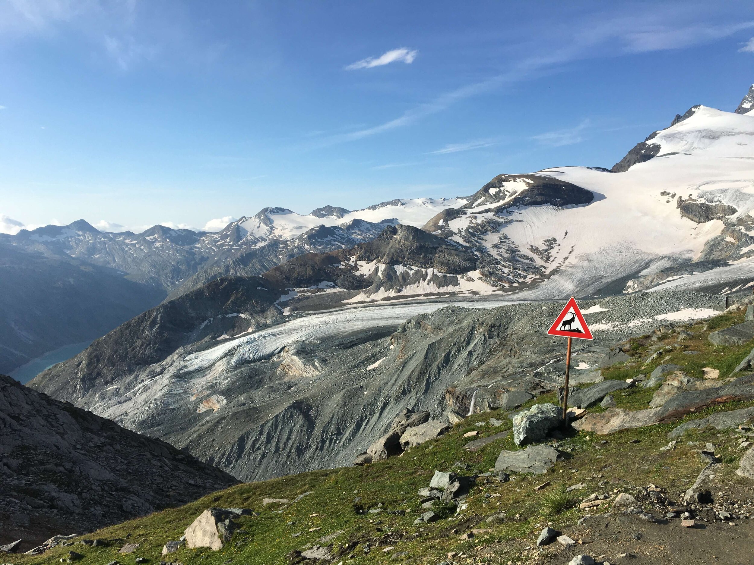
Glacier Trail is a spectacular variant located between Saas Fee and Mattmark Dam, that allows hikers to get up-close with
As with all multi-day trails in the Alps there is a “standard” route and then many variations, shortcuts and detours for hikers to choose from. The standard route is:
Distance: 162 km / 100 mi
Elevation gain: 11,000 m / 36,000 ft
Highest point: 3,301m / 10,830 ft
Number of days to complete: 9 (at Steady pace)
Please note that the 162km (100mi) stated above for the main route distance has been determined using detailed GPS tracking and trail measurement software. This may be different to guide books, that disclose their distance as an estimate only, and UTMR race (170km | 106mi), that has sections on the road away from the main TMR trail. Learn more about our accurate trail data.
Depending on your route, hiking speed, and including public transport it can take anywhere from 6 to 13 days to complete the journey around Monte Rosa. See sample itineraries here.
We include the most popular alternativee routes, such as Hornli Hut, Glacier Trail, Colle di Pinter and Mattertal Valley Trail in our trip planning app. These alternative routes include additional highlights, avoiding challenging sections of trail or skipping highlights on the main trail by going more direct. For a full summary of the main and alternate routes (including images, trail stats and descriptions), read the detailed blog posts.
HOW LONG DOES IT TAKE TO HIKE THE TOur of MOnte Rosa?
The trail typically takes 8-10 days to complete, depending on your desired speed/time on trail and alternative routes.

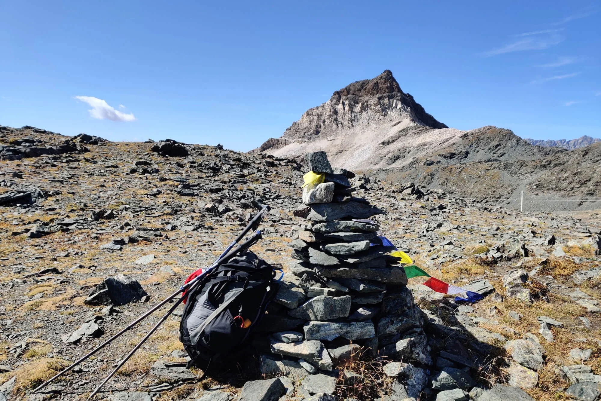
Mattmark Dam: Glacier fed dam located at over 2,200m / 7,200ft
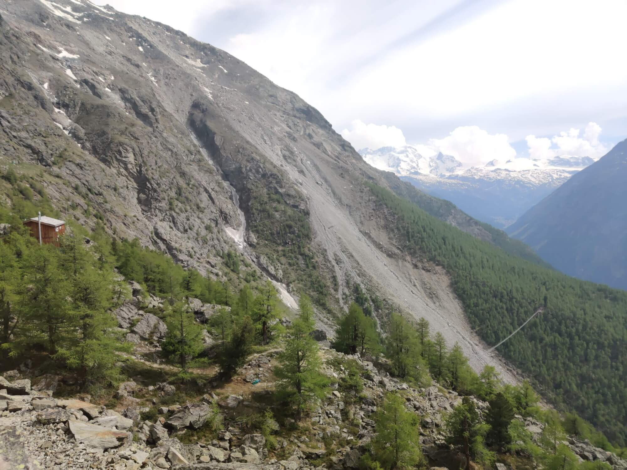
The Tour of Monte Rosa is a hike through high alpine terrain. The standard trail stays mostly above 2,000m / 6,650ft, with 6 mountain passes between 2,600m / 8,530ft and 3,295m / 10,810ft which tests even the fittest hiker. Some sections are well maintained, undulating and an absolute delight. Other sections are rocky, with boulder crossings that challenge hikers in both the ascent and descent. There are TMR trail markers at key junctions for the standard route. However, as the Alps is a network of trails, there are many route options along the way. It is therefore necessary to be familiar with your daily route and have an up-to-date GPS map to navigate your chosen route.
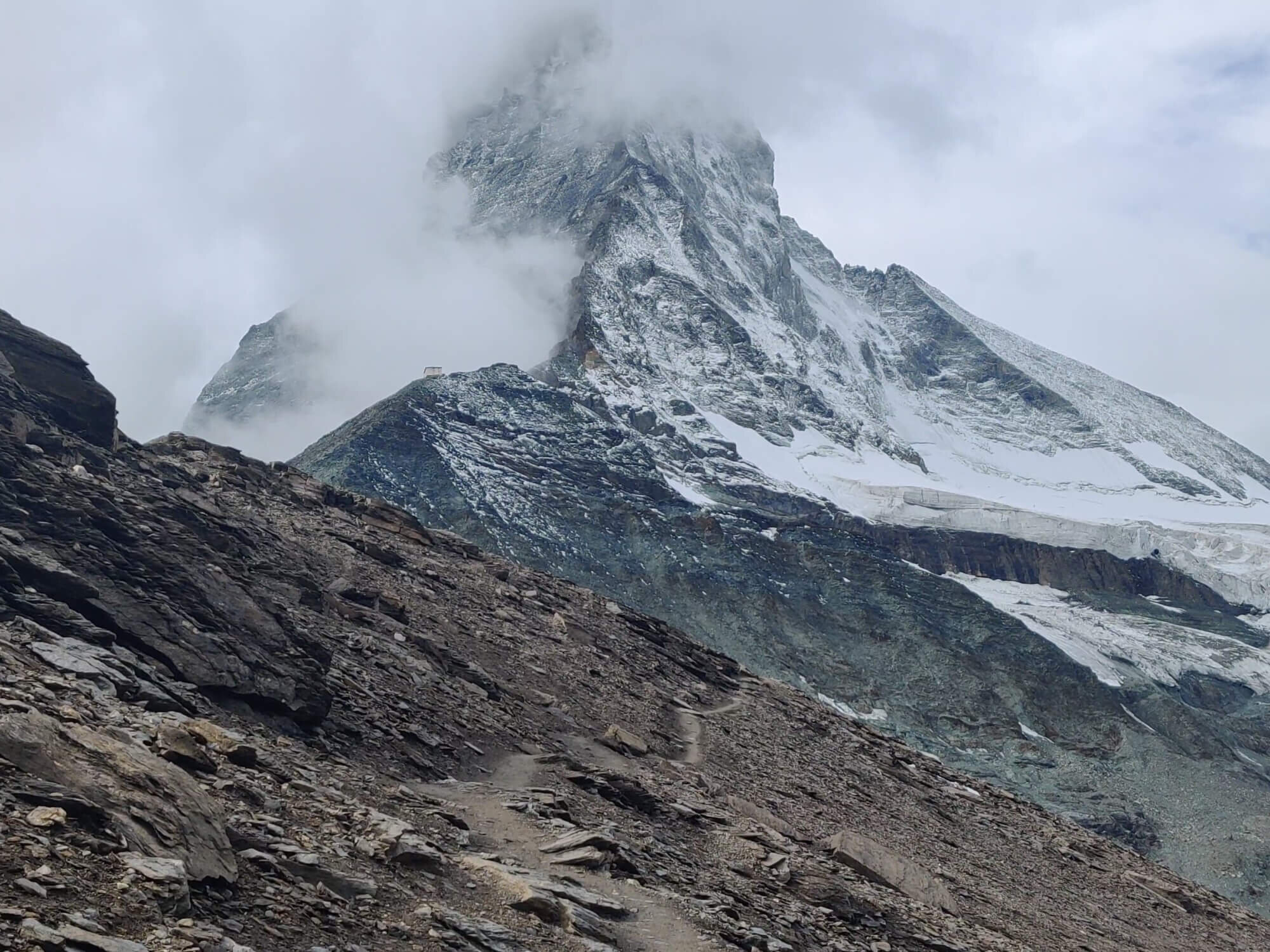
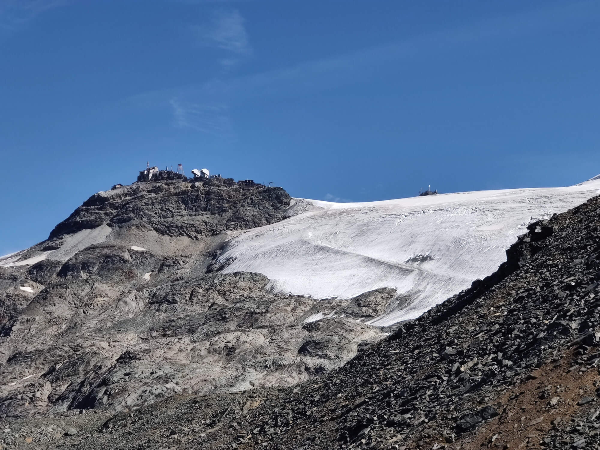
The glacier crossing on the Swiss side of Theodul pass is a unique feature not typically found on other multi-day hiking trails in the Alps. It is important to prepare with the appropriate equipment (and guide), consider the weather forecast, and take sufficient time to complete this section. As of 2023, there is now an option for hikers to skip the glacier crossing by taking the Matterhorn Alpine Crossing gondola, the highest cable car in the Alps connecting Switzerland and Italy.
There are also some long stretches of trail without hotel/hut accommodation which must be achieved within a day as there is no option for transport or shortcuts. The most notable is between Macugnaga and Rifugio Pastore which has a distance of 22km / 14mi with 1,500m / 4,900ft of elevation gain (280m / 920ft less if you hike the section in the opposite direction) - for the average hiker, this will require about 10 hours of hiking. Those bivouacking the trail do have options to shorten this and other long sections.
With big elevation gains, high alpine passes, 1+ glacier crossings and long sections of trail that must be achieved in one day, the Tour of Monte Rosa is less popular than other legendary trails in the area. But, offers those capable of meeting the challenge a truly rewarding experience through the Alps.
NEED HELP WITH YOUR TRIP?

Where to start The Tour of Monte Rosa?
As noted above, the Tour of Monte Rosa is a circumnavigation of the Monte Rosa and Mischabel group massifs. It does not summit any of the peaks, however some hikers choose to add on a summit to their itinerary, such as the Breithorn (4,164m / 13,661ft) which is accessible from the Zermatt ski area. The 4 most popular start/end locations are:
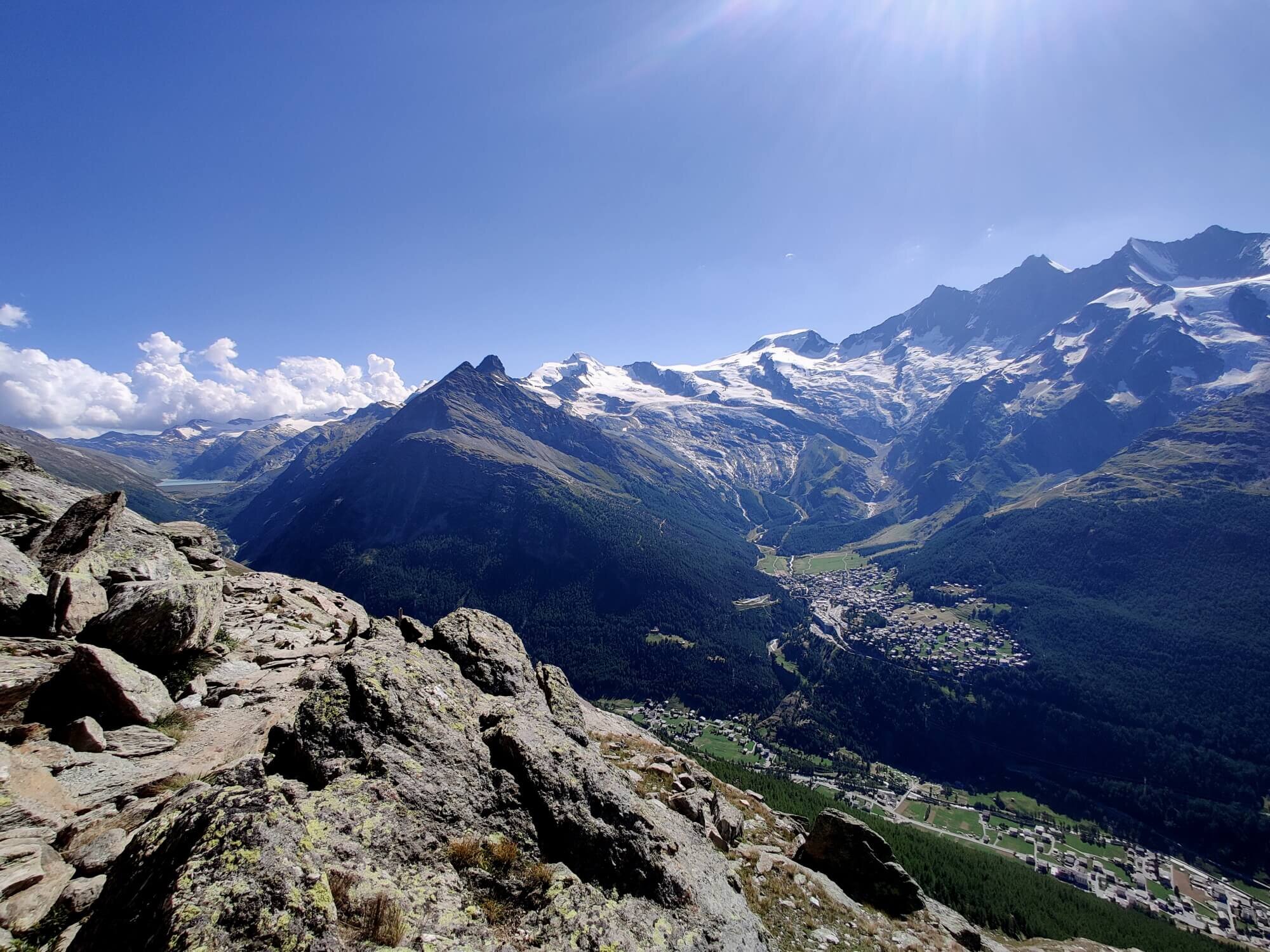
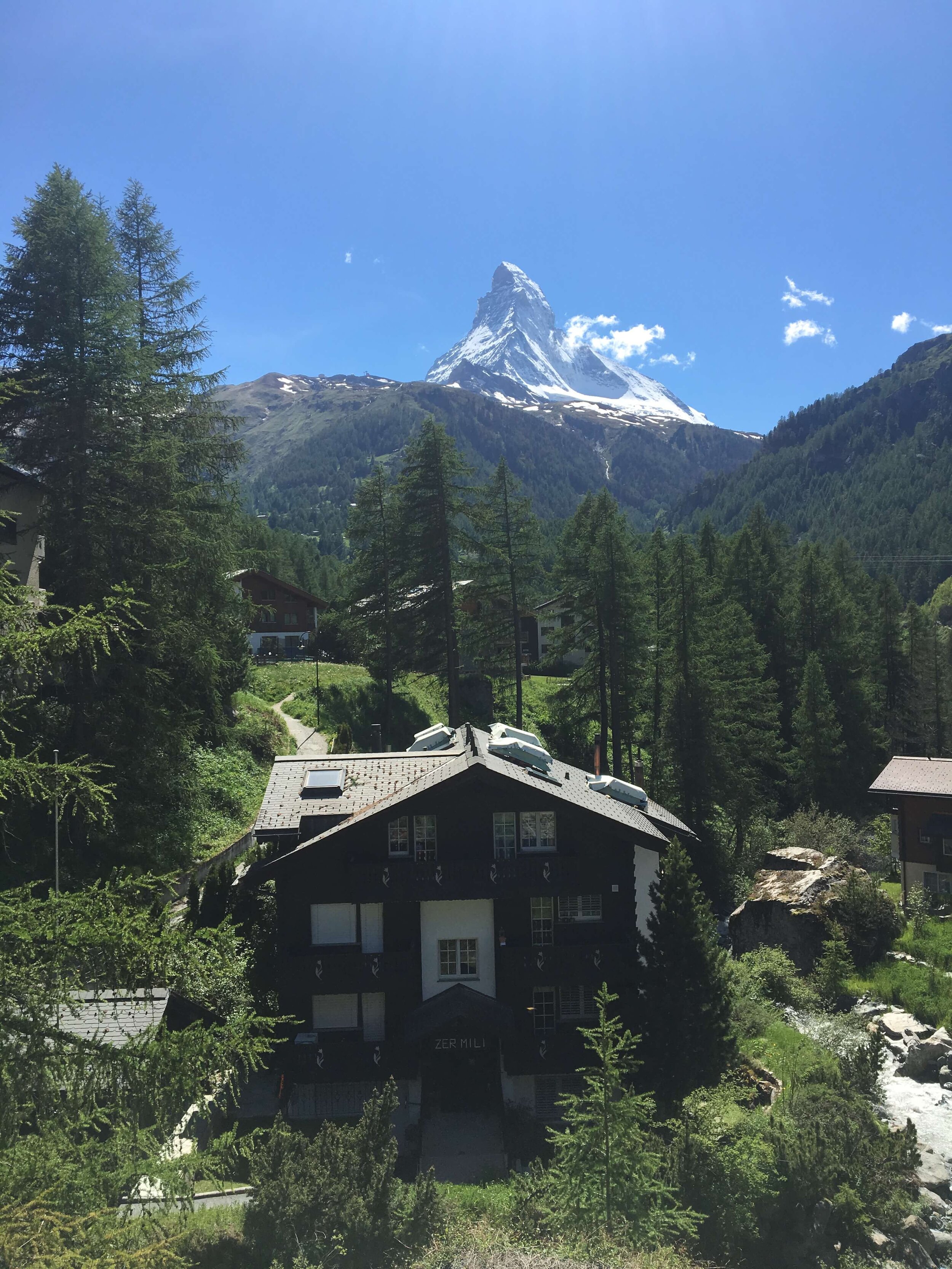
ZERMATT, SWITZERLAND
The car-free village of Zermatt draws mountain lovers and adventurers from all over the world. It has a massive range of accommodations, international cuisines, specialty stores, and all the other shops and services you'd expect from a world-class resort. The iconic Matterhorn towers above, constantly drawing attention from people in the village and surrounding mountains as the sky changes throughout the day. It's a worthy destination to bookend and celebrate your epic Tour of Monte Rosa hike.

Zermatt: A popular start/end location for the Tour of Monte Rosa
Choose Zermatt as your start/end location in our planning app for accurate daily hiking stats.
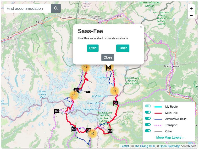
SAAS FEE, SWITZERLAND
Saas Fee, known as “The Pearl of the Alps", is a glacial village located at 1800m / 5,900ft on a high alpine plateau and is most renowned for the 13 four thousand meter peaks and their glaciers that surround it. It offers a wonderful variety of day hikes to acclimatise prior to your tour, gondolas/cable cars/funiculars to whisk you up to restaurants on the edge of glaciers and plenty of outdoor stores to buy any last minute hiking or camping gear and supplies.
Saas Fee: A popular start/end location for the Tour of Monte Rosa
Choose Saas Fee as your start/end location in our planning app for accurate daily hiking stats.
Grächen, switzerland
The mountain village is situated on a broad sun terrace in the Mattertal Valley, which focuses on being a family-friendly resort. Grächen has a reputation as a hiking destination due to the famous Höhenweg and Europweg trails connecting it to Saas-Fee and Zermatt, respectively, and a broader network of trails through the forest, to mountain lakes, along irrigation channels, and even to the edge of a glacier. It is a full-service village with many hotels, restaurants, supermarkets, and a bakery.
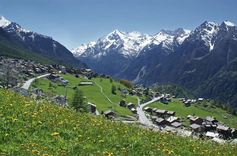
Grächen: A popular start/end location for the Tour of Monte Rosa
Choose Grächen as your start/end location in our planning app for accurate daily hiking stats.
ALAGNA VALSESIA, ITALY
This small mountain town is located at 1,191m /3,907ft within the Valsesia alpine valley, a UNESCO World heritage site since 2013. The town has several buildings built around 1500–1600 in a pure "Walser Style" using local wood and stones, still in perfect condition. There are several hotels, restaurants, small supermarkets, and ATMs available.
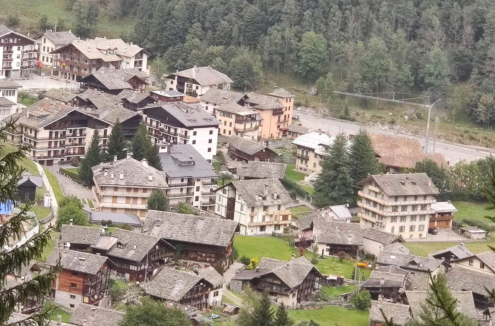
Alagna Valsesia: An alternate start/end location for the Tour of Monte Rosa
Choose Alagna Valsesia as your start/end location in our planning app for accurate daily hiking stats.
which direction to Hike the Tour of Monte Rosa?
The Tour of Monte Rosa can be hiked in either a clockwise or counter-clockwise direction, however, there are a few things to keep in mind when making your choice;
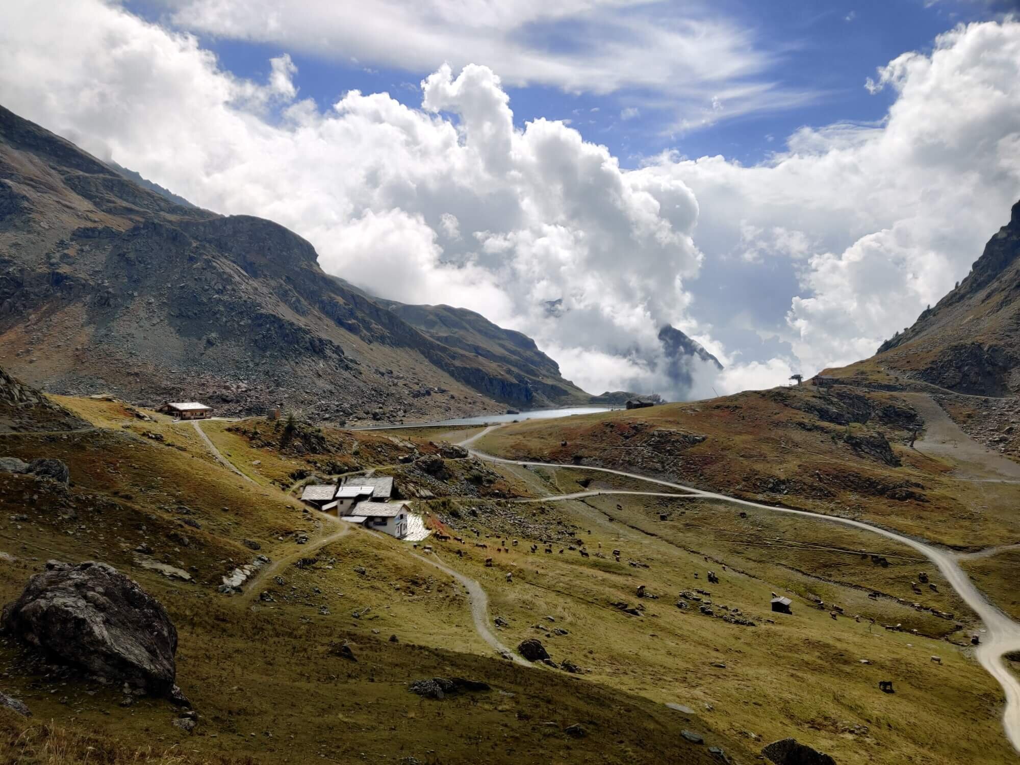
Theodul Glacier Crossing: Glaciers are best crossed in the morning before the summer sun speeds up the melt and creates weaknesses. Those hiking in a counter-clockwise direction need to consider what time they will be able to reach the Theodul glacier from Zermatt, given it is 11km / 6.8mi with 1,570m / 5,151ft elevation gain to the glaciers edge. Luckily, for those open to taking some transport on their tour, it is possible to catch a gondola from Zermatt to Trockener Steg which is only 1.6km / 1mi with 250m/ 820ft elevation gain from the Theodul glacier.
For those hiking clockwise, there are two alpine huts at/near the Theodul pass which you can stay at before crossing the glacier first thing in the morning.
Regardless of your hiking direction, we recommend hiring a guide for this section of the trail and they will inform you of the best time window to cross the glacier based on the date of your tour and weather/glacier conditions.
Theodul Glacier in September.
Macugnaga and Rifugio Pastore: For those staying in huts and hotels, the trail between Macugnaga and Rifugio Pastore must be completed in one go as there is not accommodation between. While the distance of 22km / 13.7mi is obviously the same in both directions, the elevation gain is 1,850m / 6070ft if hiking in a counter-clockwise direction and 1,585m / 5,200ft in a clockwise direction. Although it is a massive day in either direction, those looking for any option to make it shorter will benefit from hiking in a clockwise direction. Those bivouacking the trail do have an option to shorten this section which removes it from being factor in their direction decision.

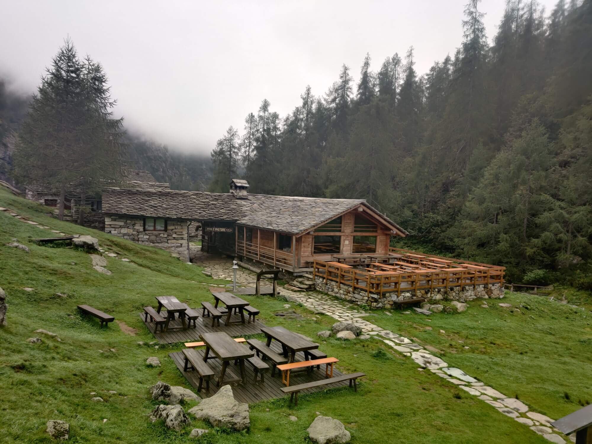
Rifugio Pastore is a medium sized alpine hut located at 1,575m / 5,167ft elevation in the Alta Valsesia Natural Park.
Warming up the legs: Most hikers would prefer to start a big multi-day trail on a flat and/or gradual sloping section to blow off the cobwebs and get used to carrying a pack again. By starting in Saas Fee in a clockwise direction hikers begin with a gradual descending trail for the first hour, followed by a gradual ascent mostly through the trees to Mattmark dam, then hiking alongside it on a mostly flat track before a final ascent to Monte Moro pass (border between Switzerland and Italy).
What are the Tour Monte Rosa TRAIL Highlights and Alternative Route Options?
Main Trail Highlights
For a full summary of the main trail (including images, trail description and transport shortcuts), read this detailed blog post.


Alternate Route Options
For a full summary of the alternate routes (including images, trail stats and descriptions), read this detailed blog post.


How does the Tour of Monte Rosa compare to other legendary hikes in the area?
The Tour of Monte Rosa is one of most challenging legendary hiking trails in the Alps due to its steep climbs, high mountain passes, glacier crossing and challenging terrain. We recommend hikers have previous experience hiking in the Alps (or similar terrain) to confidently embark on this trail.
WHAT TYPE OF ACCOMMODATION IS AVAILABLE ON THE TOUR OF MONTE ROSA?
Hikers have the opportunity to stay in both alpine villages and mountain huts along the trail. We have created a comprehensive list of all private room, shared room and campsite accommodation on the Tour of Monte Rosa, as well as links and information on how to book each one.
For those that haven’t experienced staying in a mountain hut - also known as refuges (German) and rifugios (Italian - this is your opportunity. Sleeping amongst the mountains, indulging in local cuisine and meeting other hikers is a unique experience not to be missed.
Some of the most popular huts include:
Europahutte: located at 2,220m along the famous Europaweg trail
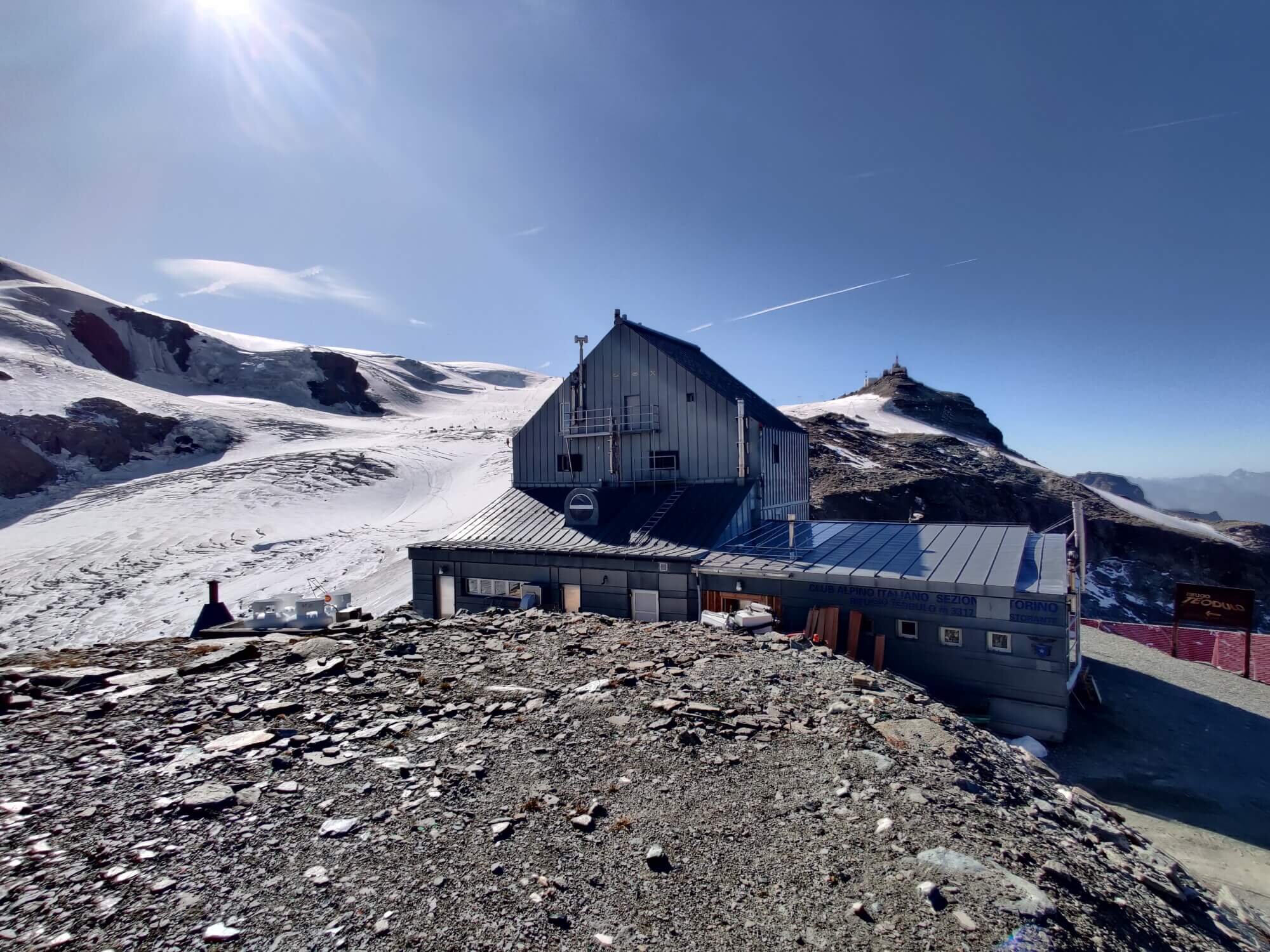
Theodulhutte: located at 3,317m on the border between Switzerland and Italy
Rifugio Gabiet: located at 2,375m on Gabiet Lake
Rifugio F Pastore: located at 1,575m
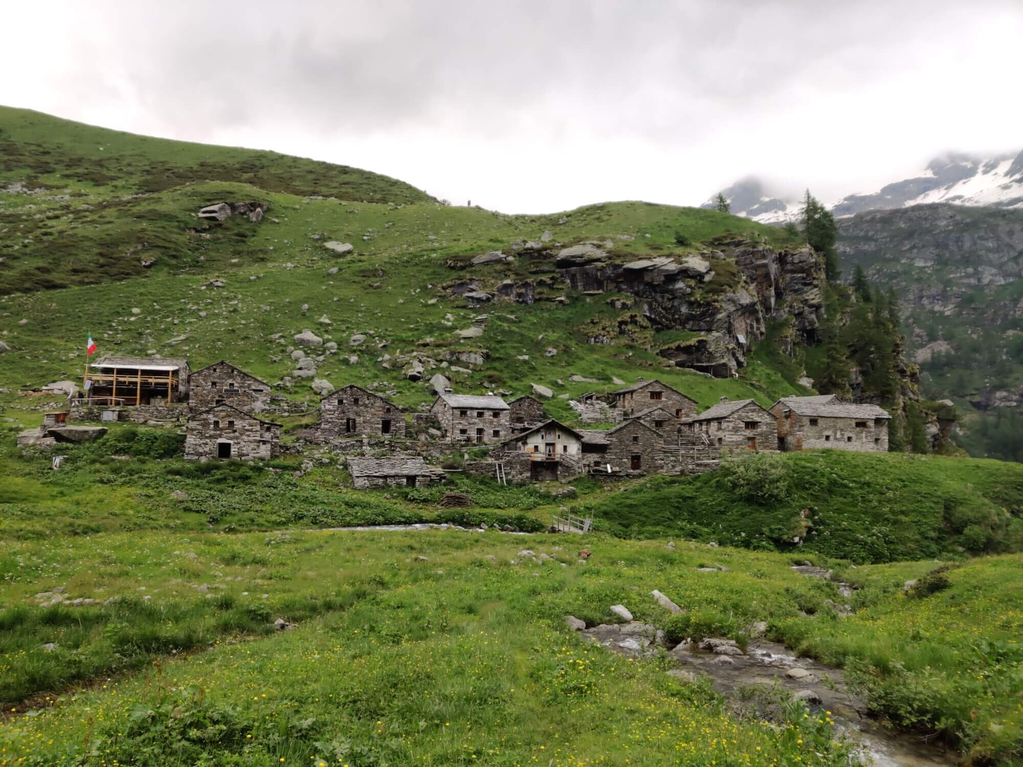
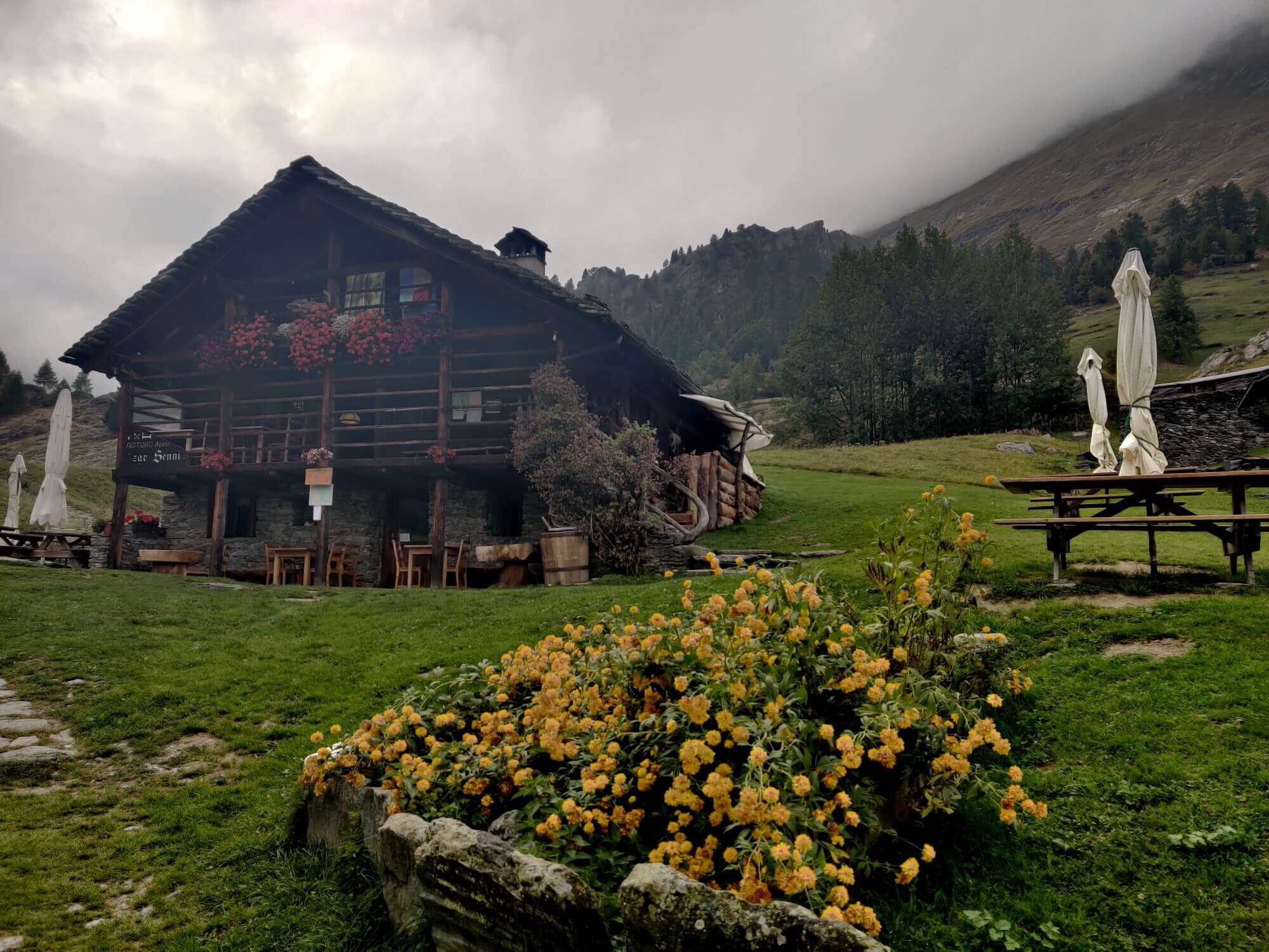
Rifugio Zar Senni: located at 1,664m
Is it possible to CAMP along the Tour of Monte Rosa?
Yes, it is possible to bivouac or stay in campgrounds in villages along the Tour of Monte Rosa.
There are very strict rules put in place by the national and local governments for those that wish to bivouac. Due to the prevalence of private land (high alpine farms/ski resorts), protected reserves and inhospitable slopes for sleeping, there are only a handful of locations along the trail that abide by these guidelines and are suitable.
In terms of campgrounds, the type and quality of facilities differ based on the campground, but in general there are hot showers, kiosk/cafe or restaurant and wifi. The average cost for 1 person in a small tent is 20-25 EUR per night. Unfortunately some villages (and key locations) don’t have campgrounds. However, there are low cost dormitory or hotel room options available for those nights.
Read our detailed blog post on “The Complete Guide to Camping on the Tour of Monte Rosa” for a full write up.

Find permitted bivouac locations and campgrounds in our trip planning app for the Tour of Monte Rosa
HOW MUCH DOES IT COST TO HIKE THE TOUR OF MONTE ROSA?
One of the primary questions first-timers have about hiking in the Alps is how much it will cost. There are so many elements to calculate - accommodation, transportation, food etc - that can make it difficult to determine whether a bucket-list trip to the Alps is possible.
Using actual costs as of January 2024, once you arrive in Geneva Airport, you can hike the Tour of Monte Rosa from:
Camping: 850 EUR per person
Solo in Dormitory: 1,000 EUR per person
Double in Private Rooms (where possbile): 1,100 EUR per person
This is based on a standard 9 day route and what you can expect by planning your trip using our self-guided products. It includes private mountain guide for Theodul glacier crossing, transfers to/from the trail, accommodation in huts/hotels and eating delicious 3-course meals of local delights, as you self-guide your way across one of the legendary trails of the world. If you would like to include add-ons such as Breithorn summit or a night at Hornli Hut, this is additional.
For those looking to join a tour group rather than self-guide, the cost is upwards of 2,500 EUR per person.
For a full break-down of the cost calculation, see the detailed blog post.
READY TO START PLANNING YOUR OWN TOUR OF MONTE ROSA HIKE?
Everything you need to plan, book, prepare and navigate your adventure. This package includes;
Access a trail expert to prepare an itinerary that meets your needs.
This package includes;
60 min consultation
Personalised itinerary designed by our trail expert