Download before you leave
Once the required base maps and your route files are downloaded, your device can use GPS positioning without relying on mobile reception.

04 Navigate your hike
Download personalised GPS files based on your exact itinerary—including your route to and from accommodation, planned alternatives, transport locations and useful places along the way.

Platform access from €79 · One payment per hiking season


 Explore trails
 France · Italy · Switzerland
Tour du Mont Blanc
→
France · Italy · Switzerland
Tour du Mont Blanc
→
 France · Switzerland
Walker’s Haute Route
→
France · Switzerland
Walker’s Haute Route
→
 Dolomites · Italy
Alta Via 1
→
Dolomites · Italy
Alta Via 1
→
 Dolomites · Italy
Alta Via 2
→
Dolomites · Italy
Alta Via 2
→
 Dolomites · Italy
Alta Via 4
→
Dolomites · Italy
Alta Via 4
→
 Switzerland · Italy
Tour of Monte Rosa
→
Switzerland · Italy
Tour of Monte Rosa
→
 Valais · Switzerland
Tour des Combins
→
Valais · Switzerland
Tour des Combins
→
 Bernese Oberland · Switzerland
Bernese Oberland Traverse
→
Bernese Oberland · Switzerland
Bernese Oberland Traverse
→
 Jungfrau · Switzerland
Tour of Jungfrau Region
→
Jungfrau · Switzerland
Tour of Jungfrau Region
→
 Switzerland
Via Alpina Switzerland
→
Switzerland
Via Alpina Switzerland
→
 Scotland
West Highland Way
→
Scotland
West Highland Way
→

Personalised map files
Your custom map files reflect the itinerary you created in The Hiking Club platform—not a generic version of the trail.
Your highlighted route continues all the way to and from your selected accommodation, transport connections and other planned stops.
Based on the daily stages you selected.
See each planned overnight location along your route.
Locate the services included in your itinerary.
Carry the route options relevant to your plan.
Offline navigation
Download your personalised GPS files before your hike and use them with compatible navigation apps and supported GPS watches.
Once the required base maps and your route files are downloaded, your device can use GPS positioning without relying on mobile reception.
Send the latest files to everyone in your hiking group so each person can carry the planned route on their own compatible phone or watch.
GPX and KML files are available for use with compatible navigation apps on iPhone and Android devices and with supported GPS watches.

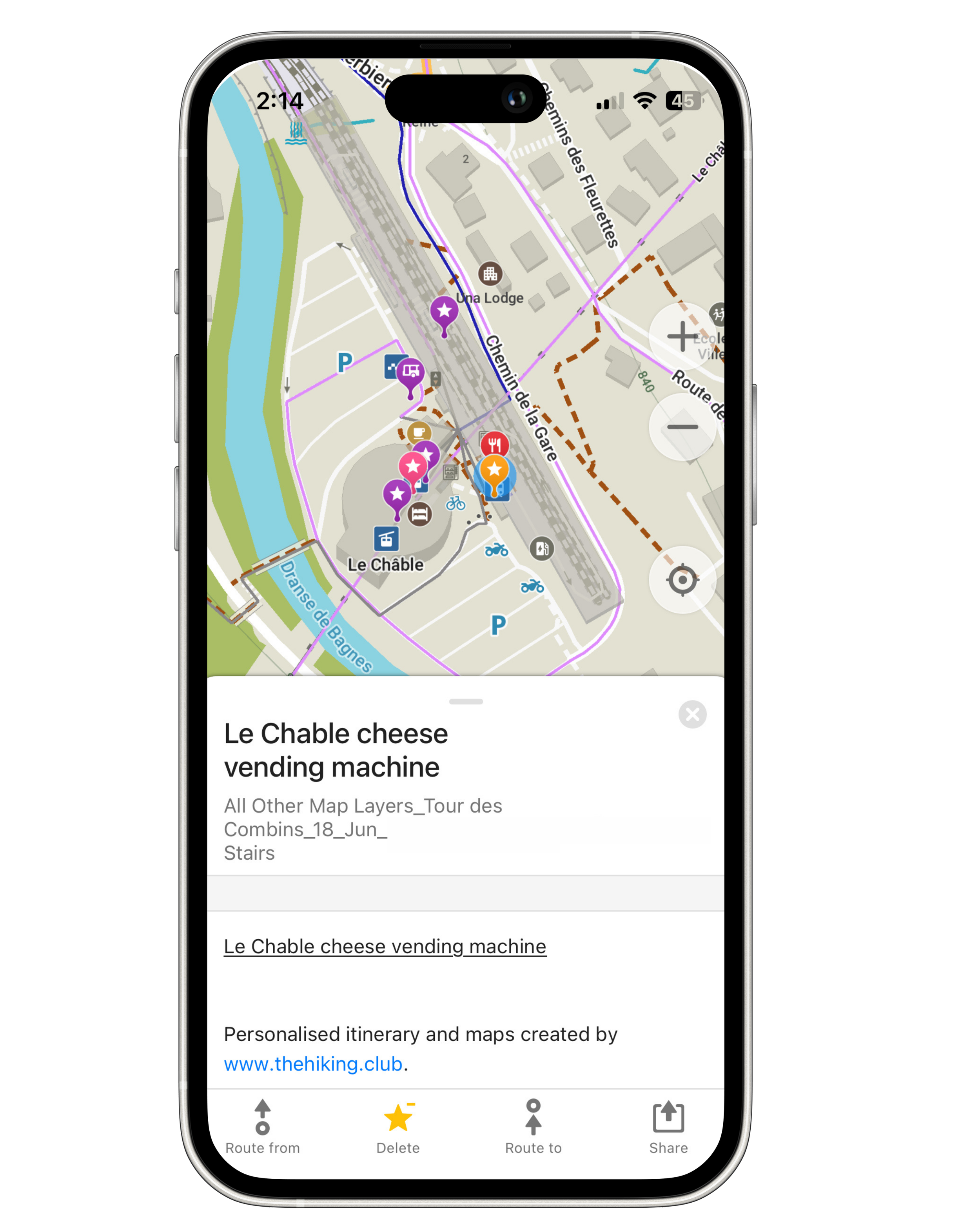
Useful places
See practical stops in relation to your planned route—not as a separate list you need to interpret while hiking.
Decide where you can refill water, buy food, withdraw cash or stop before continuing to your accommodation.
Spend less time searching while you hike and make each stop part of your planned day.
Seasonal transport
Mountain transport does not operate on the same schedule throughout the year. The Hiking Club connects relevant services to your itinerary and hiking dates.
See departure locations, operating periods and available timetable information for the transport that can help you reach the trail, adjust a stage or return from your route.
Understand whether a service fits your dates before you depend on it as part of your hiking plan.


Planned alternatives
Your map files can include more than the route you intend to hike. Relevant alternate trails and transport options are carried alongside your main plan.
If circumstances change while you are on the trail, you can see the available options in relation to your location and make an informed decision for your group.
Review the other mapped routes and nearby transport.
Understand where a stage could be adjusted using transport.
See relevant alternatives without searching from scratch.
Route decisions remain the responsibility of each hiker. Always assess current conditions, official advice and your group’s experience before changing your planned route.
Ready for the trail
Build your itinerary, prepare with current trail information and download personalised navigation files for your exact hiking plan.
Platform access from €79
Sign up to receive regular updates on trail conditions, new products and blog articles about hiking in the Alps.
Please enter a valid email address.
Choose the trails you’re interested in after signing up. Unsubscribe at any time.