

Details about the section of Europaweg trail closed for the 2024 hiking season
While many of the wonderful Tour du Mont Blanc refuges will feature on your ideal self-guided hiking itinerary, what do you do if they have no availability when you go to book your own trip? In this blog post, I’m going to share accommodation booking tips and my top 4 booking tricks for finding accommodation that will keep your trip alive.
It costs 500 Swiss Francs to plan your own 6-day hike in Bernese Oberland, Switzerland.
This cost will vary depending on the number of days on the trail, and your accommodation, food, and transport preferences. So, how do you calculate how much it will cost for your trip? Here are a few sample itineraries using actual 2024 costs to help you out!
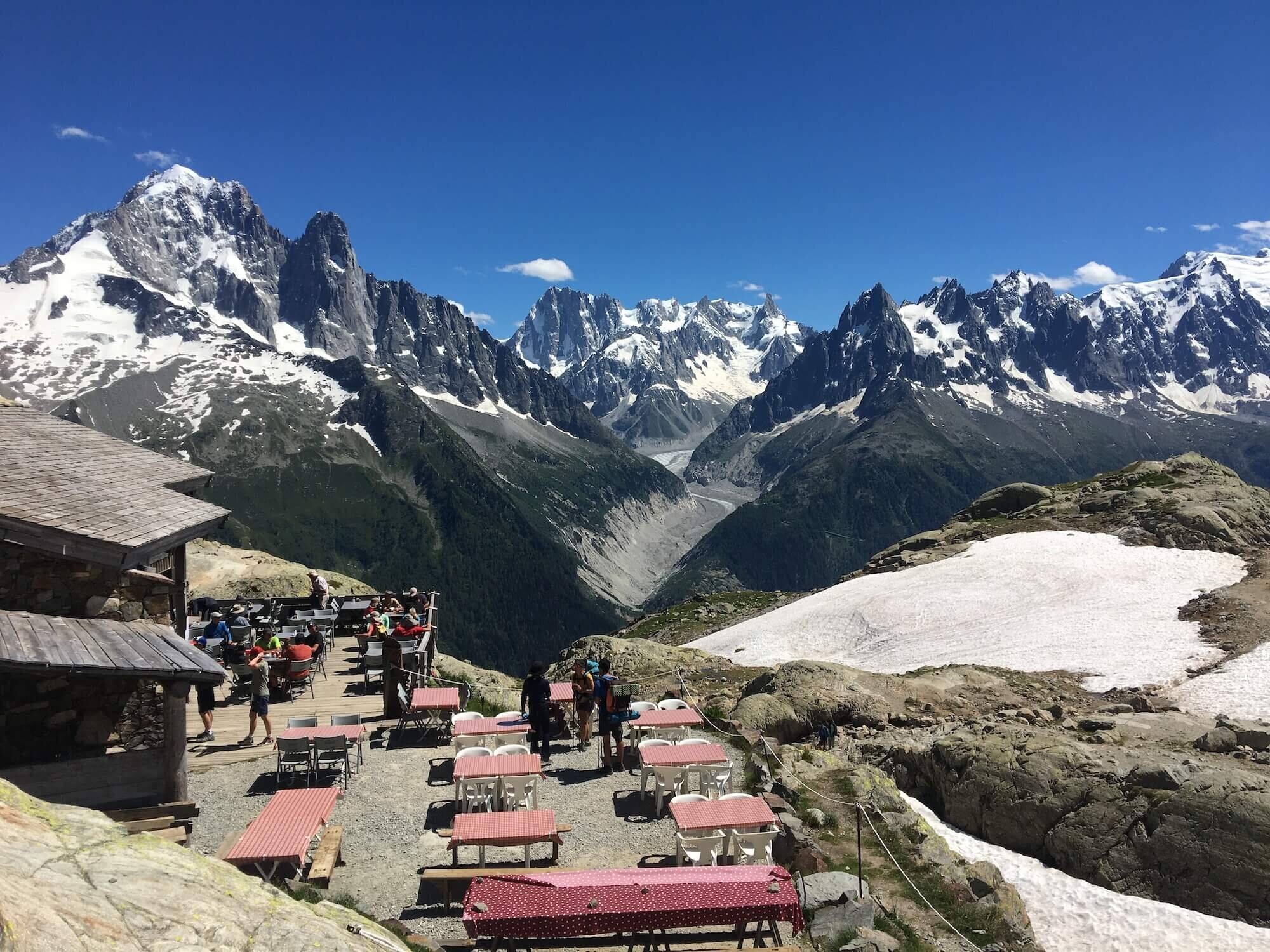
The Europaweg Trail between Grächen and Zermatt is one of the most famous two-day hikes in the Alps, as well as forming part of the Walker’s Haute Route and Tour of Monte Rosa. In the past few years, there has been some confusion about where exactly the Europaweg trail goes, due to the original route still appearing on some outdated maps, apps and guidebooks. In this updated post, I share details about the Europaweg trail, clarify where the route goes and share a brief history of trail changes in recent years.
It costs €826 to plan your own 10-day hike of the Tour du Mont Blanc. This amount comes from our new cost calculator for the Tour du Mont Blanc, which uses over 300 actual customer itineraries and 2023 costs from nearly 100 accommodation and service providers along the trail.
the calculator is for self-guided hikers to estimate how much it will cost them to organise their own hike of the Tour du Mont Blanc based on their preferences. Give it a try!
How much it costs to hike the Walker’s Haute Route is one of the most common questions I’m asked. Armed with my accounting background and mission to make every hikers self-guided dreams come true, I’ve dug deep into the numbers across all the different accommodation types, food and services available to provide firm guidance on what it costs to hike the Walker’s Haute Route.
There are several parking options for those hiking the West Highland Way, whether you plan to park at the starting point (Milngavie), near key sections of the trail, or at the end point (Fort William).
Here’s an overview of the parking facilities and considerations along the West Highland Way:
Milngavie Station Car Park:
The main car park at Milngavie Train Station is a popular place for hikers to park at the start of the West Highland Way.
Cost: The station car park is free. Arrival early to secure a space.
Duration: The car park is suitable for long-term parking (i.e., for the duration of your hike), but check the specific parking regulations.
Town Center Car Parks:
There are also other public car parks in the Milngavie town center, offering free or low-cost parking for short to medium-term use.
Check signage to ensure you’re in the correct type of parking for longer stays.
For hikers starting from one location but wishing to park and hike from different points, there are parking options available at several popular locations along the West Highland Way:
Drymen:
Drymen Car Park: Located near the village center, it's a pay-and-display car park suitable for short-term parking.
Cost: Approximately £2 to £5 per day.
Balmaha:
Balmaha Car Park: This car park, located at the shores of Loch Lomond, is a popular starting or stopping point.
Cost: Around £3 to £5 per day, depending on the time of year and duration of stay.
Tyndrum:
Tyndrum Car Park: Available for hikers wishing to start or stop at Tyndrum, which is located roughly halfway along the trail.
Cost: Typically £3 to £6 for overnight parking.
Bridge of Orchy:
There are a couple of small car parks in Bridge of Orchy, though they can fill up quickly during peak seasons.
Cost: Usually low cost, around £3 to £5 per day.
Kinlochleven:
Kinlochleven Car Park: A car park located near the village, ideal for hikers wanting to leave their car before heading into the more remote parts of the West Highland Way.
Cost: Approximate fees of £3 to £5 per day.
Fort William Station Car Park:
There is a car park at Fort William Train Station, where you can park at the end of your hike.
Cost: It's a pay-and-display car park, with rates typically around £2 to £5 per day.
Long-term Parking:
There are also long-term parking facilities around Fort William, including public car parks near the town center. If you are planning to leave your vehicle for the full duration of the hike, ensure you are in a long-term parking area to avoid fines.
Free Parking: Free parking may be available at some more remote locations, especially in small villages or near public amenities, but always check the signage as parking regulations can change.
Overnight Parking: Many car parks along the trail offer overnight parking, but be sure to confirm this in advance, especially during busy periods, as parking spots may be limited.
Pay-and-Display: Most parking areas along the West Highland Way, especially near towns, are pay-and-display. Always carry coins or ensure you can pay via mobile payment apps, as some areas may not accept card payments.
Parking at Trailheads: For those wanting to leave a car at a trailhead and use public transport to reach the start of their hike, parking at key trailheads (e.g., Milngavie, Tyndrum, Kinlochleven) is available, but booking in advance is recommended during peak season.
Some hikers prefer to use a park and ride or shuttle service to drop off their car at a trailhead and then take public transport (train or bus) back to the start point. This can be a convenient option for avoiding the need to park for an extended period at the start or end points.
There are multiple parking options along the West Highland Way, especially at Milngavie, Fort William, and several key towns and villages along the route. Most of these are pay-and-display, with costs ranging from £2 to £6 per day. Some car parks are suitable for long-term parking while you hike, but it’s important to check for any specific overnight parking restrictions or regulations. For added convenience, you can also consider using a shuttle service or taxi for one-way journeys.

Several taxi operators serve the West Highland Way, providing transport for hikers, whether it's for baggage transfer, shortcuts, or simply getting to or from the trail.
Here are some of the main taxi companies and services along the West Highland Way:
If you want to skip a section of the West Highland Way, or if you need to get to or from a certain point quickly, taxis can be a convenient option. For example:
Milngavie to Drymen: A short taxi ride can bypass the first 7 miles of the trail if you're short on time or prefer not to hike the initial section.
Tyndrum to Bridge of Orchy: If you want to skip the 6-mile stretch between Tyndrum and Bridge of Orchy, local taxis are available.
Kinlochleven to Fort William: You can avoid the Devil's Staircase by taking a taxi from Kinlochleven to Fort William, skipping this steep section of the trail.
Here are some local taxi services that can be contacted along the West Highland Way:
West Highland Taxis: Based in Kinlochleven but can cover from Tyndrum to Fort William.
BOO Cars: Based in Bridge of Orchy.
Alistair’s Taxis: Based in Ballachulish and have no geographical limits. Has an 8-seater and prefers to book via phone.
Glencoe Taxi Services: A reliable option for anyone in the Glencoe area needing to travel short distances along the trail.
Crianlarich Cars: Pre-booked service only.
Booking in Advance: It's advisable to book taxis in advance, especially during the busy tourist seasons (spring and summer) when demand is high. You can usually do this by calling the taxi companies directly or using online booking services if available.
Availability: Some taxi companies may require you to call them for pick-ups from certain spots along the trail. Having their contact details on hand can help you arrange transport if needed.
Cost Estimates: Taxi fares along the West Highland Way vary depending on the distance, but typical short journeys (such as from Tyndrum to Bridge of Orchy) may cost around £15 to £25. Longer journeys, such as Kinlochleven to Fort William, might cost closer to £30 to £40.
Group Rates: If you’re traveling with a group, you may be able to get a better rate, as you can split the fare.
In addition to taxis, there are also shuttle services available along the West Highland Way that can transport you between accommodations or specific trail sections. These shuttle services can often be arranged through your accommodation or with local transport providers.
Taxi operators along the West Highland Way provide essential transport services for hikers. Whether you need a lift between towns, want to skip sections of the trail, or arrange baggage transfer, local companies like Tyndrum Taxis, Fort William Taxis, and Glencoe Taxis offer reliable services. Be sure to book in advance, especially during busy times, to ensure availability.
Baggage transfer is a popular option on the West Highland Way for hikers who want to travel lighter and avoid carrying heavy gear, especially on the longer and more challenging days of the trail. Several companies provide baggage transfer services along the route, allowing you to send your bags ahead to your next accommodation each day.
Here's a summary of the key baggage transfer options:
Several companies specialize in providing luggage transfer services along the West Highland Way. They collect your bags from your accommodation each morning and deliver them to your next destination, so you can walk without a heavy pack.
AMS: Service runs from mid-March to mid-October.
Baggage Freedom: Service runs from mid-March to mid-October. Prices start from £45 per bag.
Travel-lite: Service runs from mid-March to mid-October. Prices start from £45 per bag.
Sherpa Van: Service runs from end-March to mid-October. Prices start from £65 per bag.
Booking: You’ll need to book your baggage transfer in advance, typically before starting the hike or the day before each transfer. This can usually be arranged with the accommodation or directly with the transfer company.
Pickup: Your luggage will be picked up from your accommodation in the morning, usually before 9:00 AM. You’ll need to make sure your bags are packed and ready for collection.
Delivery: Your bags will be delivered to your next stop along the trail, often by mid-afternoon, depending on the distance between stops.
Cost: The price usually ranges from £6 to £12 per bag per day (prices may vary based on the company, distance between accommodations and frequency of baggage drops). Discounts may apply for booking multiple days of baggage transfer.
Luggage Restrictions: Many companies have a weight limit for each bag (usually 15-20 kg per bag), so it’s important to pack light.
Flexibility: Some companies allow you to choose whether you want a same-day or next-day transfer, so you can adjust according to your needs.
Booking Ahead: It’s best to book the baggage transfer service well in advance, particularly during peak season (April to September), as spots can fill up quickly.
Alternatives: If you don’t want to use a luggage transfer company, you can also arrange for taxi transfers for your bags, although this can be more expensive and less consistent.
Comfort: Hiking without a heavy pack can make the journey much more enjoyable and manageable, especially over long distances or on challenging sections.
More Enjoyment: Without the burden of carrying a large pack, you can enjoy the scenery and focus on the hike itself, making it a more relaxed and pleasant experience.
Practicality: It allows you to carry only what you need for the day (e.g., water, snacks, waterproofs, and a light jacket), which is far easier to manage on long or wet days.
While it’s not essential, many people find that baggage transfer services enhance their West Highland Way experience. It makes the hike more comfortable and allows you to focus on the trail itself, knowing your overnight gear will be waiting for you at your next accommodation. However, if you prefer a more self-sufficient hiking experience, carrying your own gear is always an option.
There are several reliable baggage transfer companies along the West Highland Way that allow you to travel without the burden of carrying heavy packs. The process typically involves booking in advance, having your bags collected in the morning, and delivered to your next stop by the afternoon. The cost is usually around £6 to £12 per bag per day, and this service can greatly enhance your experience by lightening your load and making the journey more enjoyable.


Milngavie:
the official start location
Milngavie is the starting point of the West Highland Way and is easily accessible from Glasgow, which is just a short distance away.
Here are the main ways to get to Milngavie:
From Glasgow City Centre:
Train Station: Glasgow Queen Street Station Low Level (Main station for trains to Milngavie).
Train Route: Take the Glasgow to Milngavie train (on the North Clyde Line).
Duration: The journey takes around 20-25 minutes.
Frequency: Trains run regularly throughout the day, typically every 15-30 minutes.
Cost: A one-way ticket usually costs £2.50 to £4, depending on the time of day and any available discounts. Tickets can be booked via Scotrail.
From Glasgow City Centre:
You can take a bus from Glasgow's Buchanan Bus Station to Milngavie, though this route is less common than the train.
Duration: The bus journey will take around 30-40 minutes, depending on traffic.
Cost: A one-way bus fare is typically around £3 to £5. Tickets can be booked via Citylink.
Driving Directions:
Milngavie is around 8 miles (12 km) north of Glasgow. The easiest route is to take the A81 from Glasgow.
Driving Time: It typically takes around 20-30 minutes to drive to Milngavie, depending on traffic.
Parking: There are public car parks in Milngavie, some near the train station, where you can leave your car if you prefer to drive to the start. An early arrival is recommended to guarantee a space.
If you're flying into Glasgow International Airport and want to reach Milngavie:
By Taxi: A taxi from the airport to Milngavie will take around 25-30 minutes and cost approximately £25-£35.
By Bus: You can also take an airport shuttle bus to Glasgow City Centre, then transfer to a train or bus to Milngavie.

Fort william:
the official end location
Fort William, the endpoint of the West Highland Way, is well-connected by train, bus, and car, making it relatively easy to reach from various locations in Scotland. Here’s how you can get there:
From Glasgow to Fort William:
Train Station: Depart from Glasgow Queen Street Station.
Train Route: Take the Scotrail West Highland Line, which goes directly to Fort William.
Duration: The train journey takes around 4 to 4.5 hours.
Frequency: Trains typically run once or twice a day, but service may be more frequent during the summer months.
Cost: The fare varies, but typically costs around £20 to £40 for a one-way ticket, depending on booking time and any discounts.
From Glasgow to Fort William:
Bus Station: Depart from Glasgow Buchanan Bus Station.
Bus Route: The Citylink bus service operates routes from Glasgow to Fort William.
Duration: The journey takes around 3.5 to 4 hours.
Frequency: Buses run regularly, typically 2 to 3 times per day.
Cost: A one-way ticket typically costs between £15 to £25, depending on the time of booking and availability.
Driving Directions:
The drive from Glasgow to Fort William takes around 3 hours. The most direct route is via the M8 motorway to A82.
From Glasgow, head west on the M8 towards Paisley, then take the A82 north, passing through Loch Lomond, Tyndrum, and Ballachulish, before arriving in Fort William.
Distance: The distance is around 100 miles (160 km).
Parking: Fort William has several car parks, both near the town center and close to the train station, where you can park your car.
If you're coming from Inverness (northeast Scotland), Fort William is about 66 miles (106 km) to the southwest.
By Train: You can take a train from Inverness Station to Fort William, which takes around 2 hours.
By Bus: The bus journey from Inverness to Fort William typically takes around 2 hours and costs about £10 to £20.
By Car: Driving from Inverness takes about 1.5 to 2 hours via the A82 road.
The nearest airport to Fort William is Inverness Airport (about 65 miles away).
From Inverness Airport, you can take a train to Inverness, then a bus to Fort William, or drive directly.
Travel Time: The drive from Inverness Airport to Fort William takes around 1.5 hours.
The West Highland Way is one of Scotland’s most famous long-distance trails, stretching 97mi / 155km from Milngavie to Fort William. Choosing the right time to hike this spectacular route can make all the difference in your experience.
Here’s a breakdown of what to expect in each season, so you can decide when to take on the adventure.

Spring (March - May)
Wildflowers and fewer crowds
Spring is a fantastic time to hike the West Highland Way, with milder temperatures and the Scottish countryside bursting into life. March can still be quite chilly, especially in the higher sections, but by April and May, the days get longer, and the wildflowers are in bloom. Another advantage of hiking in spring is fewer crowds compared to the peak summer months. However, be prepared for unpredictable weather and occasional heavy rain.
Pros:
Fewer hikers on the trail
Beautiful wildflowers and fresh greenery
Less chance of encountering midges (pesky biting insects)
Cons:
Unpredictable weather with possible late snowfall
Some accommodation may still be closed early in the season

Summer (Jun - Aug)
Long days and peak popularity
If you want the best weather and the longest daylight hours, summer is the prime season. June through August offer warmer temperatures, making it comfortable for long days of walking. The scenery is lush and breathtaking, with clear views of Scotland’s iconic mountains and lochs.
However, summer is also the busiest time, meaning more hikers on the trail and higher demand for accommodation. You’ll also have to deal with Scotland’s infamous midges, which are most active in the warm and humid conditions.
Pros:
Warmest weather and longest days
Stunning scenery in full bloom
Most facilities and accommodations are open
Cons:
The busiest season, requiring advance booking
Midges can be a nuisance, especially in July and August

Autumn (Sep - Nov)
Golden landscapes and cooler air.
For those who love crisp air and golden hues, autumn is a great choice. September still enjoys relatively mild weather with fewer midges, and the changing colors of the trees create a stunning backdrop. By October and November, temperatures drop, and daylight hours shorten, making the trek more challenging. Accommodation options start to decrease as some businesses close for the season.
Pros:
Fewer crowds than summer
Beautiful autumn colors
Less risk of midges after mid-September
Cons:
Shorter daylight hours
Cooler temperatures and potential for heavy rain
Some accommodations and services begin to close
winter (dec - Feb)
A challenge for the experienced
Winter hiking the West Highland Way is not for the faint-hearted. Snow, ice, and strong winds can make the trail treacherous, particularly in exposed areas. However, for experienced hikers equipped with winter gear, the rewards include solitude, snow-covered mountains, and an unforgettable adventure.
Accommodation and services along the route are very limited in winter, so careful planning is essential.
Pros:
Complete solitude and stunning winter landscapes
A true wilderness experience
Cons:
Harsh weather conditions with snow and ice
Short daylight hours
Very limited accommodation and services
The best time depends on your preferences. If you want fewer crowds and mild weather, late spring (April-May) or early autumn (September) are ideal. If you prefer warmer temperatures and don’t mind the crowds (or midges), summer is the way to go. Winter should only be considered by experienced hikers who are well-prepared for extreme conditions.
Whenever you decide to go, the West Highland Way offers an unforgettable journey through some of Scotland’s most spectacular landscapes. Happy hiking!
The cost of walking the West Highland Way can vary depending on several factors, including the type of accommodation, meals, transport, and any additional services like luggage transfers.
Here's an approximate breakdown of the costs you can expect:
Camping: Campsites along the trail typically cost between £8 to £15 per night for a pitch. Wild camping is free but not always recommended due to weather conditions and lack of facilities.
Hostels: Prices range from about £20 to £30 per night for a bed in a shared dormitory.
Bed and Breakfasts (B&Bs): Typically, B&Bs charge around £30 to £50 per night per person for a shared room, with private rooms costing more, often around £60 to £100 depending on the location and amenities.
Hotels and Guesthouses: A standard hotel room can cost between £80 and £150 per night depending on the location and season.
Self-Catering Cottages: Prices for self-catering cottages range from £100 to £200 per night, often for a group or family, with discounts for longer stays.

Forest View Guest House, Kinlochleven
Meals: Expect to pay £5 to £15 per meal in casual restaurants or cafes. Evening meals at pubs or restaurants generally cost £10 to £20.
Self-Catering: If you're staying in a self-catering accommodation or camping and cooking your own meals, you can reduce food costs by purchasing groceries, with typical grocery bills being around £20 to £40 for a week.

Delicious meal at Kingshouse
Getting to the Trail: Travel to Milngavie (start of the trail) from Glasgow by public transport (train or bus) costs about £3 to £6.
Getting Home from Fort William: A train or bus back from Fort William to Glasgow costs around £20 to £30 depending on the service.
Luggage Transfer: Many hikers opt to use luggage transfer services, which cost around £6 to £12 per day per bag. This can total £30 to £70 for a full 5-7 day hike.
Official end of The West Highland Way in Fort William
Budget Option (Camping/Hostels, Self-Catering Meals): £350 to £500
Mid-Range Option (B&Bs/Guesthouses, Eating Out): £600 to £900
Comfortable Option (Hotels, Eating Out, Luggage Transfer): £1,000 to £1,500
The cost of hiking the West Highland Way can range from around £350 to £1,500+ depending on your accommodation choices, meals, and services you opt for (like luggage transfers). It's a good idea to plan and budget ahead, especially during peak season when accommodation may be pricier.
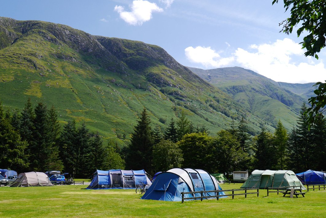
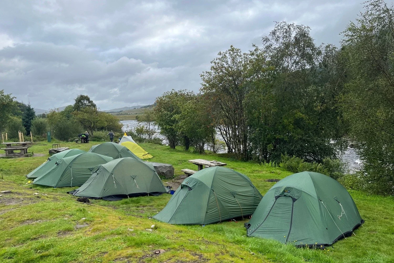
Camping along the West Highland Way is a rewarding way to experience the trail, especially if you're looking for a more budget-friendly and nature-focused option. There are several camping options available, from official campsites to wild camping. Here’s an overview:
There are several designated campsites along the trail, which provide facilities such as toilets, showers, and sometimes kitchen areas. These campsites tend to be located near towns or at popular stopping points along the route. Here are some key campsites along the West Highland Way:
Balmaha (Loch Lomond) – One of the most popular campsites, offering good facilities with beautiful views of Loch Lomond.
Inverarnan – Located near the Inverarnan Hotel, this site offers basic facilities and is a great midway stop.
Tyndrum – A well-equipped campsite with views of the surrounding mountains.
Kinlochleven – Near the end of the trail, this campsite offers good facilities to rest before tackling the final stretch to Fort William.
Bridge of Orchy – This campsite offers great views and is conveniently located for a stopover on the trail.
Glen Nevis Campsite
Legal Status: Wild camping is permitted in Scotland under the Land Reform (Scotland) Act 2003, as long as it's done responsibly and with respect for the environment. This means you can camp in most places, provided you follow the "Scottish Outdoor Access Code" principles.
Best Areas for Wild Camping: Many parts of the West Highland Way are ideal for wild camping, including areas around Loch Lomond, Rannoch Moor, and near Glencoe. However, some sections, like those near villages or sensitive nature areas, may have restrictions or be less suitable for wild camping. Read the official Camping Management Byelaws to understand the specific camping restrictions and permit requirements.
Important Considerations:
Campsites vs Wild Camping: While wild camping gives you more flexibility, official campsites offer more security and facilities, making them easier and more comfortable.
Weather: The weather in the Scottish Highlands can be very unpredictable, so wild camping requires good preparation, especially in terms of gear and knowing how to handle the conditions.
Water Sources: Make sure to camp near a reliable water source, but always purify water before drinking.
Respect for Nature: Always camp at least 100 meters away from any buildings or roads and avoid camping on agricultural land or near protected wildlife areas.
Wild camping (bivy) location at Bridge of Orchy
Tent: A lightweight, weatherproof tent is essential for wild camping, especially given the often wet and windy conditions in the Highlands.
Sleeping Bag and Mat: Ensure you have a good sleeping bag suited for the season and a comfortable mat for insulation.
Cooking Equipment: If you plan to cook your meals, you’ll need a stove, fuel, and cooking utensils. Many campsites have kitchen areas, but for wild camping, bring your own.
Another option is bivvying, where you sleep in a bivy bag (a lightweight, weatherproof shelter). This is suitable for more experienced hikers looking to travel light. However, it's more exposed to the elements, and you need to be prepared for changing weather conditions.
Plan Your Stops: While you can camp at many points along the trail, some areas may be better for camping than others, especially in terms of terrain, weather protection, and distance between campsites.
Booking Campsites: In high season, some campsites may require pre-booking, especially those near popular areas like Loch Lomond.
Avoid the Crowds: If you prefer more solitude, wild camping is a good option, though it’s still important to camp away from heavily trafficked areas.
Keep It Clean: Always follow the Leave No Trace principles—dispose of waste responsibly, pack out all trash, and leave the area as you found it.

Glencoe Mountain Resort Campsite
You can definitely camp along the West Highland Way, with both official campsites and wild camping being available. Official campsites provide amenities and a bit more comfort, while wild camping offers more freedom and a closer connection to nature. Just be sure to plan ahead, respect the environment, and bring suitable gear to handle the often unpredictable Scottish weather.
The West Highland Way is considered an easy to moderate long-distance trail. Its difficulty depends on factors such as fitness level, experience, weather conditions, and how many days you choose to complete the hike. Here’s an overview of what makes it manageable or difficult:
1.Distance and Duration:
The main trail covers 97 mi / 155 km and typically takes 5–10 days to complete, averaging about 12–20 mi / 19–32 km per day depending on the hiker’s plan.
Breaking it into more days with shorter distances per day makes it more manageable, while completing it in fewer days increases the challenge.
2. Elevation Changes:
The trail has a cumulative elevation gain of approximately 12,800 ft / 3,900m.
While the climbs are not extremely high compared to mountain trekking, sections like Conic Hill, the Devil's Staircase, and parts of Rannoch Moor involve notable ascents and descents that can be strenuous.

Conic Hill
3. Terrain:
The trail covers varied terrain, including paved paths, forest trails, rocky and uneven paths, and boggy moorland.
Sections like Rannoch Moor are remote and exposed, offering beautiful but potentially challenging hiking, especially in poor weather.
4. Weather Conditions:
Scotland’s weather can be highly unpredictable, with sudden rain, wind, and fog, even in the warmer months.
Good preparation with waterproof gear and layered clothing is essential to handle changes in weather.
5. Midges:
From late spring to late summer, midges can be an annoyance, particularly in the mornings and evenings, adding a layer of discomfort if not prepared with repellent.

Drove road to Glencoe via Rannoch Moor
Moderately Experienced Hikers: Those with some long-distance hiking experience should find the trail challenging but manageable, especially if broken into smaller daily sections.
Beginners with Preparation: Less experienced hikers can also complete it with adequate preparation, reasonable fitness levels, and a plan that includes shorter daily hikes and plenty of rest.
Inexperienced Hikers: Without any prior hiking experience, the length and elevation changes can be daunting.
Those Unprepared for Weather: The unpredictable weather can make it challenging if hikers are not prepared with proper clothing and gear.
Hikers with Time Constraints: Attempting to complete the trail in a shorter period can turn it into a grueling experience.

Start of Devil’s Staircase
Train in advance with long walks and some hill climbing to build stamina.
Invest in quality hiking boots and waterproof gear.
Plan accommodation and food stops ahead, especially in peak season.
Check weather forecasts and adjust your itinerary as needed.
Overall, the West Highland Way offers a rewarding hiking experience with some challenges, balanced by spectacular scenery and a sense of achievement upon completion.

Our 3-month hiking training plan is designed for hikers preparing for a multi-day hike.
It’s for those that are looking to improve their hiking performance through a combination of step endurance, cardio, and strength activities.

We are excited to share that Ricky Munday has joined The Hiking Club team as “Trail Expert, West Highland Way”.
Ricky is a qualified Mountain Leader, Chartered Accountant and has summited a spectacular list of the world’s highest peaks including Everest. He is also the Founder Director of Inspire Alpine, a social enterprise to help close the attainment gap faced by disadvantaged young people.
Ricky lives in Glasgow, Scotland and knows the West Highland Way inside and out. He has walked, cycled and ran stages of the West Highland Way over the past 15+ years. He has experienced the route during all seasons - summer, winter and shoulder. He has camped and stayed in accommodation. He has hiked with and without baggage transfer. He also provides guiding services for those that are interested in tackling more technical and/or remote alternative routes, such as summiting Ben Nevis.
As the “Trail Expert, West Highland Way”, Ricky will be the key point person on our team for this trail. Our planning app will not only include necessary data and information to hiking the main trail, but also the inclusion of alternative routes, highlights and Munros that provide a unique experience. He will also provide consulting services via our Expert Access and Expert Consultation packages, present workshops and webinars, answer customer support questions and lead marketing activities.
With Ricky’s local expertise, we aim to bring the most comprehensive planning tool for the West Highland Way to The Hiking Club community.
While many of the wonderful Tour du Mont Blanc refuges will feature on your ideal self-guided hiking itinerary, what do you do if they have no availability when you go to book your own trip? In this blog post, I’m going to share accommodation booking tips and my top 4 booking tricks for finding accommodation that will keep your trip alive.
This summer, The Hiking Club team will be completing over 1,200km / 750mi to hike the top 8 multi-day hikes in Europe. We’ll be doing this as part of our 2025 Trail Updates program, as well as launching new hikes onto The Hiking Club platform. Sounds exciting, right? But, if I’m honest, also a little daunting. When it’s not hiking season in the Alps, I live at sea level and don’t have mountains on my doorstep. Not the best environment to get my body mountain fit!
Like previous years, I will be using our 3-month training plan that was developed in collaboration with Stacey Hardin, Doctor of Physical Therapy, and Athletic Trainer. This training plan helps people like me, build the endurance and strength to complete a multi-day hike in the Alps.
The aim of this training diary is to keep me accountable, share my progress and hopefully motivate you to start or continue training for your next epic hiking journey
If you’re interested which legendary hikes we’ll be doing, they are: Tour du Mont Blanc, Alta Via 1 Dolomites, Walker’s Haute Route, Tour des Combins, Bernese Oberland Traverse, Tour of Monte Rosa, West Highland Way, and a few we’ll keep on the downlow :P

(Monday 12th March > Sunday 16th March)
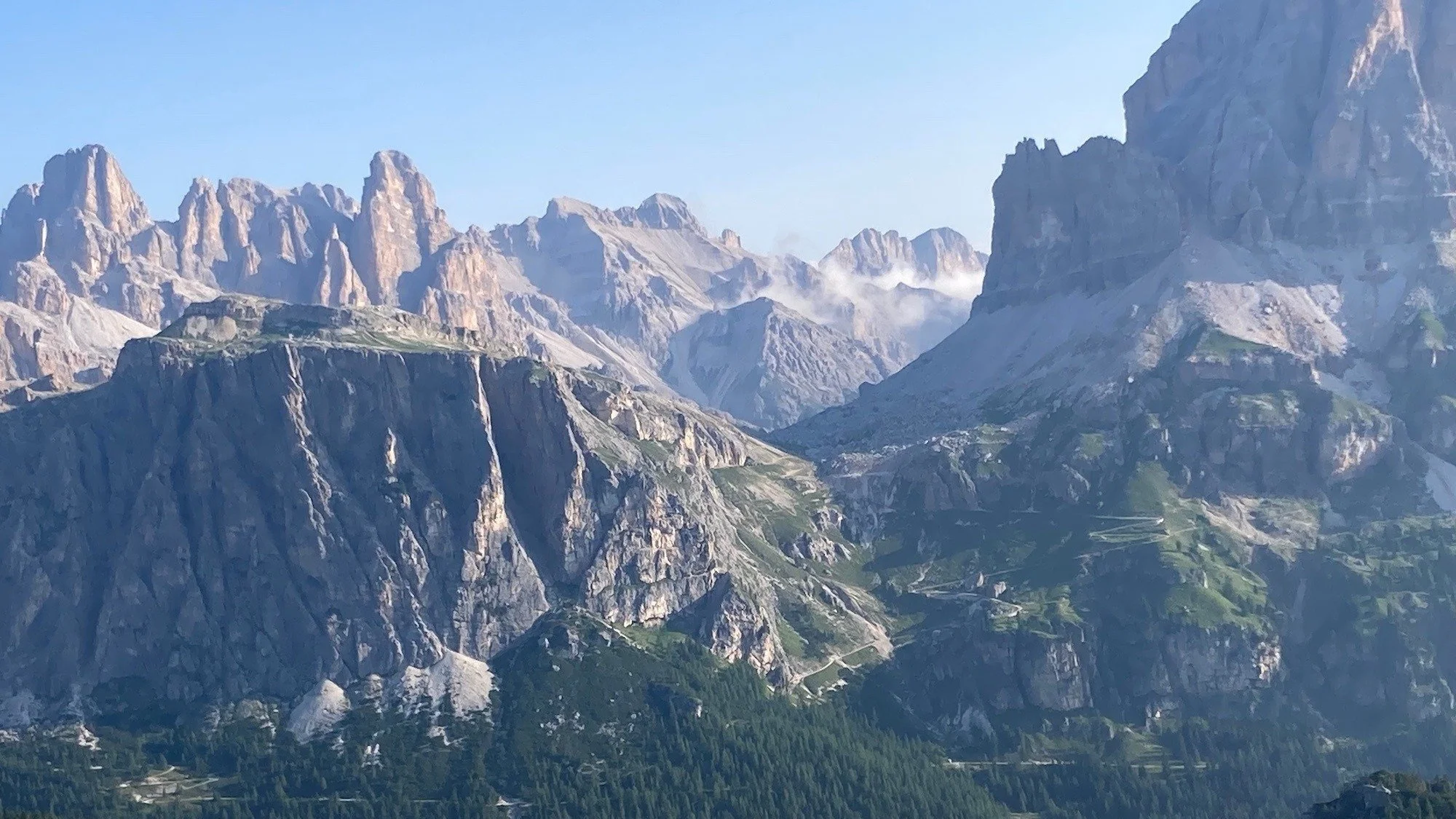
The first hike that I’ll be tackling in June is the Alta Via 1 in the Dolomites. The trail is 120km / 75mi, 7,400m / 24,00ft in elevation gain, and I’m aiming to complete it in 5 days.
One of the first pieces of information the training template needs to calculate how long it will take me to prepare for this trail distance is my current weekly step count. Luckily, I wear my Apple Watch everyday so I can easily check last week’s count - 77,000 steps.
Based on the above information, it shows it will take me 13 weeks to work my step count to the hike distance of 120km / 75 mi. (See how the right column turns green at week 13 when my step gap to readiness goal is met). With my trip 12 weeks out, I need to get cracking to ensure I’m ready!
Based on last week’s step count and the trail stats for Alta Via 1 Dolomites, the training plan shows it will take me 13 weeks to build up the endurance to complete the trail in 5 days.
The next step is creating my week 1 training plan. This week is a little bit different from normal as I got a Peleton bike for my birthday (yes - best husband ever!) so I’ll start to incorporate indoor cycling into my weekly schedule.
My focus for the first 4 weeks is ramping up key elements:
Increasing to 3 x strength sessions per week, by the end of the month
Plan: Use the training videos as part of the 3 month training program and start with 1 session in week 1, increase to 2 sessions for week 2 and 3, end with 3 sessions in week 4. I will tune into how my body feels as I activate new muscle groups and adjust accordingly.
Add one big steps day per week, increasing by 10% per week
Plan: Schedule short hike / trail run on Friday mornings, starting with 1 hour.
Continue 4+ short cardio sessions per week
Plan: Mixing up running, swimming and cycling
Gradually increasing total weekly step count (+5% per week, to minimise chance of injury)
Plan: Last month average was 77,000 steps per week. Aim to increase to 90,000 steps by week 4.
Here’s what my week 1 plan looks like:
My week 1 training plan using the training template from the 3 Month Training Program.
I’ll report back on progress over the next few weeks. Wish me luck!
Updated 6th March 2025 for new properties.
As part of our acquisition of TMB Planner, we’ve integrated technology into our app to check bed availability for mountain huts. At time of launch, we focused on incorporating the existing TMB Planner accommodation scope for the Tour du Mont Blanc trail, however, we’ve now extended the same technology to other popular trails where accommodation is challenging for DIY planners to find, such as Alta Via 1 in the Dolomites and the newest trail, the West Highland Way in Scotland.
The scope of mountain huts is limited to those which list their availability online. We can not provide availability data for mountain huts that do not list their availability online, for example, those properties requiring bookings to be made via phone, email, or submitting an online form.
In our accommodation database, we also have many more accommodation types along the trail, such as hotels, campgrounds and bivouac locations. Where an accommodation location lists their availability online, such as hotels, we plan to integrate this information into our app over the next year.
If the accommodation location is one of the following, there is no availability data that we can provide you;
Bivouac or wild camping locations
Campgrounds that don’t accept/need bookings
Accommodation that don’t list their availability online
A general accommodation location rather than being for a specific property
The following Tour du Mont Blanc properties are now live. From March 7th 2025, you will also be able to see real-time availability and set alerts for the following properties on our other trails. More are planned to be added by the end of March!
Chalet Les Meandres (ex Tupilak)
Gite Michel Fagot
Refuge du Fioux
Auberge du Truc
Chalet CAF des Contamines
La Ferme a Piron
Gite Les Melezes
Gite le Pontet
Refuge Nant Borrant
Refuge des Pres
Refuge de la Balme
Refuge de la Croix du Bonhomme
Refuge de la Nova
Les Chambres du Soleil
Refuge des Mottets
Robert Blanc
Cabane Combal
Rifugio Monte Bianco
Rifugio Maison Vieille
Gite le Randonneur du Mont Blanc
Rifugio Bertone
Hotel Funivia
Hotel Lavachey
Hotel Chalet Val Ferret
Gite Alpage de La Peule
Hotel du Col de Fenetre
Gite de La Lechere
Chalet Le Dolent
Auberge de Maya-Joie
Auberge des Glaciers
Gite de la Fouly
Hotel Edelweiss La Fouly
Pension en Plein Air
Gite Bon Abri
Chalet La Grange
Relais d'Arpette
Hotel Col de la Forclaz
Auberge la Grande Ourse
Auberge du Mont-Blanc
Refuge Le Peuty
Refuge du Col de Balme
Gite Mermoud
Gite d'Alpage Les Ecuries de Charamillon
Albert Premier Hut
Chalet CAF du Tour
Gite Le Moulin
Auberge la Boerne
Refuge Lac Blanc
Refuge Lac Blanc
Auberge la Boerne
Gite Le Moulin
Chalet CAF du Tour
Gite d'Alpage Les Ecuries de Charamillon
Gite Mermoud
Albert Premier Hut
Refuge du Col de Balme
Refuge Le Peuty
Auberge du Mont-Blanc
Auberge la Grande Ourse
Hotel Col de la Forclaz
Relais d'Arpette
Gite Bon Abri
Chalet La Grange
Pension en Plein Air
Cabane de Mille
Cabane Brunet
Cabane FXB Panossiere
Cabane de Louvie
Cabane de Prafleuri
Cabane de la Barmaz
Cabane des Dix
Cabane de Moiry
Turtmannhutte
Topalihutte
Taschhutte
Rifugio Biella
Rifugio Scotoni
Rifugio Lagazuoi
Rifugio Col Gallina
Rifugio Scoiattoli
Rifugio Averau
Rifugio Nuvolau
Rifugio Croda da Lago
Rifugio Passo Staulanza
Rifugio Adolfo Sonino Al Coldai
Rifugio Attilio Tissi
Rifugio Mario Vazzoler
Rifugio Bruto Carestiato
Rifugio Passo Duran
Ashbank B&B
Braeside Guest House
Shandon Farmhouse
Inversnaid Bunkhouse
Inversnaid Hotel
Ardess Lodge & Ben Lomond Bunkhouse
Brochhuette SAC
Berghaus Alpiglen
Rotstockhuette
Gspaltenhornhuette SAC
Bluemlisalphuette SAC
Winteregghuette SAC
Cabane de Mille
Cabane Brunet
Cabane de Louvie
Cabane FXB Panossiere
Cabane de Chanrion
Rifugio Champillon
Rifugio Frassati
Mont-Joux Auberge
Great St. Bernard hospice
Hotel du Col de Fenetre
Gite de La Lechere
Chalet Le Dolent
Auberge de Maya-Joie
Gite de la Fouly
Auberge des Glaciers
Hotel Edelweiss La Fouly
La Tsissette Hut
Pension en Plein Air
Britannia Hut
Albergo Ristoro Sitten
Topalihutte
Taschhutte
Rifugio Puez (CAI)
Essential gear for Via Ferrata: your complete gear list. Via Ferrata is an exhilarating way to experience the mountains, combining hiking with the thrill of climbing. To make sure you're well-prepared, having the right gear is crucial for safety and enjoyment. Here’s a short list of essentials you’ll need for a successful Via Ferrata adventure:
We’re excited to announce that The Hiking Club has acquired TMB Planner. Their innovative data processing and notification technology gives Do It Yourself (DIY) planners a powerful tool to assist them in booking their accommodation, and end up with the best itinerary possible for popular multi-day hikes.

The Hiking Club route planning app for the Tour du Mont Blanc now has real-time availability for mountain huts and the ability to set email alerts for room types thanks to TMB Planner joining the family :)
TMB Planner was developed by Leon Lan, a Mathematics PhD candidate focused on supply chain optimization. The idea came from a personal need he had when friends asked to join his planned Tour du Mont Blanc (aka TMB) trip only a few months out from the hiking season. As the Tour du Mont Blanc is one of Europe’s most popular multi-day hiking trails, most of the places Leon had booked no longer had any availability. Leon created a tool that tracked real-time availability and alerted him if new availability became available. As the hiking season approached, he received notifications and booked all the extra accommodation his friends needed to join him - what a good hiking buddy!
As part of this project, Leon found that most accommodation providers list new availability in the lead up to the hiking season, due to cancellations and tour operators giving up beds they don’t need. Based on data collected between December 2023 and the 2024 hiking season, over 2,000 beds were added back to online booking platforms for the mountain huts. Having already built the technology, Leon thought others in the hiking community would benefit from what he’d created, and so the availability calendar and alerts tool was born.
TMB Planner displays real-time availability for mountain huts that list their availability online, and notifies users via email when new beds become available to book for their target properties/dates. It helps:
early season hikers be the ‘first to know’ when accommodation providers list their availability for next season, and
gives later planners an opportunity to be notified when new beds (or private rooms) become available, so they can cancel off-trail accommodation and rebook their preferred property.
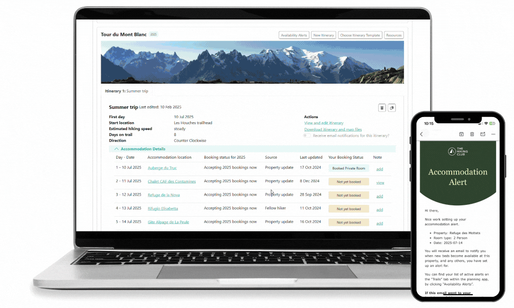
See real-time availability and set email alerts in The Hiking Club route planning app to be notified when new beds/room types become available
“We are thrilled to welcome Leon into The Hiking Club family. His innovative tools will support our mission to help self-guided hikers confidently plan, book and navigate their epic adventures. Booking your own accommodation on a multi-day hike, is one of the most difficult parts of planning your own hike. By combining TMB Planner’s technology with our own, we’ll provide The Hiking Club customers an easier booking experience, and the best chance to secure high-demand beds for their ideal itinerary”

Tour du Mont Blanc availability calendar is now available on The Hiking Club website
“I’m delighted that the technology I’ve created has found a home in The Hiking Club platform. The collaboration with Brendan and Nick from The Hiking Club has been excellent over the past few months, and I’m excited to continue working with The Hiking Club to extend the technology to other trails and maximise its benefit to the community.”
With the integration of TMB Planner into The Hiking Club platform, the availability calendar will now be accessible free on The Hiking Club website, without the need for any sign-up. The accommodation alerts have been integrated into our popular web-based planning app and available for Tour du Mont Blanc customers.
In the coming months, we’ll be working to extend the functionality to other popular trails such as Alta Via 1 Dolomites, West Highland Way, Walker’s Haute Route and more. Stay tuned for updates on this exciting integration!

About TMB Planner: Planning tools to make your Tour du Mont Blanc hike easier, including real-time hut availability and email alerts when huts begin accepting bookings for next season.
About The Hiking Club: With the first purpose-built app for multi-day hikes, up-to-date trail information, expert consultations, online events, a training program, and an active ambassador community, The Hiking Club has everything a self-guided hiker needs to confidently plan and navigate their epic adventure.