
It’s not too late to plan an incredible hut-to-hut trekking trip for 2026. In this guide, we break down where availability still exists and how you can still make your Alps hiking trip happen this summer.
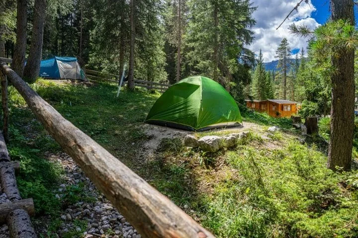
So you’re interested in hiking the Haute Route from Chamonix to Zermatt but want to camp, instead of staying huts, hotels or B&Bs each night? Great choice! Although the idea of spending each night under the stars is an idyllic option, you need to be aware of where you can actually camp along the Haute Route, as there are very strict rules put in place by the National Parks and local governments.
Over the past few years, we’ve gathered the latest information on where you can wild camp, campgrounds with facilities and mountain huts that allow you to camp nearby. About 20% of our customers use our platform to plan and navigate their camping adventure along the Haute Route. Read on to learn about the various camping options, the cost estimates for camping and other useful tips to help you prepare for camping the Walker’s Haute Route.
How much it costs to hike the Walker’s Haute Route is one of the most common questions I’m asked. Armed with my accounting background and mission to make every hikers self-guided dreams come true, I’ve dug deep into the numbers across all the different accommodation types, food and services available to provide firm guidance on what it costs to hike the Walker’s Haute Route.
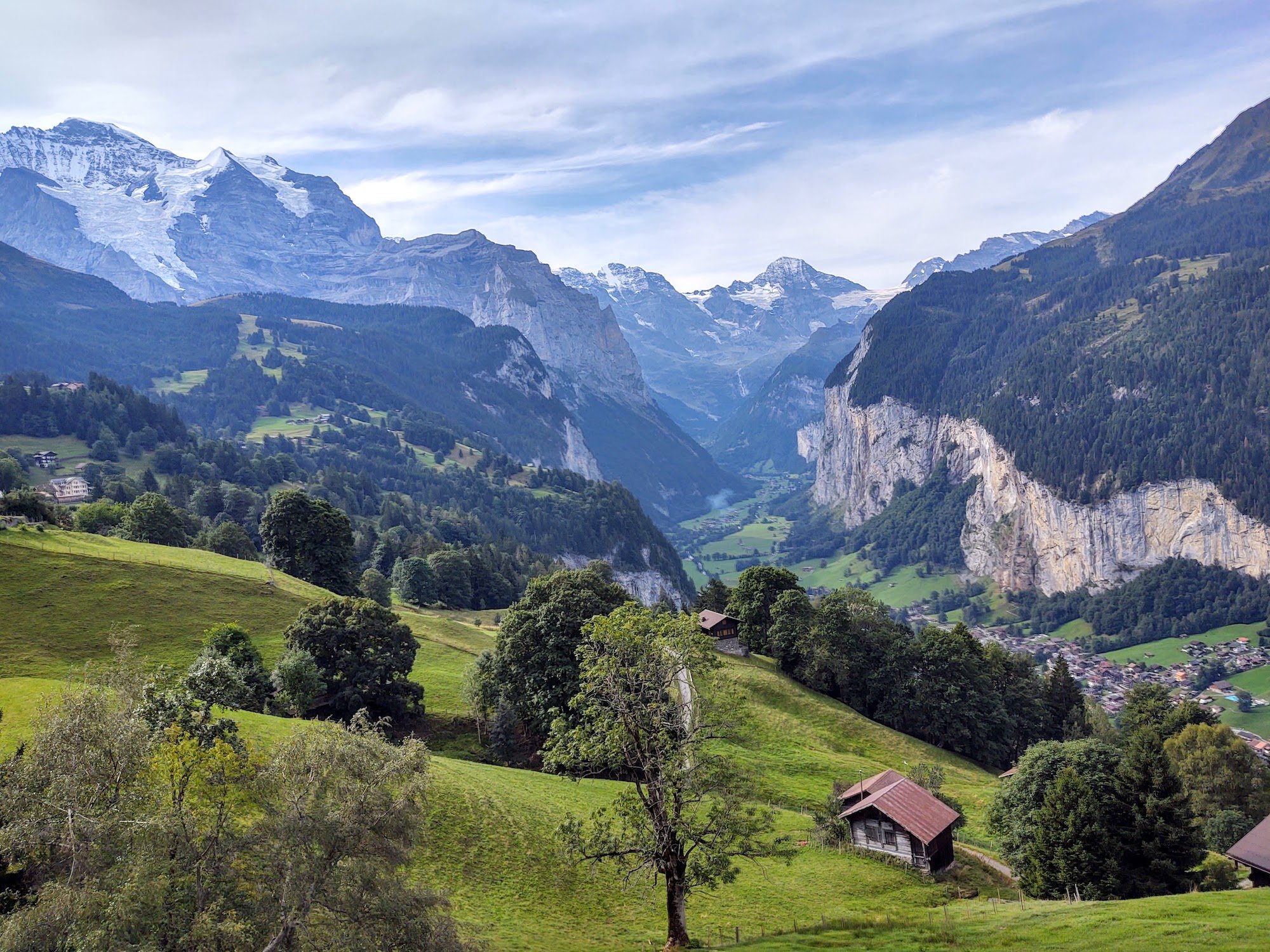
The Bear Trek is located in the Bernese Oberland, Switzerland and is part of the Via Alpina 1 hike that includes 20 stages from Lichtenstein and continues to Montreux, Switzerland. Read Cindy and Bob’s trip report documenting stages 10 - 15 from Meiringen to Lenk, Switzerland. Spoiler: No bears were seen on this hike!
It costs €826 to plan your own 10-day hike of the Tour du Mont Blanc. This amount comes from our new cost calculator for the Tour du Mont Blanc, which uses over 300 actual customer itineraries and 2023 costs from nearly 100 accommodation and service providers along the trail.
the calculator is for self-guided hikers to estimate how much it will cost them to organise their own hike of the Tour du Mont Blanc based on their preferences. Give it a try!
While many of the wonderful Tour du Mont Blanc refuges will feature on your ideal self-guided hiking itinerary, what do you do if they have no availability when you go to book your own trip? In this blog post, I’m going to share accommodation booking tips and my top 4 booking tricks for finding accommodation that will keep your trip alive.
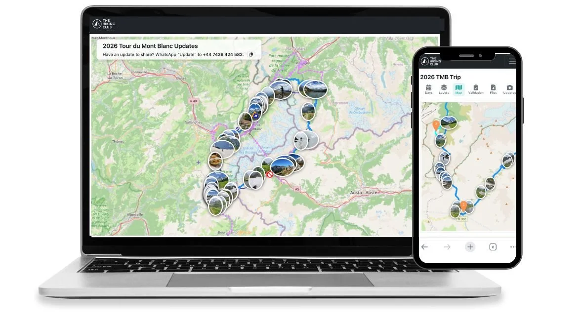
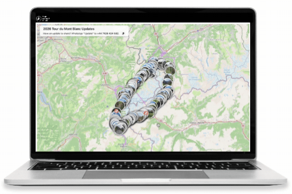
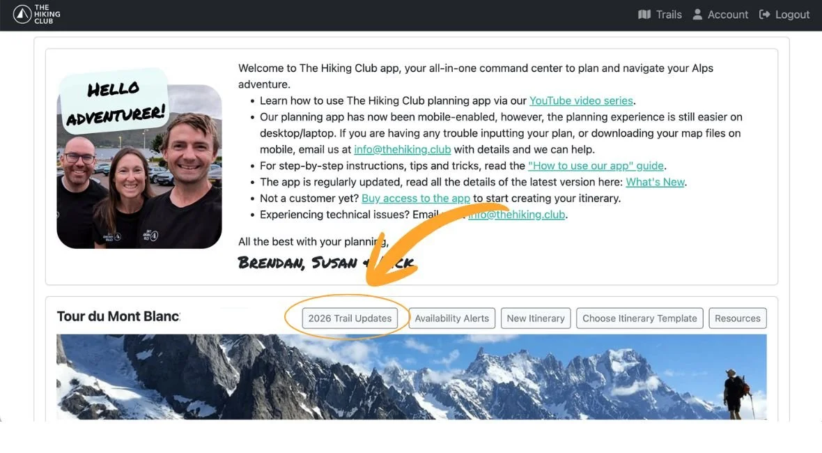
Today, we’re launching the first version of our 2026 Trail Updates Map — a new way to explore the latest trail conditions, closures and mountain updates directly on the trail map inside The Hiking Club platform.
For years, hikers have relied on scattered social media posts, group chats and outdated forum threads to understand what conditions are really like on the trail. The problem? Those updates rarely include context. A beautiful photo of snow coverage or a washed-out bridge only helps if you know exactly where it was taken — and when.
The 2026 Trail Updates Map changes that.
Instead of endlessly scrolling through feeds hoping to find relevant information, you can now see real-time trail updates directly on the map itself.
Best of all, the 2026 Trail Updates Map is completely free to access inside The Hiking Club platform. Simply create a free account to start exploring the latest trail photos, closures and mountain updates across the network.
The 2026 Trail Updates Map brings together the latest trail photos, route and transport closures into a single map-based experience, helping you understand what’s happening across the trail network before you head out this season.
With the 2026 Trail Updates Map, you will be able to:
Explore the latest uploaded trail photos directly on the map
Search updates by specific locations such as mountain passes or sections at higher elevation
View trail closures and warnings in context
See transport disruptions including gondola and chairlift closures
Scroll back through previous uploads to understand how conditions change throughout the 2026 season
Share important updates and images with fellow hikers
First updates loaded onto the 2026 Trail Updates map on May 29th, 2026 from the Tour du Mont Blanc.
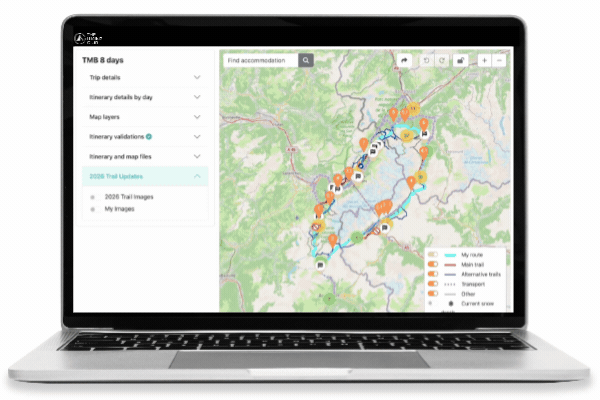
For paid customers of The Hiking Club, our new Trail Updates feature becomes even more powerful.
Instead of viewing updates only on the general trail map, paid members can see trail conditions, photos, closures and transport alerts directly alongside their planned itinerary route. This makes it easier to understand exactly what’s happening on the sections you’ll be hiking in the days ahead — latest snow conditions on a mountain pass, a trail detour, or a gondola closure affecting your planned route.
By combining live trail updates with your personalised itinerary, The Hiking Club helps you stay informed and make smarter decisions before and during your hike.
The 2026 Trail Updates Map is powered by people on the ground — the hikers out there walking them every day.
Each June, The Hiking Club team heads to the Alps for our annual “Break The Trail” hikes, capturing the first comprehensive overview of trail updates, snow conditions and route information.
We then pass the baton to our incredible community of Trail Ambassadors, who will continue sharing daily trail photos, trip reports and insights from the trail. Their updates help hikers embarking after them feel safer, more informed and a clearer picture of what’s happening across the mountains.
We hope that the 2026 Trail Updates Map becomes a community-powered view of the hiking season as it unfolds.
Want to help fellow hikers this season? We’re always looking for passionate hikers to join our ambassador community and contribute trail updates from across the network. Learn more here.
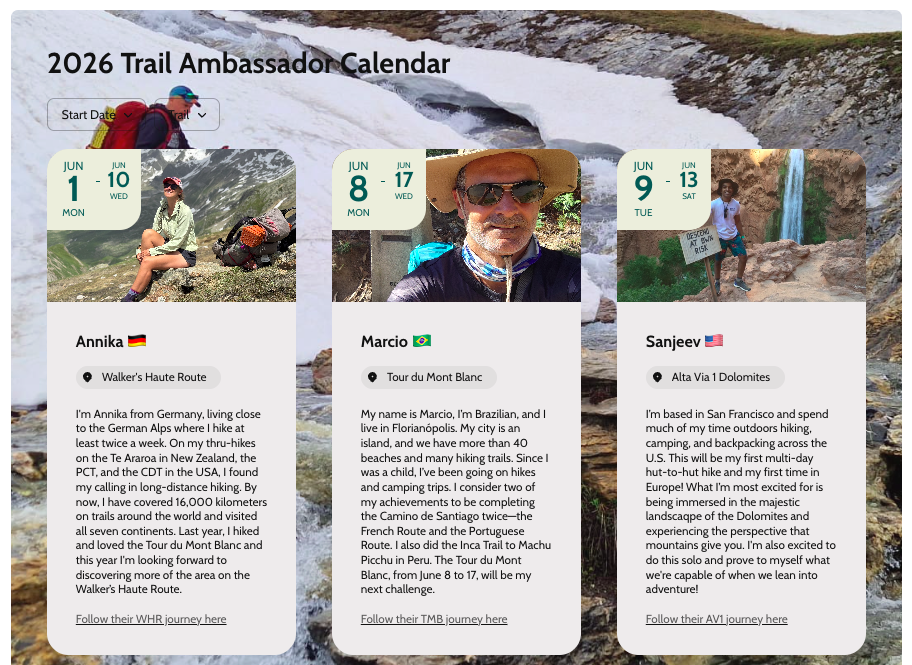
Our Trail Ambassadors kick off their trail updates on June 1st and continue through to the end of September.
The 2026 Trail Updates Map is launching as an evolving feature for the 2026 hiking season, and we’ll continue improving it as more hikers begin using it on the trail.
Feedback from our community will play a huge role in shaping what comes next.
If you spot something that could be improved, have ideas for new features, or want to tell us what’s working well, we’d love to hear from you. The goal of the Trail Updates Map is simple: make trail information more useful, more accessible and more reliable for everyone heading into the mountains. Contact us at: info@thehiking.club to share your feedback.
The 2026 Trail Updates Map is available free inside The Hiking Club platform.
Dedicated 2026 Trail Updates Maps will be available for:
Tour du Mont Blanc
Walker’s Haute Route
Tour of Monte Rosa
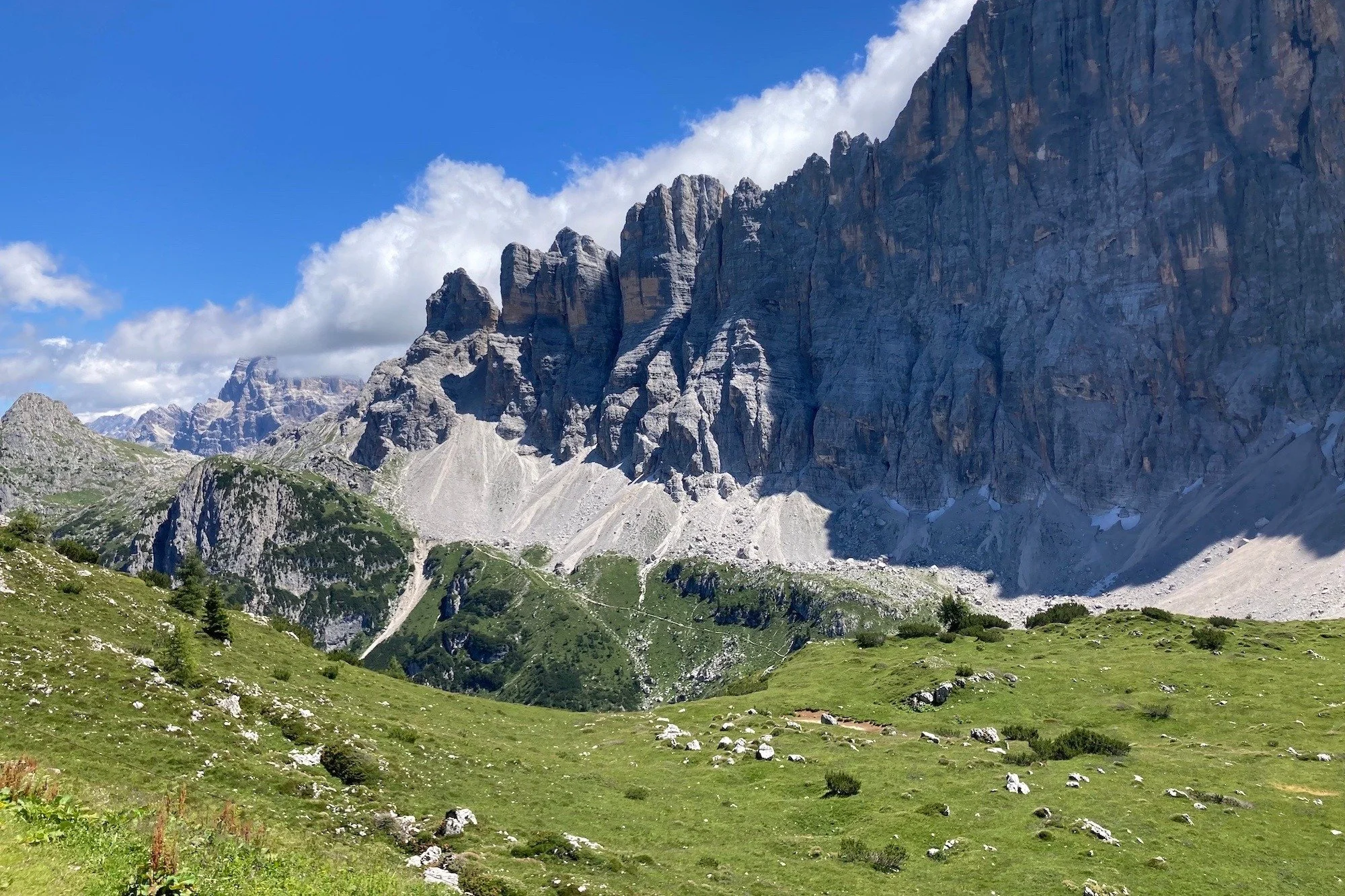
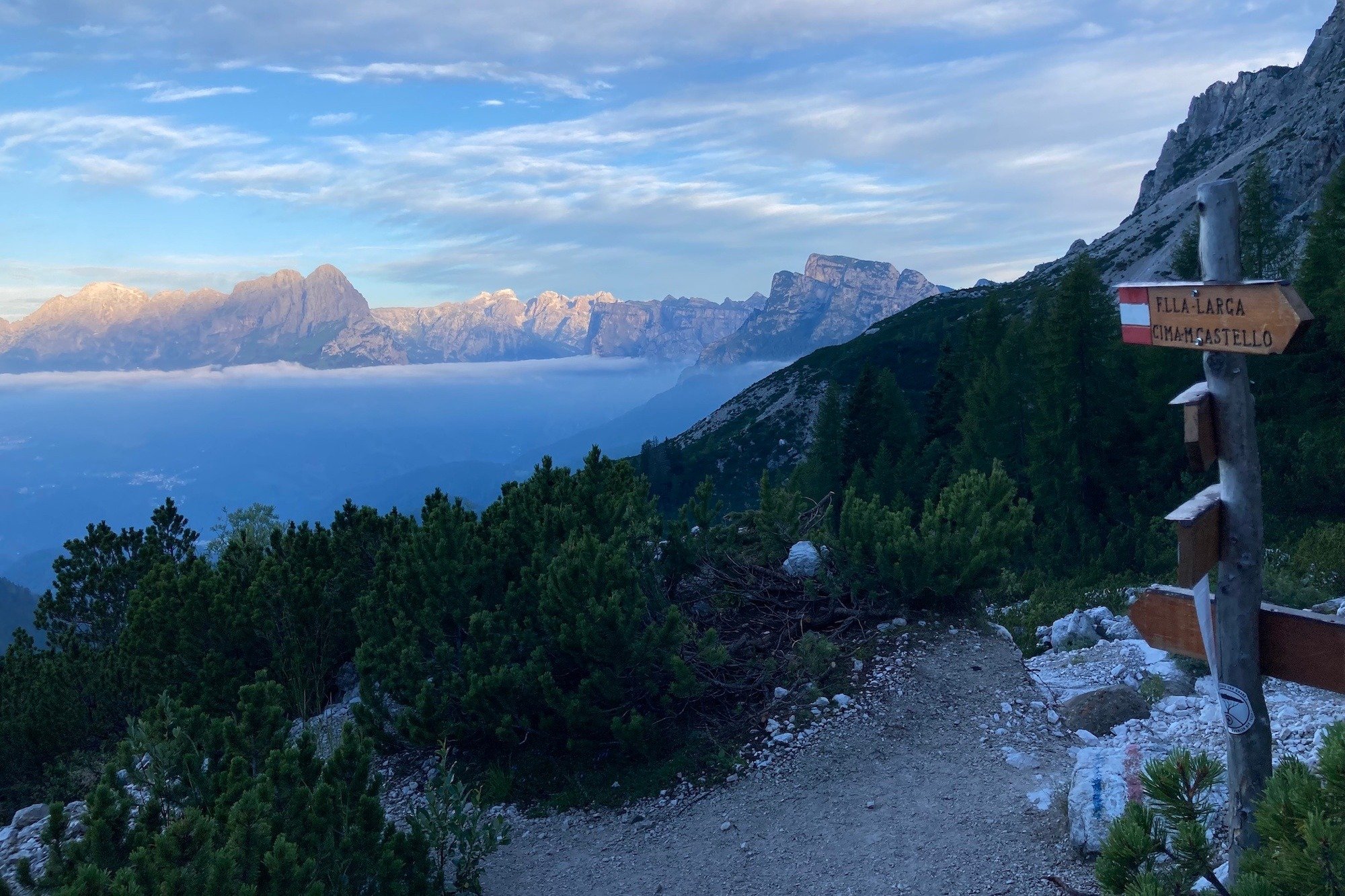
Alta Via 1 Dolomites
Alta Via 2 Dolomites
Bernese Oberland
Tour des Combins
West Highland Way
Don’t yet have an account? Create your free account to explore the latest trail conditions, community updates, transport closures and “live from the trail” photos throughout the 2026 hiking season.
Create a free account at www.app.thehiking.club to view the 2026 Trail Updates map.
Essential gear for Via Ferrata: your complete gear list. Via Ferrata is an exhilarating way to experience the mountains, combining hiking with the thrill of climbing. To make sure you're well-prepared, having the right gear is crucial for safety and enjoyment. Here’s a short list of essentials you’ll need for a successful Via Ferrata adventure:
Updated 13th May 2026.
As part of our acquisition of TMB Planner, we’ve integrated technology into our app to check bed availability for mountain huts. At time of launch, we foucsed on properties along the Tour du Mont Blanc trail. However, we’ve now extended the same technology all of our trails, including Alta Via 1, Walker’s Haute Route, West Highland Way, Tour of Monte Rosa, Bernese Oberland, Tour des Combins, Alta Via 2, Tour of Jungfrau and Via Alpina Switzerland.
The scope of mountain huts is limited to those which list their availability online. We can not provide availability data for mountain huts that do not list their availability online, for example, those properties requiring bookings to be made via phone, email, or submitting an online form.
In our accommodation database, we also have many more accommodation types along the trail, such as hotels, campgrounds and bivouac locations. Where an accommodation location lists their availability online, such as hotels, we have an ongoing initiative to integrate their availability data into our app. For the 2026 season, we are able to display available beds for ~130 properties.
If the accommodation location is one of the following, there is no availability data that we can provide you;
Bivouac or wild camping locations
Campgrounds that don’t accept/need bookings
Accommodation that don’t list their availability online
A general accommodation location rather than being for a specific property
Confirmed Integration (2026 Season)
Albert Premier Hut
Au Coeur Des Neiges
Auberge de Maya-Joie
Auberge des Glaciers
Auberge du Mont-Blanc
Auberge du Truc
Auberge la Boerne
Auberge la Grande Ourse
Chalet CAF des Contamines
Chalet CAF du Tour
Chalet La Grange
Chalet Le Dolent
Chalet Les Meandres (ex Tupilak)
Chalet-hotel Gai Soleil
Chamonix Lodge
Gite Alpage de La Peule
Gite Bon Abri
Gite d'Alpage Les Ecuries de Charamillon
Gite de la Fouly
Gite de La Lechere
Gite Le Moulin
Gite le Pontet
Gite le Randonneur du Mont Blanc
Gite Les Melezes
Gite Mermoud
Gite Michel Fagot
Hotel Chalet Val Ferret
Hotel Col de la Forclaz
Hotel de La Couronne
Hotel du Col de Fenetre
Hotel Edelweiss La Fouly
Hotel Funivia
La Ferme a Piron
Les Chambres du Soleil
Pension en Plein Air
Refuge de la Balme
Refuge de la Croix du Bonhomme
Refuge de la Nova
Refuge des Mottets
Refuge des Pres
Refuge du Col de Balme
Refuge du Fioux
Refuge la Roselette
Refuge Le Peuty
Refuge Nant Borrant
Relais d'Arpette
Rifugio Bertone
Rifugio Elena
Rifugio Maison Vieille
Rifugio Monte Bianco
Robert Blanc
Vert Lodge Chamonix
Refuge Lac Blanc
Plus more!
Confirmed Integration (2026)
Albert Premier Hut
Auberge du Mont-Blanc
Auberge la Boerne
Auberge la Grande Ourse
Cabane Brunet
Cabane de la Barmaz
Cabane de Louvie
Cabane de Mille
Cabane de Moiry
Cabane de Prafleuri
Cabane des Dix
Cabane des Ecoulaies
Cabane FXB Panossiere
Chalet CAF du Tour
Chalet La Grange
Chamonix Lodge
Gite Bon Abri
Gite d'Alpage Les Ecuries de Charamillon
Gite Le Moulin
Gite Mermoud
Gite Michel Fagot
Hotel Col de la Forclaz
Hotel de La Couronne
Pension en Plein Air
Refuge du Col de Balme
Refuge Le Peuty
Relais d'Arpette
Taschhutte
Topalihutte
Turtmannhutte
Vert Lodge Chamonix
Chamonix Lodge
Plus some additional properties in villages
Confirmed Integration (2026 Season)
Rifugio Averau
Rifugio Biella
Rifugio Bruto Carestiato
Rifugio Coldai
Rifugio Col Gallina
Rifugio Croda da Lago
Rifugio Fanes
Rifugio Fodara Vedla
Rifugio Lagazuoi
Rifugio Lavarella
Rifugio Mario Vazzoler
Rifugio Passo Duran
Rifugio Passo Staulanza
Rifugio Pederu
Rifugio Scoiattoli
Rifugio Scotoni
Rifugio Sora'l Sass
Rifugio Tissi
Rifugio Angelo Dibona
Planned Integration (2026 Season)
Rifugio Dal Piaz (CAI)
Rifugio Pisciadu (CAI)
Rifugio Puez (CAI)
Rifugio Castilglioni Marmolada
Rifugio Boz (CAI)
Rifugio Boe (CAI)
Confirmed Integration (2026 Season)
Rifugio Tre Scarperi / Dreischusterhuette
Rifugio Locatelli / Dreizinnenhuette
Rifugio Lavaredo
Hotel Sorapiss
Rifugio Pietro Galassi
Confirmed Integration (2026 Season)
Auberge de Maya-Joie
Auberge des Glaciers
Cabane Brunet
Cabane de Chanrion
Cabane de Louvie
Cabane de Mille
Cabane FXB Panossiere
Chalet La Grange
Chalet Le Dolent
Gite Bon Abri
Gite de la Fouly
Gite de La Lechere
Great St. Bernard hospice
Hotel du Col de Fenetre
Hotel Edelweiss La Fouly
La Tsissette Hut
Mont-Joux Auberge
Pension en Plein Air
Rifugio Champillon
Rifugio Frassati
Confirmed Integration (2026 Season)
Albergo Ristoro Sitten
Britannia Hut
Taschhutte
Topalihutte
Turtmannhutte
Confirmed Integration (2026 Season)
Balmhornhuette
Berghaus Alpiglen
Berghaus Baeregg
Berghaus Maenndlenen
Bluemlisalphuette SAC
Brochhuette SAC
Doldenhornhuette SAC
Glecksteinhuette
Gspaltenhornhuette SAC
Lobhornhuette
Rotstockhuette
Schreckhorn Hut
Confirmed Integration (2026 Season)
Berghaus Alpiglen
Berghaus Baeregg
Berghaus Maenndlenen
Bluemlisalphuette SAC
Brochhuette SAC
Doldenhornhuette SAC
Glecksteinhuette
Gspaltenhornhuette SAC
Rotstockhuette
Schreckhorn Hut
Confirmed Integration (2026 Season)
Berghaus Alpiglen
Berghaus Baeregg
Berghaus Maenndlenen
Brochhuette SAC
Glecksteinhuette
Lobhornhuette
Rotstockhuette
Schreckhorn Hut
Confirmed Integration (2026 Season)
Ardess Lodge & Ben Lomond Bunkhouse
Ashbank B&B
Balmaha Bunkhouse
Bank House Guesthouse
Braeside Guest House
Craigbank Guest House
Forest View Guest House
Glenardran House guest house
Greenstone Lodge B&B
Inversnaid Bunkhouse
Inversnaid Hotel
MacDonald Hotel & Cabins
Ossians Hotel
Shandon Farmhouse
The Drovers Inn
West Highland Way Lodge
Updated for the 2026 season.
Have you started planning your Alta Via 1 Dolomites hike in the usual 11 stages and finding fully booked locations for the dates you want?
You’re not alone!
Accommodation booking anxiety is experienced by most self-guided hikers that book their own accommodation…and a popular conversation topic on the trail :)
When accommodation availability becomes scarce, this 6-day itinerary can keep your Alta Via 1 dreams alive! Staying at villages and using transport provides you a much needed bed and allows you to hike 100km / 62mi along the Alta Via 1 route. You can opt to use just one, a few or all days to make your hike happen.

Average daily stats:
Distance: 17km / 11mi
Elevation gain: 950m / 3,100ft
Time (steady pace): 6 hours, not including breaks
Accommodation: Staying in villages that have the most accommodation options
This 6-day itinerary for the Alta Via 1 Dolomites gets around all of the Northern locations that are typically booked out…without needing to do any camping!
The Hiking Club has always championed self-guided hikers who want to stay in control of their itinerary and costs, by planning and booking their own trips. We have over 7 years of experience creating itineraries that are available to book at any time of the year. Our trip planning app is the 3rd generation of our self-planning product that gives hikers the power to easily create an achievable, inspiring, and available-to-book itinerary in one session.
If you want some assistance in designing an itinerary that is ready for you to book based on your specific dates and requirements, we can do this via our Expert Access package.

day 1: lago di braies to san vigilio
The first stage travels through the Fanes, Sennes, Braies Natural Park, with 4 rifugios to choose from (Biella, Sennes, Fodara Vedla and Pederu). Once these are booked up, hikers have three options to overcome fully booked locations here:
Set cancelled bed alerts at Rifugio Biella, Rifugio Fodara Vedla and Rifugio Pederu.
Continue hiking into Fanes section of Natural Park (Total 22km / 14mi) to reach 3 more accommodation options (Ucia dles Muntagnoles, Fanes, Lavarella)
Catch the bus to stay in San Vigilio for the night. It takes 20 minutes and has 20+ hotels, b&bs, holiday rentals and campgrounds for hikers to choose from. In the morning, catch the same bus back to the trailhead to continue your hike.
Click to expand. The trip planning app is included in all self-guided packages.

day 2: san vigilio to san cassiano
One of the most popular rifugios on the AV1 is Rifugio Lagazuoi. It (and surrounding rifugios) often book out quickly for peak dates and therefore forces hikers to either hike a longer day to find accommodation or use public transport to reach a nearby village.
For those that can’t find accommodation along the trail at popular rifugios (including Lagazuoi, Scotoni, Valparola, Col Gallina), the best option is:
Set cancelled bed alerts at Rifugio Lagazuoi, Rifugio Scotoni and Rifugio Col Gallina
Catch the bus from either Sciare or Passo Falzarego to San Cassiano for the night. There are 15+ hotels, b&bs and holiday rentals to choose from. In the morning, catch the same bus back to the trailhead to continue your hike.
Click to expand. The trip planning app is included in all self-guided packages.

day 3: san cassiano to cortina
There are 6 rifugios in and around the Cinque Torri and Nuvolau area [Cinque Torri, Scoiattoli, Averau, Nuvolau, Fedare and Berghotel Passo Giau]. If these are all booked out on your dates, it is too far to continue on to Citta di Fiume, the next rifugio along the trail.
Therefore, the best options are:
Set cancelled bed alerts at Rifugio Scoiattoli, Rifugio Averau
Consider whether Rifugio Dibona, Rifugio Col Gallina, Rifugio Croda da Lago, Rifugio Malga Fedare are suitable alternatives for your itinerary
Finish your hike at Cianzope bus stop and catch the 20 minute bus into Cortina, where there is lots of accommodation to choose from.
Finish you hike at Cianzope bus stop and catch 2 buses to San Cassiano, if you plan to stay there the previous night. Therefore you can hike today with just a daypack (luxury!).
Click to expand. The trip planning app is included in all self-guided packages.

day 4: cortina to pescul
If you are unable to secure accommodation at Rifugio Citta di Fiume, Aquileia or Passo Staulanza, your options are:
Continue hiking to Rifugio Palafavera (Total 27km / 17mi)
Set cancelled bed alerts for Rifugio Staulanza
Finish your day by taking an alternative trail to Pescul, a small town with 10+ hotel, b&b and holiday rentals to choose from.
Click to expand. The trip planning app is included in all self-guided packages.

Day 5: Pescul to alleghe
If you are unable to secure accommodation to Rifugio Coldai, Tissi or Vazzoler, then you’ll need to find accommodation in Alleghe for the night:
Catch the gondolas down to Alleghe, a small town with 10+ hotel, b&b and holiday rentals to choose from. In the morning, catch the gondolas back to the trailhead to continue your hike. If you are feeling energetic, you could walk this section, rather than take the gondola.
Set cancelled bed alerts at Rifugio Coldai, Tissi and Vazzoler
Consider hiking to Rifugio Capanna Trieste (distance dependant on departure location)
Click to expand. The trip planning app is included in all self-guided packages.
day 6: alleghe to listolade
If you are unable to secure accommodation at Rifugio Carestiato, San Sebastiano, Passo Duran or Malga Calleda, then there are three options:
Set cancelled bed alerts for Rifugio Carestiato and Rifugio Passo Duran
Continue hiking to Rifugio Pramperet (Total 35km / 22mi)
Finish you day (and your hike!) by taking an alternative route down to Listolade, a small village on the main road between Alleghe and Belluno. From here you can choose to catch a bus back to Alleghe, to Agordo for the closest accommodation, or all the way to Belluno, where you can stay or catch bus/train on to Venice or Cortina.
Click to expand. The trip planning app is included in all self-guided packages.
optional day 7: passo duran to forno di zoldo
If you have been able to secure accommodation at one of the 4 rifugios near Passo Duran, including Rifugio Passo Duran, San Sebastiano, Carestiato and Malga Calleda, then you can continue your hike south. The next difficult spot to secure accommodation is Rifugio Pramperet, Malga di Pramperet and Rifugio Pian de Fontana. If you are unable to get a bed in one of these locations, you will need to:
Finish your day by hiking an alternative route to Forno di Zoldo, a small town with 10+ hotels, b&bs, holiday rentals and campground to choose from. There is a shuttle bus to reduce the last stretch of this section
Many people that stay in Forno di Zoldo, choose to finish their hike here. Otherwise it is necessary to retrace all the way back to Rifugio Pramperet to continue on the main trail to the official finish point, La Pissa Bus Stop, or via Soffranco/Longarone on the alternative route.
Click to expand. The trip planning app is included in all self-guided packages.
So there you have it. The “AV1 6 Day Anytime” itinerary for those booking in October, January, March or July. This itinerary can provide you accommodation options to make you Alta Via 1 journey a reality!
Oh and if you want the “AV1 6 Day Anytime” itinerary, it’s available in our itinerary library so all you need to do is buy a self-guided AV1 package and this itinerary can be loaded straight into your app for planning, booking, and navigating!
When planning a European trekking adventure, two routes often stand out for their breathtaking scenery, sense of adventure, and challenge: the Tour du Mont Blanc (TMB) and the Alta Via 1 (AV1) in the Dolomites. While both are famous and stunning in their own right, they offer different experiences in terms of length, difficulty, crowds, terrain, and scenery. So, which is the better fit for your next trek?
Hiking poles are essential gear for long-distance hiking in the Alps. They provide a number of physical benefits that can help you hike more comfortably and efficiently. Read our blog post to learn more about why to use hiking poles, how to use them, where to buy them and how to travel with them on the aeroplane.
When creating your Alta Via 1 Dolomites itinerary using our trip planning app there are so many options and decisions you can make - route, accommodation, transport and more. Here are our top tips to creating the ultimate itinerary using our trip planning app for the Alta Via 1 Dolomites.
The “main” Alta Via 1 Dolomites trail is 120km / 75mi and travels past spectacular alpine lakes, dramatic rock formations and lush green meadows. Many hikers choose to take one or more alternate routes along their journey to include a specific highlight (such as the Lagazuoi WWI tunnels), stay at a prominent accommodation option (such as Lago Federa) or take a more direct route (such as Passo Falzarego). Read our blog post which takes a visual “walk through” of main trail and popular alternative routes.
Most people take between 6 - 10 days to hike the Alta Via 1 Dolomites. Anything quicker requires part trail running; anything longer would allow for frequent breaks and a relaxed trekking pace.
Since 2018, we’ve produced 100’s of personalised hiking itineraries that have helped 2,000+ self-guided hikers confidently plan their Alps multi-day journey. To achieve this, we focus on the following 4 steps that help to determine how long it will take to hike the Alta Via 1 Dolomites.
It costs €700 to plan your own 8-day hike of the Alta Via 1 Dolomites.
This cost will vary depending on the number of days on the trail, and your accommodation, food, and transport preferences. So, how do you calculate how much it will cost for your trip? Here are a few sample itineraries using actual 2023 costs to help you out!
We’ve created a collection of the top mountain huts across Switzerland, France and Italy for hikers. None of these huts require technical gear to reach them - no glacier crossings, no via ferrata, no climbing equipment etc. Most are located in alpine areas and therefore all you need to reach them is good fitness.