Cindy Scheyer and Bob Hamilton live in Seattle, US. They have hiked across North America; including the Cascade mountains near Seattle, the La Sal range near Moab, Utah, the Canadian Rockies near Banff, Glacier National Park in Montana, Yellowstone, and the Grand Tetons. They have hiked the Walker’s Haute Route, Alta Via 1 and West Highland Way using The Hiking Club products. Cindy and Bob are also avid dancers – they met through Scandinavian folk dancing and have traveled to Sweden and Norway for dance festivals.

TRIP SUMMARY
8 hiking days, including stage 10-15 of the Via Alpina
Total distance: 105km / 65mi
Total elevation: 7,400m / 24,300ft gain, 7,700m / 25,300ft loss
6 mountain passes: Große Scheidegg, Kleines Scheidegg, Sefinenfurgge, Hohtürli, Bunderchrinde, Hahnenmoospass.
Start / End: Meiringen to Lenk, Switzerland

Cindy’s Bear Trek itinerary as shown in our trip planning app
After re-hiking some of the stages Walker’s Haute Route, we did the ‘Bear Trek’ in the Bernese Oberland which is part of the Via Alpina 1 hike that includes 20 stages from Lichtenstein and continues to Montreux, Switzerland. Our trip included stages 10 - 15 from Meiringen to Lenk. There are no bears! It’s simply a reference to wilder times in the far past when there would have been bears. Our goal was to do some amazing hiking and take enough time to visit extra natural attractions in the area. All of the stages on the Via Alpina 1 are from valley to valley, so there is always a small village to find lodging. You can do some variations to stay in mountain huts in some areas such as the Gspaltenhornhütte and Blüemlisalphütte.

Source: Schweizmobil.ch
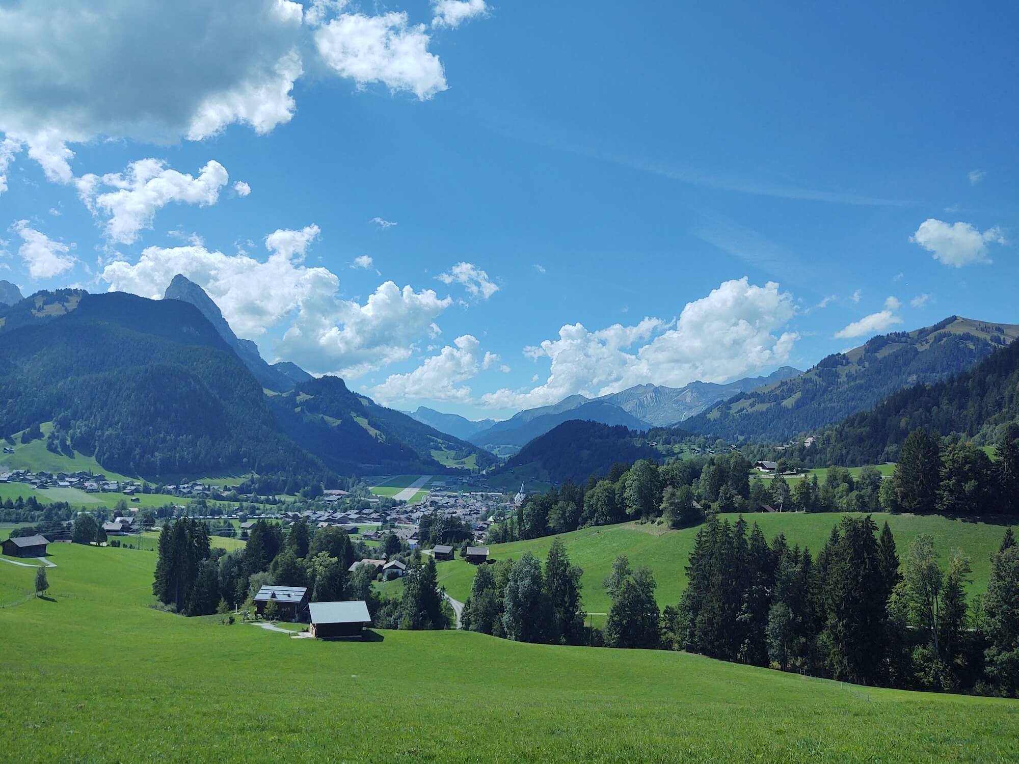
Stage 10: Meiringen to Grindelwald
To get to this part of the Swiss Alps, we traveled for 3 hours by train from Zermatt to Meiringen and then took the Post Bus up a super windy, steep single-lane mountain road to Schwarzwaldalp. The bus driver blasted his horn before most corners to alert oncoming cars and bikes that he was coming. Quite an experience! Then we started our hike to Grindelwald.
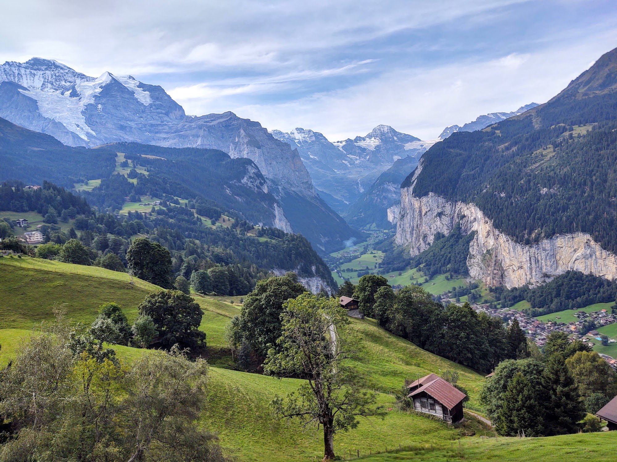
The hike goes over the pass of Grosse Scheidegg between the Schwarzhorn and Wetterhorn mountains. We opted for the higher trail that contours above the valley to the first gondola station above Grindelwald. It was noticeable that the hiking was in a more pastoral landscape, greener, and less wild than we experienced in the Pennine Alps earlier on this trip. We had our first views of the Eiger, Mönch, and Jungfrau peaks, and the Finsteraarhorn which is the tallest peak in this mountain range. Cindy went out on the First Cliff Walk and then we took the gondola down to our hotel and dinner in the village.

Looking back toward Schwarzwaldalp

Eiger, Monch and Jungfrau behind Bob. Tallest snowy peak is Schreckhorn
Rest Day: With two nights scheduled in Grindelwald, we had a ‘rest day’ to experience the Jungfraujoch – “Top of Europe” at 3454 meters (11,332 feet). What an amazing experience! We took the gondola to the Eiger Glacier viewing area. It was really beautiful but also troubling to see how much the glaciers have melted. We then took the train that tunnels 7 kilometers through the north face of the Eiger mountain to the Jungfraujoch which is a saddle between the Mönch and Jungfrau mountains. The observatory here partners with the one we saw at Gornergrat near Zermatt and has the highest viewing platform for the area. We hiked out on an ice field up to the Mönchsjochhütte so we could have lunch at 3657 meters! (11,965 feet). On the way back to the observatory we saw several large crevasses and a couple of small rockslides. The way back to Grindelwald was on two cogwheel trains: The train through the Eiger tunnel and another one from Kleine Scheidegg through the valley. A really fun day!

Cindy stands on the Mathildespitze which is a small peak on a ridge leading to the Jungfrau.

View from the Mönchsjochhütte - not a painting!
Stage 11: Grindelwald to Mürren
On our 3rd day, with a forecast for rain by 11 or 12, we opted to skip hiking to Mürren and took advantage of the Swiss trains and gondolas to get from Grindelwald to Lauterbrunnen and then Mürren. We were worried we wouldn't get to see everything we wanted to see in Mürren and Lauterbrunnen before it clouded up or rained. We left Grindelwald at 8:48 am and were at the top of the Schilthorn by noon! Fantastic Swiss engineering and planning. We took the train to Lauterbrunnen at the bottom of the valley and then a gondola and train up to the top of the cliff on the right side of the valley to Mürren. Our hotel is literally on the cliff and our room looks straight at the Schwarzmönch, Eiger, and Mönch.

Lauterbrunnen Valley - Mürren is on top of the right cliff
We immediately took another gondola up to the Schilthorn while the weather was good. Outstanding 360-degree views! We could see the Sefinenfurgge pass we'll be hiking over on our next hike. The Schilthorn Piz Gloria is where they filmed the James Bond movie "On Her Majesty's Secret Service" in 1969. Beautiful views down to Mürren, the Thunsee of Interlaken, the Eiger, Mönch, and Jungfrau peaks, the Lauterbrunnen Breithorn, the Gspaltenhorn, the Blüemlisalp peaks, and more. Luckily the weather held off until around 5 pm, so we had the entire day to enjoy the mountains and valley views!

View to the Sefinenfurgge Pass, Gespaltenhorn and Blüemlisalp from the Schilthorn.
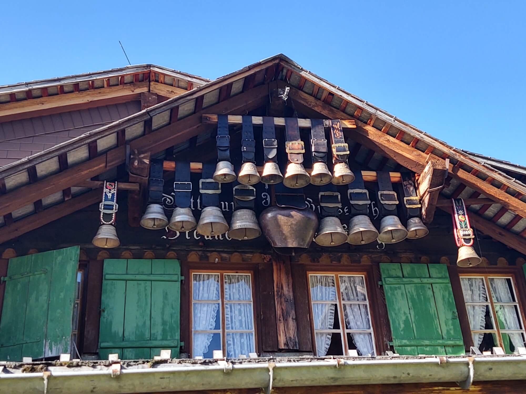
Rest day: With two nights in Mürren, we had a free day to explore the Lauterbrunnen Valley. The barn with the cow bells is in Gimmelwald, another tiny picturesque, classic Swiss village below Mürren. We took the cable car from Gimmelwald down to Stechelberg in the Lauterbrunnen Valley and we could feel the cable car lurch as it went over the edge of the cliff to descend almost vertically to the valley floor. It was a gorgeous day to stroll down the steep-walled valley which is known for its 72 waterfalls!

Eiger, Mönch, Jungfrau and Schwarzmönch seen from Mürren
Mürrenbach Fall is one of the highest in Switzerland with a drop of 250 meters. On our way, we visited the famous Trümmelbach Falls which is a series of 10 glacier-fed falls reached by a funicular and stairs built in 1913 inside a cave in the mountain. The water was gushing this time of year from the melting glaciers. We walked the rest of the valley along the river enjoying beautiful farmhouses and gardens and passed by the Staubbach Fall which is even higher at 300 meters.
Transportation is easy to navigate here. We took the cable car and train up the cliff to Mürren in time to enjoy cake and tea on our hotel terrace in front of the Bernese "Giants". And then enjoyed a bottle of Schwarz Mönch beer from the brewery in Gimmelwald. It's a dark Swiss lager that was the highest-rated Schwarzbier in the world from 2018-2020. I loved it. Prost! 🍻

Schwarzmönch from our hotel terrace in Mürren
Stage 12: Mürren to Griesalp
As we started out hiking today, I kept looking back instead of forward. I'd look back to catch one more glimpse of the Wetterhorn, Eiger, and Jungfrau peaks. We could even look up and see the Schilthorn we had visited a few days ago. Eventually, I could no longer see them and started looking ahead to the Gspaltenhorn and the Sefinenfurgge pass we would be crossing.
Today's hike was lovely. We had beautiful weather, gorgeous mountains and saw lots of animals. I'm more inclined to call this the 'Cow Trek" since we see so many! It seems they are always free-range here.

Hiking from the Rotstockhütte to the Sefinenfurgge Pass
Our hike took us by the Rotstockhütte just in time for a yummy lunch of soup, rösti, and plum pie. This fueled us for a hike up the very steep pass. Near the top, there were short, steep switchbacks and then ropes and then wood stairs! 95 up to the top of the Sefinenfurgge Pass. There were another 162 stairs down the other side of the pass. The reason for the stairs is that the top of the pass is gritty black shale and scree on a very steep slope that is not stable.

Looking up to the stairs at the top of the Sefinenfurgge Pass

Stairs down the other side of the Sefinenfurgge Pass toward Griesalp
Hiking down into the Kiental valley toward Griesalp, our destination for the night, we were joined by a group of goats. They looked to all be pregnant and very much in need of milking. The clever goats know how to get around the gate too! I think they were on a mission to be milked before nightfall.

Goats leading us down to Griesalp
Stage 13: Griesalp to Kandersteg (or Oeschinensee)
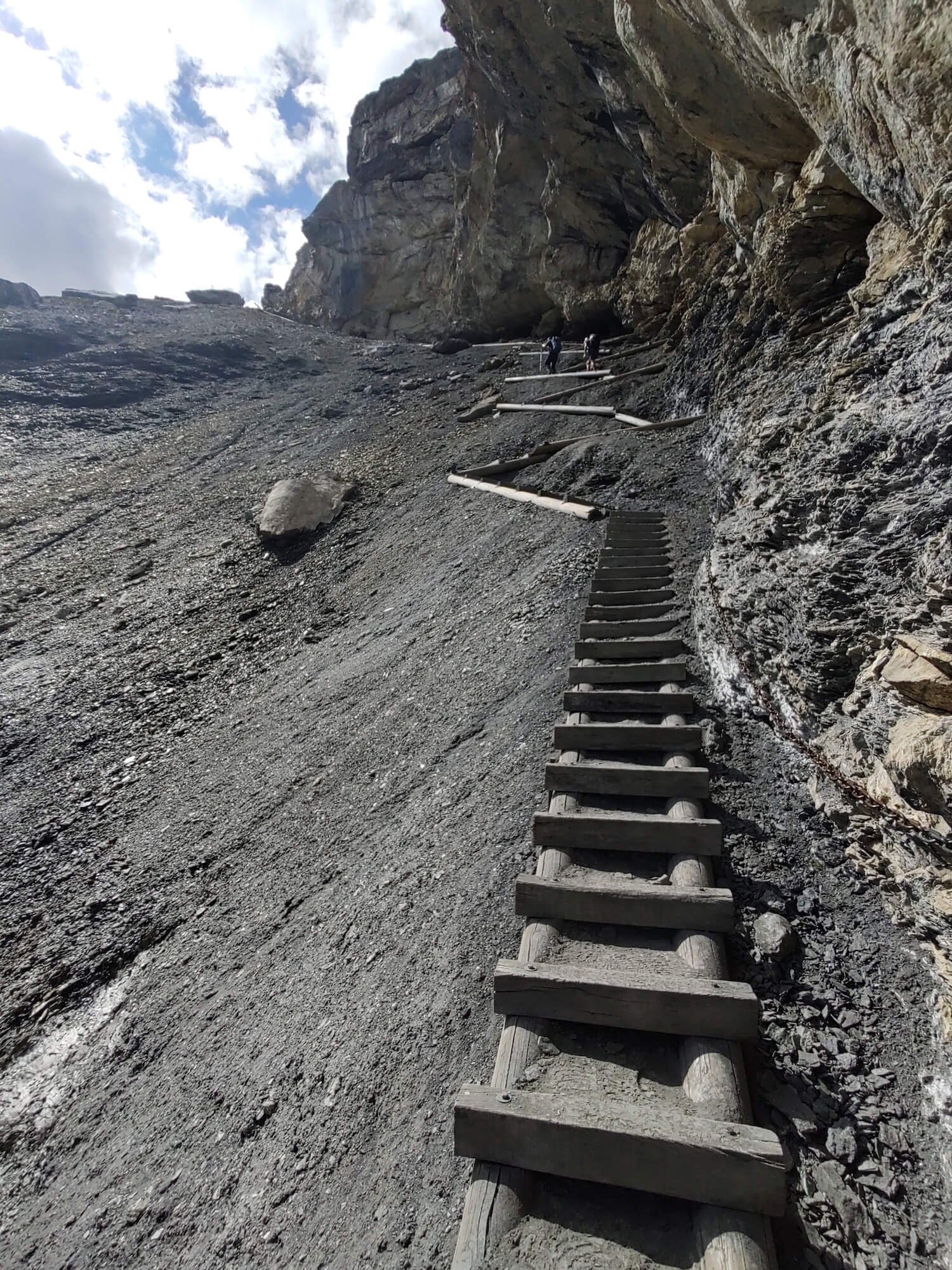
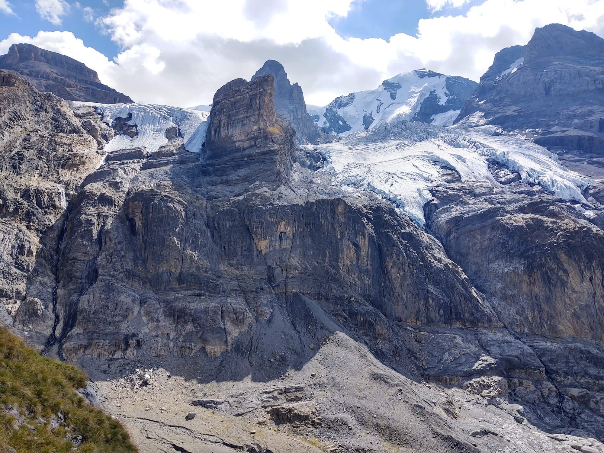
But wait....it gets steeper! We thought yesterday's hike was very steep at the final ascent to the pass. Today was even more challenging! From Griesalp, the hike was immediately steep. Approaching the pass, the climb became more severe with a black grit spur eroded with gullies. We gained elevation with every step and could see the Blümlisalp peak and hut above.
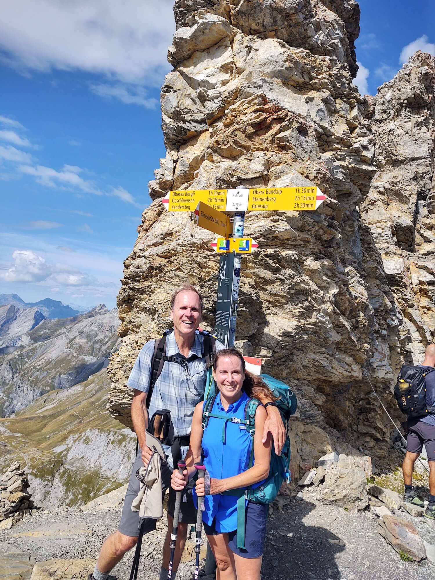
The ascent steepened even more and as I peered around a rock wall corner I was astonished to see timber liners for more wood stairs. First, there were fixed cables and then the stairs began. They were built beneath overhanging craggy rocks and I started to count. There were 567 stairs for the final ascent to the Hohtürli Pass, the highest pass on the Bären Trek at 2778 meters. The views were outstanding and made the effort worthwhile. The snowy peaks of the Blümlisalp dominated and on the hike down the other side, we saw the shrinking Blümlisalp glaciers.
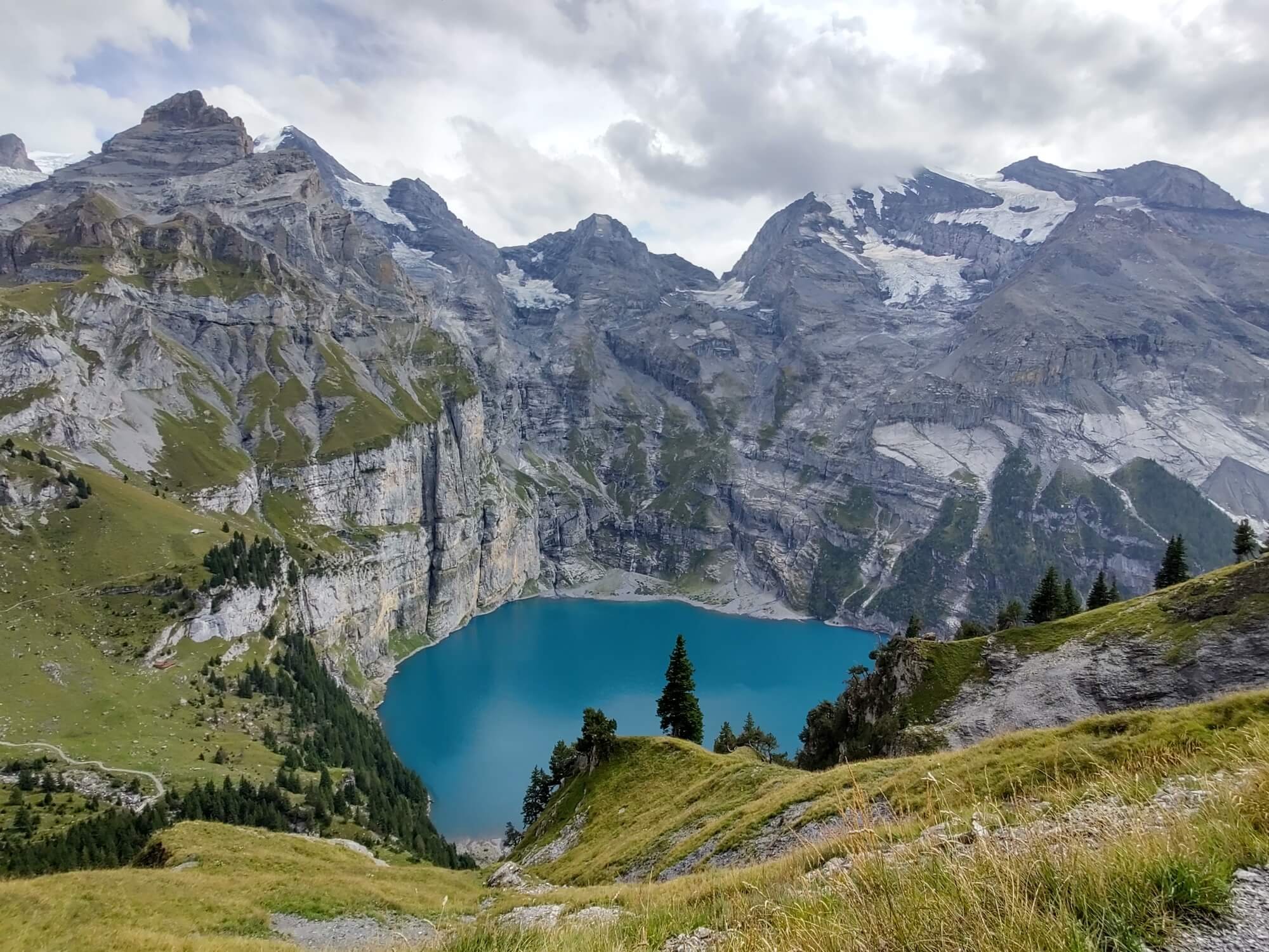
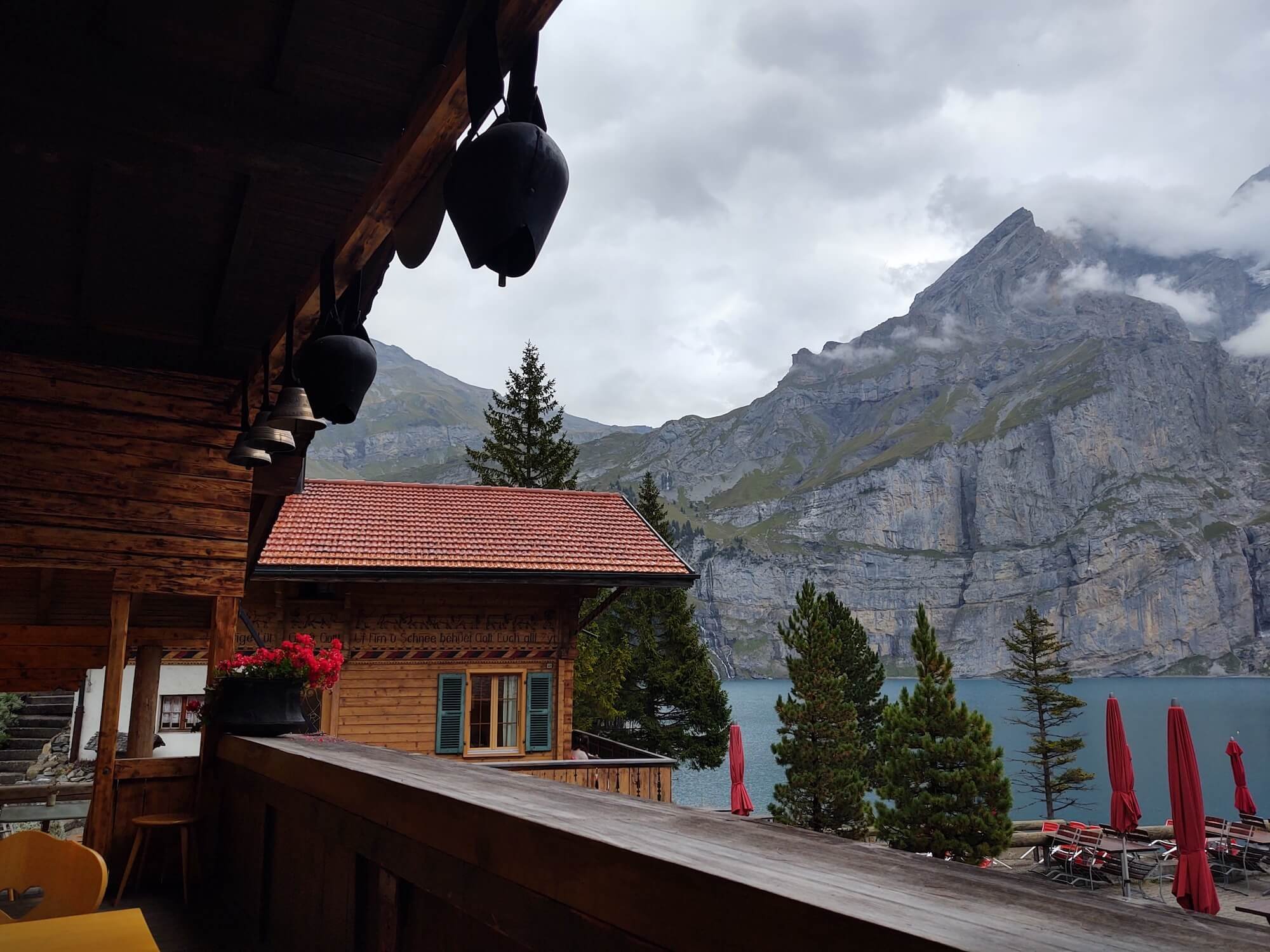
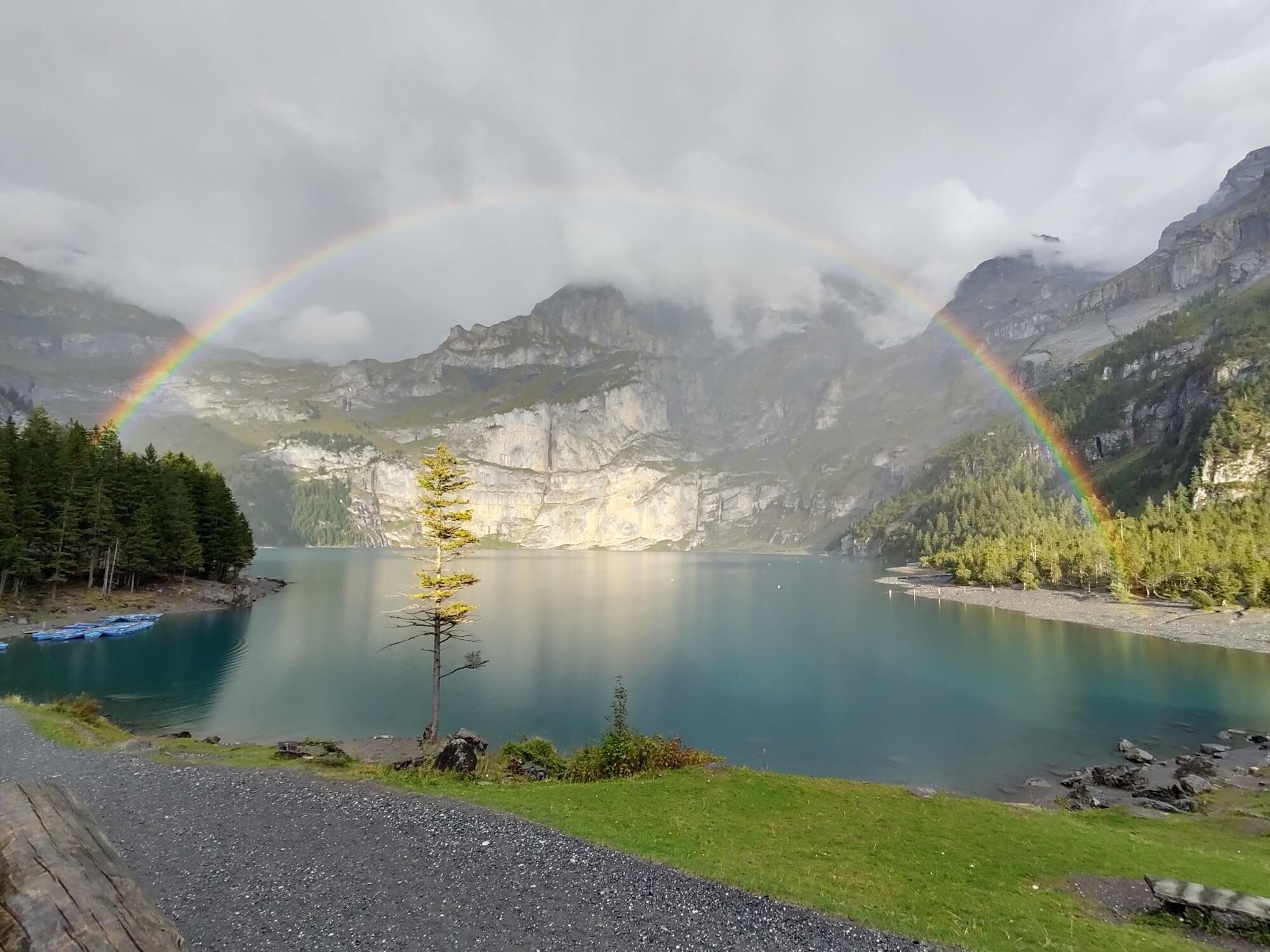
Descending into the valley brought us to the Bärgli hut where we caught our first glimpse over the precipice into the steep-walled basin of Oeschinensee, a beautiful alpine lake. We opted for the high trail with stunning views of the lake and peaks. Lucky for us, we reserved a room with a balcony at the Arva Gasthaus right on the lake. A short rain in the early evening rewarded us with a full rainbow over the lake.
Stage 14: Kandersteg (or Oeschinensee) to Adelboden.

How many people can you spot climbing the via Ferrata?
This was our very last full day of hiking. We said goodbye to the beautiful Lake Oeschinen, watched a rockslide above the lake (!), and started off to Adelboden with a combination of gondolas for the steep, cliff sections and hiking. If you zoom in on the waterfall and cliff photo (right), you'll see people doing a very vertical via Ferrata.
As we headed up to Bunderchrinde Pass we were caught in some rain which made the very narrow ascending traverse a little bit scary. As soon as we completed that section, the rain stopped and a rainbow appeared! This pass was much different than the last two days, with more gradual, long traverses up the steep parts... no stairs! We hiked up the rest of the way to the pass and enjoyed views back to the lake where we had started and ahead to the Adelboden valley.
Adelboden is a village tiered on the slopes of the valley and is known as a big ski area. In the evening, the church bells rang for 15 minutes straight right outside our hotel!

Other side of Kandersteg looking back toward Oeschinensee and mountains

Bob, in orange, on trail approaching Bunderchrinde Pass
Stage 15: Adelboden to Lenk
For our last day, we hiked from Adelboden over Hahnenmoospass to Lenk. The pass is part of the ski area and connects Adelboden in the Bernese Oberland to Lenk im Simmental. There are gondolas everywhere in this valley so we hiked, took a gondola, and then hiked the rest of the way to the pass and then down the valley to Lenk. Compared to previous days, this was a pretty easy hike! At the pass, I again saw the colorful Trotti bikes that we've seen at all the ski areas. The Hahnenmoospass has an RC Glider club and many people were out flying their gliders.
Approaching Lenk and the end of the Bear Trek
From Lenk we hopped on the train to head to the Geneva Airport. Luckily, the conductor held the train for a couple of minutes to give us time to buy our tickets from the vending machine! We decided to hop out at Montreux to find a very late lunch/early dinner and happened upon a Freddie Mercury festival (of "Queen" band fame). Interesting event. Very different to be in a city and at a festival after hiking in the mountains for 2+ weeks!
We're back home in Seattle now and enjoying all the memories and photos we took. Thank you for joining us on our adventure!
Author and photography: Cindy Scheyer

6 Day Bear’s Trek sample itinerary from our planning app
Cindy’s 8 Day Bear Trek Itinerary
Average daily hiking stats:
Distance: 12 km / 8 mi
Elevation gain: 8,50 m / 2,800 ft
Time (steady hiker): 5 hours, not including breaks
Accommodation: Alpine villages
WHO ARE WE?
The Hiking Club empowers anyone to walk the way they want in the wild with personalised self-guided hiking experiences that are easy to find, quick to plan and simple to navigate.
We believe hiking experiences have the power to transform lives. With a growing range of personalised hikes that take into account your preferences, fitness and interests, we give you everything you need to explore the legendary trails of the world!