Tour of Monte Rosa: Complete Package


Tour of Monte Rosa: Complete Package
Everything you need to plan, book, prepare and navigate your adventure. This package includes;
access to our planning app
Put down the guidebook, delete your spreadsheet and close all your open tabs. It’s time to upgrade to the first purpose-built, all-in-one planning app for multi-day hikers to create an itinerary that is achievable, inspiring and bookable! The web app allows you to:
Create your itinerary
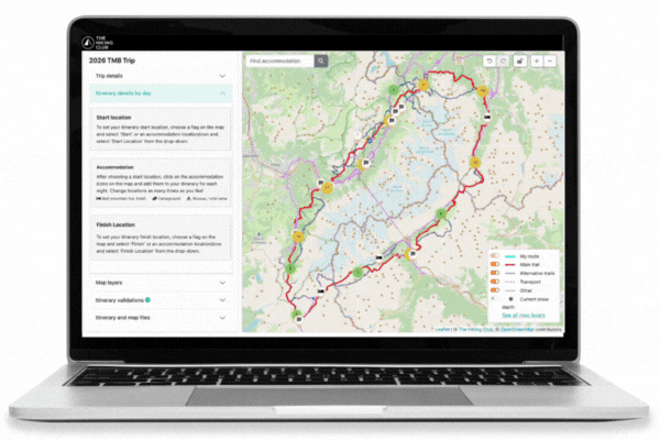
Design your own itinerary in one sitting: Use our extensive trail database to select your route (main or variant) and accommodation directly on the map. Easily visualise your route, broken down day by day, to prepare each day of your trip.
Choose from sample itinerary database: Want a starting point to plan your multi-day hike in the Alps? Explore our database of sample itineraries with options based on trail, hiking speed, hiking days, and accommodation preference.
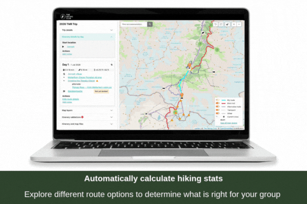
Automatically calculate hiking stats: Select your accommodation, campground or permitted bivouac location to get accurate daily hiking stats. Your estimated time, distance, and elevation change are automatically calculated and displayed with every route and transport decision.
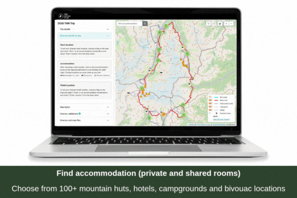
Explore accommodation options: We have 100+ accommodation options on and nearby the trail, ranging from mountain huts, hotels, campgrounds and permitted bivouac locations. Information on private v. shared rooms, booking status, and how to book. Great rest day options to choose from too!
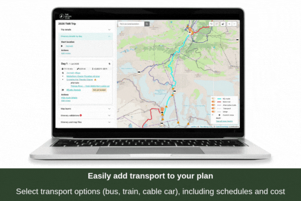
Add transportation to your plan: Easily select transport options (gondola, bus, train) to see the impact to your daily hiking stats. All transport details including 2026 schedules and costs are included in your final GPS map.
Detailed itinerary document: Download and/or print your daily hiking plan which includes your distance, elevation profile, estimated hiking time and information on your chosen route.
Book your accommodation
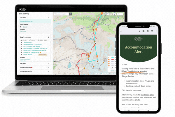
See which properties are taking 2026 online bookings: Don’t miss out on your preferred accommodation by seeing their booking status directly on the map. Links to book/reserve your chosen accommodation location
See real-time hut availability: For the huts with online booking systems, see their real-time hut availability for the upcoming season. The list of huts we have real-time availability for can be found here.
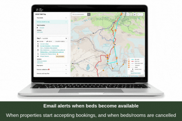
Get email alerts when beds become available to book: Set email alerts to be notified when: properties start accepting online bookings for the season, and when they list new beds online for different room types (ie: due to cancellations)
Prepare for your trip
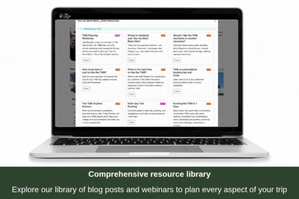
Resource library: Explore 30+ resources including webinars, workshops and blog posts created by our trail experts on how to plan and prepare for your trip. Including - packing list, best time to hike, how to get to/from the trail, best weather apps, baggage transfer options, emergency service numbers and more.
Daily snow data: See estimated current snow depth and 48 hour snow forecast on your route to make informed route and gear decisions. Data integrated from ExoLabs.
NAVIGATE with your phone
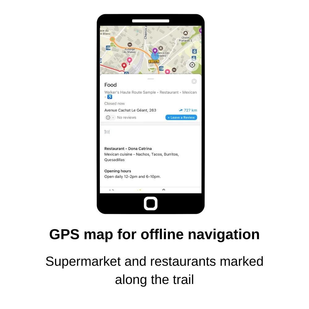
Your personalised GPS trail map allows you to navigate your hike in the same way you would in urban areas. Your map is created based on your specific plan/route and can be used on any Android or Apple smartphone. Key features on your GPS map:
Your current location is visible on the map
Your personalized daily hiking statistics are displayed for each section and day of your itinerary
Coloured markers to highlight points of interest, such as water refill, toilet, food/supermarkets and laundry locations
Current season transport schedules to reroute your plan if you need to skip ahead on the trail
Bad weather routes if you need to change to an easier hiking route (where possible)