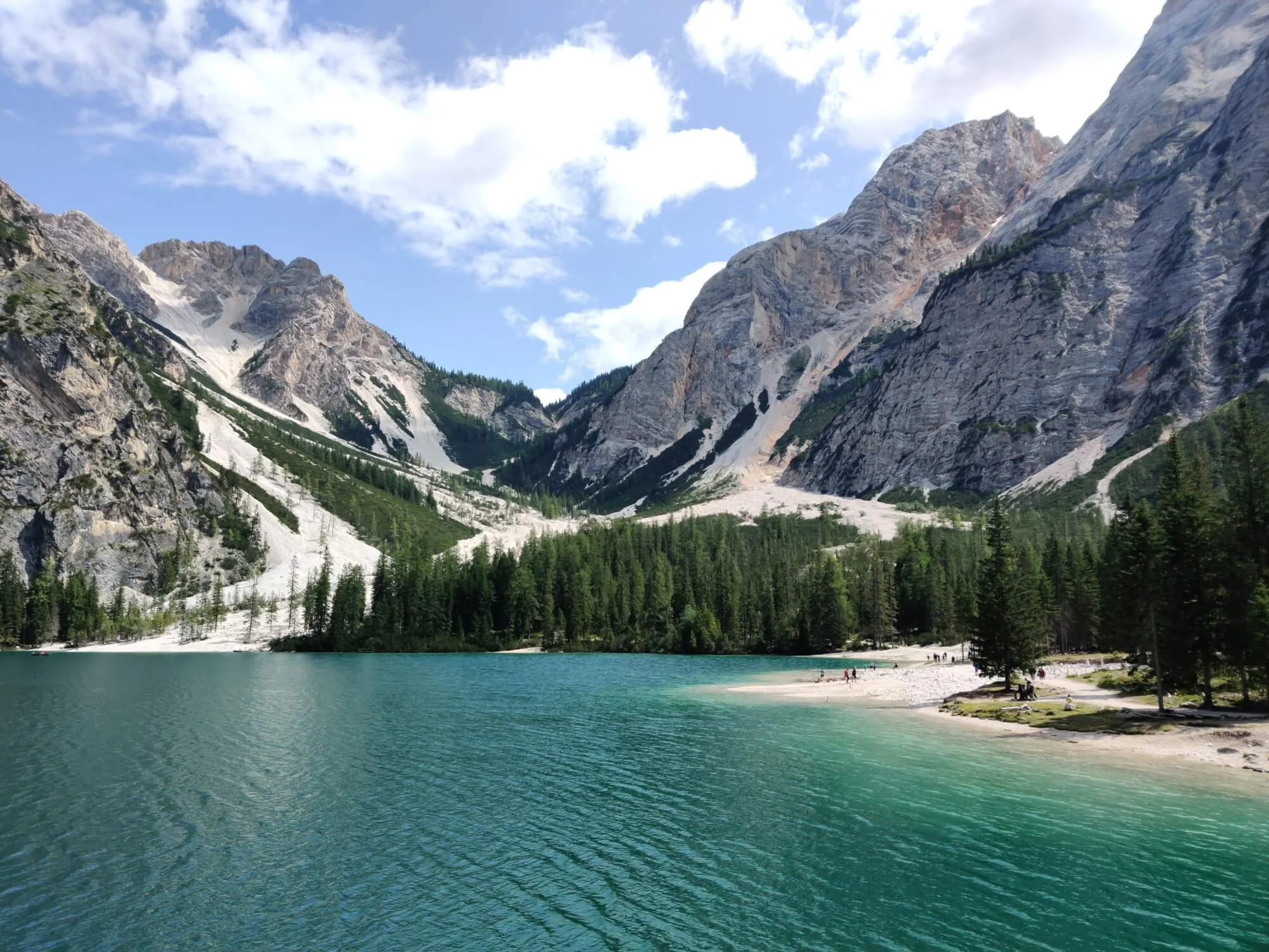
South Tyrol · Northern start
Lago di Braies / Pragersee
An alpine lake beneath steep limestone peaks and the traditional starting point for the north-to-south route.

Alta Via 1 Dolomites
Build an itinerary around your hiking style, secure the best accommodation and confidently prepare for your self-guided journey through the Dolomites.
The trail at a glance
The Alta Via 1 (AV1) is a multi-day hut-to-hut hiking route through the Italian Dolomites. The classic route travels south from Lago di Braies to La Pissa, passing limestone peaks, alpine lakes, mountain passes and rifugios. Your distance and daily stages will vary with your route and accommodation choices.
Alta Via 1 route map
The classic Alta Via 1 runs from Lago di Braies in the north towards La Pissa near Belluno. There are alternative paths, different places to start or finish, and accommodation options beyond the main trail.
Use the map as an overview; build your own itinerary to see the hiking distance and ascent for each day you choose.
Explore the itinerary planner →
Start planning
Choose an itinerary that suits your group, understand the current accommodation situation and keep up with conditions as your hike approaches.
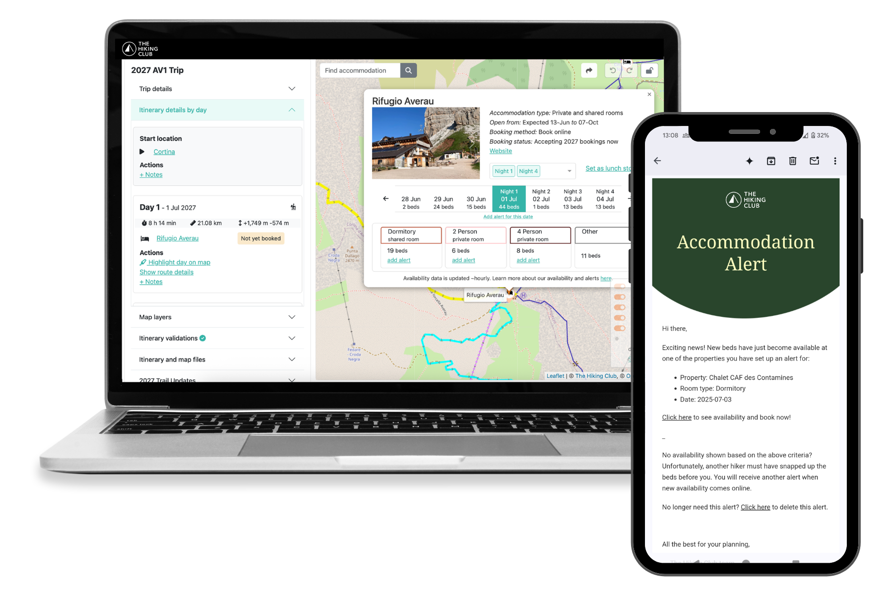
The Hiking Club platform
Turn the Alta Via 1 into an itinerary designed around your group. Bring your route, rifugio bookings, trail preparation and navigation together—and keep adjusting the plan as your trip takes shape.
Platform access from €79 · One purchase covers your hiking group

The Italian Dolomites
Your itinerary determines how much time you have to enjoy each part of the route.
Choosing your itinerary
Most hikers plan around 8–10 days for the Alta Via 1. The right duration depends on your hiking pace, the distance you want to cover each day and where you can secure accommodation.
An Alta Via 1 itinerary can follow the full route from Lago di Braies towards La Pissa bus stop or focus on a shorter section. Alternative paths, rifugio locations and transport connections can change your daily stages.
4–7 days
A shorter section or a demanding pace
Choose a section of the route, or plan longer consecutive days if your group has the experience and fitness for them (i.e trail running).
8–10 days
A classic Alta Via 1 itinerary
Plan the main traverse with daily stages shaped around your pace, preferred rifugios and available rooms.
11+ days
More time for the Dolomites
Allow for shorter hiking days, alternative routes or extra time around the places you most want to explore.
Accommodation on the Alta Via 1
The Alta Via 1 has mountain rifugios along the route and hotels and guesthouses in nearby villages. Where you stay will shape your daily stages, so compare accommodation options and booking availability as you build your itinerary.
Popular rifugios and private rooms can fill early. Check which properties are accepting bookings, design your itinerary around current availability and the dates when other properties open for bookings.
Mountain rifugios
The classic hut-to-hut experience, usually with hot showers and food provided.
Private rooms
Available at selected rifugios, with limited capacity and strong demand.
Hotels and guesthouses
Variety of accommodation options in local villages, accessible from the trail by public transport.
Campgrounds
Private campgrounds with services located outside the nature parks.
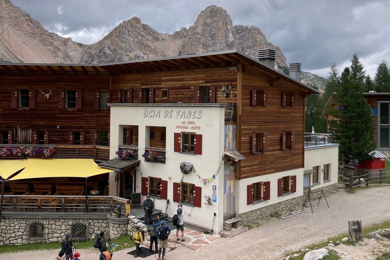
Rifugio Fanes
A mountain rifugio along the Alta Via 1.
Availability changes as rifugios open bookings and hikers alter their plans. The Hiking Club platform provides booking information, live availability and opening or cancellation alerts for supported properties. AV1 camping itineraries use campgrounds; there are no permitted bivouac locations along this trail.
Through the Dolomites
From the waters of Lago di Braies to the limestone towers around Cinque Torri, the Alta Via 1 passes alpine lakes, high mountain terrain and places shaped by the Dolomites’ history.
South Tyrol · Northern start
An alpine lake beneath steep limestone peaks and the traditional starting point for the north-to-south route.
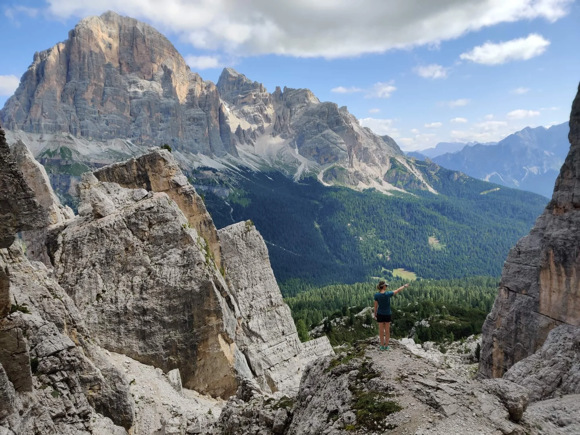
Belluno · Historic landscape
Distinctive rock towers surrounded by trails and First World War trenches and shelters.
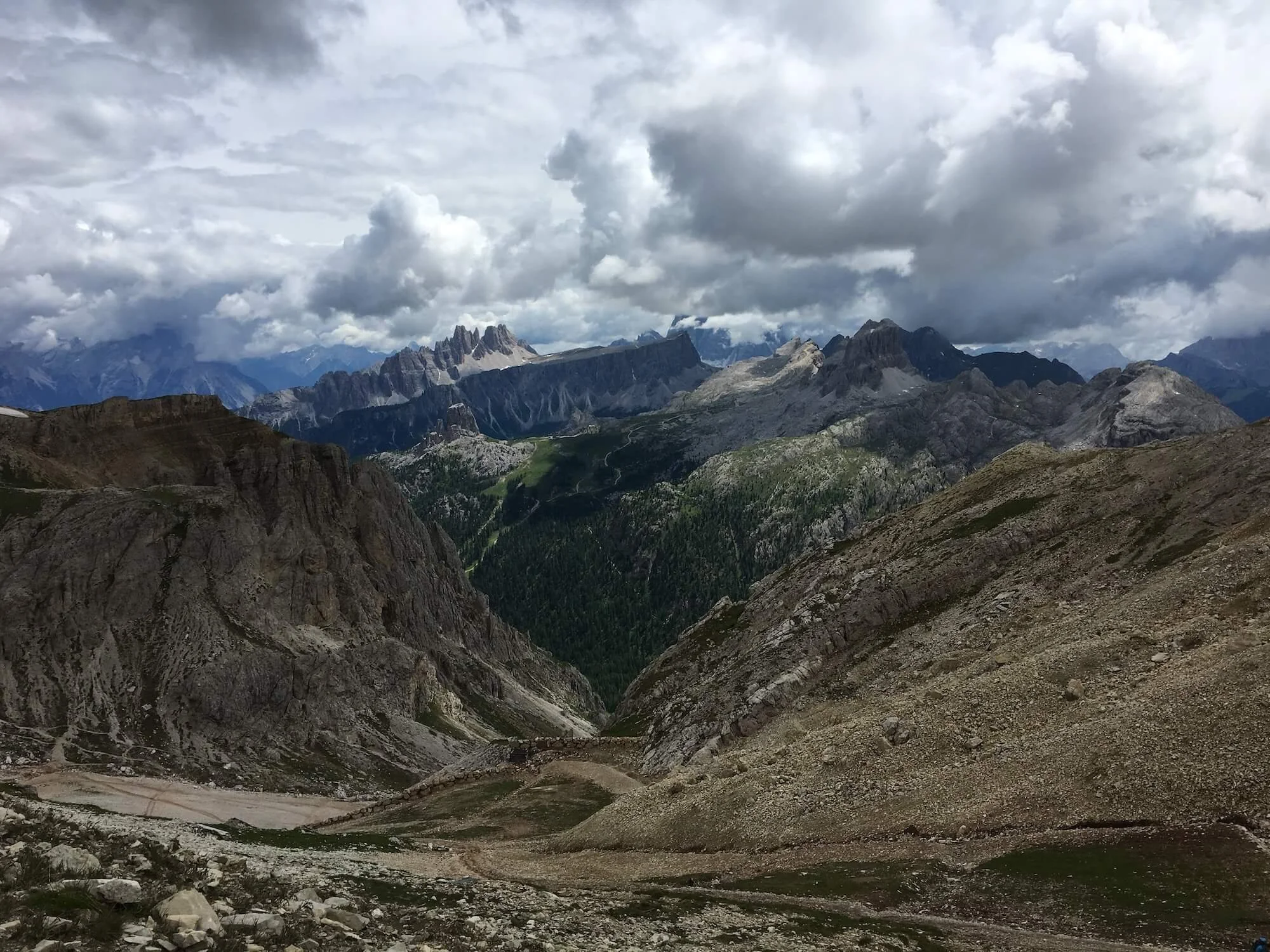
Lagazuoi area
High mountain views near Lagazuoi, where hikers can also explore wartime tunnels as a separate activity.
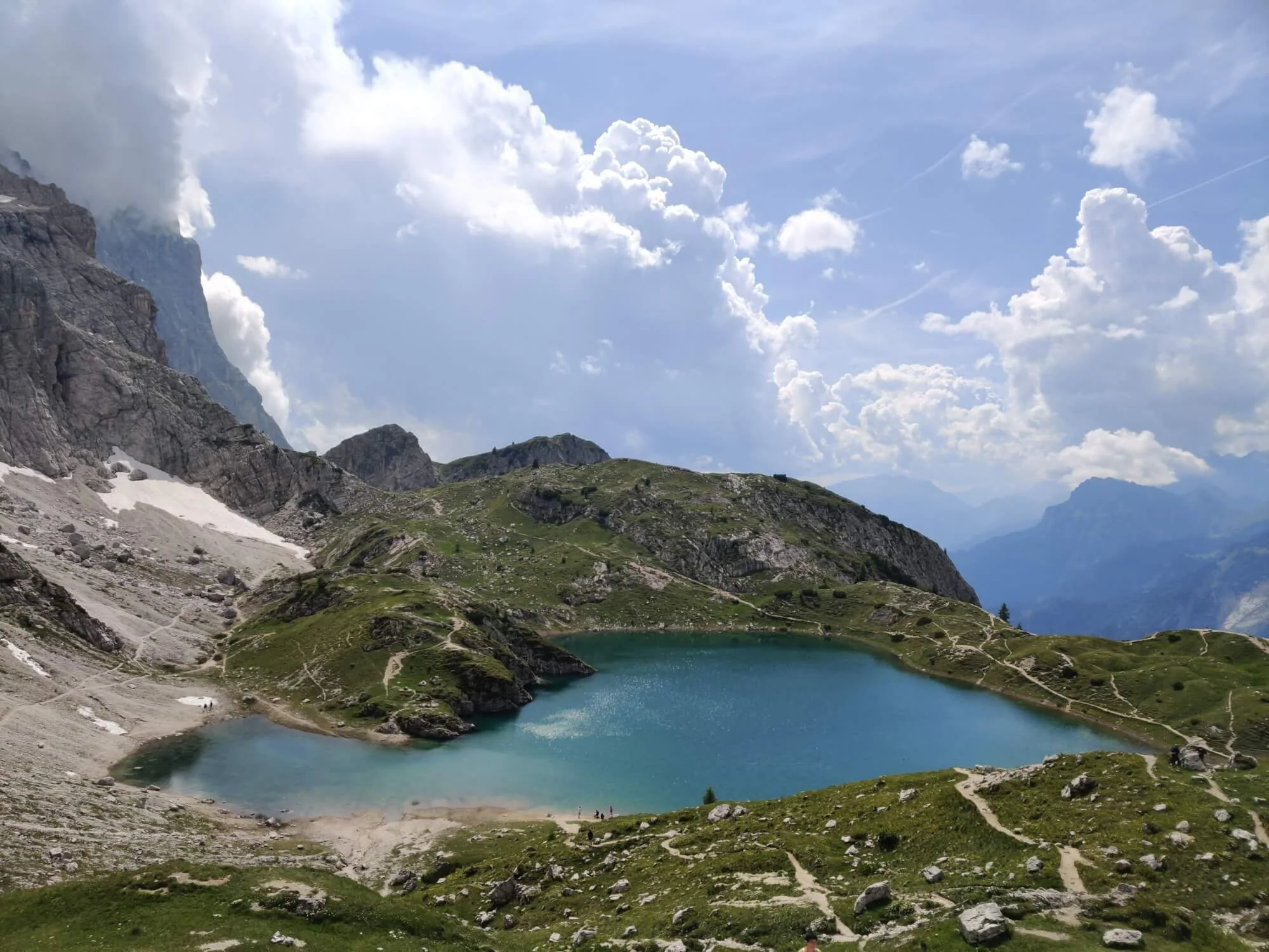
Civetta area
A high alpine lake near Rifugio Coldai, surrounded by dramatic mountain scenery.
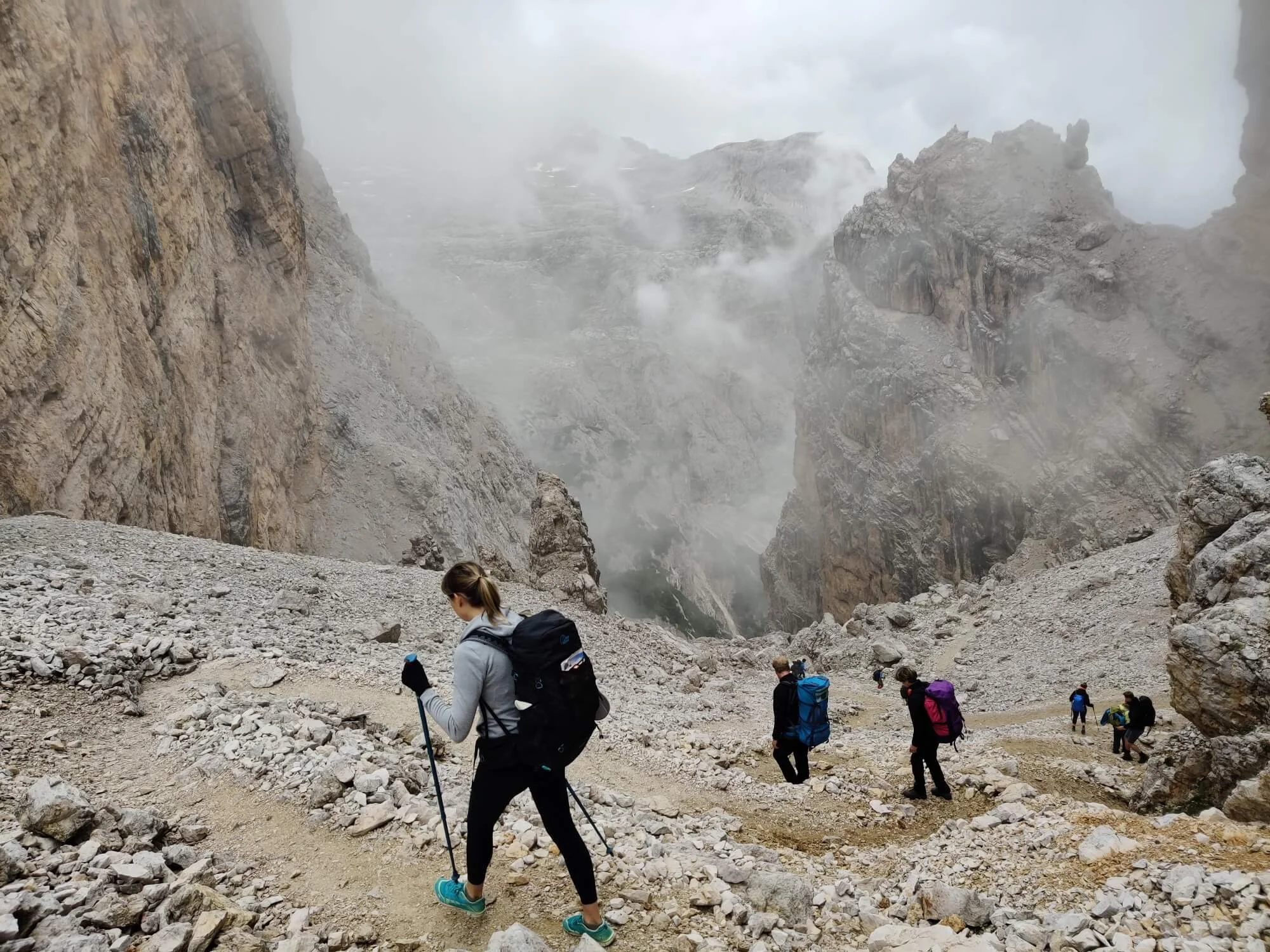
High mountain pass
A steep, rocky section that shows the more demanding side of the Alta Via 1.
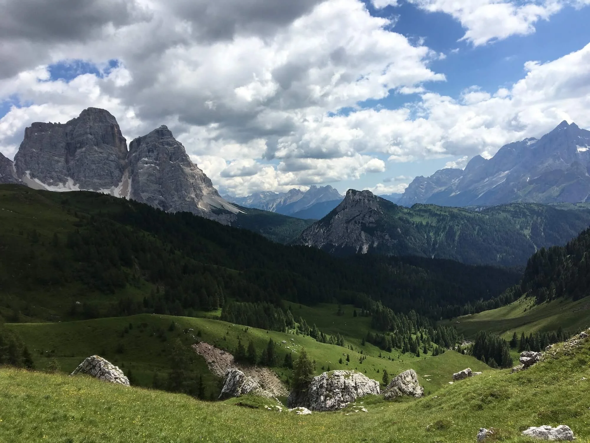
Belluno · Mountain scenery
Open Dolomites scenery and striking limestone peaks around one of the route’s best-known mountain passes.
The places you experience depend on your starting point, route, available accommodation and any alternatives you include.
Explore AV1 itineraries →Choose your trailheads
The classic route runs south from Lago di Braies to La Pissa, but you can start or finish along the trail to create a shorter itinerary. You can also hike in the opposite direction. Choose the locations that suit your available time, transport connections and accommodation.
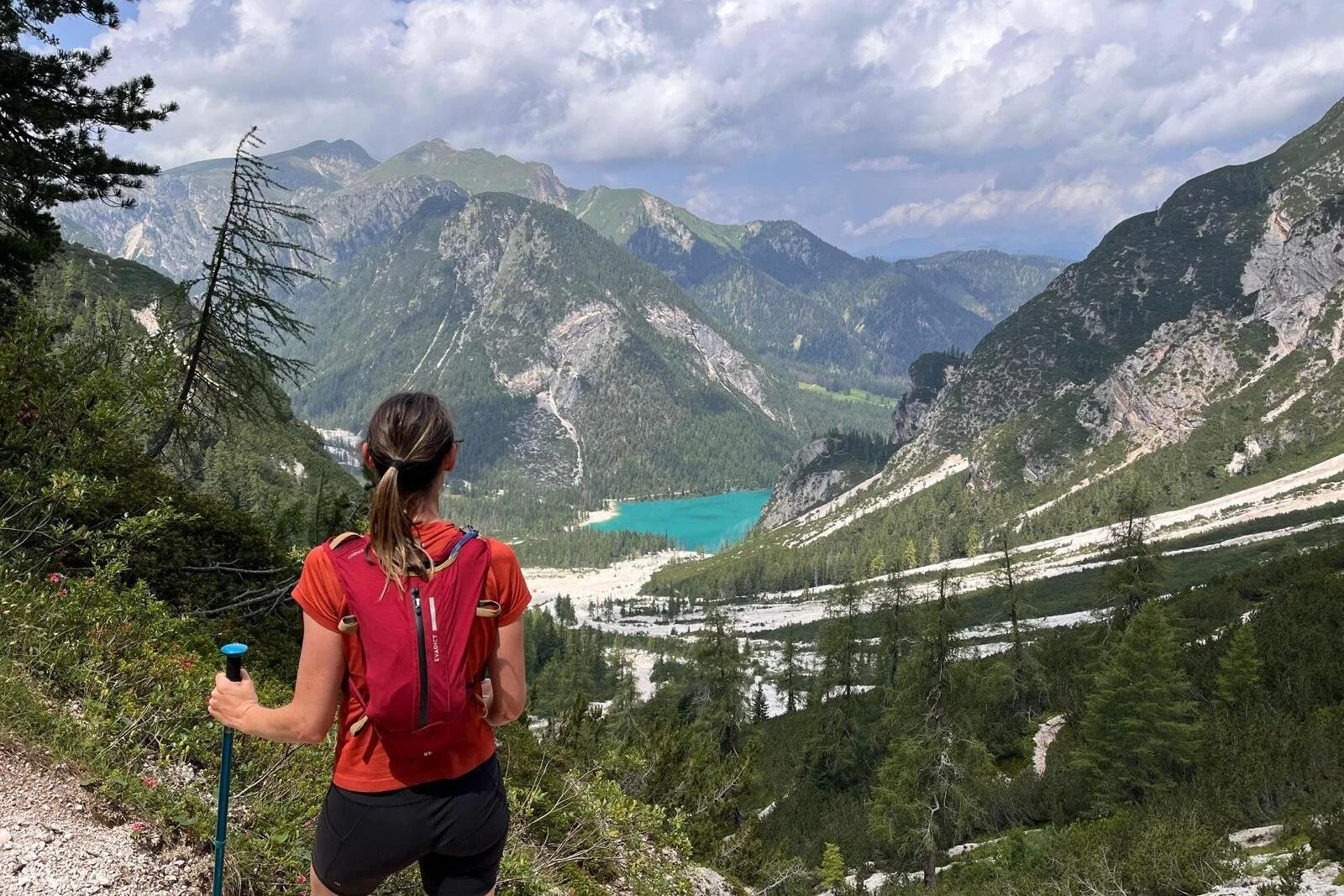
Northern trailhead
Also known as Pragser Wildsee, the lake is the classic starting point for a north-to-south traverse and the finish for hikers travelling south to north.
Trail access: Lago di Braies
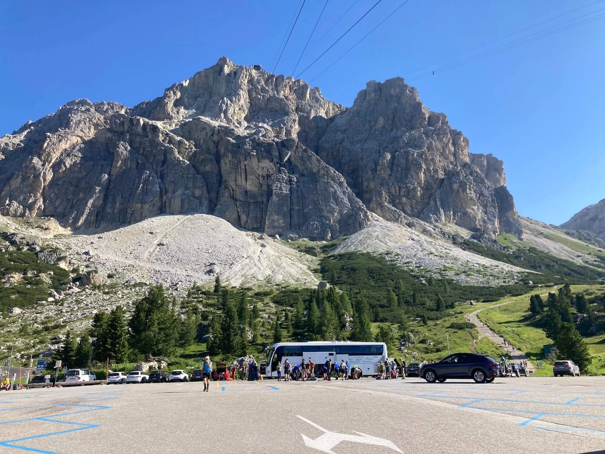
Central section
Start or finish in the central Dolomites to focus on Lagazuoi, Cinque Torri and the surrounding mountain scenery.
Trail access: Cortina or San Cassiano
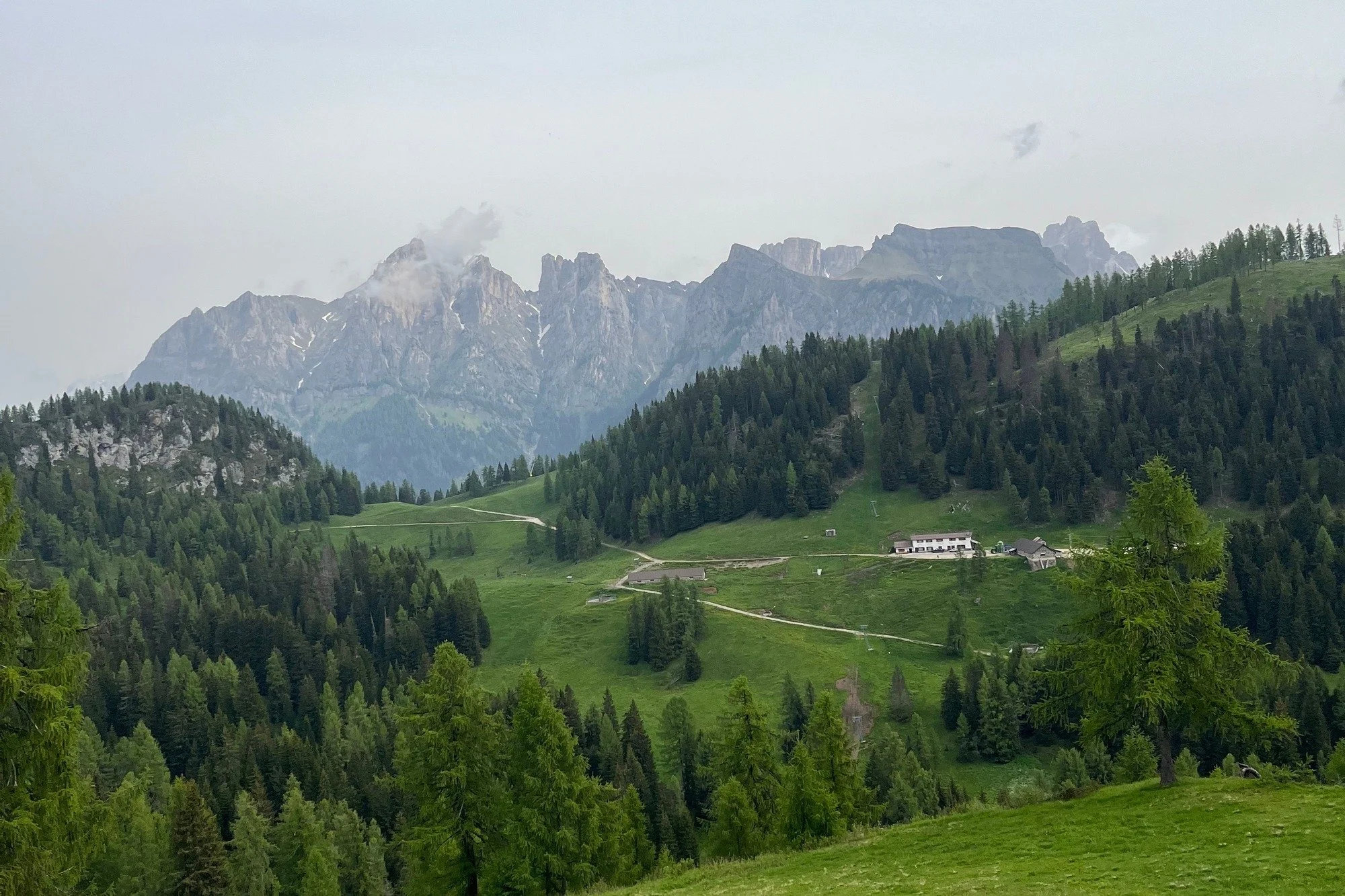
Central and southern section
Begin or end farther south for a route through the central and southern Dolomites, with your stages shaped by transport and available accommodation.
Trail access: Via Alleghe
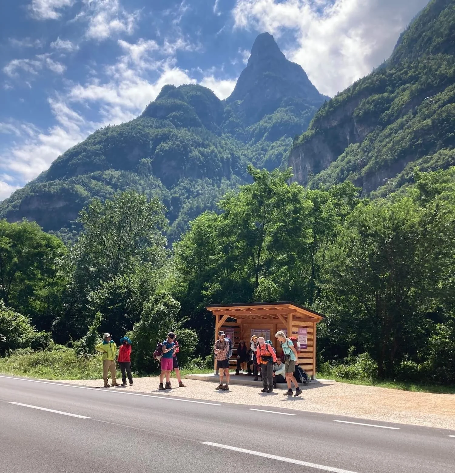
Southern trailhead
Finish the classic north-to-south traverse here, or start at La Pissa and hike towards Lago di Braies in the opposite direction to most AV1 hikers.
Trail access: La Pissa bus stop
Plan around your available time
Compare daily distance, ascent, accommodation and transport connections between your chosen trailheads before settling on an itinerary.
Personalise the route
The classic AV1 is a complete hut-to-hut journey. Alternative hiking routes can add a highlight, lead to a different overnight stop or change the terrain of a stage. Optional via ferratas are a separate, more technical choice for suitably experienced hikers.
The foundation for your itinerary
Follow the established hiking route south from Lago di Braies towards La Pissa, choosing daily stages around your pace and available accommodation. No via ferrata is required on the standard route.
Hiking alternatives
Add a summit, follow a historic trail or visit another part of the Dolomites. Each choice changes your distance, ascent and daily stages; some are substantially more demanding than the classic route.
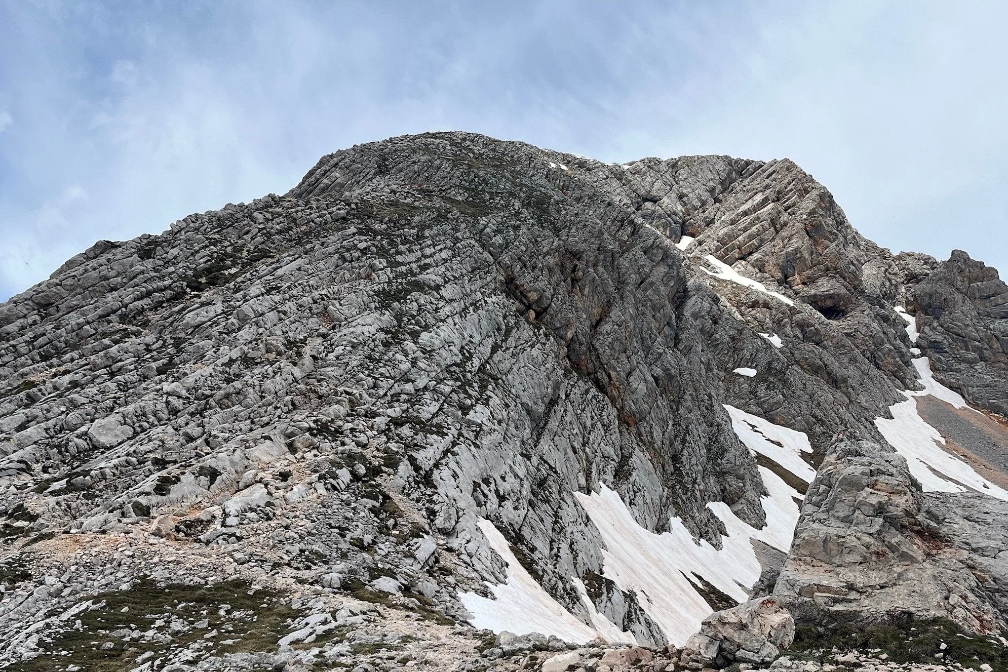
Optional summit · Northern AV1
Add an ascent of Croda del Becco above the Lago di Braies and Rifugio Biella area for wide views across the northern Dolomites. Allow time and energy for the extra climb.

Historic trail · Fodara Vedla
Follow an old military mule track built by Austro-Hungarian troops during the First World War. Interpretive signs tell the story of the Fodara Vedla plateau as a rear-line encampment and logistics area. A quieter choice for alpine scenery and Dolomites history.

First World War history · Lagazuoi
Descend through the historic tunnel system inside Lagazuoi instead of following the outdoor trail to Passo Falzarego. Check access conditions and bring a headlamp and suitable protective equipment.

Lake and rifugio · Central AV1
Take a route through the Croda da Lago area to visit Lago Federa. Stop for lunch or plan an overnight stay at Rifugio Croda da Lago if it fits your stages.
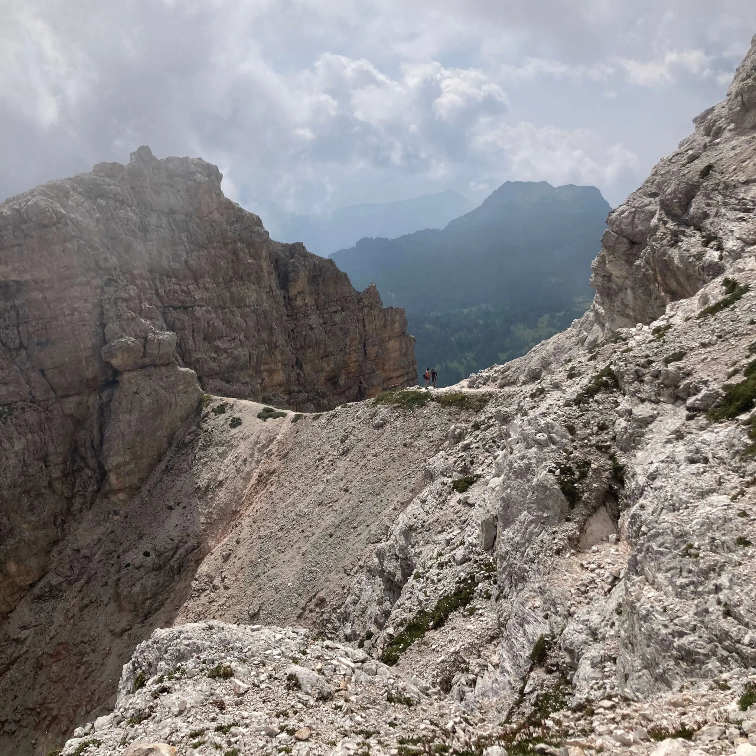
Demanding circuit · Monte Pelmo
Circle the Monte Pelmo massif on a more demanding alternative with steep, loose rocky terrain and sections assisted by cables. Assess the route and conditions carefully before adding it.
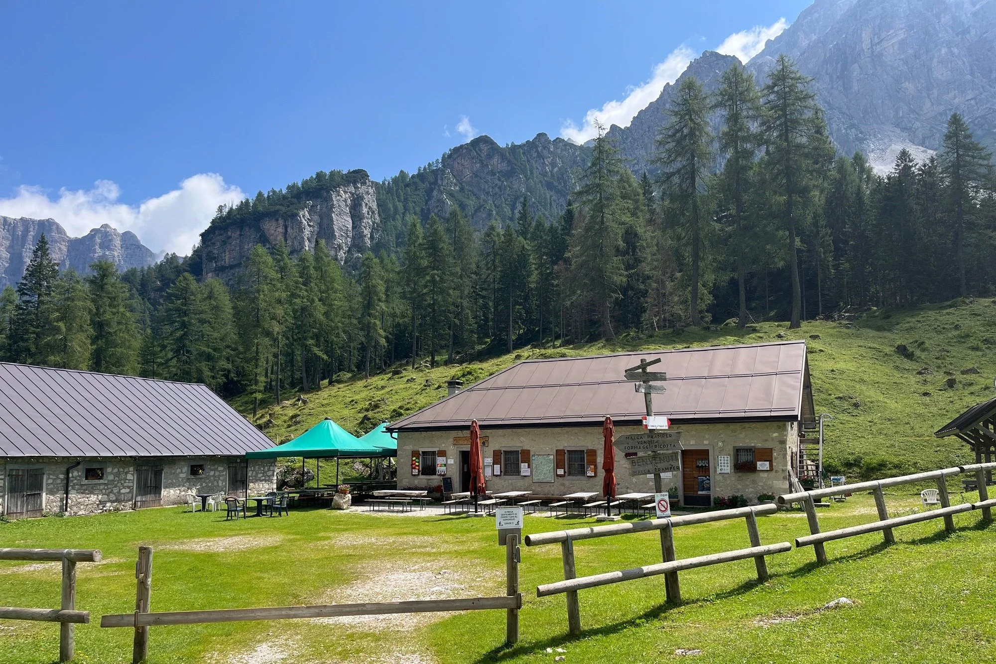
Side trip · Southern AV1
Add a side trip to Malga Pramper to spend more time in the quieter southern Dolomites. Check how the detour affects your hiking time and your next overnight stop.
Optional technical routes
These routes are separate from the standard AV1 hike. They require suitable experience, equipment and a check of current conditions; adding one can also change your daily stages.
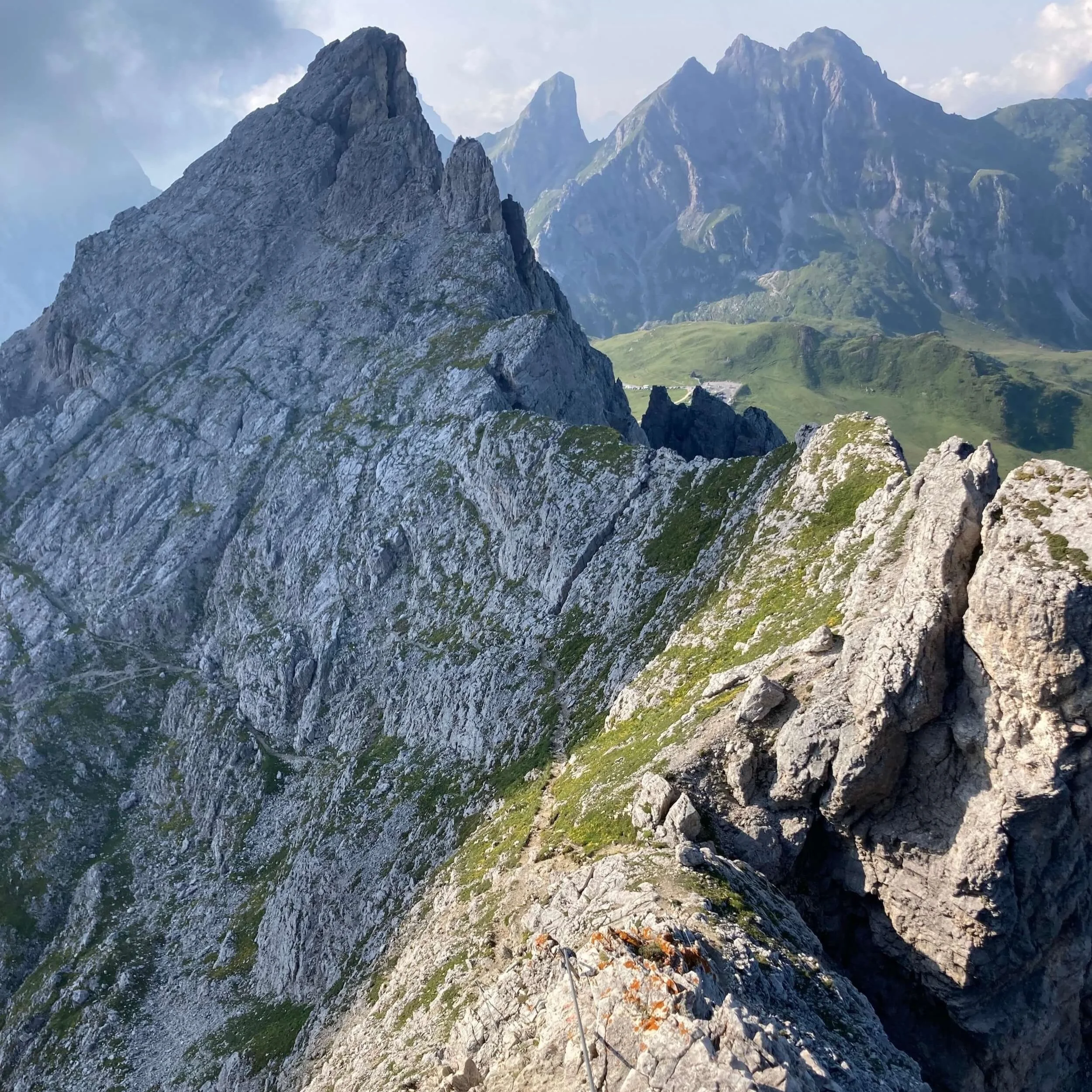
Near Passo Giau
An optional route between the Nuvolau area and Passo Giau that changes the line of this stage.
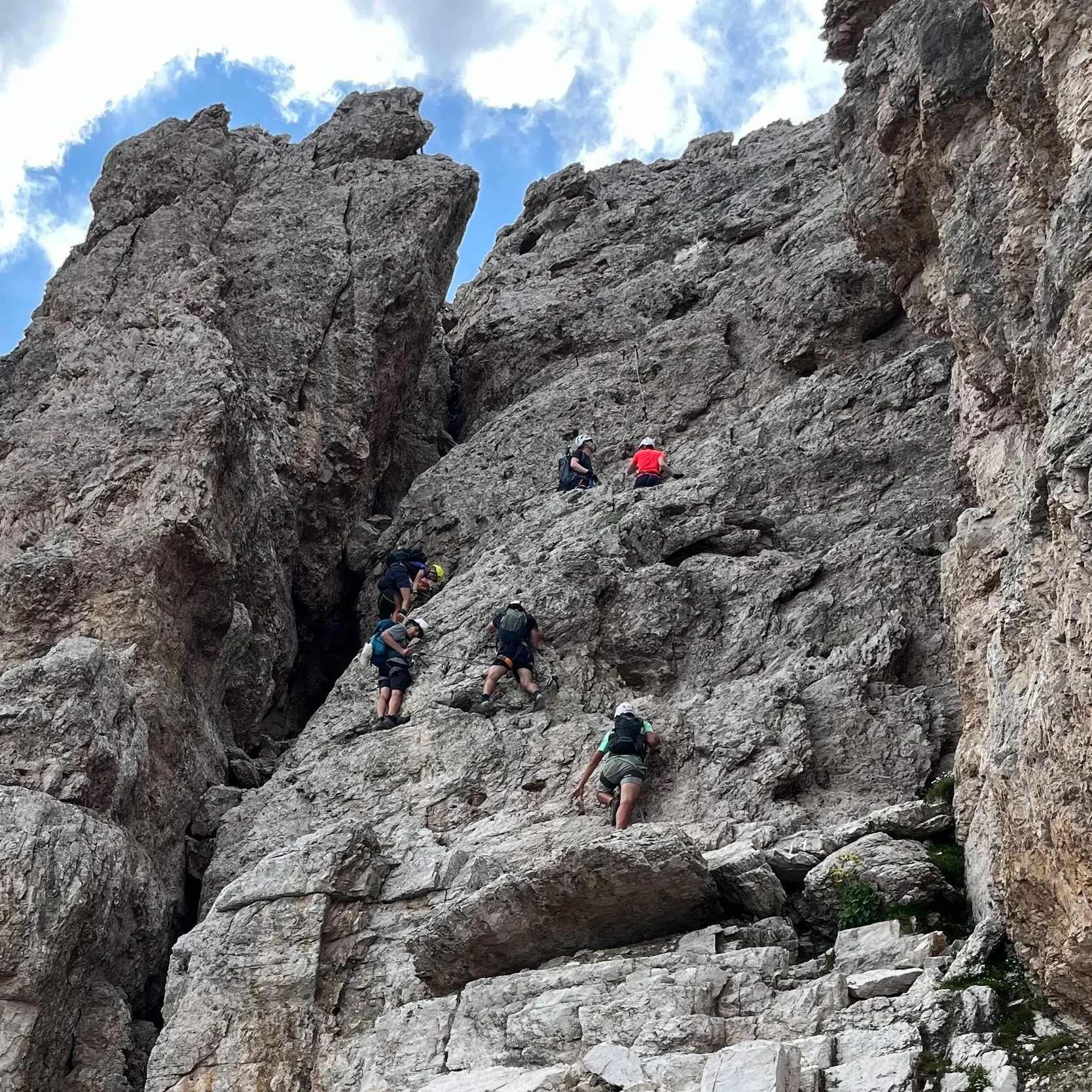
Optional summit
Add an ascent of Monte Averau for broad views over the surrounding Dolomites.
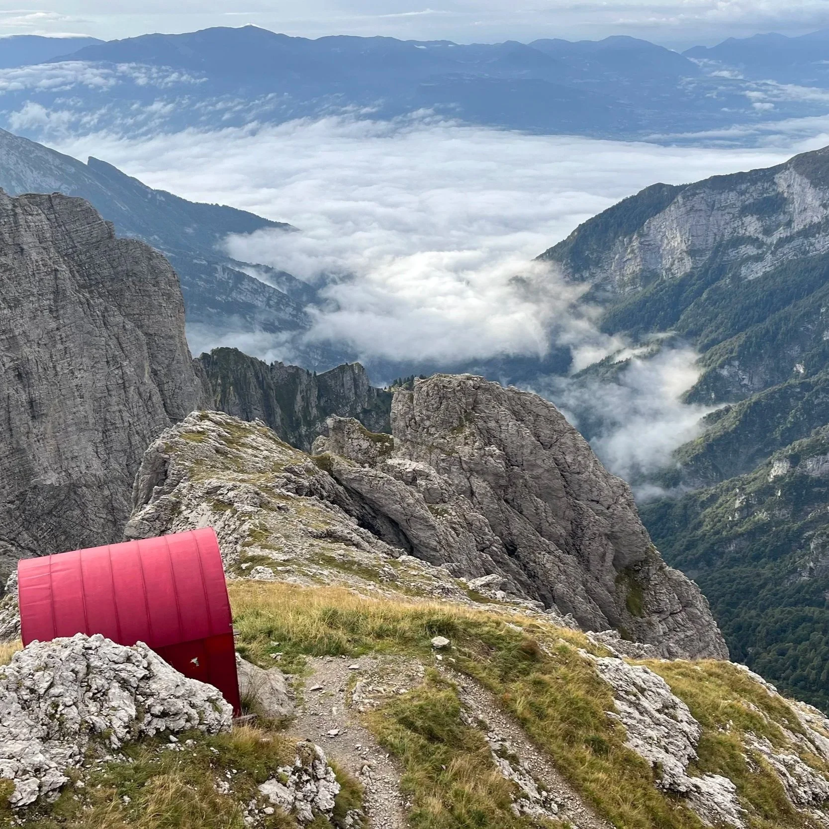
Advanced extension
A remote, exposed route in the Schiara group sometimes described as an additional stage beyond the standard AV1.
Via ferrata grading and conditions vary. Check the specific route and carry appropriate equipment; a hiking itinerary alone does not establish that a technical route is suitable for your group.
Build the route around your ability
Compare daily distance, ascent, estimated hiking time and accommodation when you add or remove routes in the planning platform.

Compare campgrounds with your daily route and hiking statistics.
Sleeping under canvas
Yes, at established campgrounds along or near selected parts of the route. A camping itinerary takes more planning on the AV1: sites are not available at every suitable overnight stop, so you may need to combine camping with nights in mountain rifugios.
Facilities and designated pitches
Campgrounds along or near parts of the AV1 can offer showers, toilets and other facilities. Check the distance and elevation needed to reach each site before making it an overnight stop.
Fill the gaps between campgrounds
Where the next campground would make a stage impractical, staying in a rifugio can keep your daily walking distances manageable. Check availability before settling on your stages.
Wild camping and bivouacking are prohibited along the AV1 through its natural parks. Do not plan to pitch a tent outside an authorised campground. Check current rules with the relevant park and campground before you travel.
Plan the complete journey
Compare campgrounds and rifugios with the distance, elevation and estimated hiking time between each stop in The Hiking Club platform.
Difficulty and preparation
The Alta Via 1 is a demanding multi-day mountain hike. The main route follows marked trails, but it includes steep climbs and descents, rocky ground and some exposed sections where confident footing matters.
The standard hiking route does not require a via ferrata. Your experience will still depend on the daily stages, alternatives, pack weight, weather and accommodation locations you choose.
Mountain passes and uneven paths can demand careful footing, particularly on long descents or loose ground.
Parts of the route, including the Forcella di Lago area, can feel challenging if you are uncomfortable with steep or exposed mountain paths.
Rain, wind and thunderstorms can make a familiar stage more difficult. Check current conditions and choose suitable alternatives when needed.
Consecutive hiking days, longer distances and accommodation detours all add to the challenge. Plan for your group's experience and recovery time.
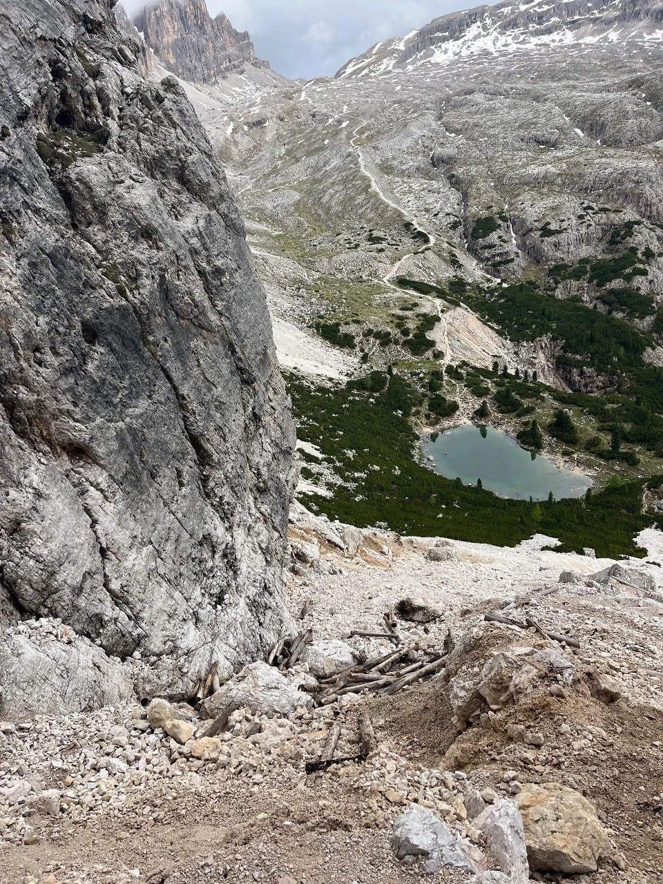
Snow can remain on parts of the route after the hiking season begins.
Choose your hiking dates
The main hiking season generally runs from mid-June to mid-September. The right dates depend on trail conditions, rifugio opening dates, accommodation availability and the experience you want.
Mid-June · Early season
Snow may remain on higher or shaded sections, and some rifugios may not yet be open. Check conditions for your exact route and confirm each overnight stop.
July–August · Peak season
More rifugios and services are generally operating, but popular stages and rooms can be in high demand. Mountain weather can still change quickly.
September · Late season
The trail can feel quieter, while daylight decreases and rifugios begin closing. Confirm your stays and prepare for colder or unsettled conditions.
Use current conditions to make the final call. The calendar alone cannot tell you whether a particular stage is suitable on the day you plan to hike it.
Plan around your dates
Compare AV1 itineraries and overnight stops for your preferred dates, then adjust your stages around the accommodation you can secure.
Build a realistic budget
The cost of a self-guided Alta Via 1 hike depends on how many days you spend on the trail, where you stay and how you plan your meals. Allow separately for flights, transfers, insurance, equipment and any buses or cable cars you choose to use.
An example from our cost guide
€850
Per person for a 10-day, 9-night shared room itinerary.
A shared room based itinerary includes mountain-hut accommodation, meals and lunches. Private rooms or a mix of village stays will produce a different total.
This is a starting estimate rather than a fixed price. Costs vary by itinerary, season, availability, exchange rates and personal spending choices.
Rifugio dormitories, limited private rooms, village stays and campgrounds have different prices and may not be available at every stage.
Half-board meals, hut lunches, packed lunches, snacks and village restaurants can change your daily spending.
Each extra hiking or rest day usually adds another night of accommodation and a day of meals.
Budget for travel to your trailhead, your journey home and any local buses or cable cars included in your itinerary.
Include in your trail budget
Remember to add
Plan your own trip
Choose your daily stages and accommodation in the planning platform, then check current prices for the places you intend to book.
Budget figures are indicative and will vary by travel dates, exchange rates, provider pricing, availability and personal choices.
Compare Dolomites trails
The Dolomites have several long-distance Alta Via routes. Compare their length and character before choosing the journey that suits your available time and mountain experience.
Current trail
A good introduction to multi-day hiking in the Dolomites. The marked hiking route links mountain rifugios and can be shaped around your pace, although you should still prepare for steep, rocky sections.
More demanding traverse
A more difficult traverse with steep climbs, exposed terrain and some cable-assisted sections. Experienced hikers can add optional via ferrata routes for a more technical journey.
Shorter, more technical route
A shorter, rugged route whose main trail includes via ferrata sections. Lower alternative routes can avoid the ferratas, but change the distance, effort and stages you need to plan.
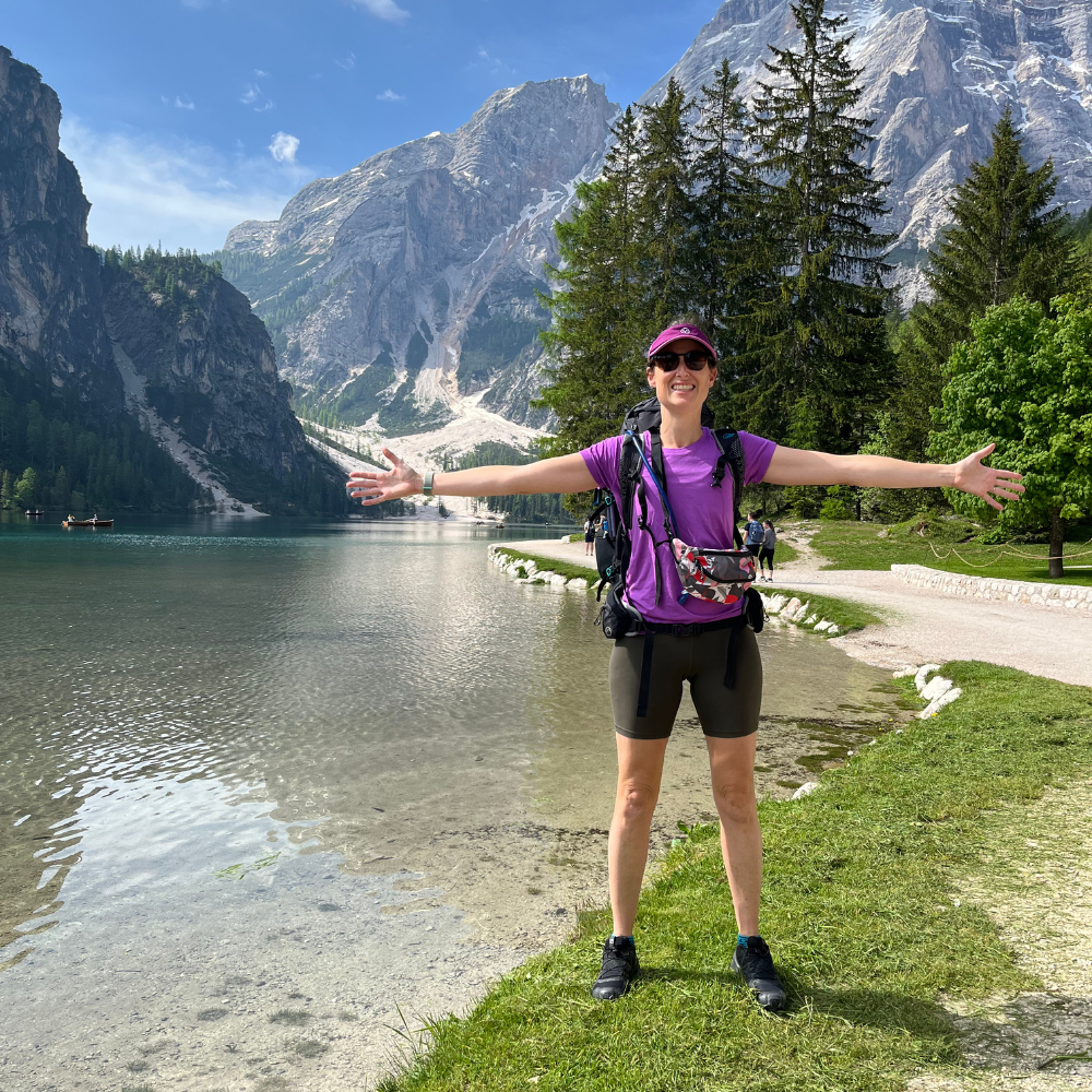
Susan
Dolomites trail specialist
Expert Access
If you would like personal help, work with Susan to design an achievable itinerary around your group, hiking dates, rifugio availability and priorities. You can then continue booking and preparing independently inside The Hiking Club platform.
Planning questions
Clear answers to common questions about planning a self-guided Alta Via 1 hike.
The classic route is approximately 120 km (75 miles), with around 7,400 metres (24,300 feet) of elevation gain. Your hiking stats change with your start and finish points, accommodation detours and alternative routes.
Most hikers plan around 8–10 days for the classic route. A shorter trip can focus on one section; additional days allow for shorter stages or more time in the Dolomites.
Compare AV1 itineraries before choosing your daily stages.
It can be a good first multi-day mountain hike for someone with suitable fitness and preparation. The standard route uses marked hiking trails and links mountain rifugios, but includes sustained climbs, rocky terrain and some exposed sections. Choose daily stages that suit your experience.
No via ferrata is required on the standard hiking route. Optional via ferrata routes are separate, more technical choices that require appropriate equipment and experience. Check the requirements of any alternative you add.
Yes. Many hikers plan and walk the AV1 independently. Self-guided hikers need to choose appropriate stages, arrange accommodation, carry reliable navigation and check current trail and weather conditions.
Learn how to prepare your route for offline navigation.
The classic north-to-south route starts at Lago di Braies and finishes at La Pissa. You can also start or finish at accessible points along the route, including the Lagazuoi and Cinque Torri area or via Alleghe, to build a shorter itinerary.
You can stay at established campgrounds along or near selected parts of the route. They may not align with every suitable hiking stage, so a camping itinerary can also include nights in rifugios. There are no permitted bivouac locations along the AV1 in The Hiking Club platform.
Rifugios open reservations at different times, and popular properties can fill early for peak hiking dates. Build more than one workable set of stages and check the booking status of the properties relevant to your dates.
See the current AV1 accommodation booking status.
Plan your self-guided AV1
Build an itinerary around your group, understand the rifugio availability for your dates, prepare for current trail conditions and take your personalised route with you into the Dolomites.
Sign up to receive regular updates on trail conditions, new products and blog articles about hiking in the Alps.
Please enter a valid email address.
Choose the trails you’re interested in after signing up. Unsubscribe at any time.