Alta Via 4 Dolomites - Route, Map, Itinerary & Hut-to-Hut Planning
Everything you need to plan, book, and self-guide this extraordinary multi-day hike through the Dolomites
Remote, rugged and spectacularly dramatic, Alta Via 4 is one of the most adventurous long-distance treks in the Italian Dolomites.
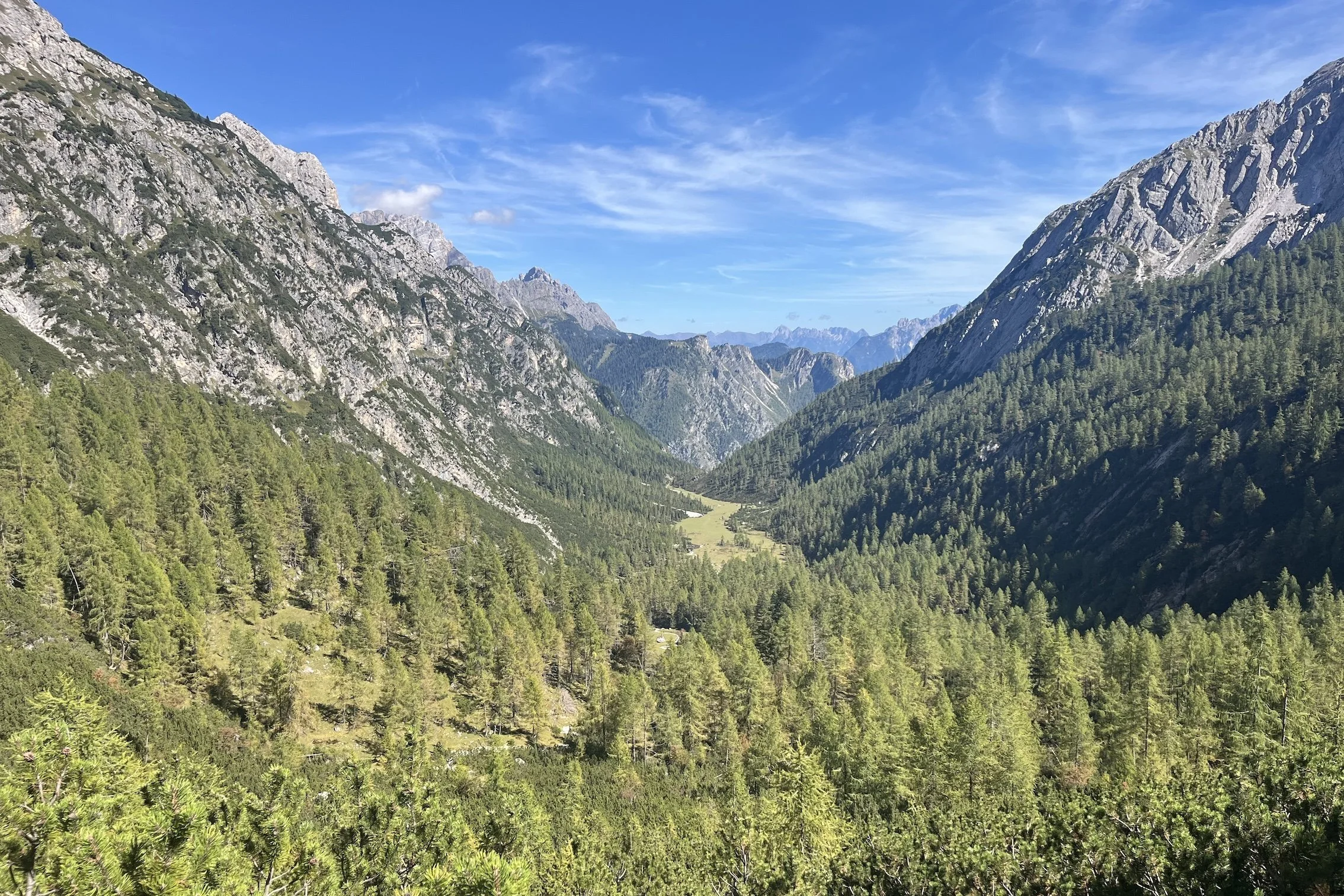
Known as the High Route of Legends, this unforgettable hut-to-hut trail winds through towering limestone massifs, quiet alpine valleys, historic mountain passes and some of the most dramatic terrain in the UNESCO-listed Dolomites, including Tre Cime di Lavaredo, Cadini di Misurina Viewpoint and Lago di Sorapis. Along the way, hikers tackle exposed mountain trails, thrilling via ferrata sections, hidden glacier basins and remote rifugios.
If you’re seeking a challenging alpine journey that combines wilderness, history and thrilling mountain scenery, Alta Via 4 is one of Europe’s great trekking adventures.
Updated for the 2026 hiking season, based on hut bookings, latest routes and transport options.
KEY TRAIL STATS for “CLASSIC” ROUTE
Country: Italy
Number of days: Typically 5 - 7 days
Distance: 70km / 43mi
Elevation gain: 5,583m / 18,317ft (South direction)
Highest point: 2,584m / 8,478 (Forcella del Ghiacciaio)
Season: June - September
Difficulty: Challenging
Traffic: Moderate (Busier in North, Quieter in South)
Official start location: San Candido / Innichen
Official end location: Pieve di Cadore
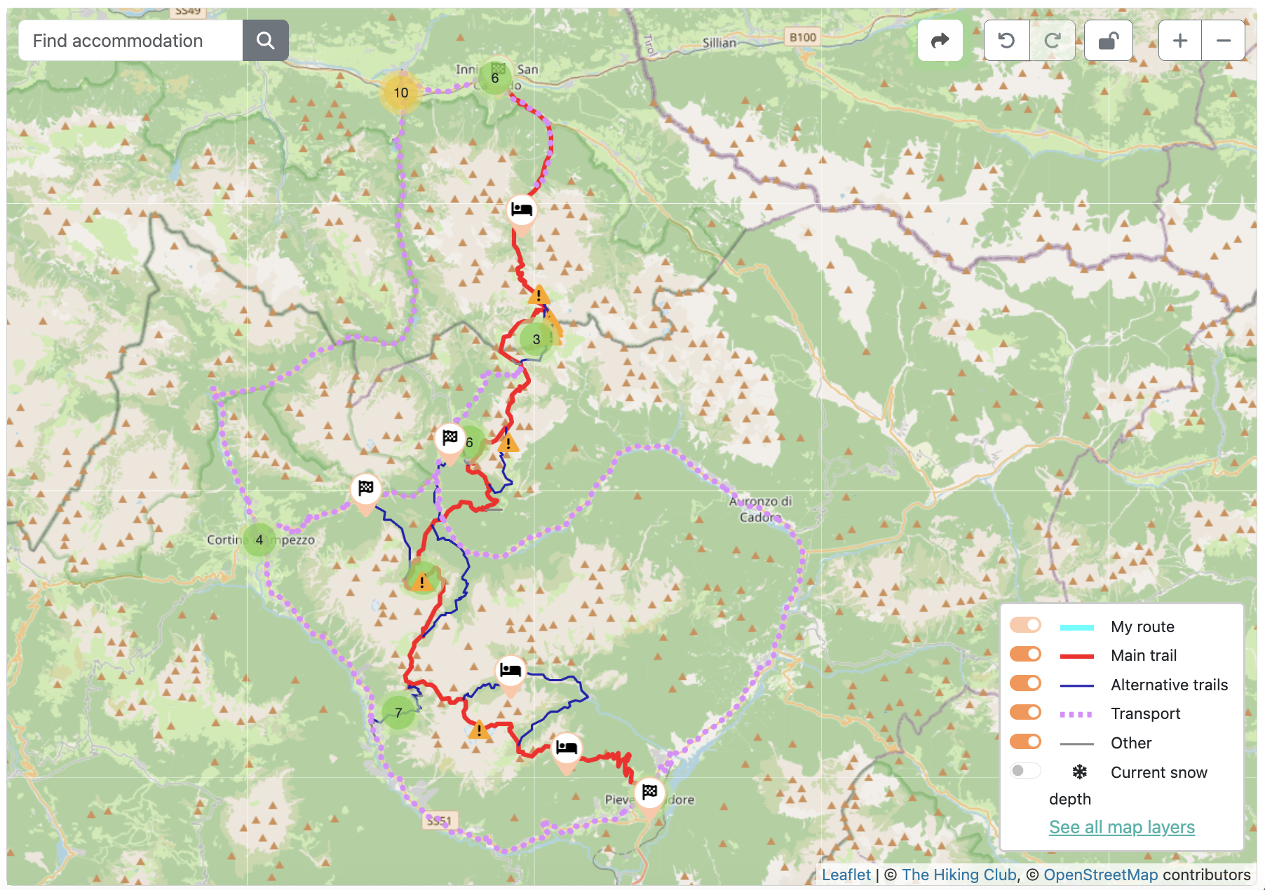
Alta Via 4 Dolomites: High level map from our planning app showing the trail through the Dolomites which are located in Northern Italy, near the border to Austria.
Alta Via 4 Highlights
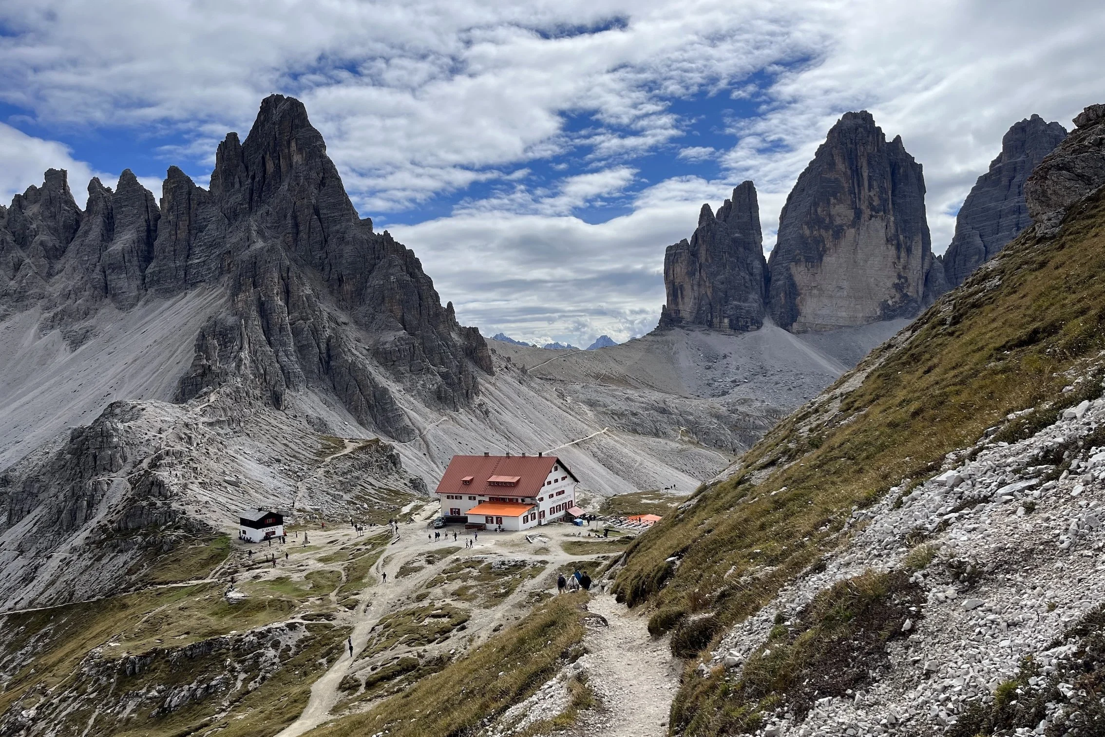
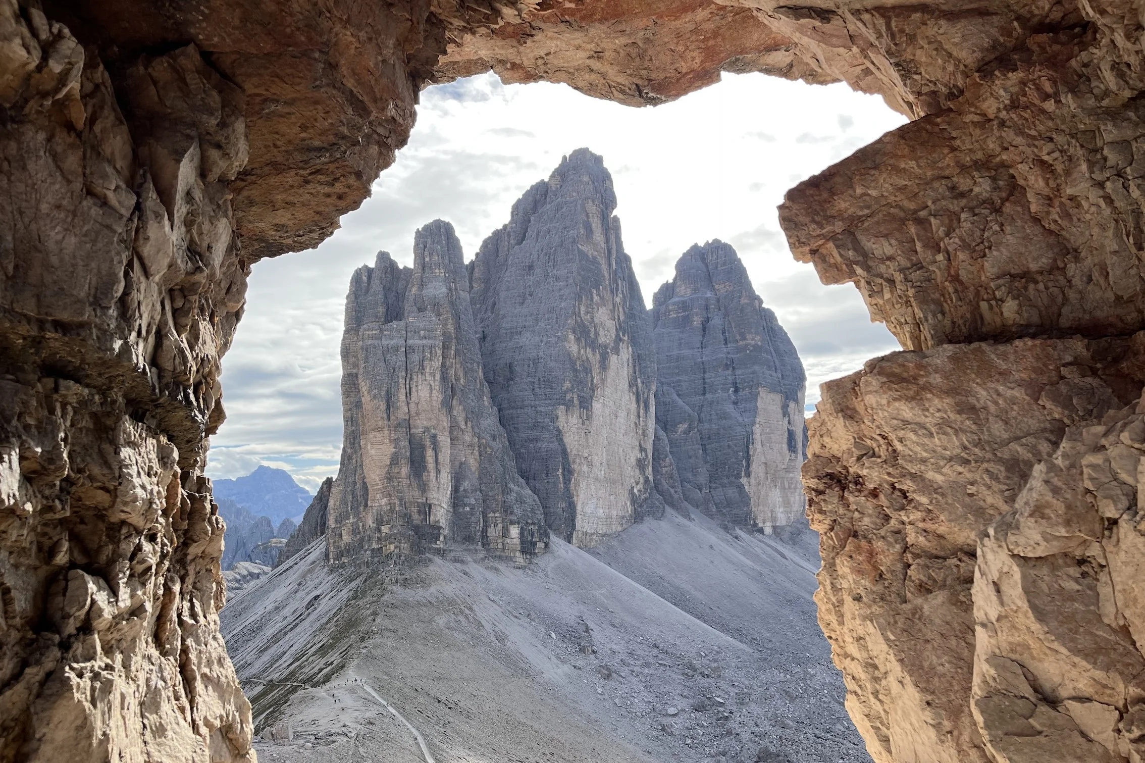
Tre Cime di Lavaredo – Admire the dramatic limestone towers of one of the most iconic and awe-inspiring landscapes in the Dolomites. Their distinctive three-peak formation and immense vertical walls make them one of the most recognisable mountain landmarks in Europe.
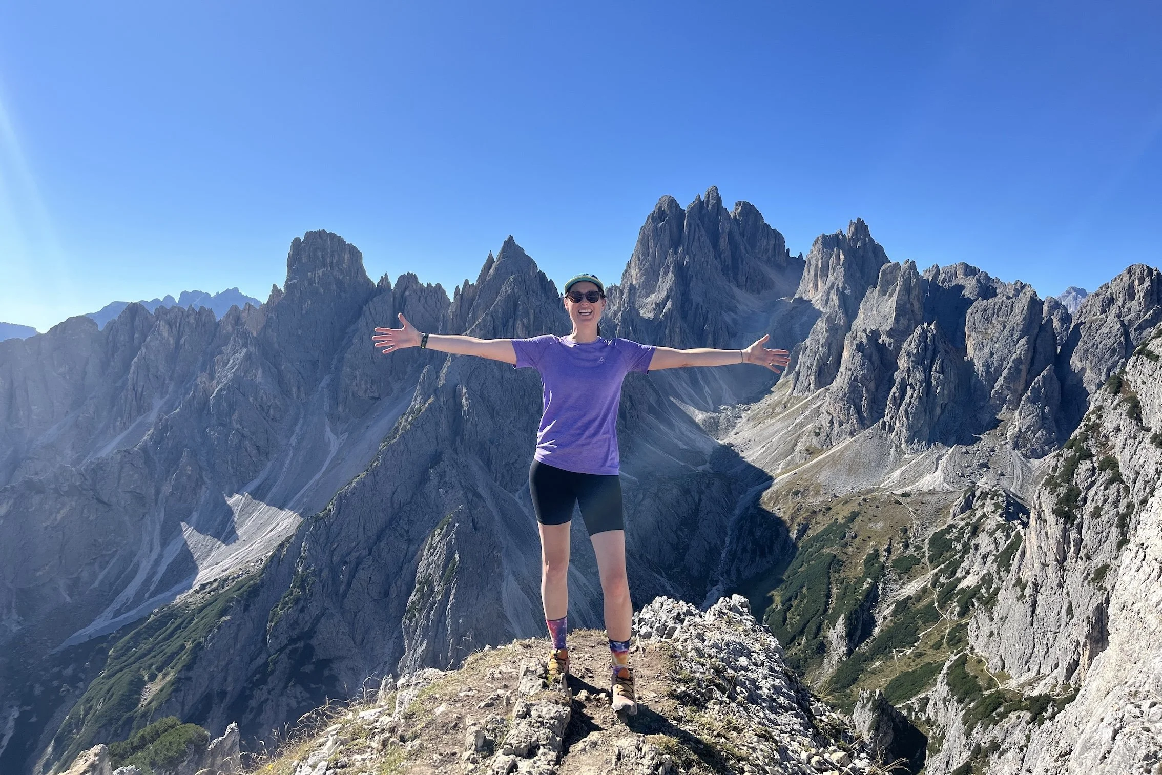
Cadini di Misurina Viewpoint – Take in one of the most dramatic viewpoints in the Dolomites, where serrated limestone spires rise in every direction above deep mountain valleys. Its iconic ridgeline perspective and extraordinary concentration of jagged peaks make it one of the most photogenic viewpoints in the region.
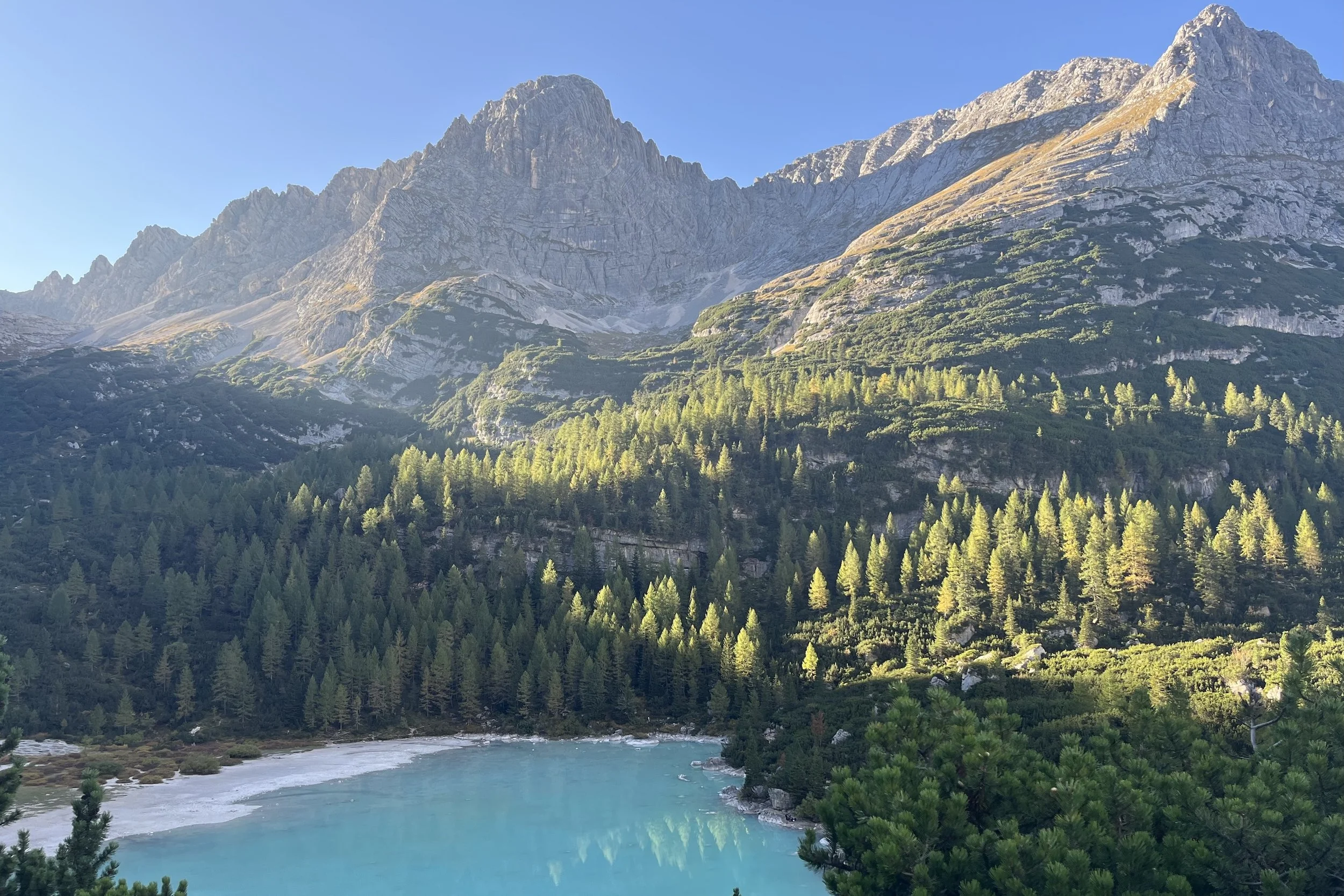
Lago di Sorapis – Visit the extraordinary turquoise waters of one of the most beautiful alpine lakes in Italy. Its striking glacial colour, created by suspended rock minerals, gives the lake an almost unreal appearance.
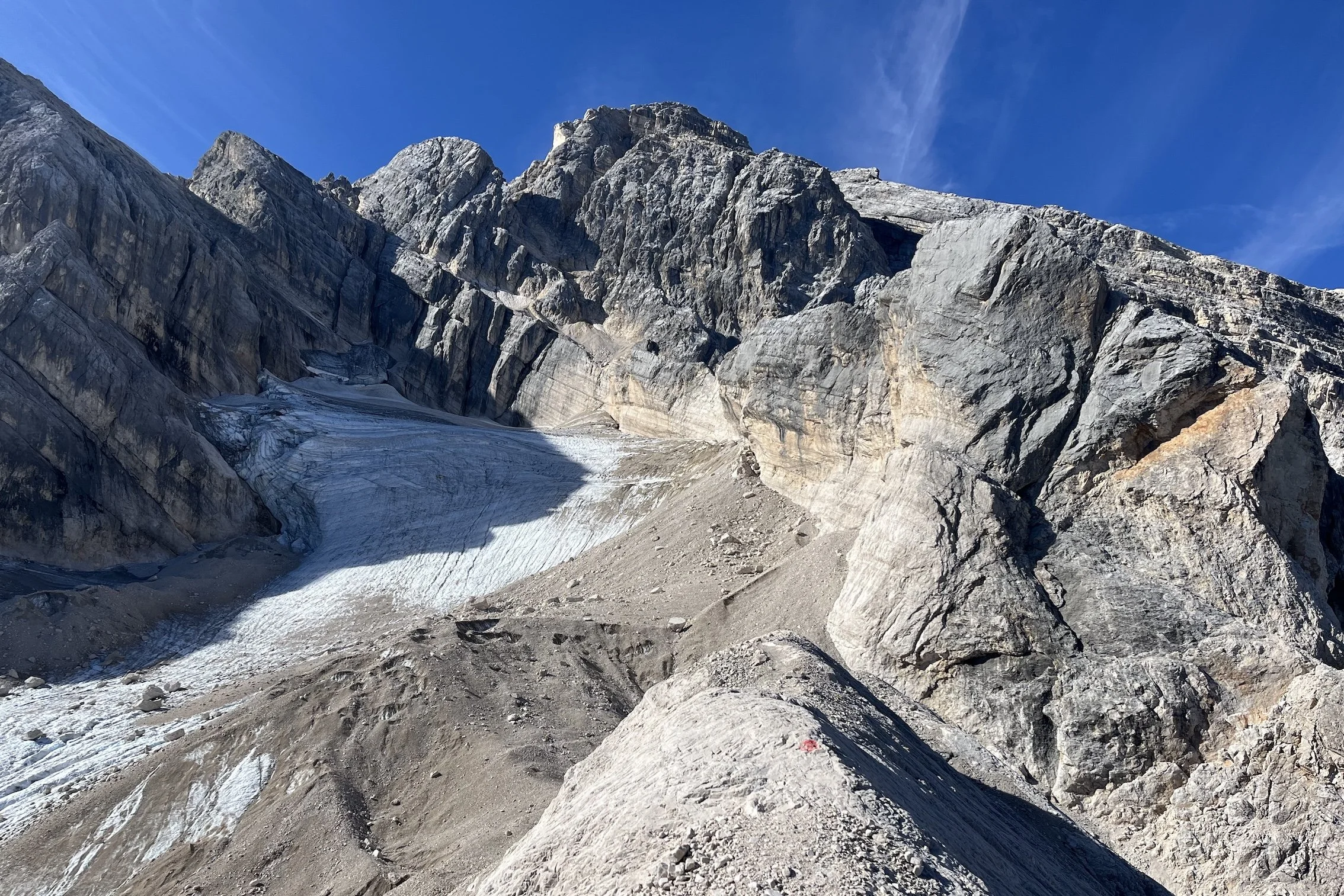
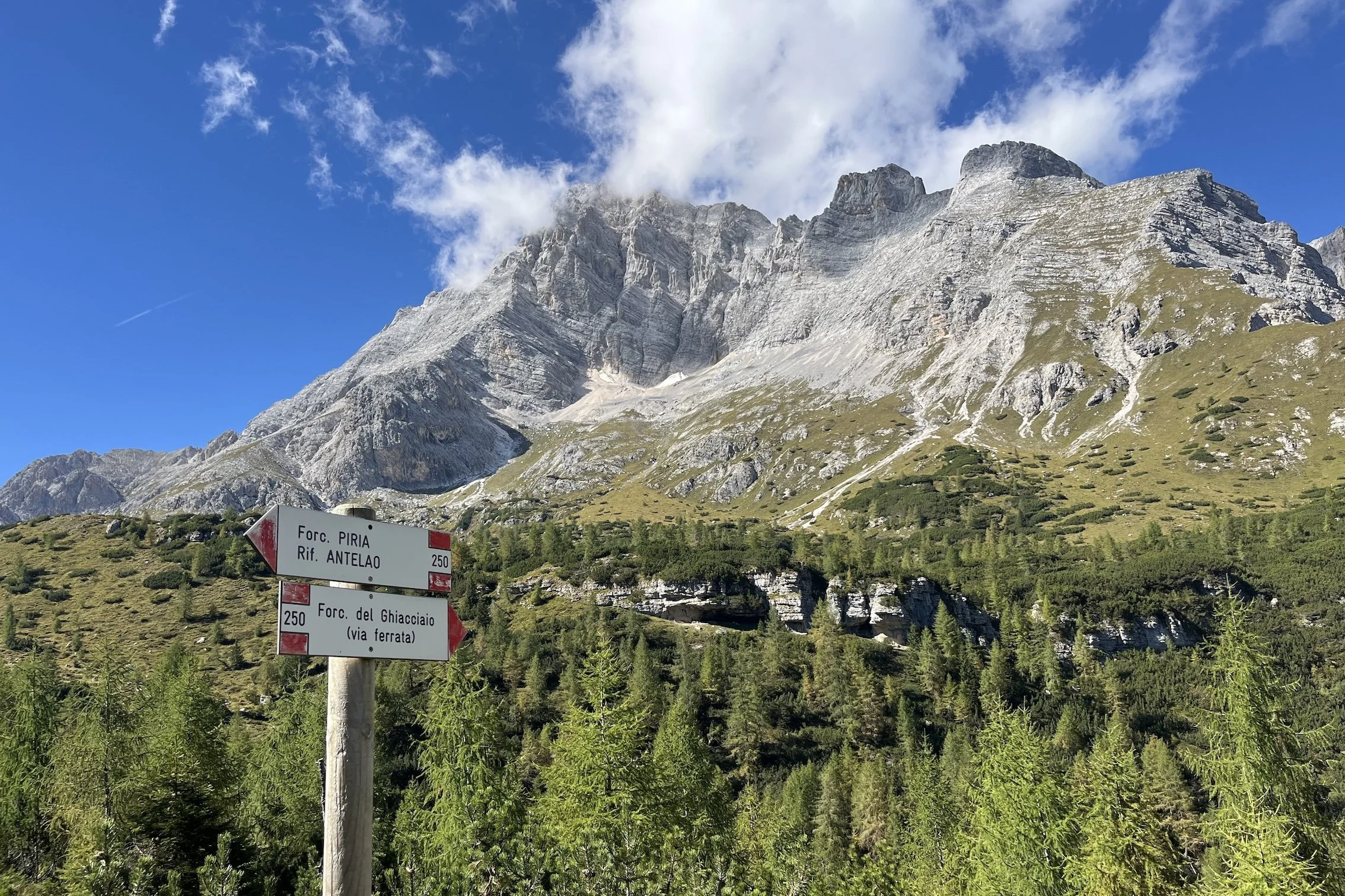
Ghiacciaio dell'Antelao – Explore remote moraine landscapes and aquamarine glacier pools in one of the wildest and least-visited sections of Alta Via 4. This rare combination of active glacier scenery, hidden meltwater pools and abundant ibex habitat makes it unlike anywhere else on the trail.
ALTA VIA 4 VIA FERRATA HIGHLIGHTS
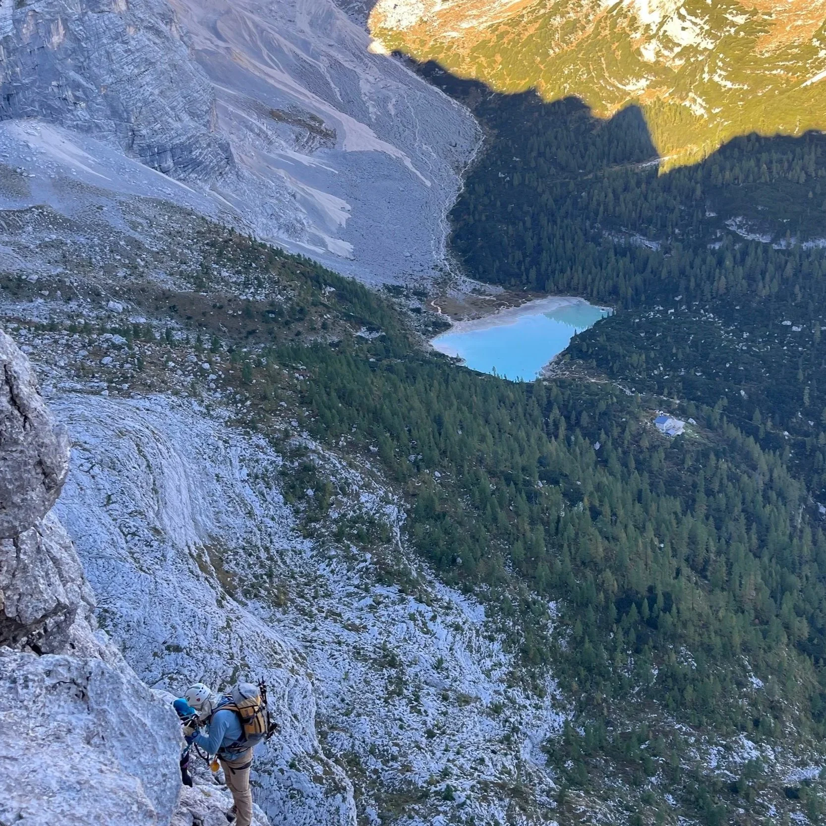
Ferrata Vandelli – Climb high above Lago di Sorapis on an adventurous protected route that quickly leaves the crowds behind for quieter mountain terrain. Its elevated position offers unmatched views over the lake, surrounding cliffs and distant Dolomite peaks.
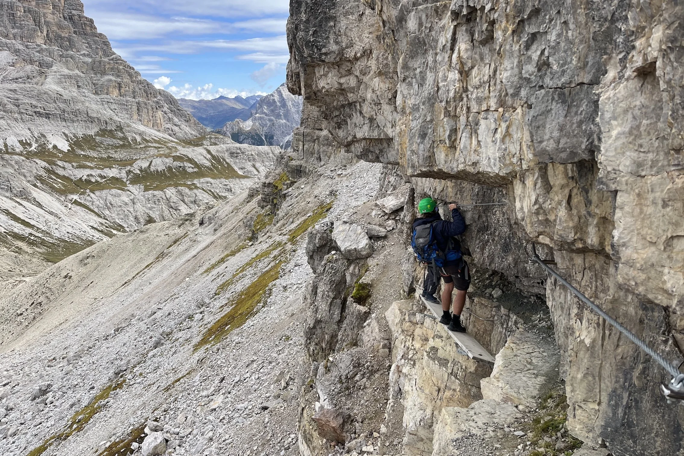
Ferrata Ghiacciaio – Ascend directly between the mountain pass and glacier moraine below on a short but dramatic protected climb. Its unusual setting above the remote glacier basin and aquamarine pools makes it one of the most distinctive ferrata experiences on the trail.
Ferrata Torre di Toblin (Add-on) – Climb a historic First World War route to a spectacular summit perch with sweeping views over the Tre Cime di Lavaredo. This add-on route for AV4 hikers is one of the most rewarding short ferratas in the Dolomites.
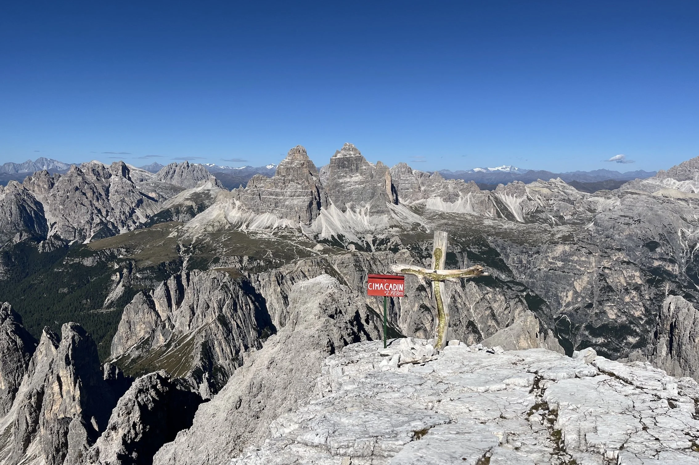
Ferrata Merlone (Add-on) – A steep and committing ferrata in the Cadini di Misurina group, the Merlone route climbs directly through narrow gullies and rocky faces using fixed cables and ladders toward the summit of Cima Cadin (2,788m / 9,146ft).

Where is the Alta Via 4 Dolomites trail?
Alta Via 4 officially starts in the village of San Cadido / Innichen
The Alta Via 4 is located in the eastern Dolomites in northern Italy, primarily within the Veneto region.
The route runs south from San Candido through Tre Cime di Lavaredo, above Lake Misurina, through the wild flanks of Antelao, before descending into Pieve di Cadore.
HOW LONG IS THE ALTA VIA 4 DOLOMITES TRAIL?
The “classic” Alta Via 4 is 70km / 43mi, with 5,583m / 18,317ft in elevation gain (South direction).
However, the distance and elevation change will vary if you deviate from the classic route, such as:
adding in more via ferrata routes,
avoiding via ferrata routes, or
staying at accommodation off the classic route (i.e Lago Misurina, Cortina or San Vito di Cadore)
It typically takes hikers between 5 and 7 days, depending on route and accommodation choice.
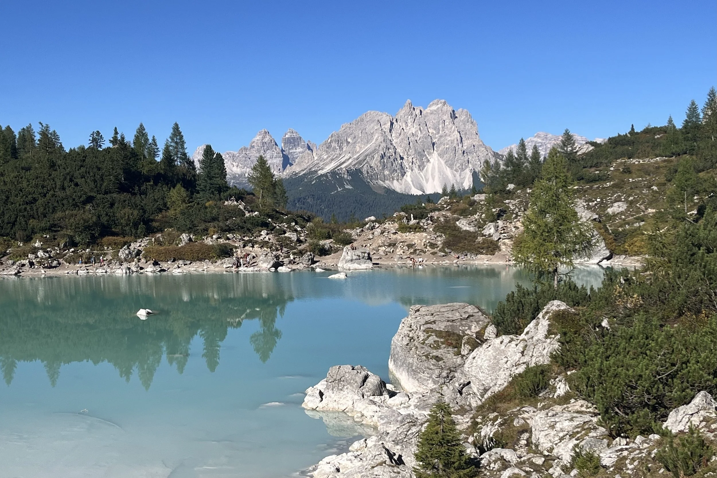
Lago Sorapis - one of the most famous lakes in the Dolomites is located along the Alta Via 4. The best part is you get to stay in a nearby refuge to enjoy the lake after the day hikers have left!
ACCOMMODATION OPTIONS ALONG THE ALTA VIA 4 DOLOMITES?
There are 20+ accommodation locations along the Alta Via 4 (Dolomites), ranging from mountain huts, known as rifugios (Italian) and refuges (German), that are typically located in remote areas, to hotels and B&Bs. Due to its popularity, many of the mountain huts are completely full for the summer hiking season.
Properties typically begin accepting bookings from October the year prior and therefore it is best to be prepared to book/reserve as early as possible to secure your preferred location and room type.
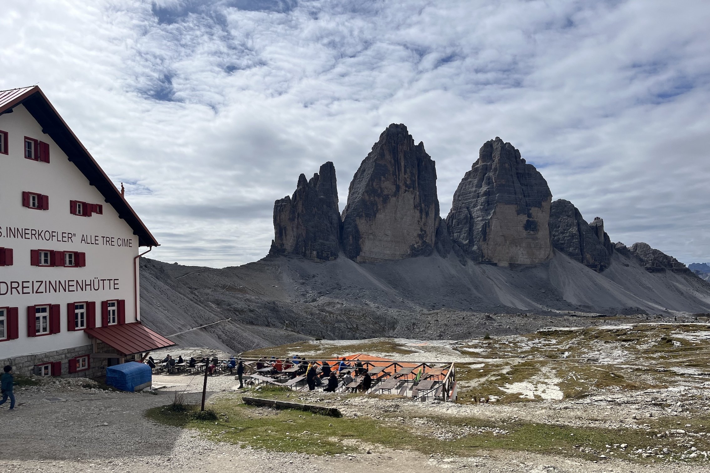
Rifugio Locatelli / Dreizinnenhuette is a popular rifugio - mountain hut - along the Alta Via 4 trail.
WHEN IS THE HIKING SEASON FOR THE ALTA VIA 4 DOLOMITES?
Antelao Massif towers above the Alta Via 4 trail
The best time to hike Alta Via 4 is from mid June to mid September, when the mountain rifugios along the route are generally open and trail conditions are at their most reliable.
However, because Alta Via 4 crosses high passes (such as Forcella del Ghiacciaio at 2,584m / 8,478ft) and includes via ferrata sections, lingering snow can remain on some sections in early season, making late June to mid September the preferred hiking window.
Peak hiking season is July and August during the European summer holidays. At this time, trails can be busy (particularly around popular highlights such as Tre Cime di Lavaredo and Lago di Sorapis), and accommodation is often booked months in advance. For quieter trails and cooler temperatures, many hikers prefer late June, early July or September.
Even in summer, weather in the Dolomites can change quickly, with cold temperatures, strong winds and occasional snowfall possible at higher elevations. Be sure to pack appropriate layers and mountain gear for variable alpine conditions.
HOW DIFFICULT IS THE ALTA VIA 4 DOLOMITES?
Alta Via 4 is considered one of the more challenging long-distance treks in the Dolomites and is best suited to experienced hikers with good fitness and some confidence on exposed mountain terrain. While the trail is relatively short compared to other Alta Via routes, it packs in steep ascents and descents, rugged trails, remote sections and occasional route-finding challenges.
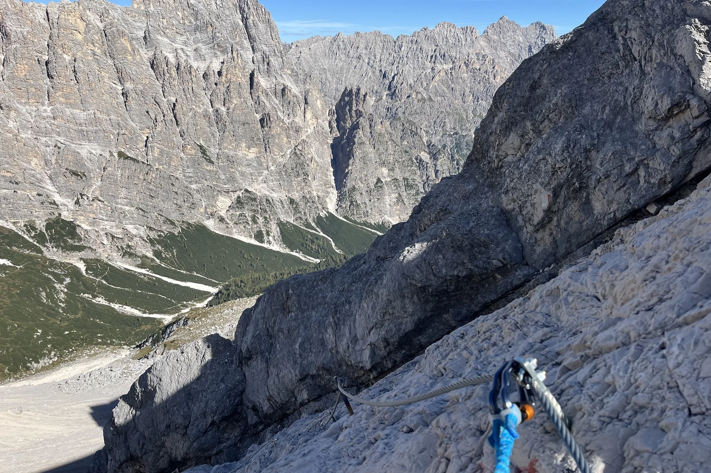
What makes Alta Via 4 more demanding is that several stages include narrow mountain paths, scree traverses, protected scrambling and ferrata routes such as Ferrata Vandelli and Ferrata Ghiacciaio. Some sections can feel exposed, and conditions may become significantly harder in rain or poor visibility.
However, the difficulty of Alta Via 4 changes significantly throughout the trail, progressively getting more difficult from North > Central > South. Read our detailed guide that breaks down each section of the Alta Via 4 trail so you can decide if its right for you.

Rugged terrain including glacier moraines and scree near Forcella del Ghiacciaio.
WHAT GEAR DO I NEED FOR THE ALTA VIA 4 DOLOMITES?
Ferrata Torre di Toblin is an equipped route requiring via ferrata lanyard, climbing harness, helmet and gloves.
For hiking Alta Via 4, you’ll need standard hut-to-hut hiking gear suitable for challenging alpine terrain. Because the route includes remote sections and rapidly changing weather, warm layers, sufficient water and rain protection are essential, even in summer.
For the via ferrata sections, you should also carry appropriate via ferrata safety equipment, including a via ferrata lanyard, climbing harness, helmet and gloves. These are important for routes such as Ferrata Vandelli and Ferrata Ghiacciaio, where fixed cables are used for protection.
Many hikers also carry trekking poles for steep descents and scree, and an offline GPS map is strongly recommended for route-finding in more remote sections.
CAN I AVOID THE FERRATA ROUTES ALONG THE ALTA VIA 4 DOLOMITES?
Yes — it is possible to hike Alta Via 4 without completing the classic via ferrata sections. The “classic” route includes two key ferrata routes, Ferrata Vandelli and Ferrata Ghiacciaio, but both can be avoided via alternate hiking routes.
These alternatives allow hikers without via ferrata equipment or experience to complete the trail, although they usually involve longer detours, additional elevation gain and sometimes adjustments to stage planning or overnight stops. In many cases, the ferrata routes provide the most direct and scenic line through the mountains, while the alternatives trade technical difficulty for extra time and effort.
Our planning app includes both classic and alternate routes to avoid all ferrata sections. You can view our sample itineraries that include both main, via ferrata add-ons and non-via ferrata.
Alternate route via Val d'Oten to avoid Ferrata Ghiacciaio