Local sources are monitored daily
We follow updates from local authorities, communes, tourism offices, transport operators, hut guardians and other relevant organisations.

03 Prepare confidently
Turn your itinerary into a departure-ready plan. Understand current trail conditions, receive relevant updates and make informed decisions about your route, equipment and preparation.
Platform access from €79 · One payment per hiking season
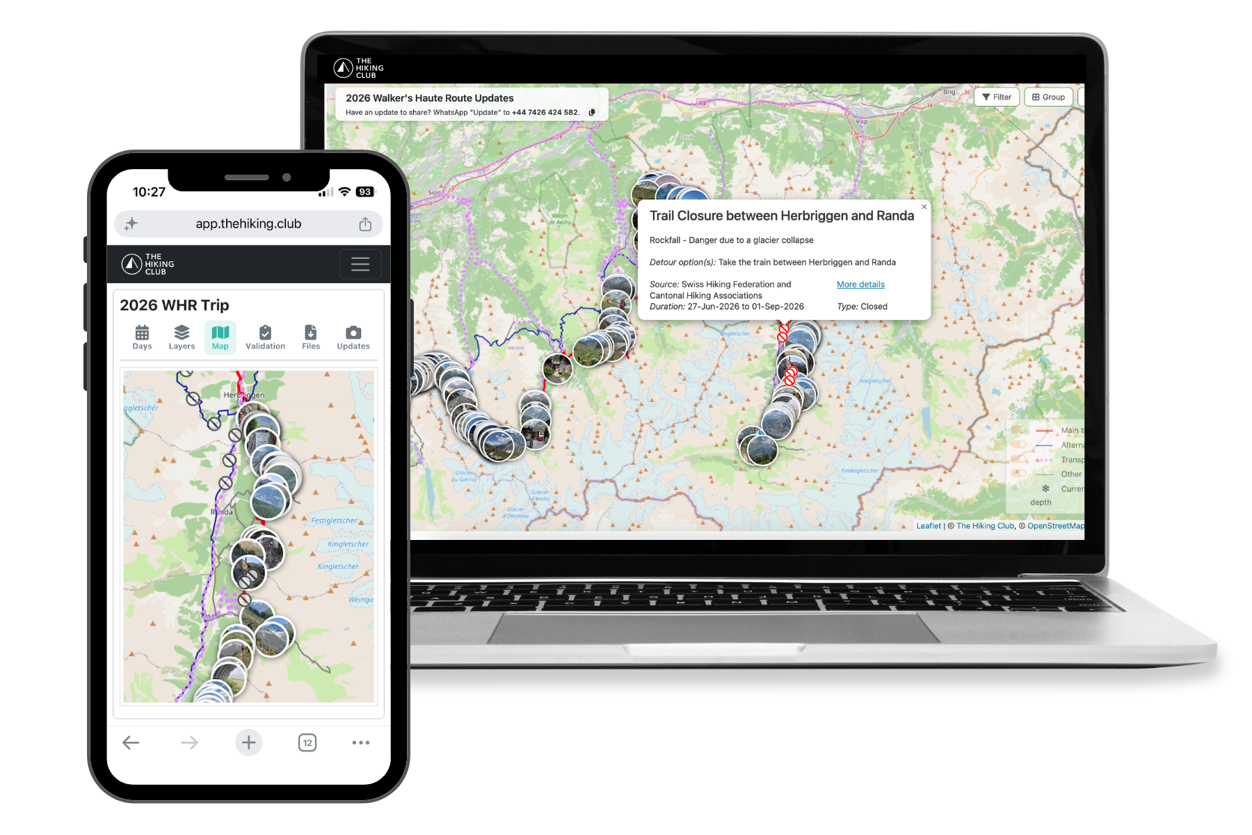
Verified trail monitoring
Our trail team monitors local sources for closures, warnings, detours and transport disruptions across our supported trails. We check the details, map the affected section and determine whether it may affect a customer’s saved itinerary.
We follow updates from local authorities, communes, tourism offices, transport operators, hut guardians and other relevant organisations.
Our team verifies the available details, identifies the affected trail section and explains what the update could mean for hikers.
If a verified issue may affect the route and dates in your primary itinerary, we email you so you can review it and decide whether your plans need to change.
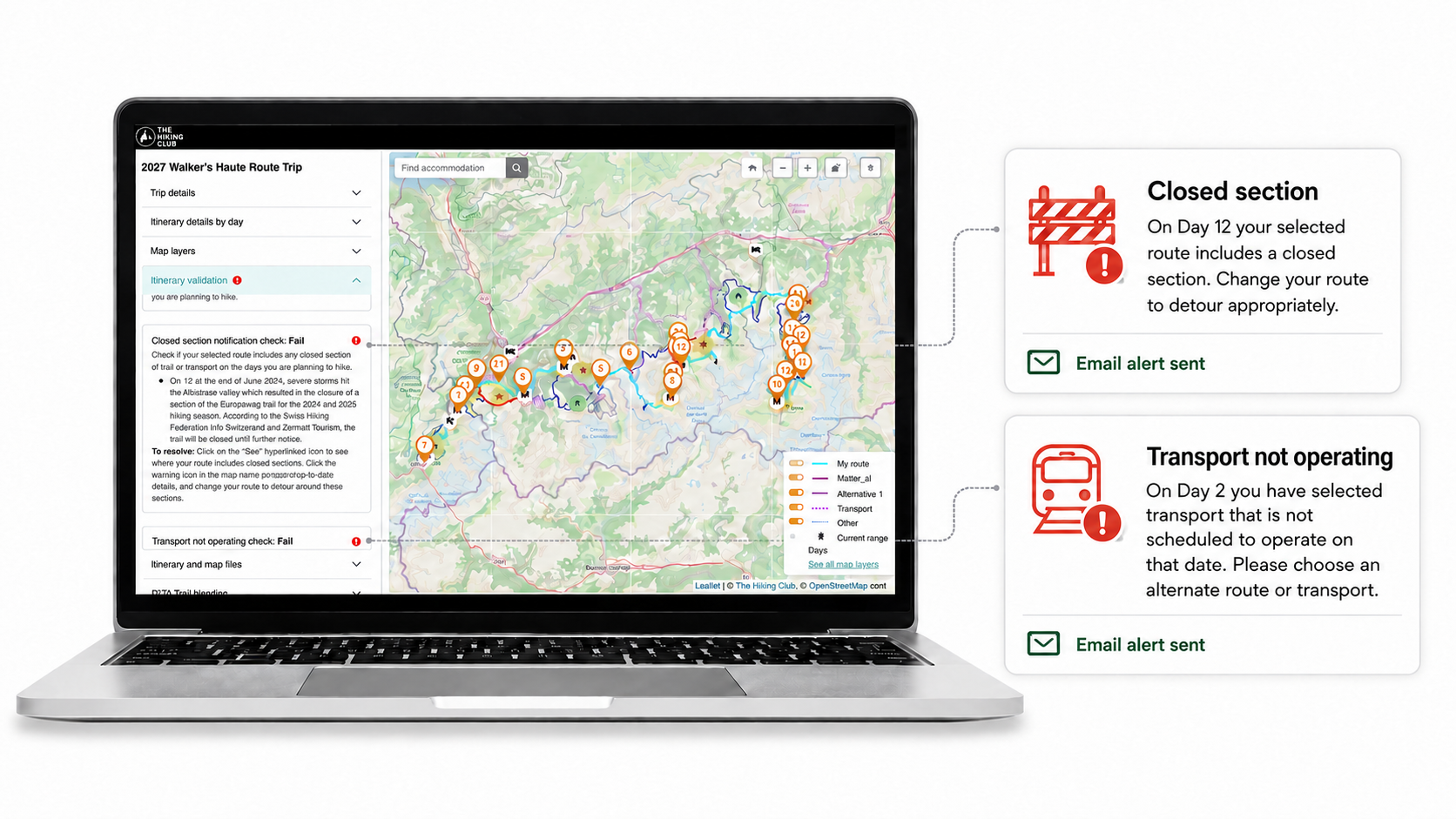
Trail-update notifications are sent by email. You will not receive an email for every update—only when an issue may be relevant to your saved primary itinerary.
Local authorities, tourism offices, transport operators and other trail sources monitored daily by our team.
Interactive Trail Updates Map
Explore recent reports, photographs, closures, warnings, detours and transport information in the locations where they matter. Filter the map to focus on your hiking dates and the sources you want to see.
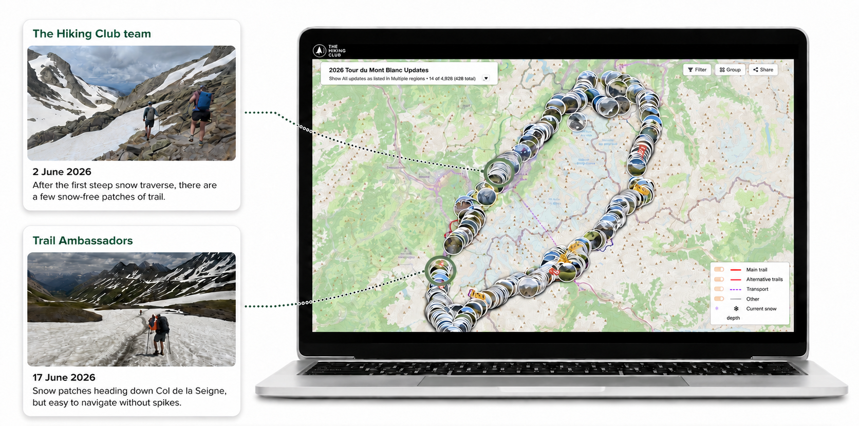
View photographs and notices pinned to mountain passes, high-altitude sections, accommodation and transport locations.
Filter reports by date to understand how snow, access and trail conditions are changing as your hike approaches.
View information from our trail team, Trail Ambassadors or members of the wider hiking community.
Compare recent and earlier reports to see whether conditions appear to be improving, deteriorating or remaining consistent.
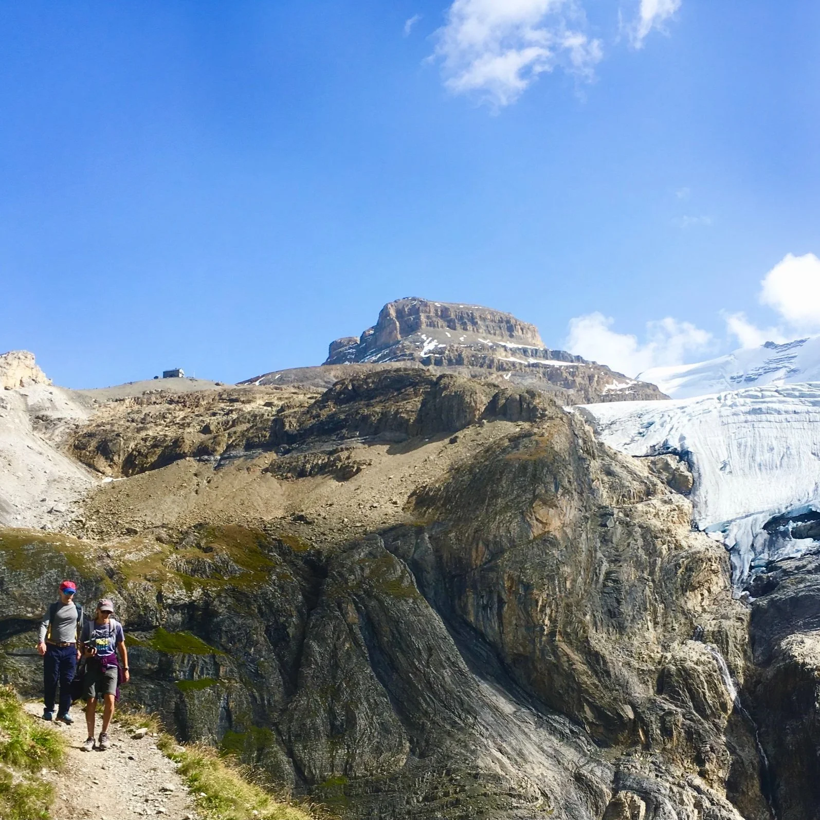
Photographs from our trail team, Trail Ambassadors and the wider hiking community create a first-hand visual record of snow, trail conditions, route changes and the experience on the ground.
Snow conditions
Snow conditions can vary significantly by elevation, aspect and location. View estimated snow depth and forecast snowfall along your planned route before making decisions about equipment, route choices or using transport to avoid a challenging section.
View where snow is estimated along your route and its expected depth, with the snow layer updated daily.
Understand where fresh snow is forecast and how much may fall along your trail during the next 48 hours.
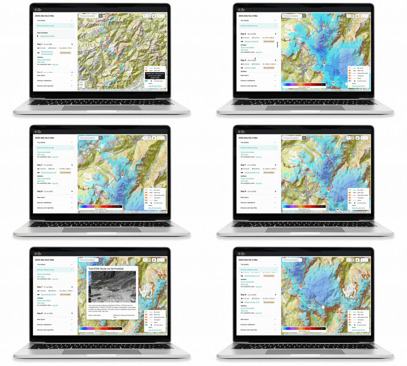
Updated daily using satellite imagery, weather data and modelling supplied by ExoLabs.
Snow information supports your preparation and decision-making. Always consider recent local advice, official warnings, current weather and the conditions you encounter on the trail.

Hiking-specific training
Build the strength and endurance needed for long climbs, steep descents and consecutive days on the trail with a structured program designed specifically for multi-day hikers.
Next in your planning journey
Download personalised GPS files based on your exact itinerary, including your route to and from accommodation, planned alternatives, transport locations and useful places along the way.
Personalised files GPX and KML based on your itinerary
Offline navigation Use with compatible phones and watches
Shared with your group Everyone can carry the latest route

Plan with confidence
Bring your route, accommodation plan, current trail information and preparation tools together in one platform.
Platform access from €79 · One purchase covers your hiking group









Sign up to receive regular updates on trail conditions, new products and blog articles about hiking in the Alps.
Please enter a valid email address.
Choose the trails you’re interested in after signing up. Unsubscribe at any time.