
The Top 10 Alternate Trails of the Walker’s Haute Route
For those that haven’t hiked in the Alps before, it is important to understand that the Alps offer a network of trails. There are always trail junctions that provide hikers the opportunity to choose a route based on the highlight, terrain or accommodation options available.
The standard “main” Walker’s Haute Route is 213km / 132mi. However, many hikers choose to take one or more alternate routes along their journey to include a specific highlight, avoid difficult terrain or stay at a particular accommodation option.

Walker’s Haute Route: High level map from our planning app showing the trail travelling from Chamonix, France to Zermatt, Switzerland. The red line indicates the “main trail” and the dark blue lines indicate “alternate trails”.
JOIN ONE OF OUR ONLINE EVENTS
Below we highlight the most popular alternate routes for the Walker’s Haute Route, including:
For The Hiking Club customers, these alternate routes are available to select within the trip planning web app for the Walker’s Haute Route. Time to get planning!
OUR SELF-GUIDED HIKING PACKAGES

Everything you need to plan, book, prepare and navigate your adventure. This package includes;

Access a trail expert to prepare an itinerary that meets your needs. This package includes;
60 min consultation
Personalised itinerary designed by our trail expert
The Top Alternate Routes for the Walker’s Haute Route
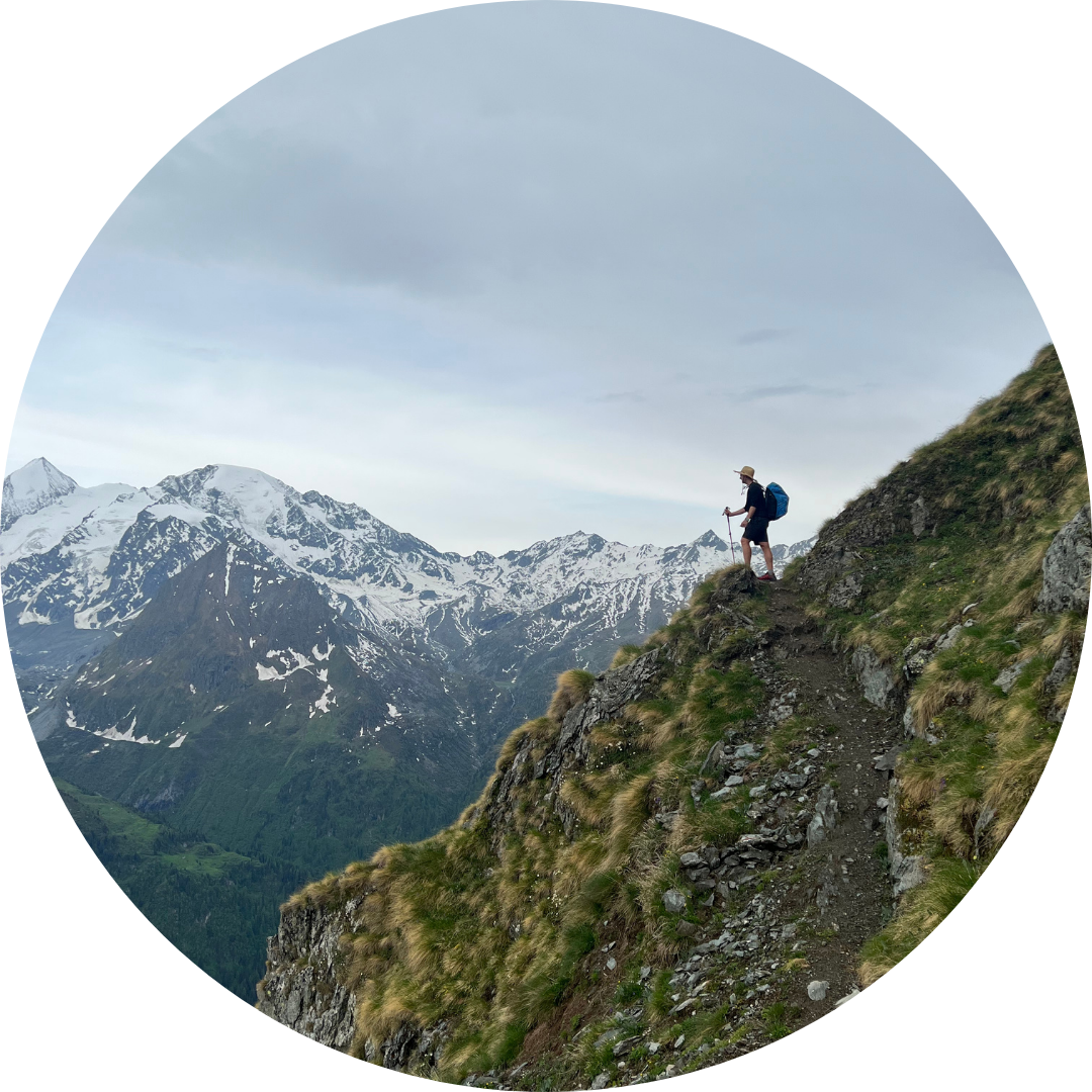
Posettes Trail
Between Argentiere and Col de Balme
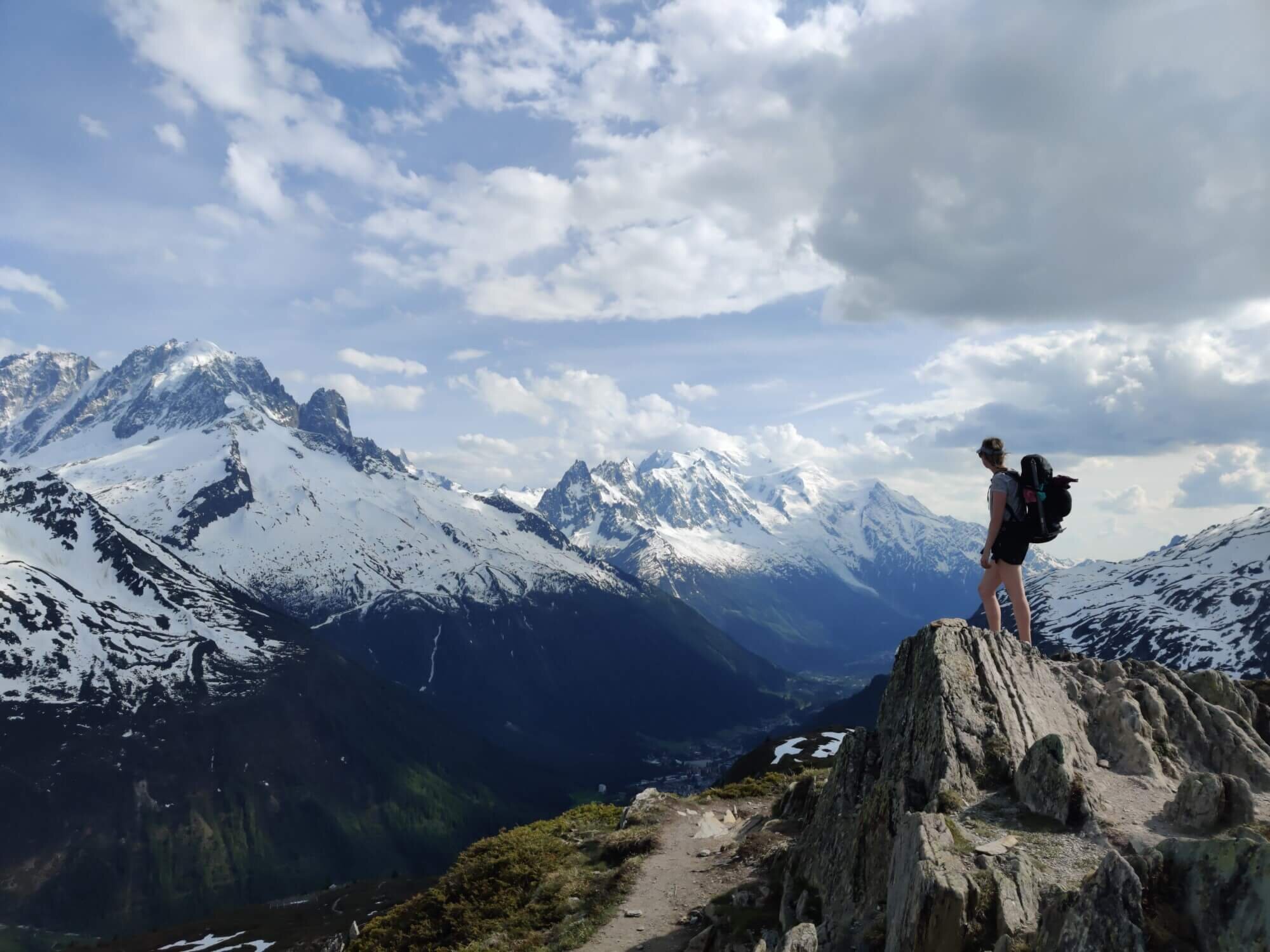
Trail Description: This route leaves the main trail at Argentiere, climbing up the north side of the valley to the alpine hamlet of Tre le Champ. From here, you will be following the same path as the Tour du Mont Blanc to Aiguillette des Posettes. The trail climbs steadily through the forest before breaking above the treeline and on to a ridge offering spectacular 360 views of the Chamonix Valley, Le Tour glacier, Emosson dam and beyond. Continuing along the trail, you enter the top section of the Le Tour ski area and Col de Balme will come into sight which marks the French/Swiss border and where you will rejoin the main trail.
Difficulty: Mountain Trail
Trail Junction Points: This route diverts from the main trail at Argentiere and rejoins at Col de Balme.
Image taken from our Itinerary Builder that allows hikers to plan their itinerary using main and alternate routes.
Glacier du Tour Trail
Return Trail from Charamillion/Col de Balme
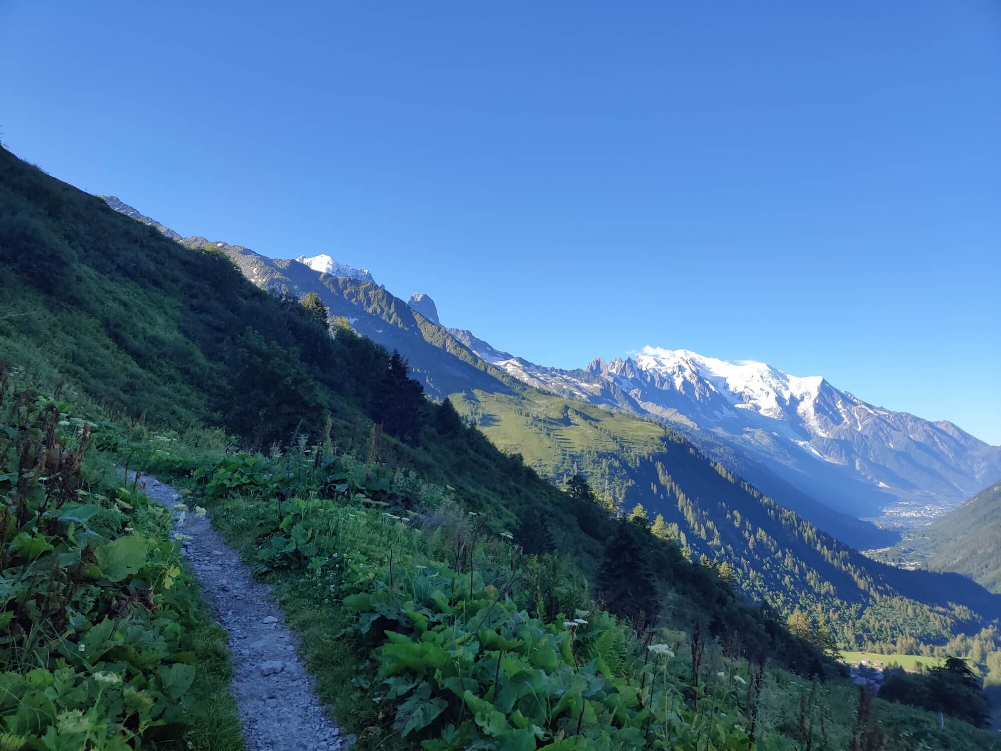
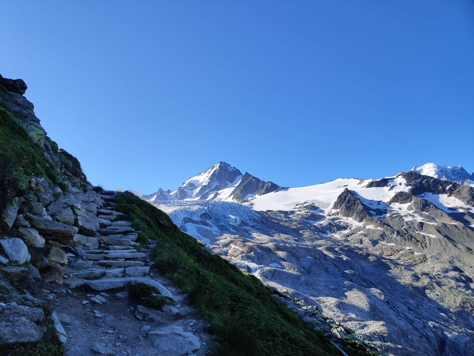
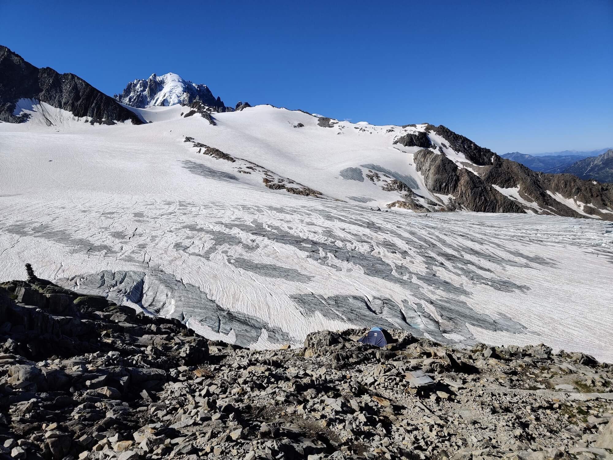
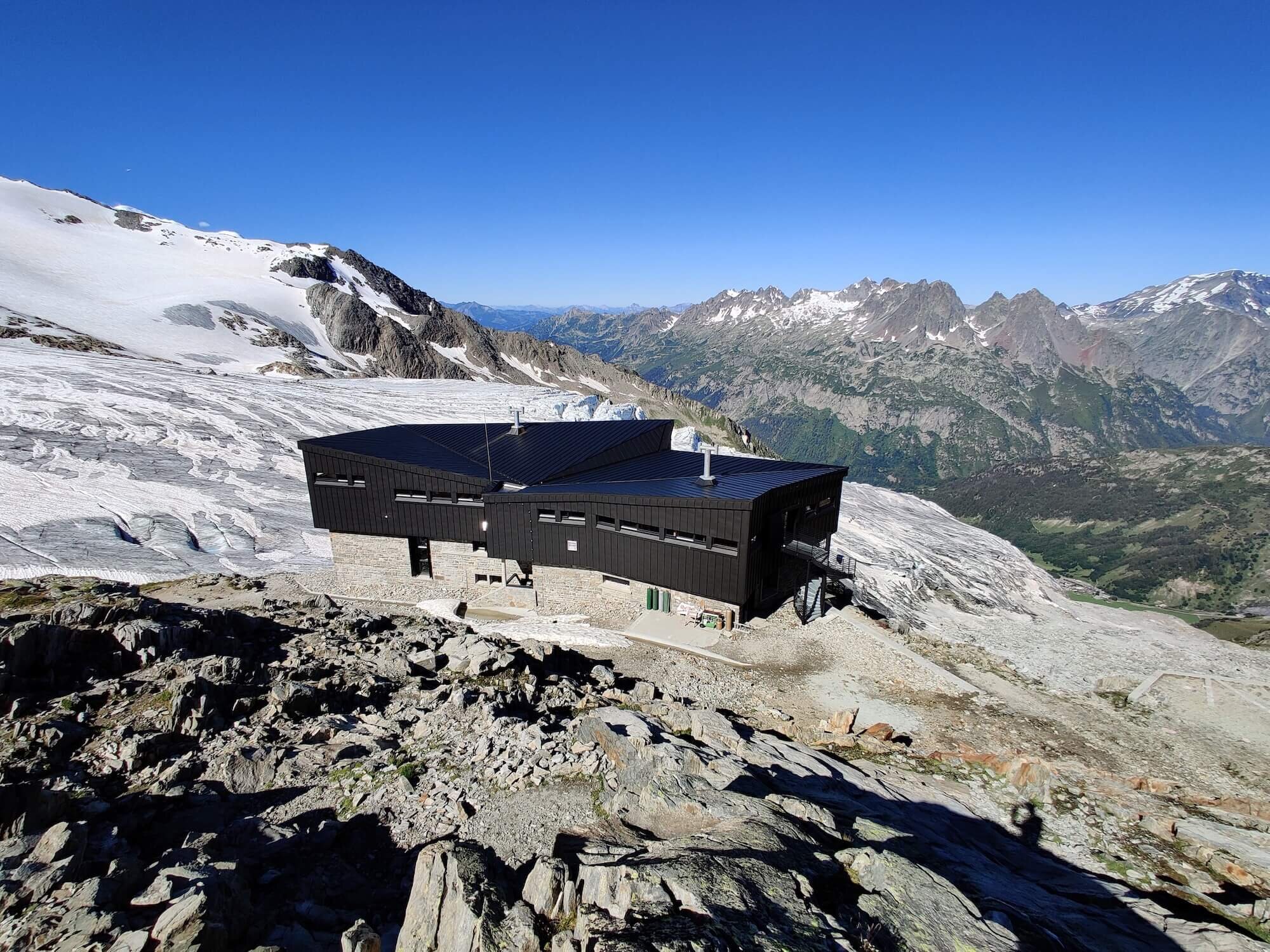
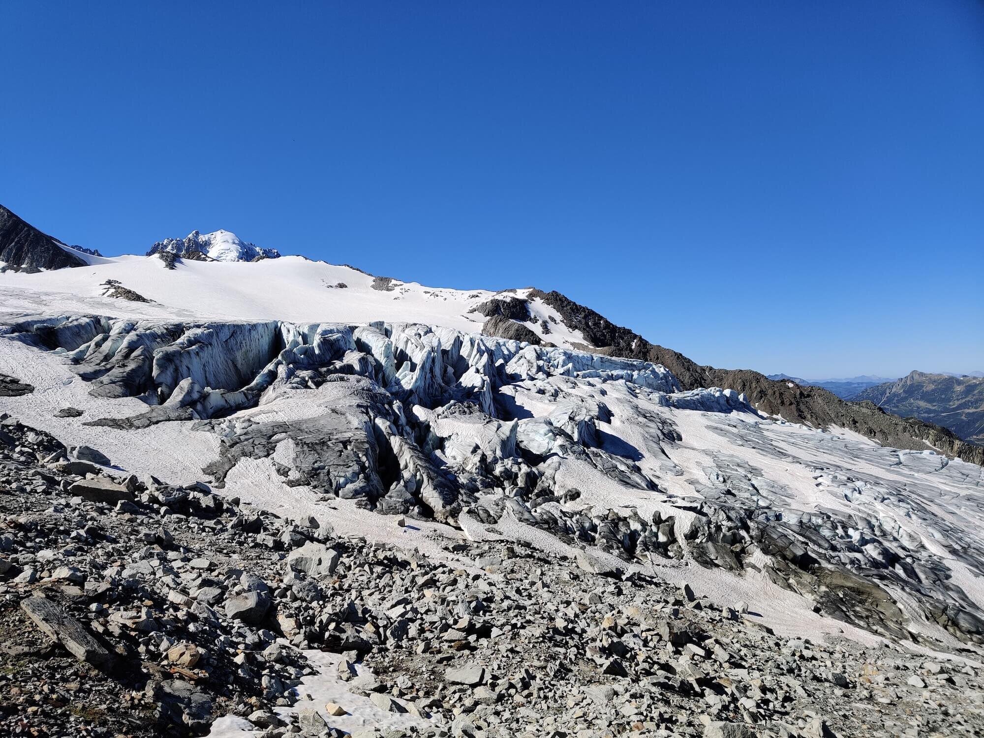
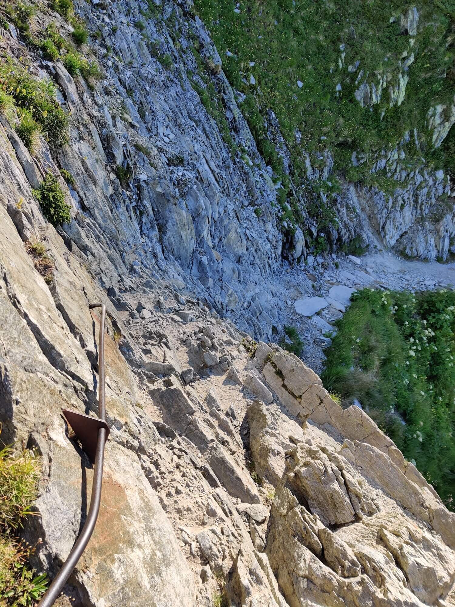
Trail Description: Did you know there are 70 glaciers on the Mont Blanc massif? Most of them are high up and difficult to reach without mountaineering equipment and skills, however, Le Tour glacier is within reach of hikers. This route leaves the main trail at Charamillon within Le Tour ski area, by branching right/south and heading toward the Mont Blanc massif. After crossing an alpine plateau, a balcony trail then leads you higher and back towards Chamonix, offering stunning views of Mont Blanc and Aiguilles Rouges from the high mountain vantage point. Some exposed and cable/ladder assisted sections need to be crossed and the final 0.6km / 0.4mi ascent is steep but well marked along a rocky path that zig zags its way up to the edge of Glacier du Tour and Albert Premier (1er) refuge. The descending route follows mostly the same path. It is possible to bivouac/wild camp above the refuge.
Difficulty: Mountain Trail.
Trail Junction Points: The trail diverts at Charamillion and rejoins at Col de Balme.
Considerations: Choosing this option may add 1 day to your overall itinerary if you decide to stay overnight.
Image taken from our Itinerary Builder that allows hikers to plan their itinerary using main and alternate routes.
Les Grands Trail
Between Col de Balme and Chalet du Glacier
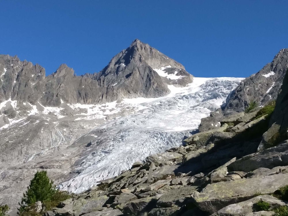
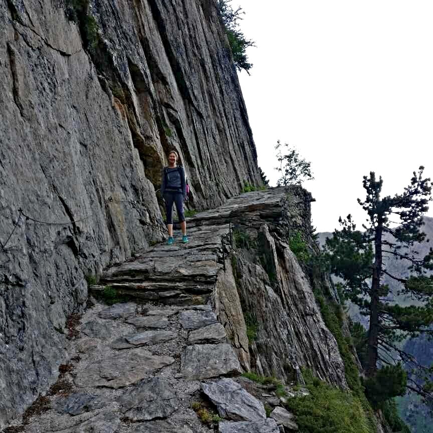
Trail Description: A more direct route to Champex Lac that bypasses most accommodation options in the Trient valley. From Col de Balme, this route leaves the main trail (which descends to Le Peuty) by branching south and gradually climbing higher to reach Refuge Les Grands. The route then descends to the valley below, offering a unique perspective of the Trient glacier and a magnificent rock carved staircase which is a standalone highlight. The route rejoins the main trail at Chalet du Glacier next to the Trient river.
Difficulty: Mountain Trail with some boulder crossings.
Trail Junction Points: The trail diverts at Col de Balme and rejoins at Chalet Du Glacier.
Considerations:
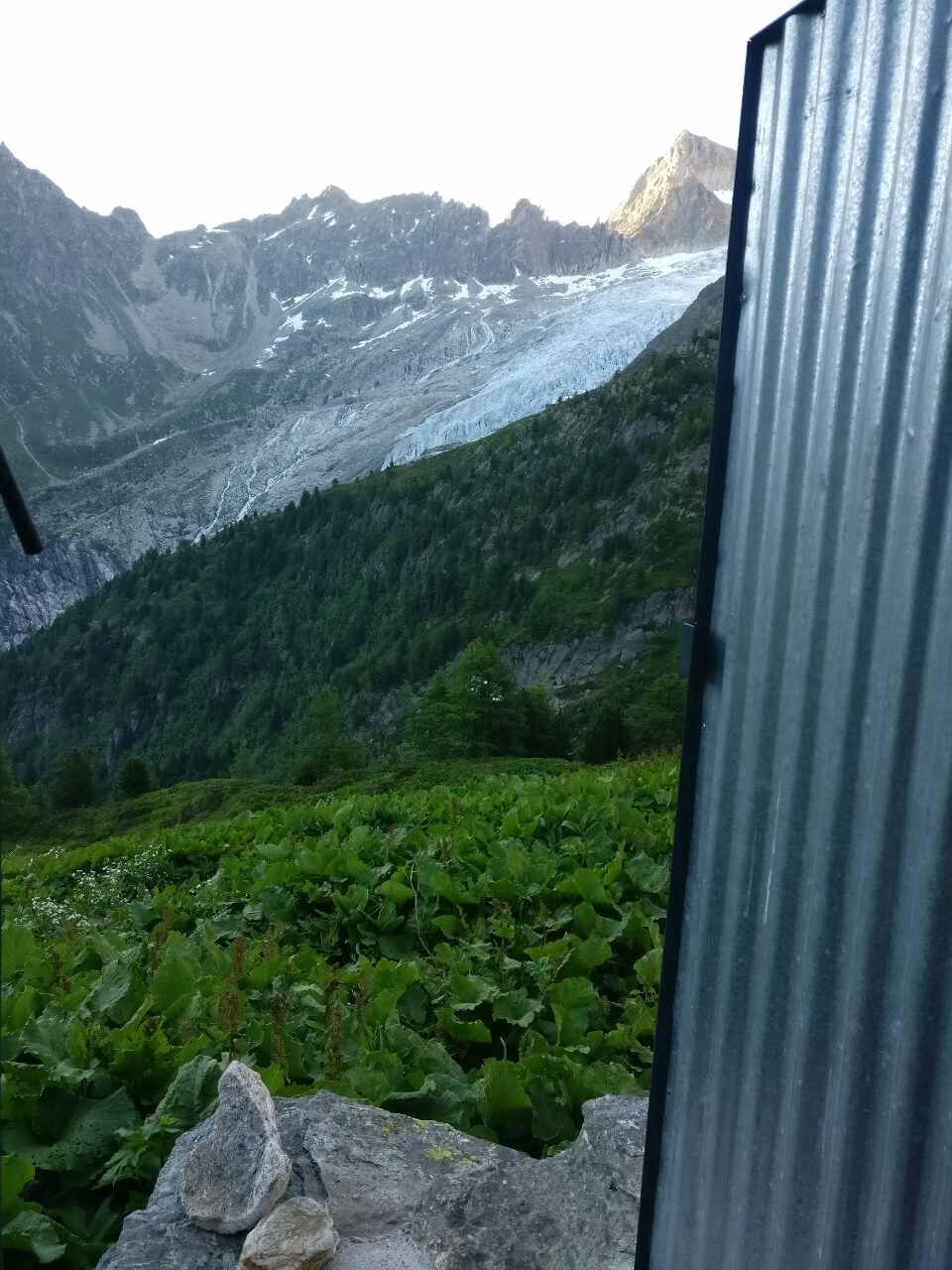
There is only 1 accommodation option on this section - Refuge Les Grands - and they don’t provide meals. There is also only an outdoor shower, but it has one of the best views of the Trient glacier from the toilet :)
Choosing this option may reduce your overall itinerary by one day as it is shorter than the main trail via Le Peuty
Image taken from our Itinerary Builder that allows hikers to plan their itinerary using main and alternate routes.
Alp Bovine Trail
Between Le Peuty and Champex-Lac
Trail Description: A great alternate route to Fenetre d’Arpette for those that want to avoid snow during early season or the steep descent and big boulder crossings on the East side of the pass. The Bovine route is an easier and safer route. From Le Peuty, the trail climbs to Col de la Forclaz and enters the forrest on a well maintained trail. Make sure to stop at Alp Bovine summertime cafe for a snack and the view of Martigny and the Bernese Alps! The trail continues to wind along the valley mostly in the trees with a couple of easy steam crossings where you may get a little wet. The trail becomes wider and easier underfoot as hikers pass Plan de l'Au and Champex Den Haut, which lie just North of Champex Lac where the main trail rejoins.
Difficulty: Mostly Mountain Trail.
Trail Junction Points: The trail diverts from the main trail at Le Peuty and rejoins at Champex Lac.
Col de la Chaux Trail
Between Cabane du Mont Fort and Louvie Termin Junction
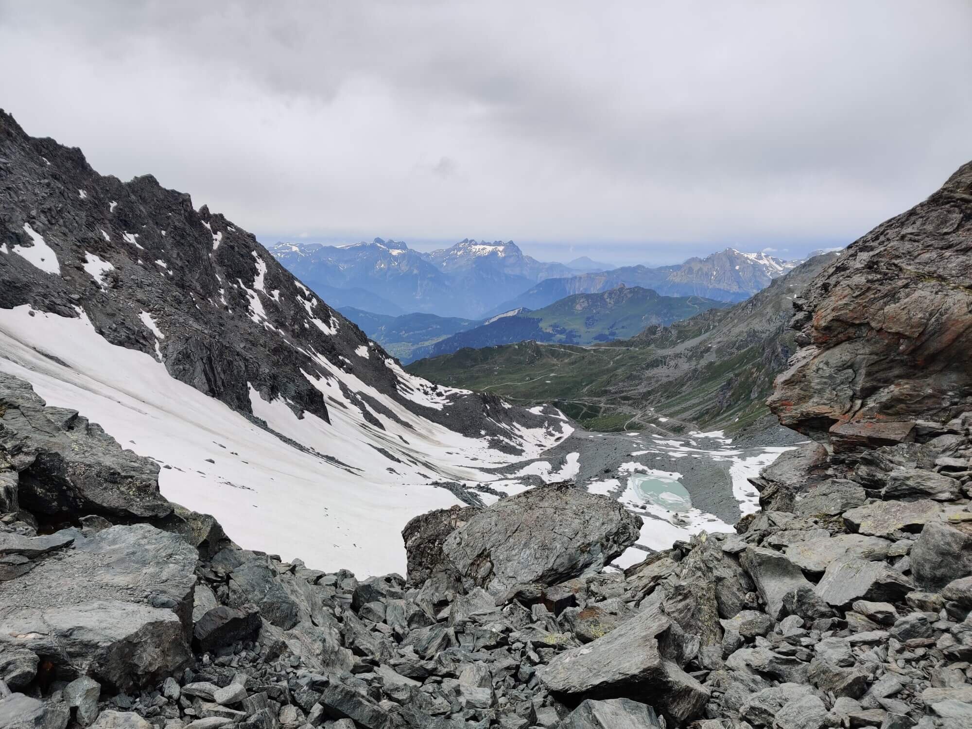
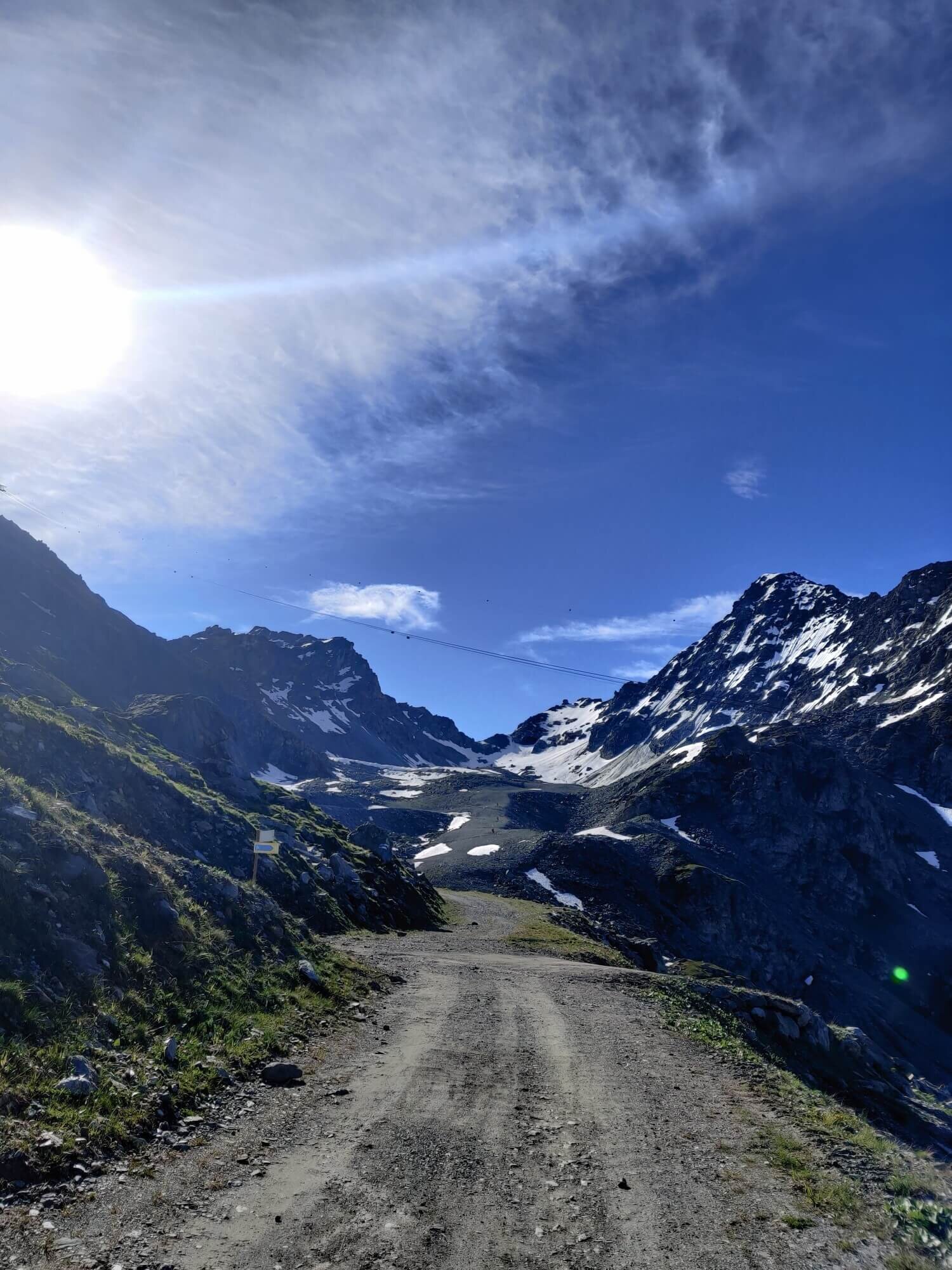
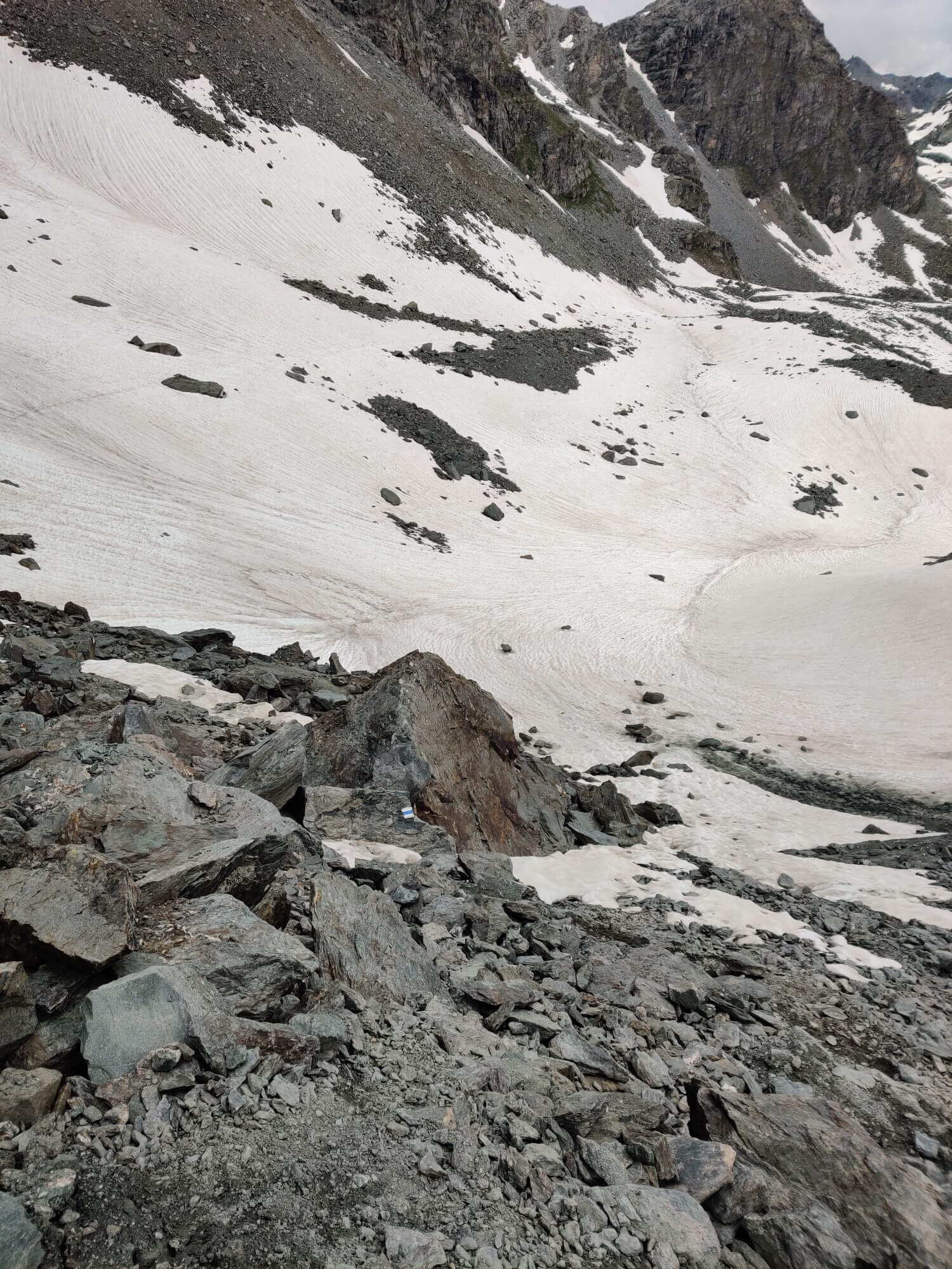
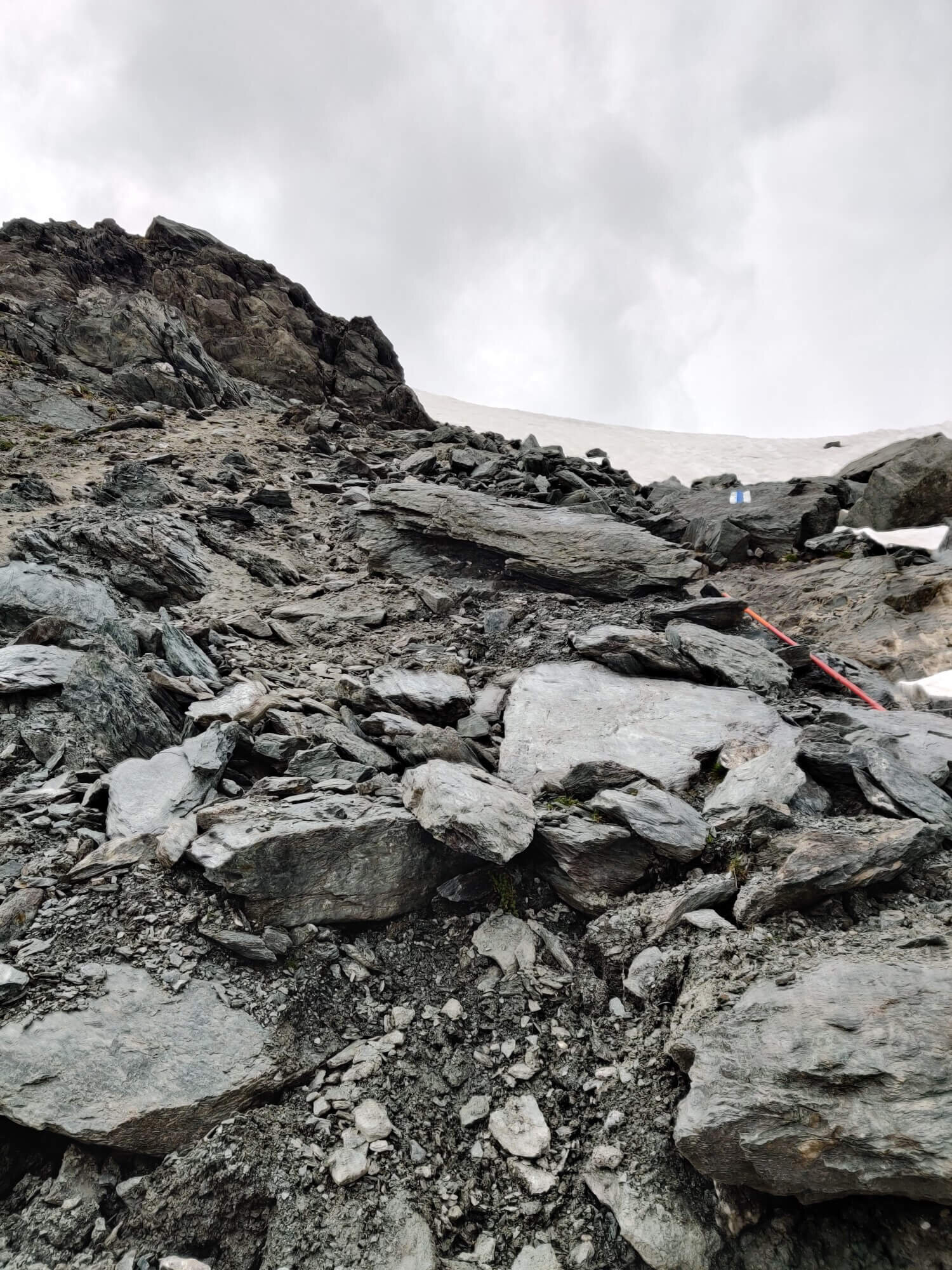
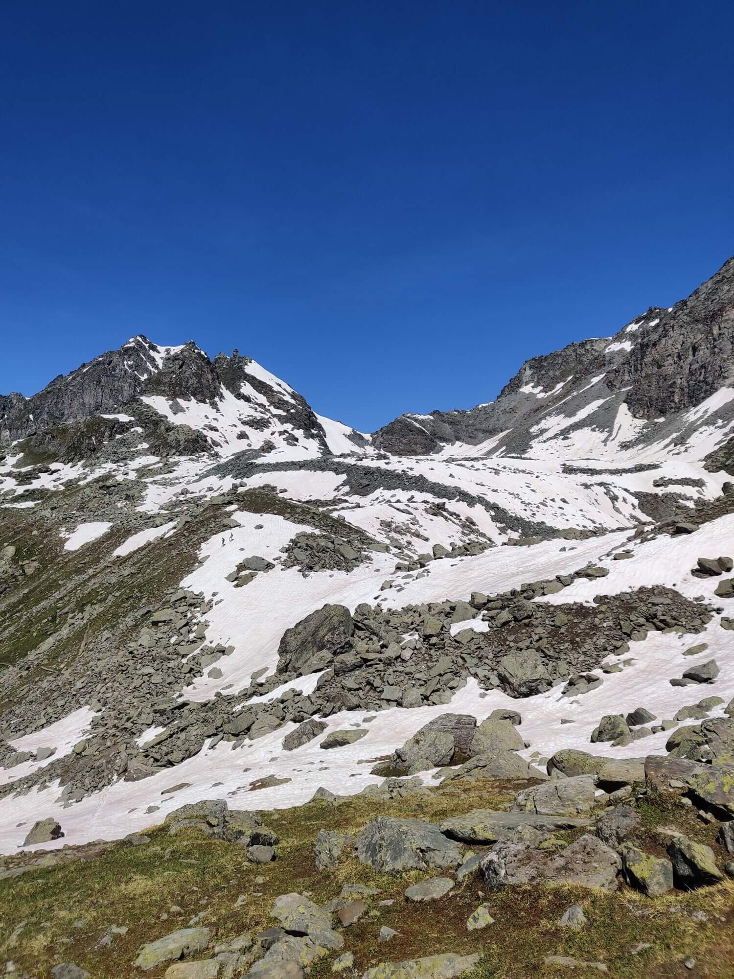
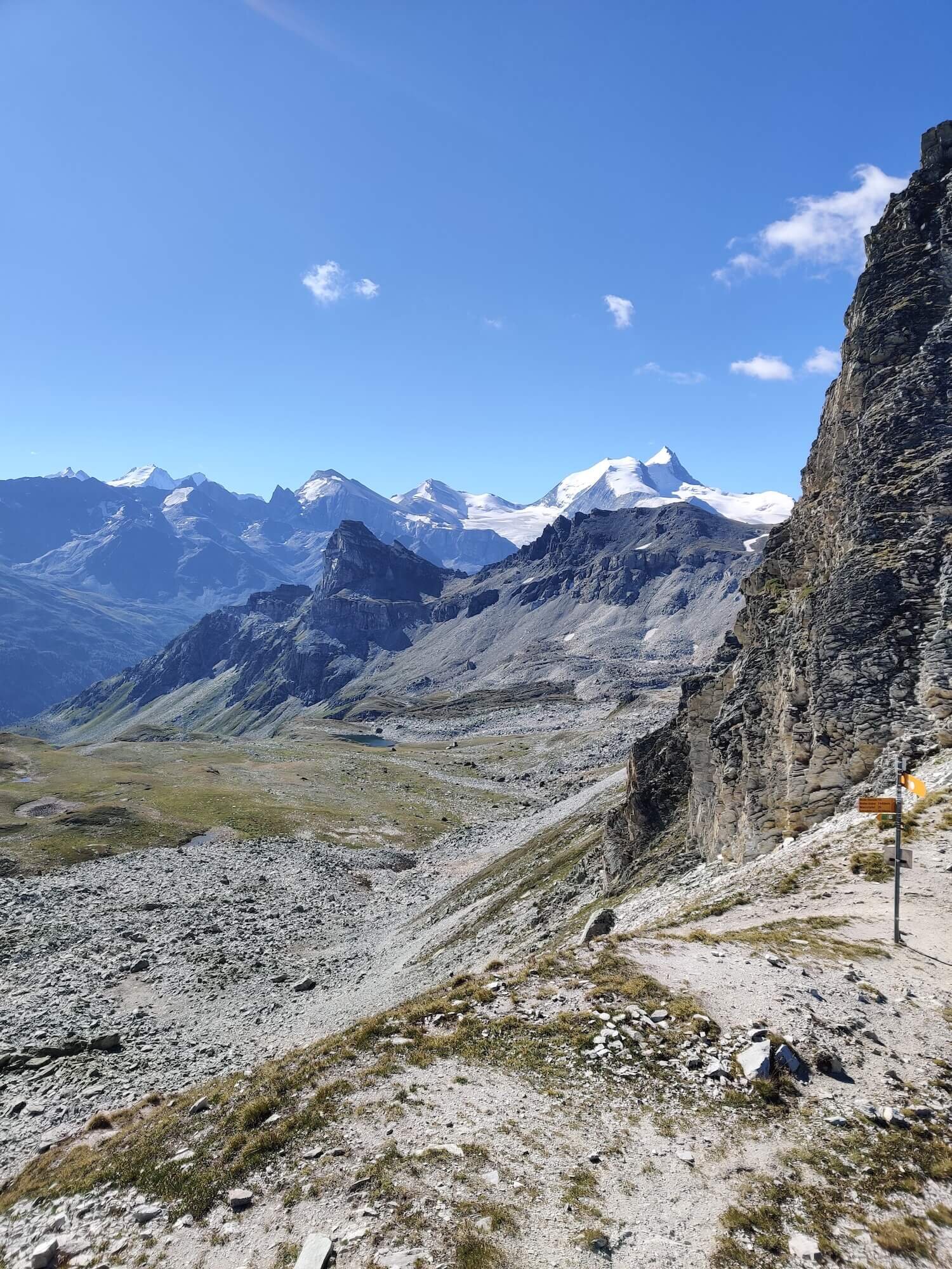
Trail Description: A more direct but challenging route to reach the Grand Desert. Leaving the main trail at Cabane du Mont Fort, the route climbs through the Verbier ski area to the pass that lies on the south side of Mont Fort. The pass is steep on both sides, with some erosion on the Grand Desert side, making it particularly challenging. After descending from the pass, follow the rocky and mostly flat valley past the Lac du Petit Mont Fort to rejoin the main trail just below Col de Louvie, where the Grand Desert begins.
Difficulty: Alpine and Mountain Trail.
Trail Junction Points: The trail diverts from the main trail at Le Peuty and rejoins at Champex Lac.
Considerations: Col de la Chaux is 2,939m / 9,642ft which is 200m / 650ft higher than the main trail. It will carry snow later into the summer which requires microspikes, poles/ice-axe and experience negotiating steep snow/ice to be safely crossed. Check with the guardian at Cabane Mont Forte for latest trail conditions. Photos are from first half of July in last two seasons.
Image taken from our Itinerary Builder that allows hikers to plan their itinerary using main and alternate routes.
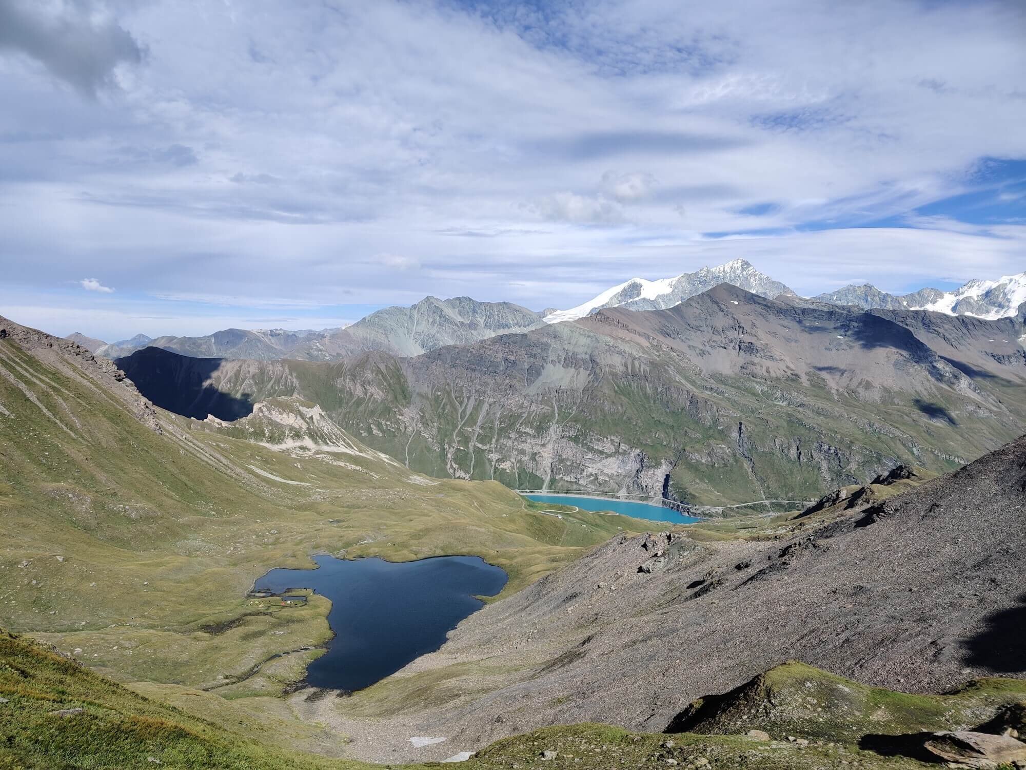
Col de la Meina
Between Cabane de Prafleuri and Les Hauderes
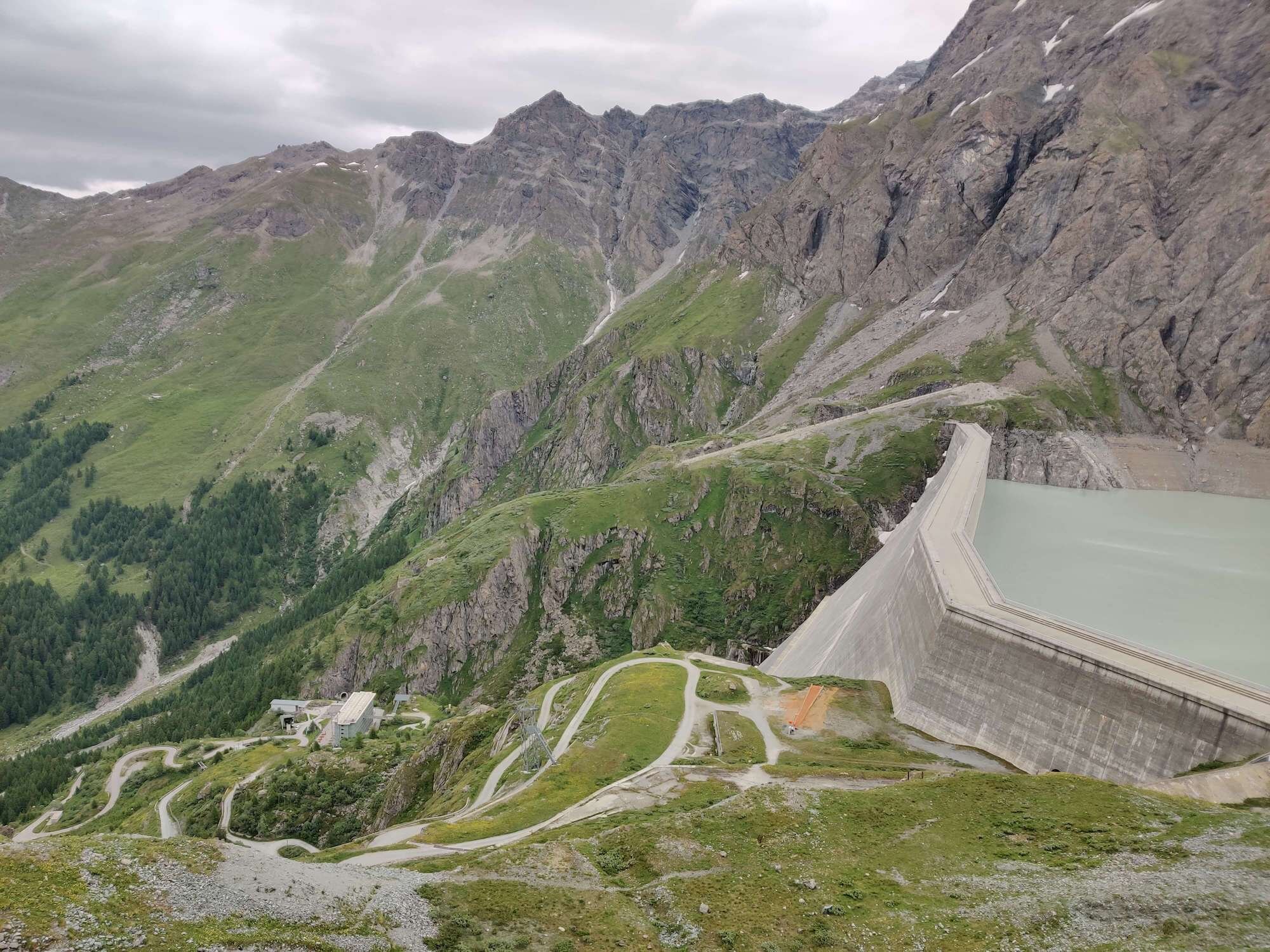
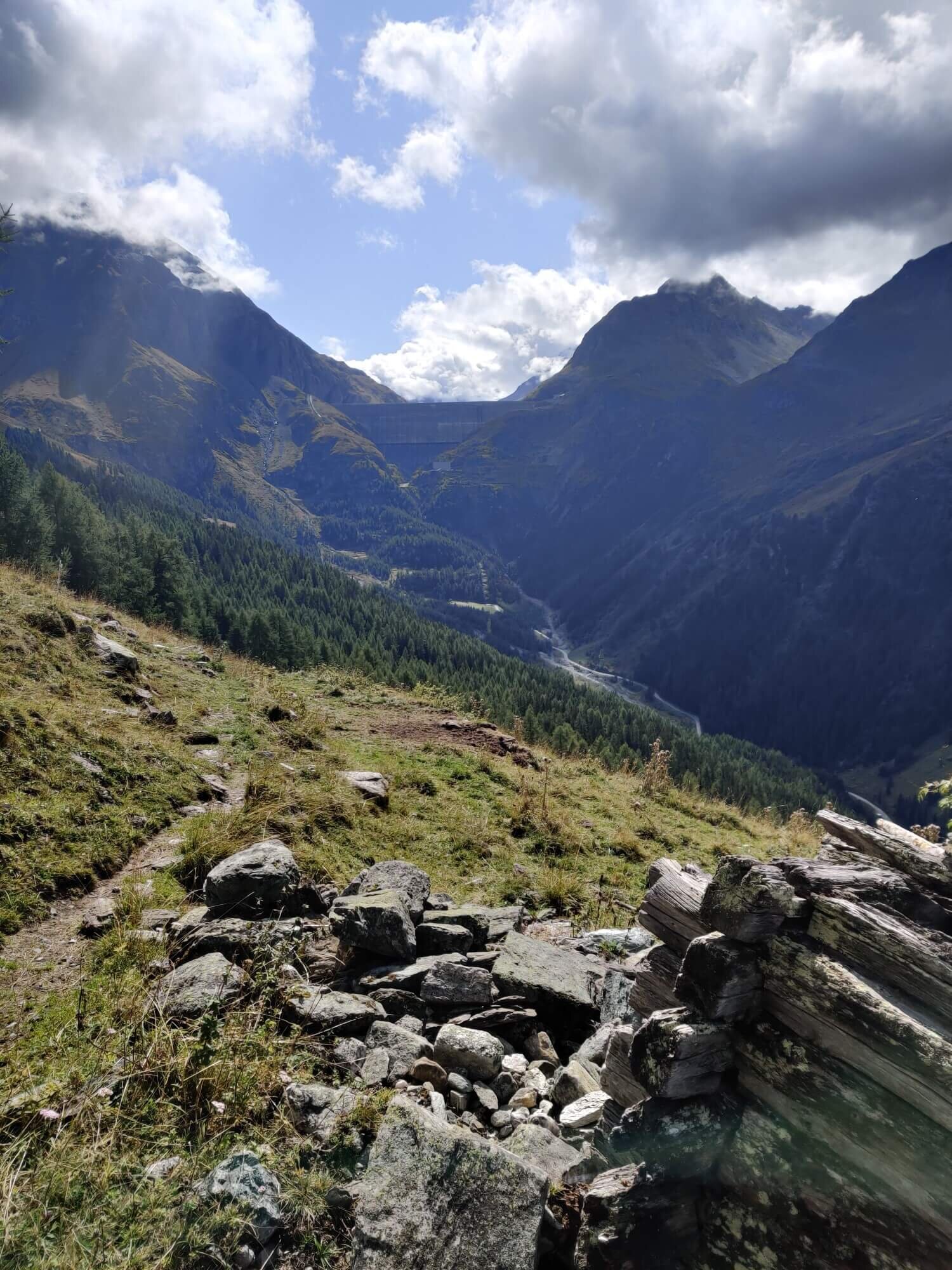
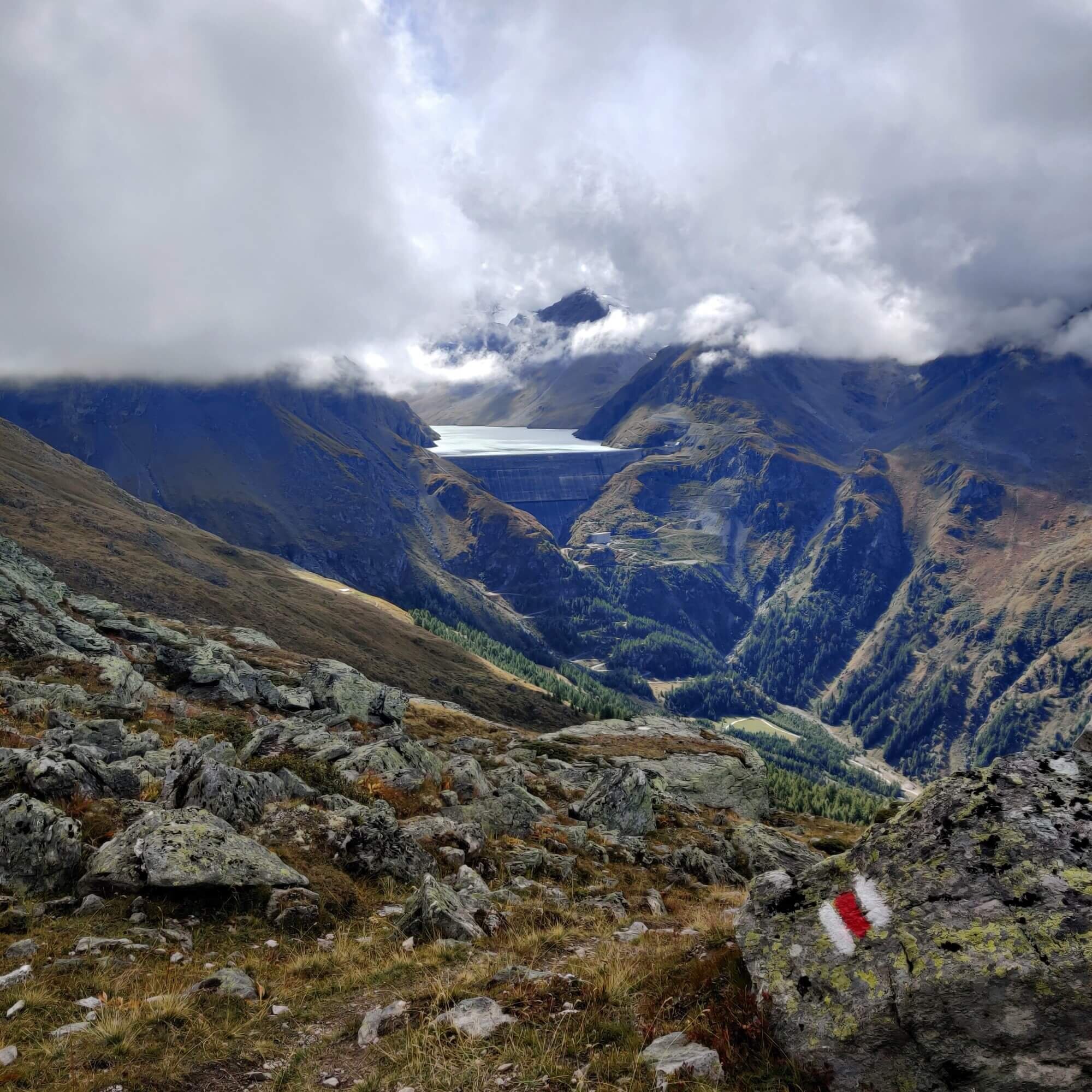
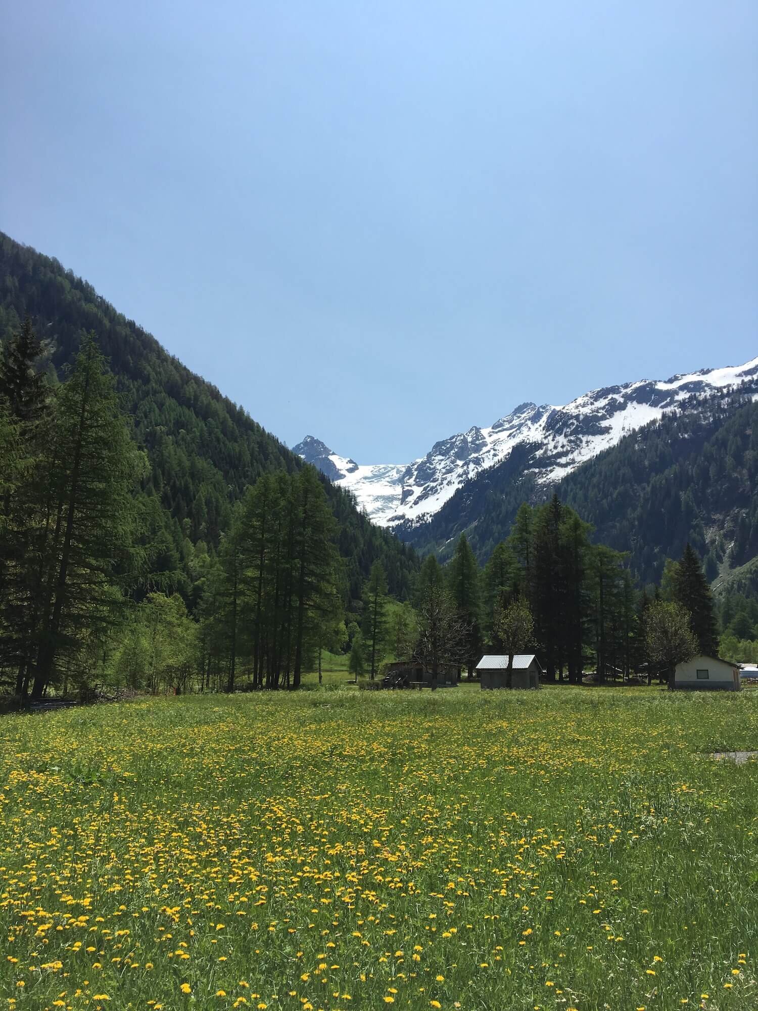
Trail Description: This route leaves the main trail at either Cabane de Praflurie or Refuge La Barma and leads to Hotel du Barrage at the Grand Dixence dam wall. From here, the trail descends away from the dam where it crosses the valley and starts to climb through the forest, then farmland. As the path turns at Noveli toward the pass, you will be able to enjoy views of Lac Des Dix and the dam wall from your high vantage point. After crossing the mountain pass, the trail descends through alpine farmland and the Evolene ski area to the village below.
Difficulty: Hiking and Mountain Trail.
Trail Junction Points: The trail diverts from the main trail at Cabane de Prafleuri and rejoins at Les Hauderes.
Considerations:
This alternative route allows you to avoid the Pas de Chevres rock scramble and ladders on an easier trail.
Depending on where you choose to stay overnight, this route may reduce your overall plan by 1 day.
There is a chairlift between Chemeuille chair top and Lannaz (within Evolene ski area) to reduce total hiking time.
Image taken from our Itinerary Builder that allows hikers to plan their itinerary using main and alternate routes.
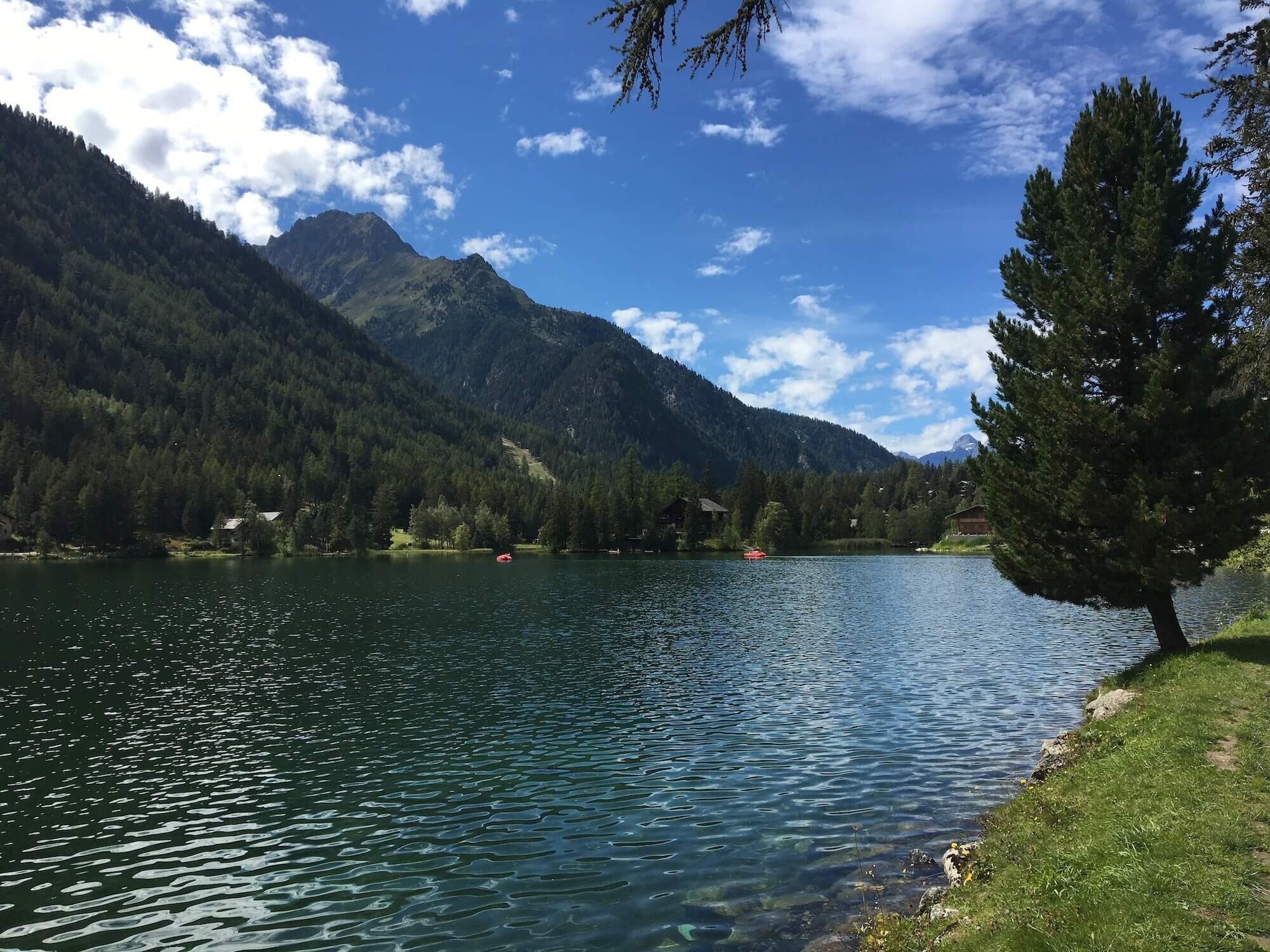
Col de Torrent and Grimentz Trail
Between La Sage and Zinal
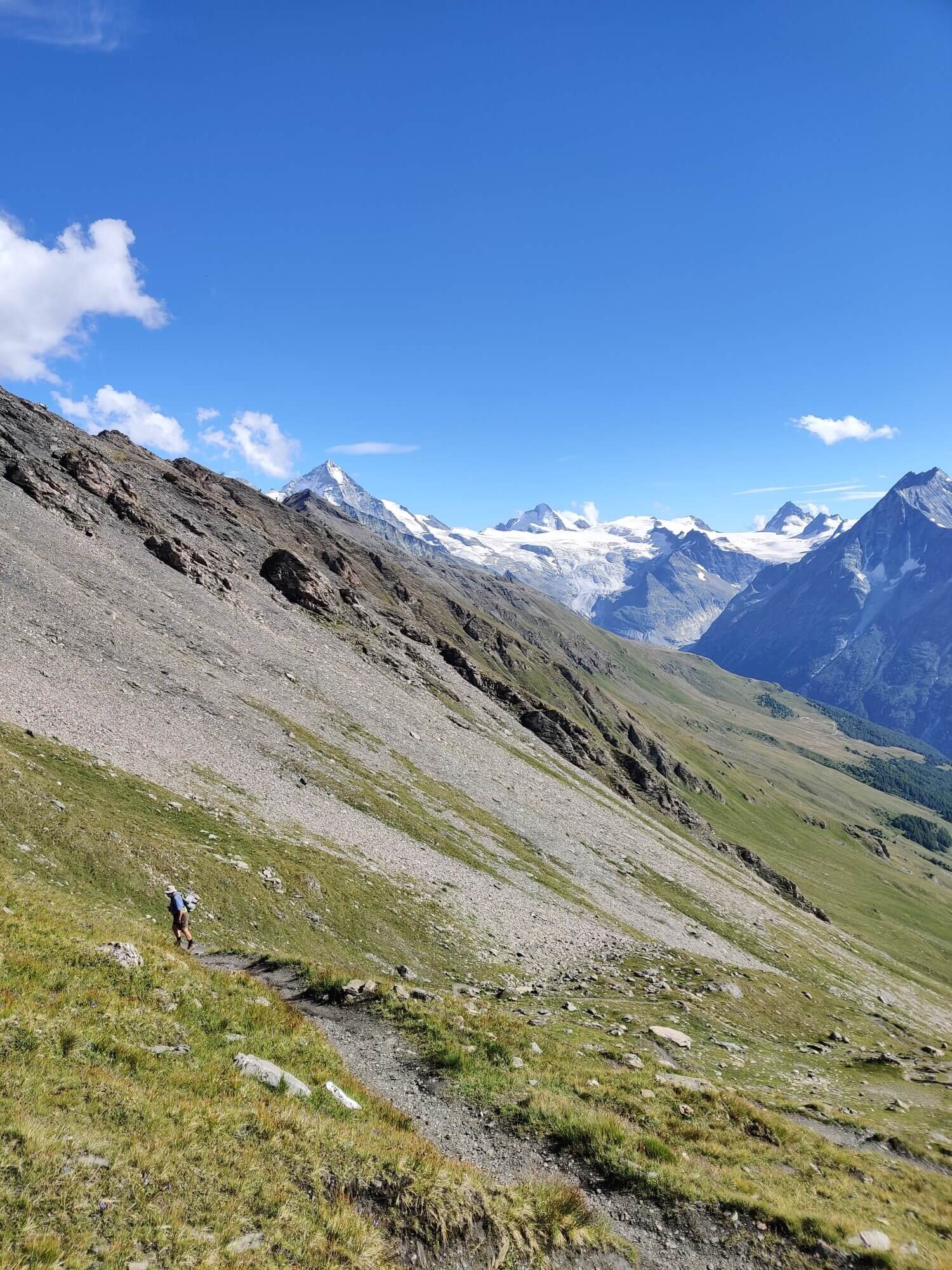
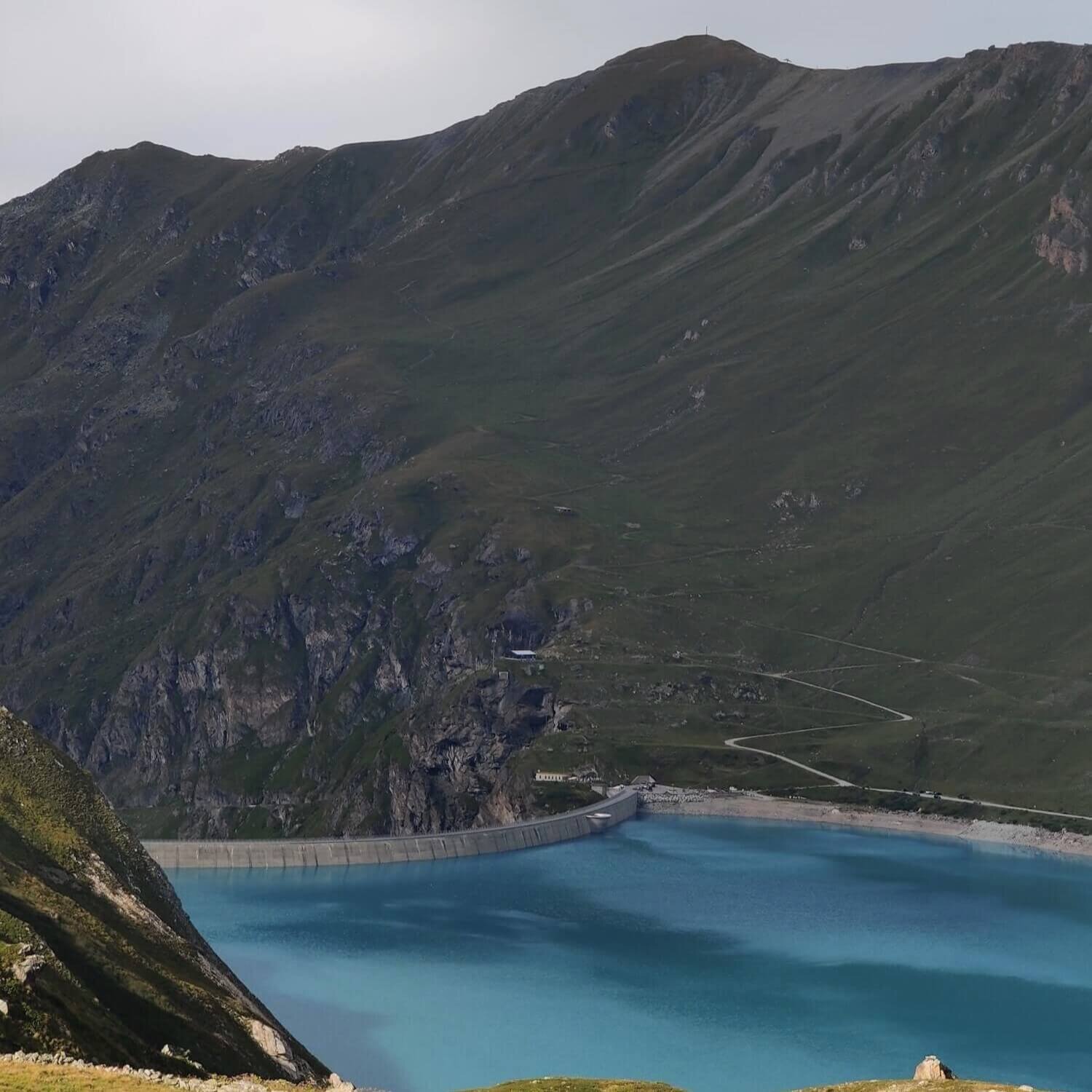
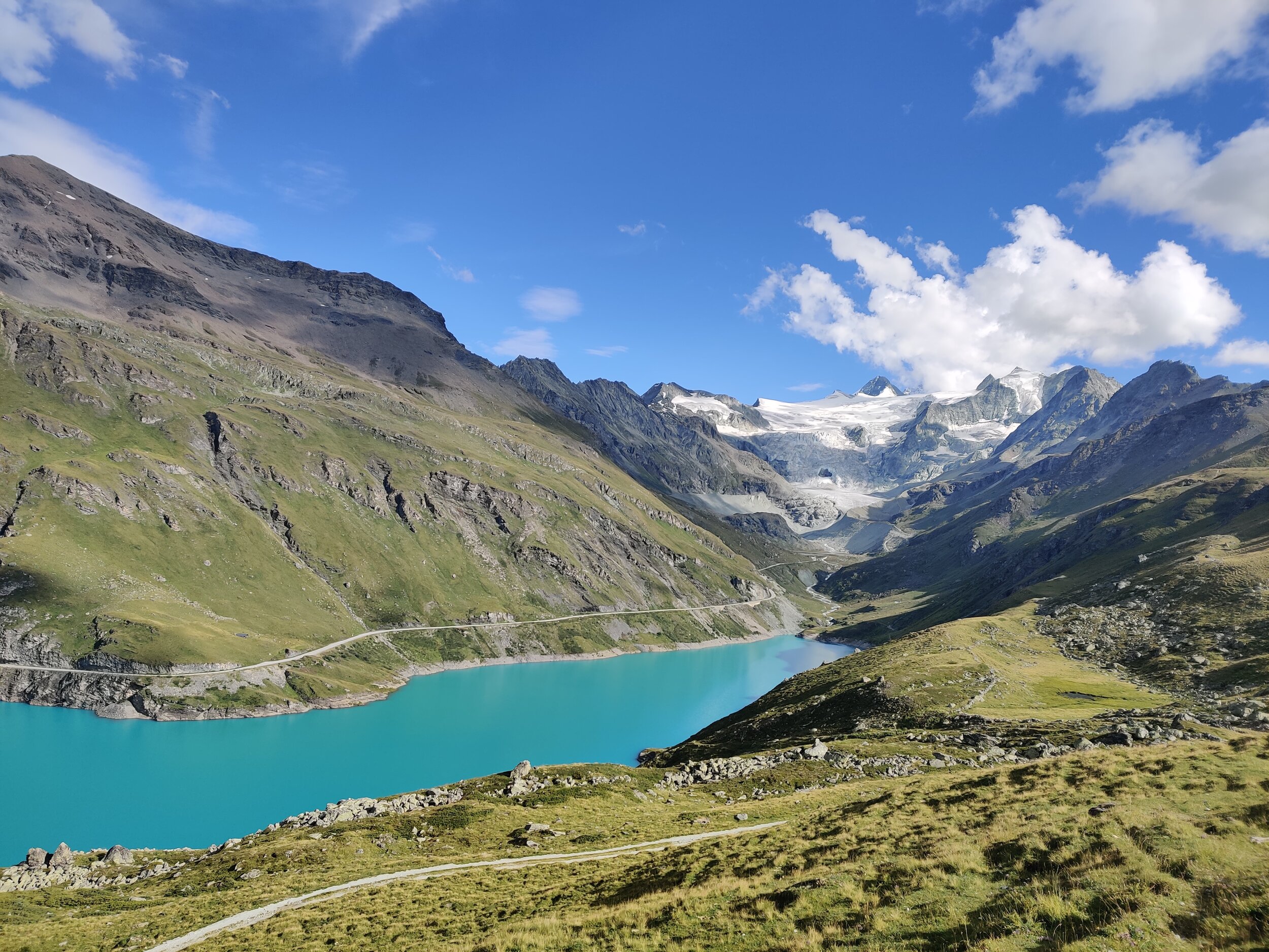
Trail Description: This route leaves the main trail at La Sage and climbs through alpine hamlets and meadows to Col Torrent. Although its elevation is similar to Col Tsate on the main trail, you are treated to wider landscape views of the Pennine Alps which is the main mountain range guarding the border between Switzerland and Italy. Once the trail reaches Lac de Moiry on the east side of the pass, the view of the lake are as impressive as the main trail, however, the view of the Moiry Glacier is not, as it forms only a small part of your landscape. Barrage de Moiry offers a small number of dormitory beds for those that want to spend a night by the lake.
From the restaurant, cross over the barrage to the trail that continues down the valley to reach the cute alpine ski village of Grimentz which has all types of accommodation on offer. The following day, continue on an easy trail below the ski area that goes through the forest to reach Zinal where it rejoins the main trail.
Difficulty: Hiking and Mountain Trail.
Trail Junction Points: The trail diverts from the main trail at La Sage and rejoins at Zinal.
Considerations:
There is a bus between Barrage de Moiry and Zinal to reduce total hiking time.
It is possible to hike from Barrage de Moiry over Col de Sorebois to Zinal, however, it will be too far from La Sage for most people so a night at the Barrage will be necessary.
Image taken from our Itinerary Builder that allows hikers to plan their itinerary using main and alternate routes.
Hotel Weisshorn and Meidpass Trail
Between Alpe Nava and Gruben
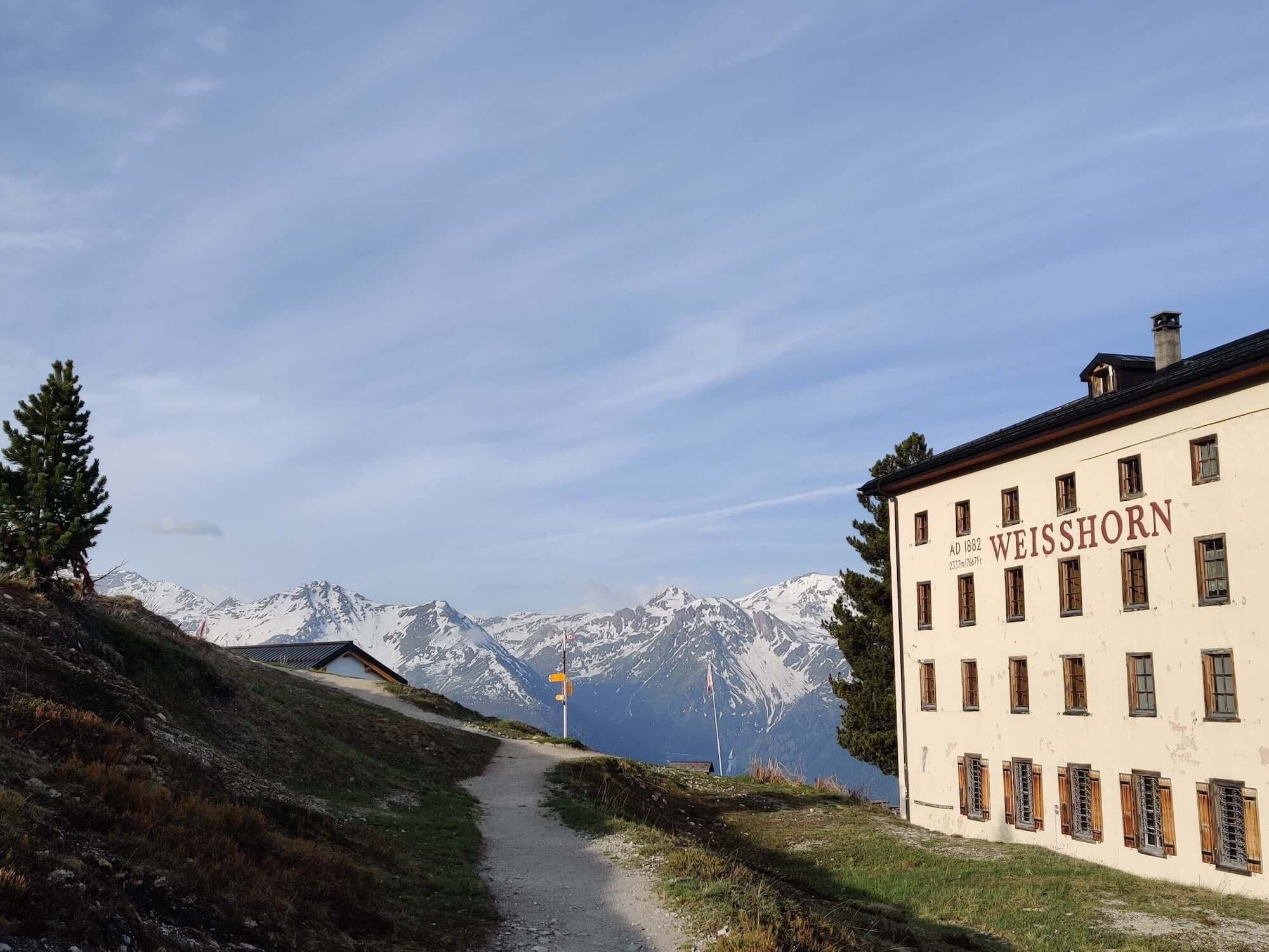
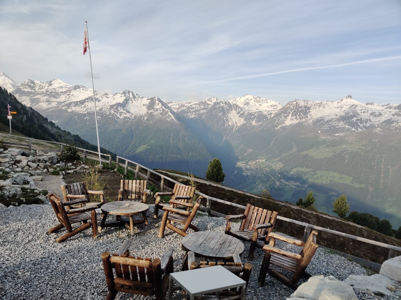
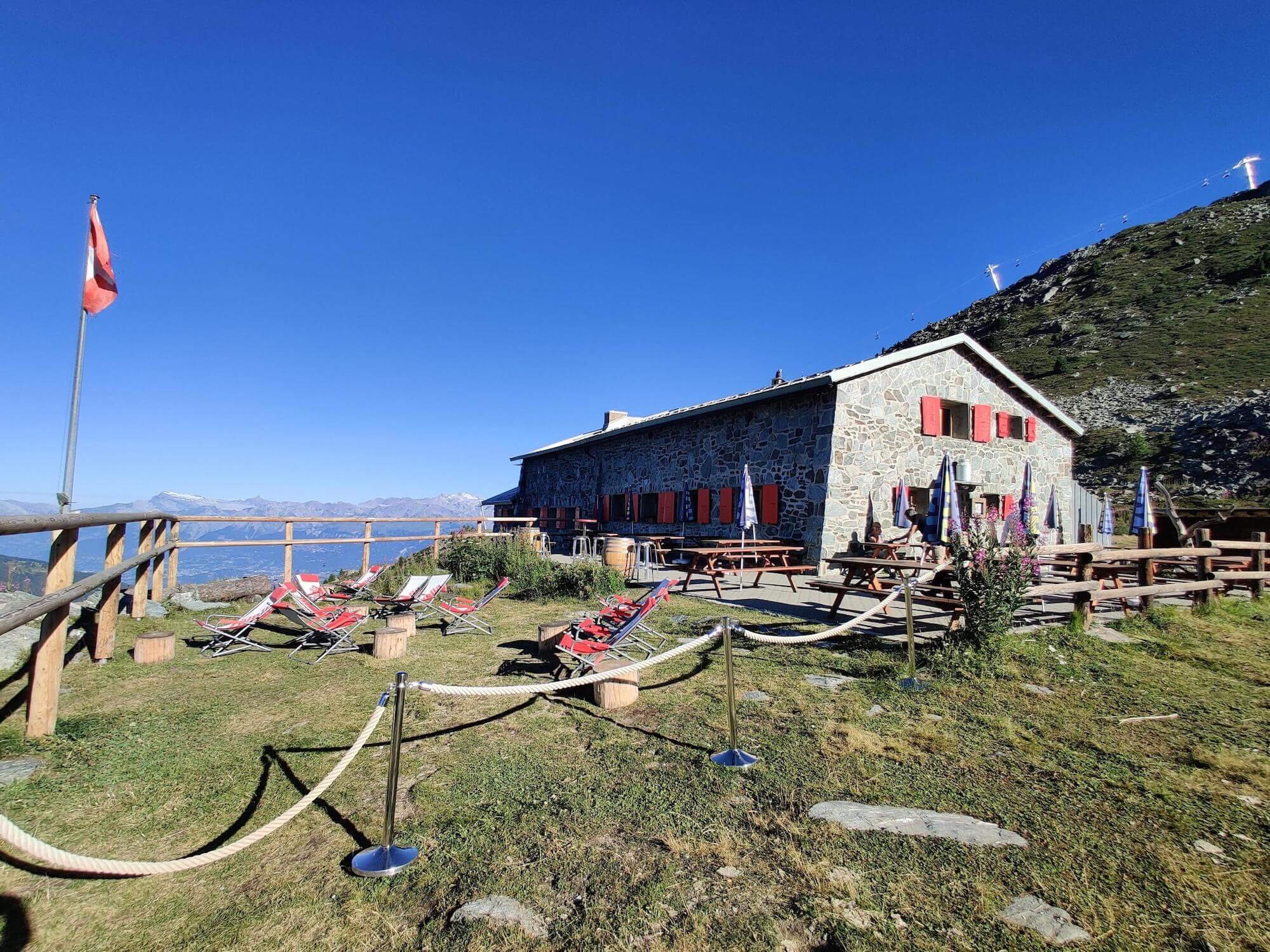
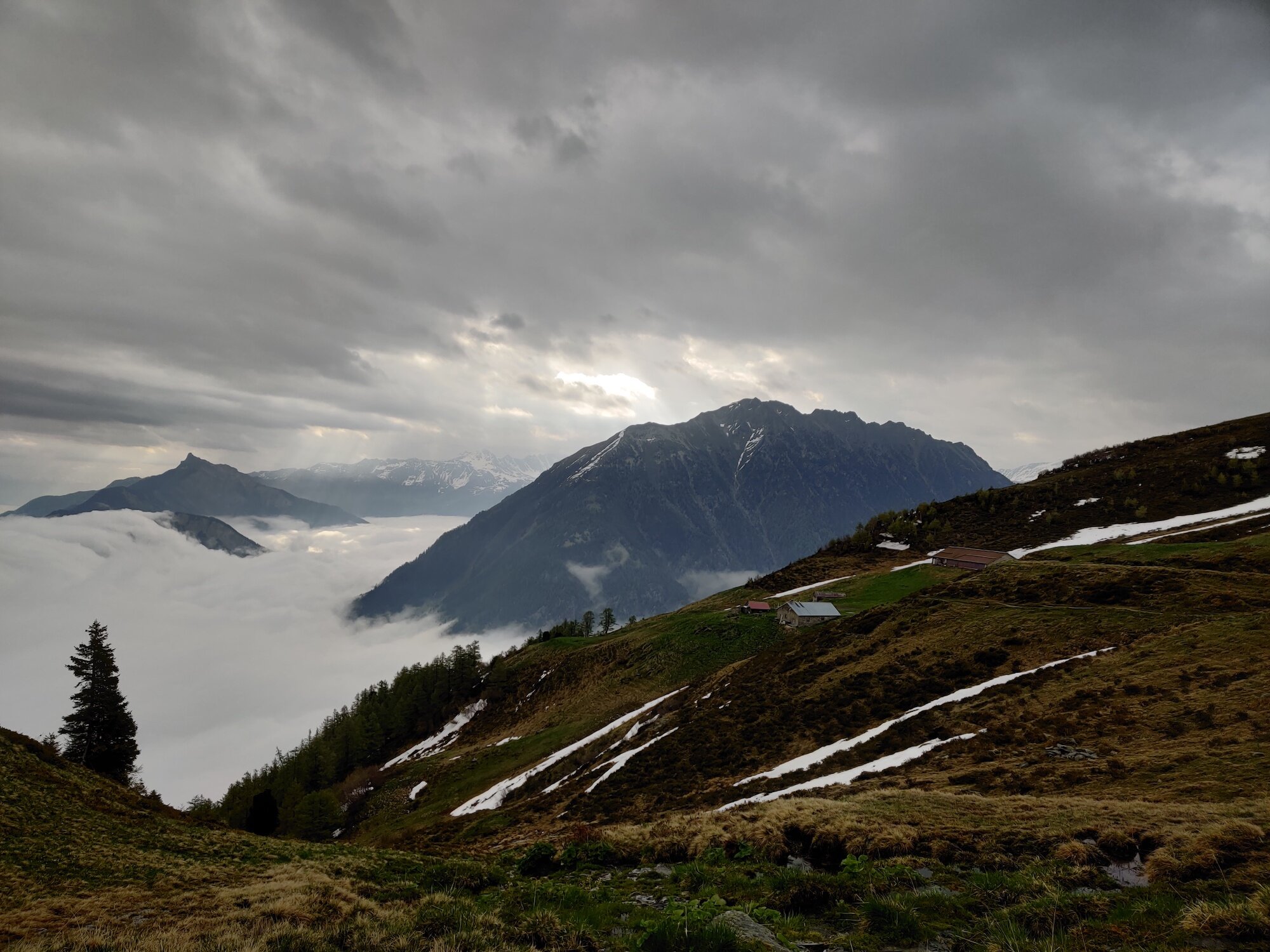
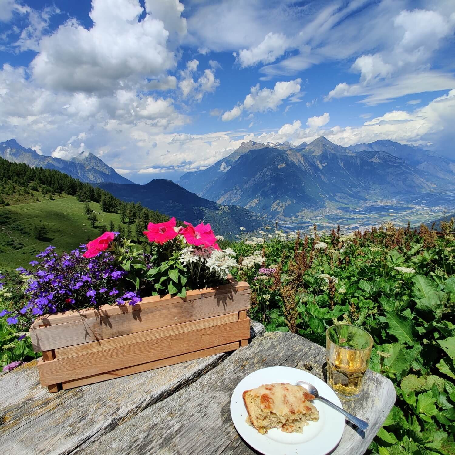
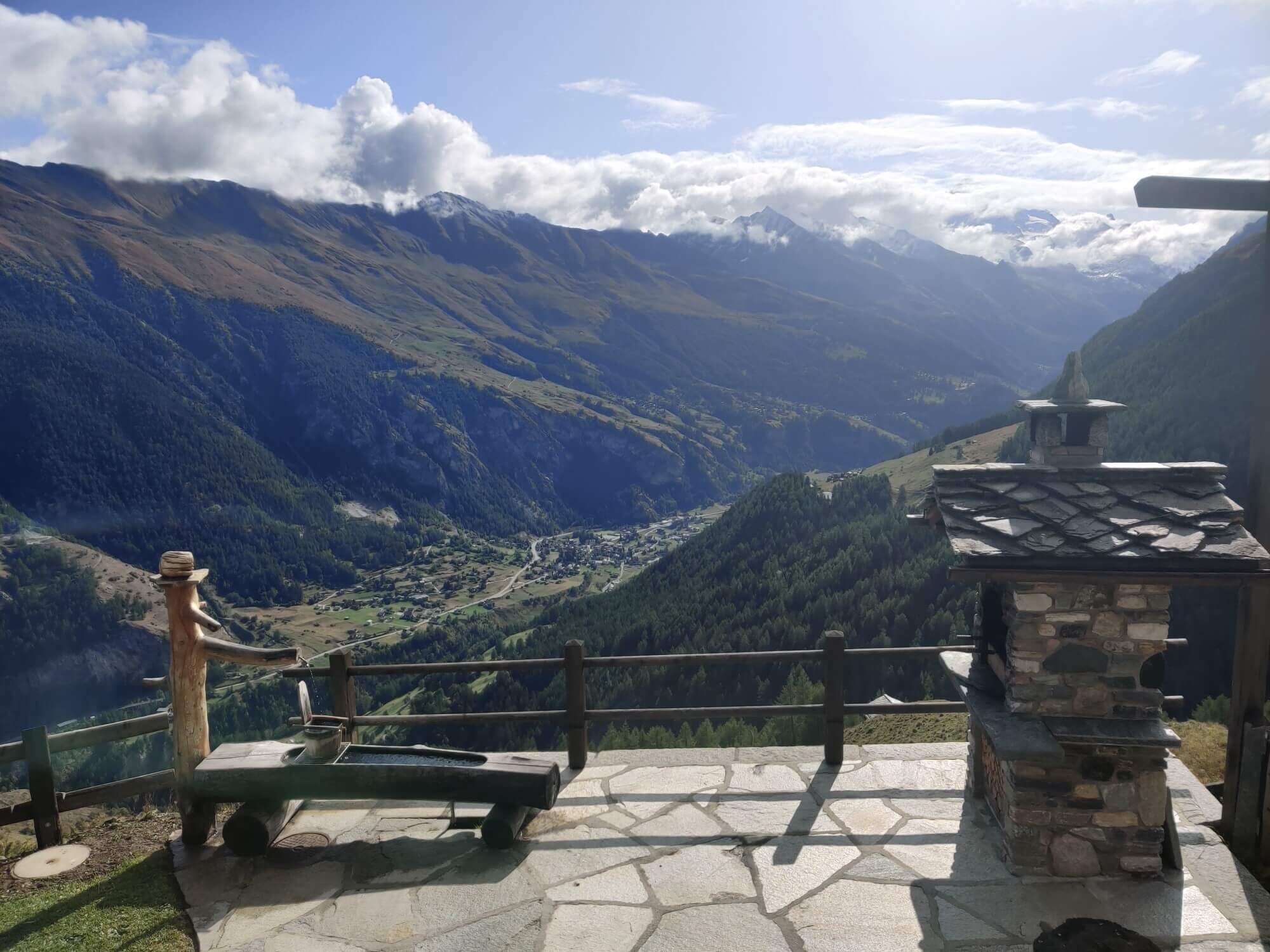
Trail Description: This route leaves the main trail at Alpe Nava and follows a wide track through alpine meadows and along the Pointes de Nava mountain range to Hotel Weisshorn. Whether you are planning to stay here or not, it is worth stopping to enjoy the patio views and hospitality of this alpine establishment. The trail continues east, skirting the edge of the Saint Luc ski area to reach Meidpass. The descent is steep to start, before crossing a large alpine plateau to Meidsee. The route continues from here through alpine hamlets to the remote village of Gruben in the valley below where German is now the primary language.
Difficulty: Hiking and Mountain Trail.
Trail Junction Points: The trail diverts from the main trail at Alpa Nava and rejoins at Gruben.
Image taken from our Itinerary Builder that allows hikers to plan their itinerary using main and alternate routes.
Turtmannhutte Trail
Between Chalte Berg and Grueobu Oberstafel
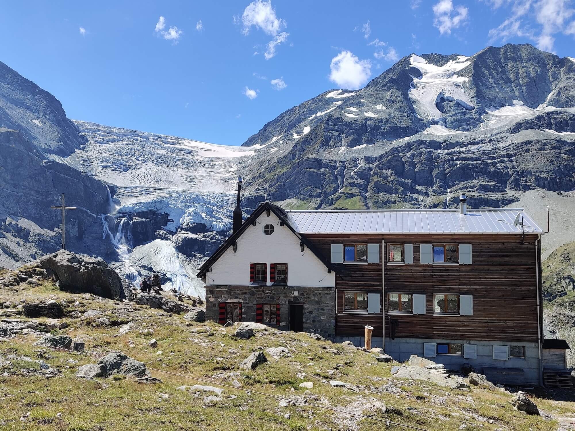
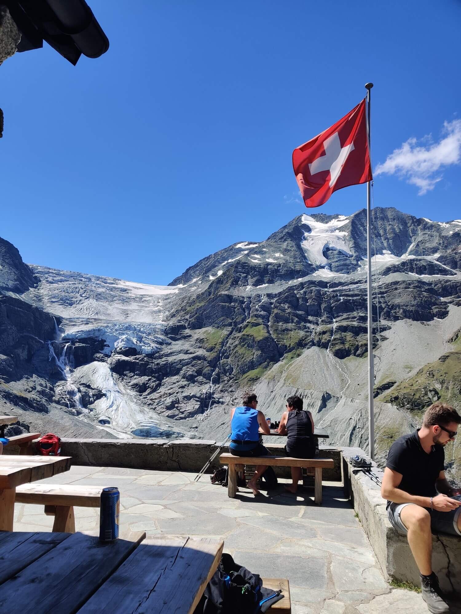
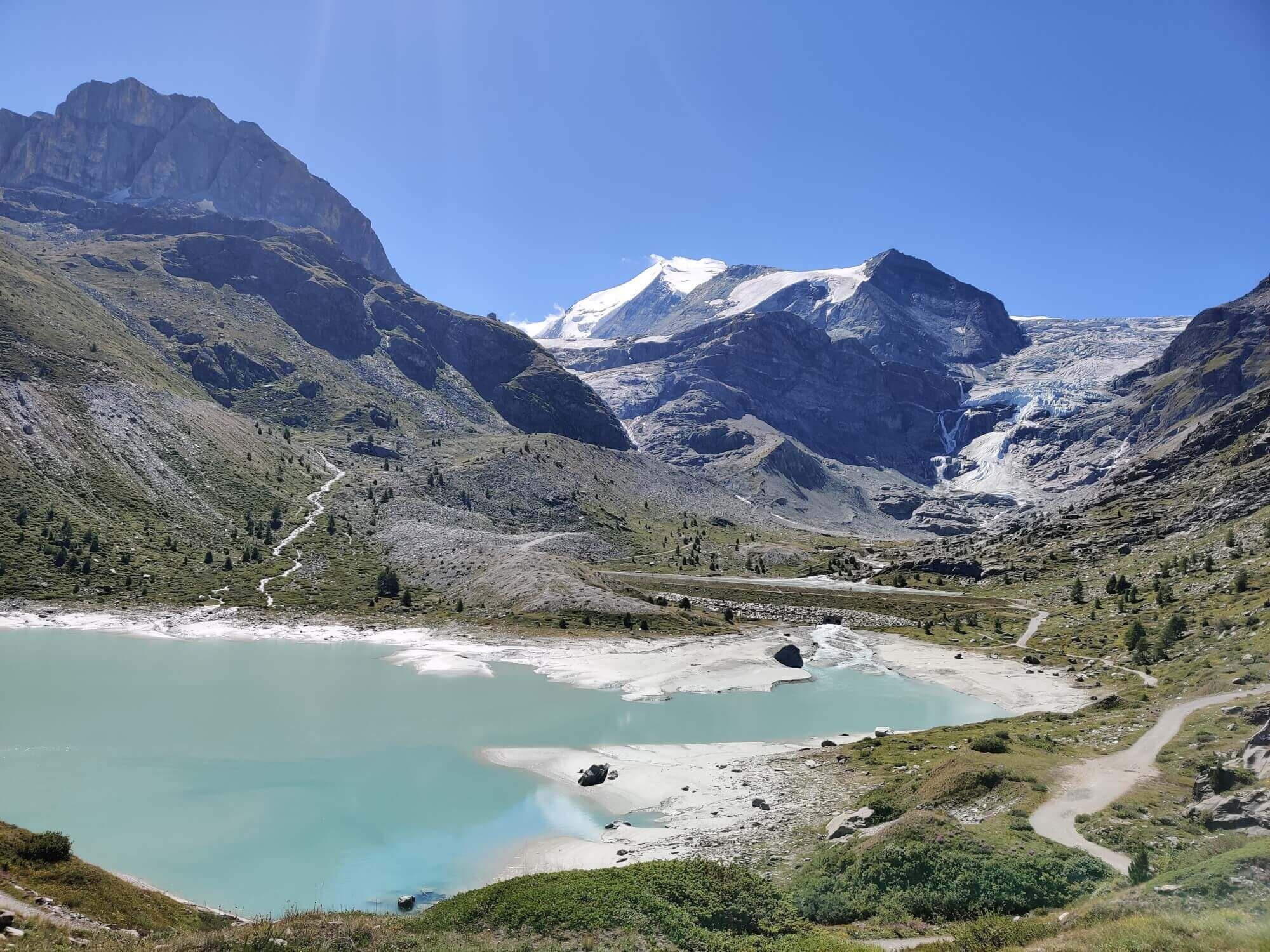
Trail Description: After descending from Forcletta to the hamlet of Chalte Berg, this route leaves the main trail by turning right/south and follows a mostly descending balcony trail all the way to Turtmannsee at the end of the valley. Turtmannhutte can be seen perched high up above and offers guests eye-level viewing of its namesake glacier from their sunny patio. The trail continues down the valley on the east side, mostly above the treeline and maintaining the elevation to rejoin with the main trail at Gruobu Mittelstafal above Gruben.
Difficulty: Mountain Trail.
Trail Junction Points: The trail diverts from the main trail at Chalte Berg and rejoins at Grueobu Oberstafel.
Image taken from our Itinerary Builder that allows hikers to plan their itinerary using main and alternate routes.
Mattertal Valley Trail
Between St Niklaus and Zermatt
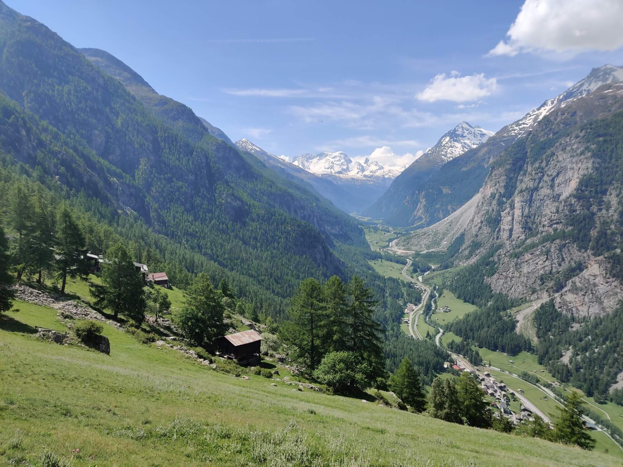
Trail Description: This alternative route is much easier than the main trail.
The lower valley section starts at St Niklaus and follows the Matter Vispa (river) up the valley to Randa. Here there is an opportunity to climb up to the Europaweg trail to cross the Charles Kuonen Suspension Bridge and then either descend back to the valley or continue along the high trail all the way to Zermatt.
The upper Mattertal valley section continues to follow the Matter Vispa all the way to Zermatt.
The route follows a wide track with a gradual incline for most of the way. As you are at the base of the Mattertal valley, there are limited views of the surrounding peaks but this will not worry you when on the trail as the tranquil sound of the river will carry you along.
Difficulty: Hiking Trail.
Trail Junction Points: The trail diverts from the main trail at St Niklaus and rejoins at Zermatt.
Considerations: Choosing this option may reduce your overall itinerary by one day.
Image taken from our Itinerary Builder that allows hikers to plan their itinerary using main and alternate routes.
New trail update
We are working to add the following alternative routes to our itinerary builder. At this stage, they can only be added to your itinerary and map via our BYO Itinerary or custom packages.
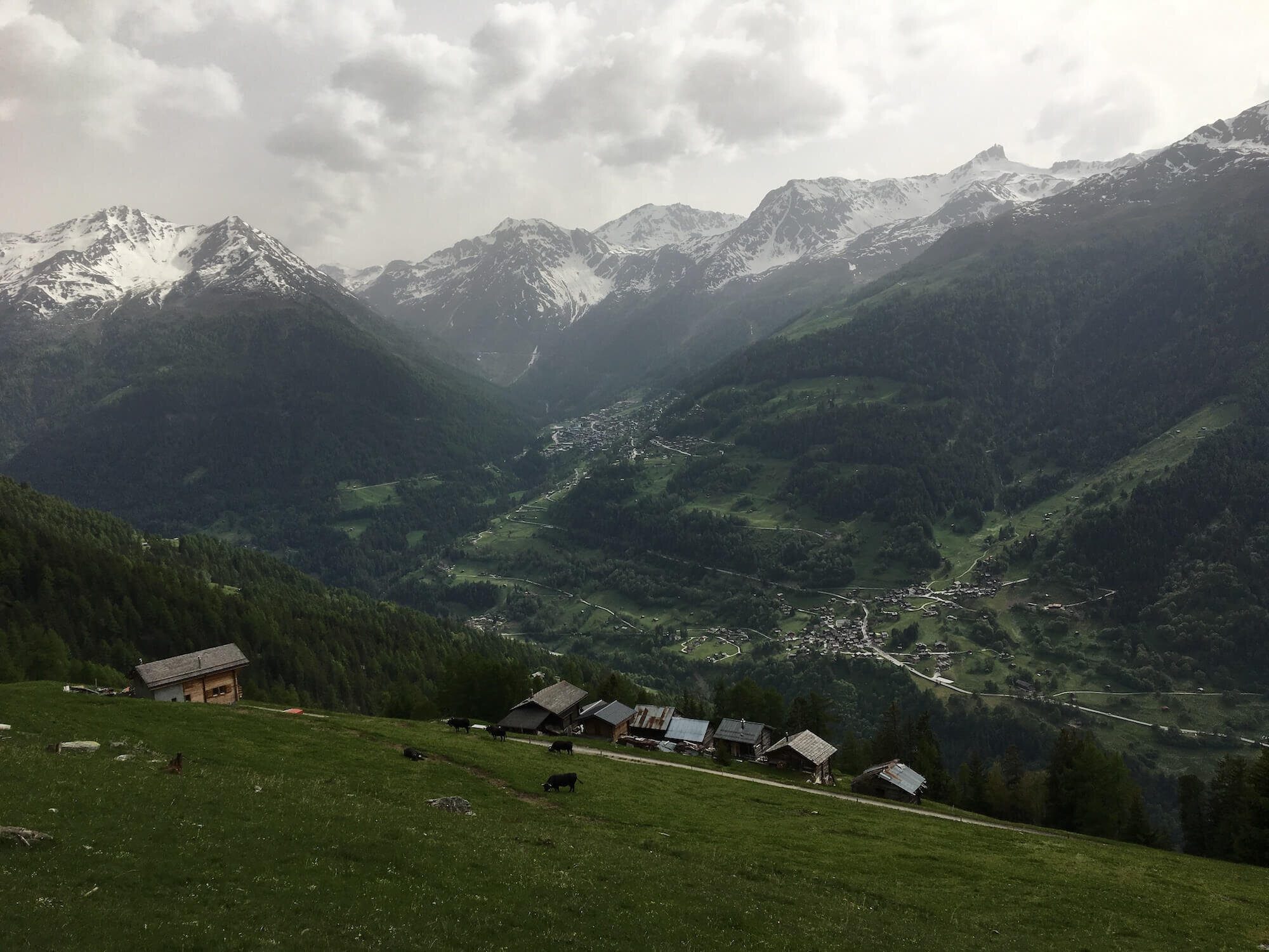
Les Tseppes trail: between Col de Balme and Trient

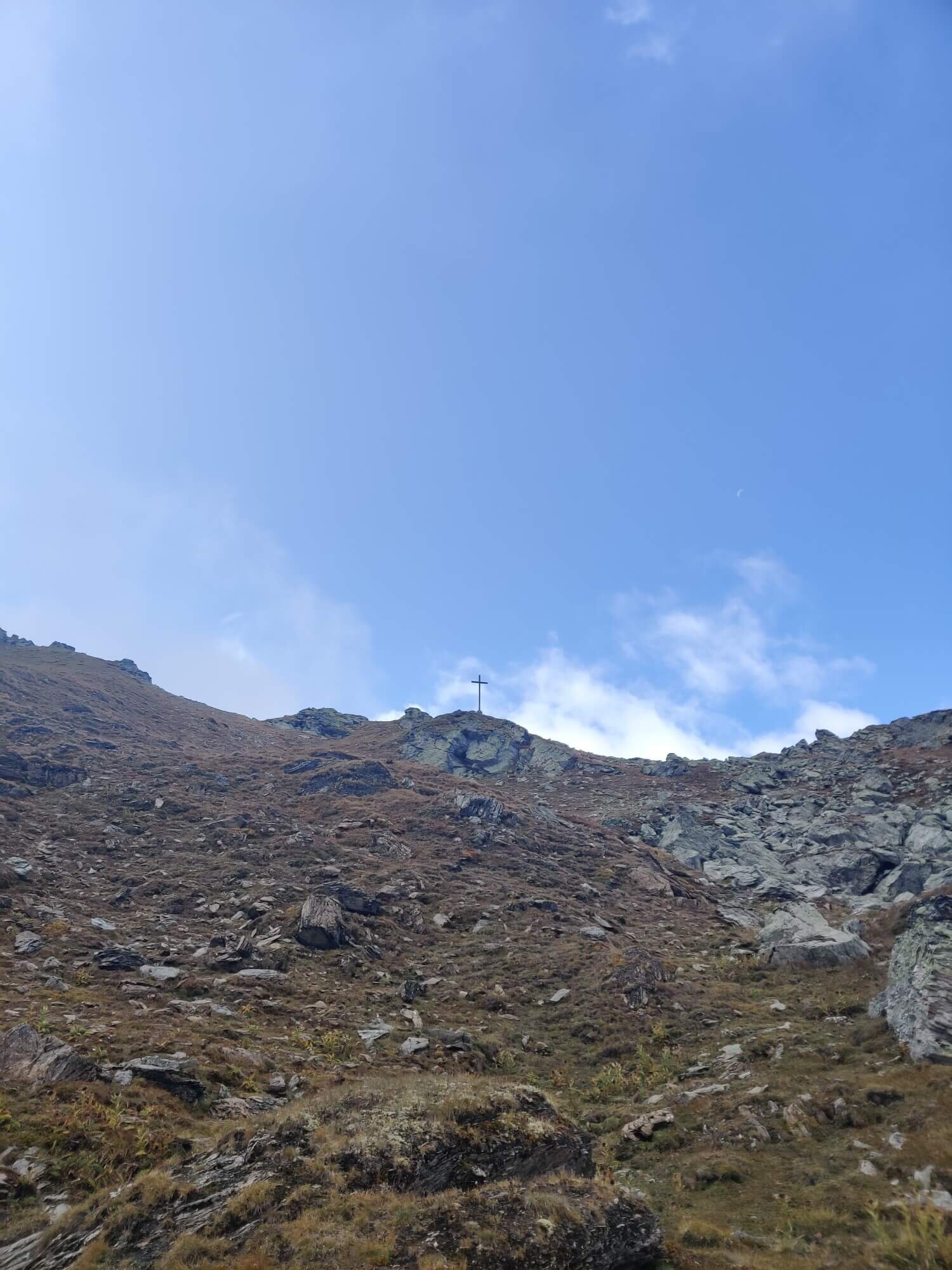
Les Tseppes trail: Leading away from Refuge du Col de Balme (middle of shot) toward the grassy mountain (Croix de Fer) behind it.
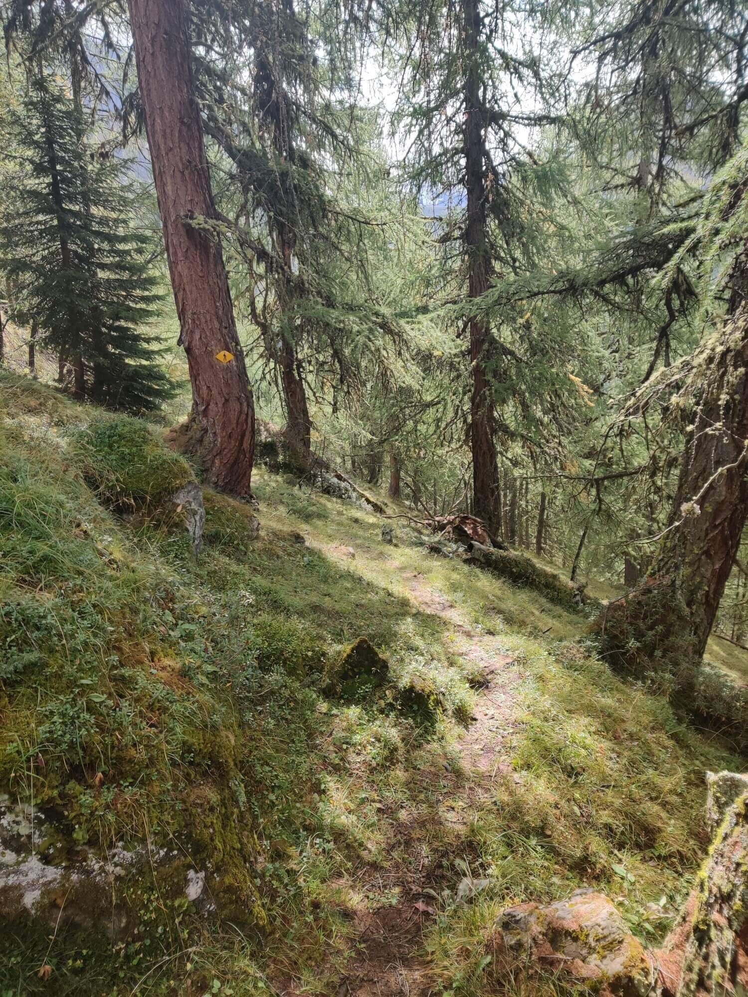
Leaving Col de Balme, this alternative route first climbs a little higher first, offering the opportunity to add on a couple of short summits to L'Arolette and Croix de Fer. The trail then begins traveling down through the meadows of Les Tseppes, which continue to offer views of Glacier du Trient, the Aiguilles du Tour and the Mont de l'Arpille, before entering the forest for the ongoing descent. It rejoins the much busier main trail that went via Chieuset in Trient.
Col de Mille trail: Between Champex Lac and Cabane de Louvie

Col de Mille trail: Cows enjoying the views of the Mont Blanc massif near Mont Brule
This route descends from Champex Lac through mostly farmland to reach Orsieres in the valley below, before immediately climbing up the opposite side. The long climb starts by passing through farmland and some small villages as it takes long sweeping switchbacks to gain elevation. Upon rising above the forest band, the trail continues through alpine meadows with cows roaming right to the top of Mont Brule. The panorama back over the Mont Blanc massif is awe-inspiring, and they continue through to Cabane de Mille where you can enjoy them overnight.
From Col de Mille, the trail follows the Tour des Combins in a clockwise direction which offers views of the Bagnes valley on its way to the popular Cabane Brunet, which is accessible by car. Here the route leaves the Tour des Combins trail to make for Mont Fort which will be visible across the valley. The trail descends deep into the valley before immediately ascending (through a protected wildlife reserve where ibex are often seen) to join with the main Walker’s Haute Route trail at Louvie.
Via Fionnay (incl. bus): Easiest way to reach Cabane de Louvie

Via Fionnay: Ibex can be often seen in the protected wildlife reserve
From Le Chable, rather than climbing up to Cabane du Mont Fort in the Verbier (4 valleys) ski area, this route first catches the bus from Le Chable to Fionnay up the valley, then hikes up through the protected wildlife reserve (where ibex are often seen) to Cabane de Louvie. This route is graded as a mountain trail under the Swiss system, whereas the main trail and alternative route that goes via Cabane du Mont Fort have sections graded as Alpine trail, due to their narrow balcony sections with exposure/cliffs and patches of erosion/rockfall disturbance.
Well that’s it - our list of top alternate routes for the Walker’s Haute Route. If you want more reading, check out our detailed blog post of the Main Trail sections of the Walker’s Haute Route. We hope this helps you decide on which routes to include (or exclude!) on your epic hike from Mont Blanc to the Matterhorn.
Happy Planning!
Brendan
Founder, The Hiking Club
READY TO START PLANNING YOUR OWN WALKER’S HAUTE ROUTE ADVENTURE?
Everything you need to plan, book, prepare and navigate your adventure. This package includes;
Access a trail expert to prepare an itinerary that meets your needs. This package includes;
60 min consultation
Personalised itinerary designed by our trail expert