Updated March 2026.
At the end of June 2024, severe storms hit the Mattertal Valley which resulted in the closure of a section of the Europaweg trail for the 2024 and 2025 hiking season. This significant detour requires hikers to descend to the valley and then ascend back up to regain the trail.
We reached out to Zermatt Tourism in January 2026 to get an update for the upcoming 2026 summer hiking season. They don’t know yet whether the trail will re-open and recommend that “everyone plan for the detour, as in previous years”. According to the Swiss Hiking Federation (via Swisstopo), the trail will be closed “until further notice”.
This closure impacts both Walker’s Haute Route and Tour of Monte Rosa hikers, as well as the many day and overnight hikers planning to complete this trail.
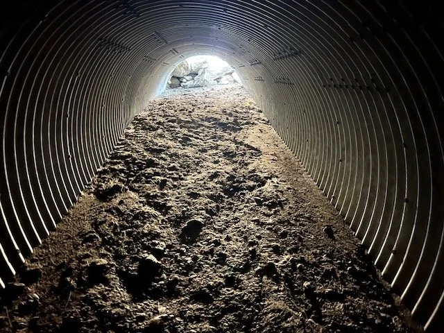
The closed section is between Springelboden (north side) and Eggenstadel (south side) which is located between the Charles Kuonen Suspension Bridge (no impact) and Taschalp. Rockfall barriers were destroyed and a tunnel crushed, serving their purpose of protecting part of the trail that had previously been impacted by rockfall events.

The reason given to the closure is ‘Stone Chipping’, which is the risk of further rocks coming down and impacting the trail in that area.
Detour Options
Unfortunately, there isn’t an easy way to detour around this closed section of the Europaweg trail. Those wanting to avoid the closure but maximise their time on the Europaweg trail will need to descend all the way down the valley and then climb back up. Please note that the trail between Springelboden and the valley is steep and considered challenging.
Given there is a road connecting Tasch in the valley with Taschalp, it is possible to take the local tourism shuttle (during summer only) or a private taxi to greatly reduce the hiking between Eggenstadel and the valley below.
Check out Taxi Christophe (near the tourism office in Tasch) for an 11 CHF per person for a shared transfer. You can just turn up and usually need to wait about 15mins for the transfer.
On the Springelboden side, there is no transport support available.
In our planning app, we have added the trails that connect both Springelboden and Eggenstadel with the valley below, as well as the transportation you can take between Tasch and Taschalp.
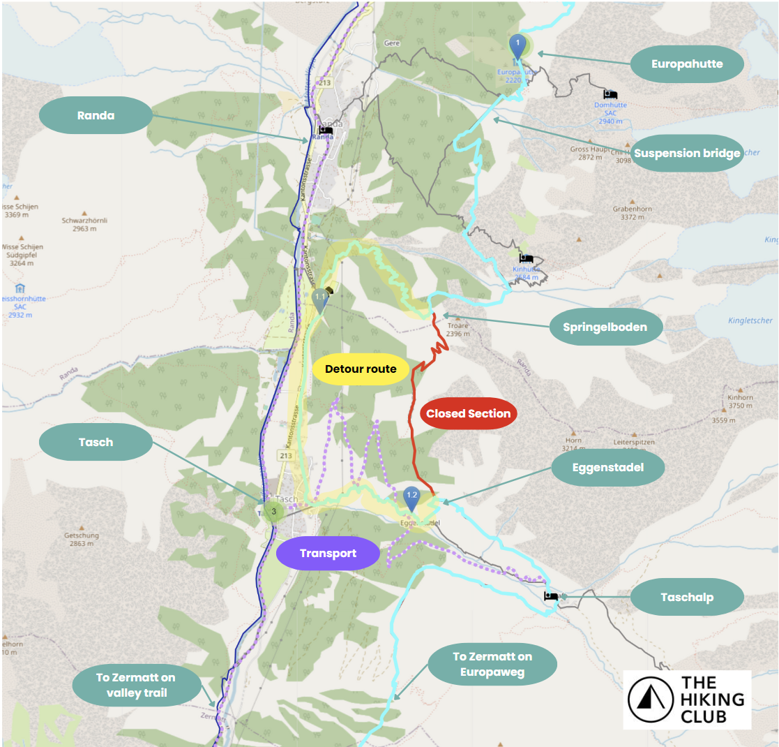
To select the detour in the planning app, create a first waymarker on the hiking route between Springelboden and Tasch (see 1.1 waymarker in image for example) and second waymarker either on the hiking route between Tasch and Eggenstadel (see 1.2 waymarker in image for example), or on the purple dotted line to use taxi/private shuttle between Tasch and Taschalp. This will automatically calculate new hiking stats and gps map files for the detour.
Customers of The Hiking Club can use our planning app to look at the suggested detour route, as well as other options that may work better with their plan. When reviewing each option, the trail statistics instantly update with any route change. When you are happy with the revised route, re-download your itinerary and map files to detour around this closure and hike with confidence.
Those planning for 2026 can include this detour in their itinerary. We’ll provide a further update via our planning app if the closure is extended into the 2027 hiking season.